Your cart is currently empty!
50 Beautiful Travel Locations in Vietnam (2024 Guide)

Why Vietnam is a Top Travel Destination in 2024
Vietnam is having a moment. The numbers prove it: over 12.6 million international visitors crossed its borders in 2023, a remarkable rebound that signals the country’s full return to the global travel stage. That surge is no accident. Vietnam packs an extraordinary range of experiences into one slender S-shaped strip of land, from misty mountain passes in the north to sun-drenched tropical islands in the south.
Few countries can match this geographic and cultural density. You can stand beneath the world’s largest cave in Phong Nha-Ke Bang National Park, wander through lantern-lit streets in Hoi An, and float past floating markets in the Mekong Delta, all within a single trip. The country stretches over 1,650 kilometers from top to bottom, which means every region offers a distinct flavor, climate, and rhythm of life.
What Makes Vietnam Different
Vietnam rewards travelers who seek depth, not just postcard views. The food alone is worth the journey, a regional patchwork of pho, banh mi, and seafood that changes with every province. The history runs deep, from imperial citadels in Hue to the Cu Chi Tunnels near Ho Chi Minh City, a 250-kilometer underground network that tells a powerful story of resilience.
Nature delivers on a grand scale. Ha Long Bay alone features over 1,600 limestone islands and islets, a UNESCO World Heritage Site that looks like a painting come to life. Sapa’s terraced rice fields climb toward Fansipan, the country’s highest peak at 3,147 meters. Ninh Binh offers a quieter version of the same karst drama, earning its nickname as “Ha Long Bay on land.”
What This Guide Covers
This guide goes beyond the typical top-ten lists. We have assembled 50 beautiful locations across all three regions of Vietnam, with a deliberate mix of world-famous icons and lesser-known gems. You will find detailed breakdowns of:
- Northern Vietnam: Ha Long Bay, Sapa, Ninh Binh, Ban Gioc Waterfall, and the Ha Giang loop
- Central Vietnam: Hoi An, Da Nang, Hue, Phong Nha, and the Son Tra Peninsula
- Southern Vietnam: Ho Chi Minh City, the Mekong Delta, Phu Quoc, and emerging islands like Nam Du
- Hidden gems: Off-the-beaten-path destinations that most guidebooks overlook
Each entry includes practical details on what makes the location special, when to visit, and how to get there. We also cover sustainable travel practices, budget strategies, and visa requirements so you can plan with confidence.
Vietnam in 2024 is more accessible than ever. New flight routes, improved infrastructure, and a thriving hospitality scene mean the country is ready for you. The only question is where to start. Let this guide be your map.
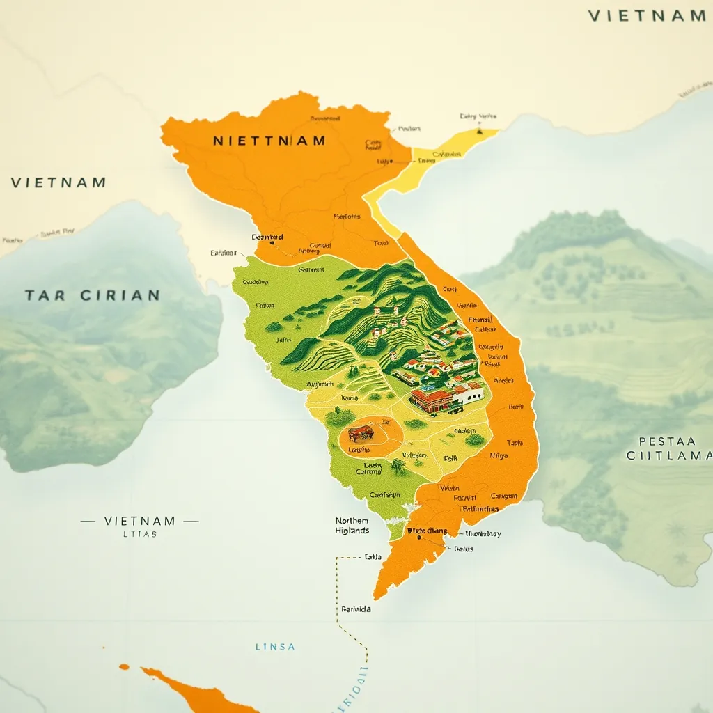
How to Use This Guide: Regions and What to Expect
Vietnam is long, narrow, and packed with variety. Trying to see it all in one trip is a mistake. This guide is organized to help you plan a realistic itinerary based on the country’s three natural regions, each with its own climate, cuisine, and character. Understanding these divisions is the first step to building a trip that matches your pace and preferences.
The Three Regions at a Glance
Vietnam splits naturally into three zones, each running roughly 500 to 700 kilometers from north to south. The weather patterns differ dramatically between them, so your travel dates matter as much as your destination choices.
| Region | Character | Best Time to Visit | Signature Experiences |
|---|---|---|---|
| North | Mountainous, cooler, historically rich | October to April | Ha Long Bay cruises, Sapa treks, Ha Giang motorbike loop |
| Central | Coastal, heritage-heavy, diverse | February to August | Hoi An lanterns, Hue citadel, Phong Nha caves, Da Nang beaches |
| South | Tropical, dynamic, river-focused | November to April (dry season) | Ho Chi Minh City energy, Mekong Delta floats, Phu Quoc beaches |
Northern Vietnam: Majestic Mountains and Timeless Traditions
The north is Vietnam’s dramatic opener. This is where limestone karsts rise from emerald waters, where rice terraces cascade down mountainsides, and where ethnic minority communities maintain traditions that span centuries. The region rewards travelers who trade comfort for authenticity.
Expect cooler temperatures, especially in the mountains. Sapa sits at 1,600 meters and can feel genuinely cold in winter. Ha Long Bay, by contrast, stays mild year-round. The north is also where you will find Vietnam’s most adventurous experiences, including the legendary Ha Giang loop, a multi-day motorbike journey that many travelers call the highlight of their entire trip.
Sections 3 through 15 cover the north’s finest locations, from the iconic UNESCO sites to remote waterfalls and mountain passes that few visitors ever see.
Central Vietnam: Ancient Heritage and Coastal Splendor
Central Vietnam is the country’s cultural heart. This narrow middle section holds three UNESCO World Heritage Sites within a few hours of each other: the imperial city of Hue, the lantern-lit streets of Hoi An, and the sprawling cave systems of Phong Nha-Ke Bang National Park. Add in Da Nang’s world-class beaches and you have a region that delivers on every level.
The central coast enjoys a dry season that runs from February through August, making it the most reliable region for beach weather. The cuisine here is distinct, with Hue’s royal dishes and Hoi An’s street food earning international acclaim. Sections 16 through 39 cover this rich region in depth, including hidden caves, scenic passes, and fishing villages that remain off the typical tourist trail.
Southern Vietnam: Dynamic Cities and River Life
The south moves at a different rhythm. Ho Chi Minh City, still called Saigon by most locals, is a sprawling metropolis of motorbikes, skyscrapers, and street food stalls that never seem to close. Beyond the city, the Mekong Delta unfolds as a flat, water-soaked landscape where life happens on rivers and canals.
The south also holds Vietnam’s best beaches. Phu Quoc Island, covering 574 square kilometers, is the country’s largest island and a tropical paradise of white sand and dense forest. The Con Dao Islands offer a quieter, more pristine alternative. Sections 40 through 55 cover these southern destinations, from the Cu Chi Tunnels’ 250 kilometers of underground history to emerging archipelagos like Nam Du that still feel undiscovered.
How Each Location Entry Works
Every destination in this guide follows the same structure, so you can compare options quickly and build your itinerary with confidence:
- What makes it special: The defining features and why it earns a spot on this list
- Practical details: Best time to visit, how to get there, and typical costs
- Nearby attractions: What else is worth seeing in the same area
- Travel tips: Insider advice that saves time, money, or hassle
You do not need to visit all 50 locations. The guide is designed for flexibility. Pick the regions that match your interests, choose a handful of destinations from each, and leave room for spontaneity. Vietnam rewards the traveler who stays open to detours. The structure here simply ensures you know what lies ahead.
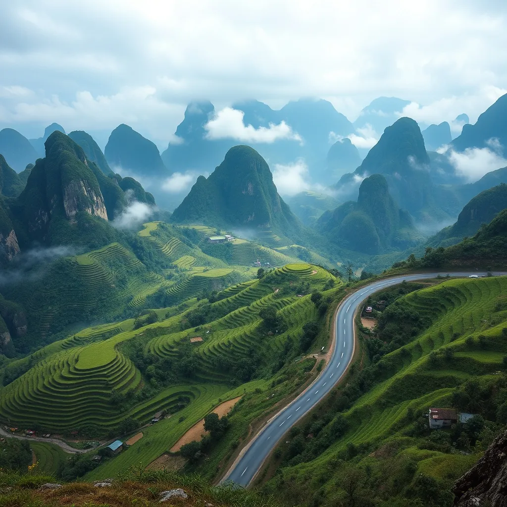
Northern Vietnam: Majestic Mountains and Timeless Traditions
Northern Vietnam is where the country reveals its most dramatic terrain. This is a land of towering peaks, deep valleys, and rivers that carve through ancient limestone. It is also home to more than 30 ethnic minority groups, each with distinct languages, clothing, and customs that have survived for centuries. The combination of raw natural beauty and living cultural heritage makes this region unlike anywhere else in Southeast Asia.
Geographically, the north is defined by the Hoang Lien Son mountain range, often called the Tonkinese Alps. Here, Fansipan rises to 3,147 meters, the highest peak in Vietnam and all of Indochina. The mountains create their own weather patterns, which means cooler temperatures year-round and a distinct seasonal rhythm that shapes both agriculture and travel.
What Makes the North Different
Travelers coming from the south or central regions notice the difference immediately. The air is crisper, the landscapes are more vertical, and the pace of life feels slower. Rice cultivation here is not just farming; it is an art form. Terraced fields carved into mountainsides create living sculptures that change color with the seasons, from the flooded mirror-like surfaces of planting season to the golden waves of harvest.
The region’s ethnic diversity adds another layer of richness. Black Hmong, Red Dao, Giay, and Tay communities are the most visible, particularly around Sapa and the northern highlands. Their traditional markets, textile crafts, and seasonal festivals offer genuine cultural encounters that go far beyond staged performances.
Vietnam welcomed over 12.6 million international visitors in 2023, and a significant portion of them headed north first. The region’s accessibility from Hanoi, combined with its concentration of UNESCO-listed sites and adventure opportunities, makes it the natural starting point for most itineraries.
Key Experiences in the North
The north rewards travelers who plan for variety. Here are the experiences that define the region:
- Ha Long Bay cruises: Glide through over 1,600 limestone islands and islets scattered across emerald waters, a UNESCO World Heritage Site that remains Vietnam’s most iconic image
- Sapa treks: Walk through terraced rice fields and hill tribe villages with Fansipan peak looming in the distance
- Ha Giang motorbike loop: Navigate some of Southeast Asia’s most spectacular mountain passes on a multi-day ride that many call the trip of a lifetime
- Ninh Binh boat rides: Paddle through karst valleys and cave systems in a landscape often compared to Ha Long Bay, but without the crowds
- Borderland exploration: Visit Ban Gioc Waterfall, one of the largest and most impressive waterfalls in Asia, tucked away on the Chinese border
Climate and Timing
The north has four distinct seasons, unlike the south’s wet-dry split. Winter, from November to February, brings cold temperatures and frequent drizzle, especially in the mountains. Sapa can drop to near freezing, and fog often obscures the views. Spring, from March to May, offers the best balance of clear skies and moderate temperatures. Summer brings heat and rain, but also the most vibrant green landscapes. Autumn, from September to October, delivers golden rice terraces and crisp, sunny days, making it the most photographed season.
The ideal travel window for most visitors is October through April. This period avoids the worst of the summer rains while keeping temperatures comfortable for trekking and outdoor activities. If your goal is to see the rice terraces at their most spectacular, plan for late September or early October, when the fields turn golden before harvest.
Getting Around the North
Hanoi serves as the region’s transport hub. From the capital, you can reach most northern destinations by bus, train, or private car within a few hours. Overnight sleeper trains connect Hanoi to Sapa and Lao Cai, while new expressways have cut driving times to Ha Long Bay and Ninh Binh significantly. For the Ha Giang loop and other remote areas, a motorbike remains the most practical and rewarding option.
The sections that follow cover 13 of the north’s finest destinations in detail. From the UNESCO-listed wonder of Ha Long Bay to the remote beauty of Ban Gioc Waterfall, these locations represent the very best of what this remarkable region has to offer. Each entry includes practical information on timing, access, and nearby attractions, so you can build an itinerary that matches your travel style and available days.
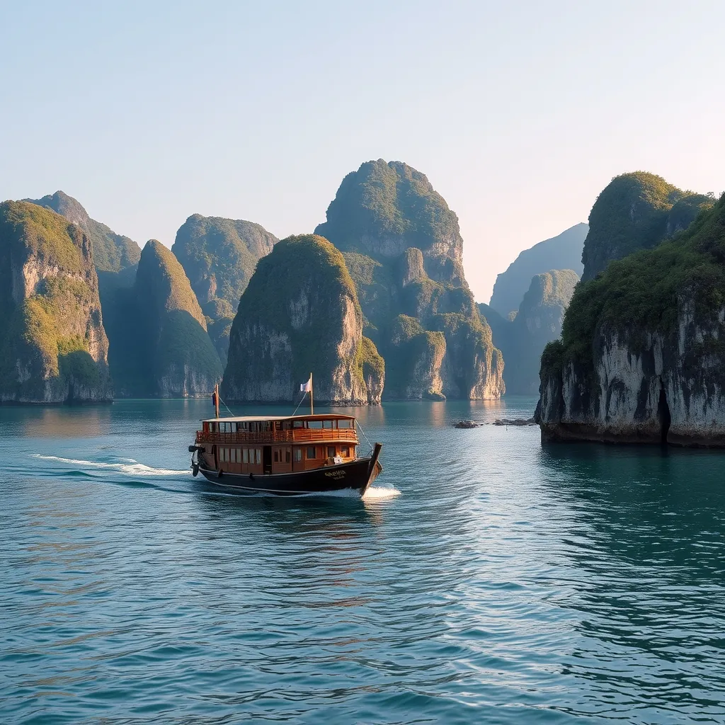
1. Ha Long Bay: The Iconic UNESCO Wonder
Ha Long Bay is the image that comes to mind when most people think of Vietnam. Thousands of limestone pillars rise from the emerald waters of the Gulf of Tonkin, creating a seascape that feels almost otherworldly. The name translates to “Descending Dragon Bay,” and local legend holds that a great dragon carved the valleys and gorges with its tail before plunging into the sea, leaving only the peaks of its handiwork visible above the waves.
UNESCO recognized Ha Long Bay as a World Heritage Site in 1994, and for good reason. The bay spans roughly 1,553 square kilometers and contains over 1,600 limestone islands and islets. These formations were shaped over millions of years by the relentless action of wind and water, resulting in dramatic towers, arches, and caves that rise abruptly from the sea. Many of the islands are hollow, containing vast cavern systems that reward exploration.
The Cruising Experience
The classic way to experience Ha Long Bay is by boat. Day cruises depart from the mainland town of Bai Chay and cover the bay’s highlights in six to eight hours. Overnight cruises offer a deeper immersion, allowing you to wake up surrounded by the karst landscape and watch the sunrise paint the limestone in shades of gold and rose. Most overnight options include kayaking excursions, cave visits, and onboard cooking classes that teach you to roll fresh spring rolls or prepare cha ca, a turmeric-marinated fish dish native to the region.
For the most memorable experience, choose a cruise that ventures into the less-trafficked corners of the bay. While the central area around Sung Sot Cave and Titop Island sees heavy traffic during peak season, the outer reaches offer quieter waters and a more intimate encounter with the landscape. Lan Ha Bay, which extends south toward Cat Ba Island, offers similar scenery with a fraction of the crowds.
Caves and Floating Villages
Beyond the scenery, Ha Long Bay hides several impressive caves. Sung Sot Cave, also known as Surprise Cave, is the largest and most visited, with chambers that open into cathedral-like spaces filled with stalactites and stalagmites. Thien Cung Cave features intricate formations that locals say resemble celestial beings. Dau Go Cave, the third major cavern, sits within easy reach of the main cruising routes and offers a more subdued atmosphere than its busier neighbors.
The bay also supports several floating fishing villages, where communities have lived on the water for generations. Cua Van is the largest and most accessible, home to around 300 people who make their living from aquaculture and tourism. A visit offers a glimpse into a way of life that has changed little over the centuries, with families moving between homes, schools, and fish farms by small wooden boats.
Practical Considerations
Ha Long Bay sits roughly 170 kilometers east of Hanoi, about a three-hour drive by road. Most visitors arrive by private car, shuttle bus, or organized tour from the capital. The nearest airport, Van Don International, opened in 2018 and now receives domestic flights from Ho Chi Minh City and a handful of international routes, cutting travel time significantly.
The best time to visit is from October to April, when the weather is cooler and the skies are clearer. Summer months bring heat and humidity, and the bay is prone to sudden storms that can disrupt cruises. That said, the misty conditions of winter create a moody, atmospheric quality that many photographers prefer.
Expect to pay between $25 and $50 for a standard day cruise, while overnight options range from $80 to $300 per person depending on the vessel’s quality and inclusions. Budget travelers can explore the bay via public ferry from Bai Chay to Cat Ba Island, though this option offers limited access to the caves and floating villages.
Ha Long Bay is not a destination to rush. Allocate at least one full day, ideally two, to appreciate the scale of the landscape and the quiet beauty that settles over the water as the day-trip boats depart and the bay returns to its natural rhythm. The combination of dramatic geology, cultural depth, and sheer visual impact makes it an essential stop on any Vietnam itinerary.
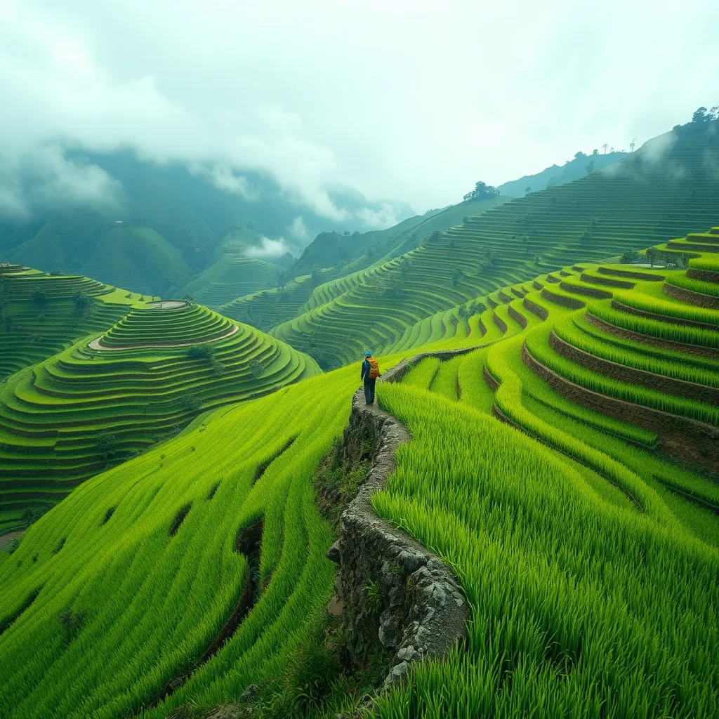
2. Sapa: Terraced Rice Fields and Fansipan Peak
Perched in the Hoang Lien Son mountain range of northwest Vietnam, Sapa sits at an elevation of roughly 1,600 meters. The town itself is a base camp for adventurers, but the real draw lies in the surrounding landscape. Sweeping terraced rice fields carve the mountainsides into stairways of green and gold, while Fansipan, the highest peak in Indochina, towers above at 3,147 meters. This is Vietnam’s alpine heart, a place where the air is cool, the mornings are misty, and the views stretch across valleys that seem to fold into infinity.
Sapa’s terraces were carved by hand over centuries by the Hmong, Dao, and Giay ethnic communities who call these mountains home. The paddies follow the contours of the slopes, creating natural amphitheaters that change color with the seasons. In May and June, the young rice shoots paint the hills in vivid green. By September and October, the fields ripen into golden waves, a spectacle that draws photographers from around the world. The planting and harvesting seasons are the most visually striking times to visit, though the terraces hold a stark beauty even in winter when the paddies lie fallow and the mist rolls through the valleys.
Conquering Fansipan Peak
Fansipan is the ultimate objective for many Sapa visitors. Known locally as “the Roof of Indochina,” the summit rewards those who reach it with panoramic views over the Hoang Lien Son range and, on clear days, all the way into China. The trek to the top is demanding, typically taking two to three days for the full ascent and descent. The route passes through dense forest, across bamboo groves, and up rocky ridgelines where the weather can shift from bright sun to freezing fog within minutes.
For those who prefer not to trek, a cable car system opened in 2016 and now carries visitors from the base station near Sapa town to within 600 meters of the summit. The ride takes roughly 20 minutes and offers aerial views over the Muong Hoa Valley and the terraced slopes below. From the upper station, a paved walkway leads to the peak, making the summit accessible to anyone with a reasonable level of fitness. The cable car has transformed Fansipan from a hardcore trekking goal into a day-trip destination, though the full trekking experience remains available for those who want the physical challenge.
If you choose to trek, hire a local guide. The trails are not always clearly marked, and the weather can disorient even experienced hikers. Guides from the Hmong and Dao communities know the mountain intimately and can adjust the pace to your fitness level. Expect to pay between $50 and $80 per day for a guide, with homestays along the route adding $10 to $15 per night. Most trekking companies also provide porters who carry food and camping gear, allowing you to focus on the climb.
The Muong Hoa Valley and Hill Tribe Villages
Below the peak, the Muong Hoa Valley spreads out in a patchwork of terraces, rivers, and scattered villages. This is where Sapa’s cultural heart beats strongest. The valley is home to several ethnic minority communities, each with its own language, dress, and traditions. The Black Hmong are the most numerous and are easily recognized by their indigo-dyed clothing, while the Red Dao wear distinctive red headscarves and silver jewelry.
Cat Cat Village, located just a few kilometers from Sapa town, is the most accessible and the most visited. It offers a glimpse of traditional Hmong life, with wooden houses, water wheels, and small craft stalls selling handmade textiles. For a more authentic experience, trek farther afield to villages like Ta Van, home to the Giay people, or Lao Chai, where the terraces are at their most dramatic. These villages are connected by a network of trails that wind through the valley, and most can be reached on a full-day trek from Sapa.
Homestays in the valley provide an immersive alternative to the hotels in town. You will sleep on a mattress in a traditional stilt house, share meals with your host family, and wake to the sound of roosters and the sight of mist lifting off the rice fields. The food is simple but generous, featuring local specialties like thang co, a hearty Hmong stew, and grilled stream fish wrapped in bamboo leaves. Prices are modest, typically $8 to $15 per night including meals, and the experience offers a connection to the landscape that no hotel can replicate.
Practical Considerations
Sapa is accessible by road from Hanoi, roughly 320 kilometers northwest of the capital. The most common route is an overnight sleeper bus or train to Lao Cai, followed by a 40-minute shuttle up the mountain to Sapa town. The train journey takes about eight hours, while the bus takes around six. A new expressway has reduced driving time from Hanoi to Sapa to about five hours, and several tour operators now offer direct transfers.
The climate in Sapa is temperate year-round, a rarity in Vietnam. Summer temperatures rarely exceed 25°C, while winter nights can drop to near freezing. The town is frequently shrouded in mist, particularly from December to February, which adds atmosphere but can obscure the views. For the clearest skies, visit from March to May or September to November. Pack layers, sturdy walking shoes, and rain gear regardless of the season, as mountain weather is notoriously changeable.
Sapa rewards those who linger. A single day offers a taste of the landscape, but three to four days allow you to trek the valley, climb Fansipan, and spend a night in a village homestay. The combination of dramatic mountain scenery, rich cultural traditions, and the simple pleasure of walking through terraced fields that have been cultivated for generations makes Sapa one of Vietnam’s most compelling destinations. It is a place that stays with you long after the mist has cleared and the mountains have faded from view.
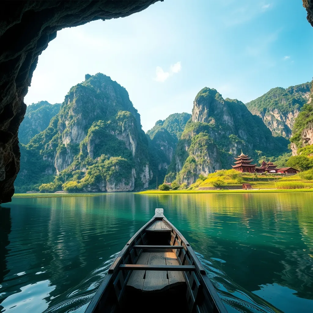
3. Ninh Binh: ‘Ha Long Bay on Land’
About 100 kilometers south of Hanoi, the landscape transforms into something unexpected. Ninh Binh province rises from the Red River Delta in a dramatic burst of limestone karsts, emerald waterways, and ancient temples. The nickname “Ha Long Bay on Land” fits, though it undersells the region’s distinct character. Where Ha Long Bay spreads across open water, Ninh Binh’s karsts rise directly from rice paddies and winding rivers, creating a landscape that feels both monumental and intimate.
The region’s geological history explains the terrain. Millions of years of erosion carved these limestone towers from an ancient seabed, leaving behind the jagged peaks, hidden caves, and underground rivers that define the area today. The result is a landscape that shifts from lush green valleys to sheer rock faces, with waterways threading through it all. In 2014, UNESCO recognized the Trang An Landscape Complex as a World Heritage Site, citing its geological significance and its role as a cradle of early human settlement. Archaeologists have found evidence of human activity in the region’s caves dating back nearly 30,000 years.
Trang An: A Boat Ride Through Time
Trang An is the crown jewel of Ninh Binh and the most popular way to experience the karst landscape. The site spans more than 6,000 hectares and contains a network of rivers, caves, and valleys that visitors explore by traditional rowboat. Local women row the wooden boats using their feet, a technique that allows them to navigate the low cave entrances with practiced ease. The standard tour lasts two to three hours and passes through a series of caves, some so low you must duck to pass beneath the rock, others opening into vast cathedral-like chambers where stalactites hang from the ceiling.
The boat routes are not arbitrary. They wind past temples built into the cliffsides, remnants of the ancient capital that once stood here. The Trinh Nguyen Temple, dating from the 10th century, clings to a rock face above the water. The boat will stop briefly so you can climb the steps and explore. The journey also passes through the site where the film “Kong: Skull Island” was shot in 2016, a detail that has drawn a new wave of visitors to the region.
A second boat tour operates at Tam Coc, a nearby site with a similar landscape but a different character. Tam Coc translates to “three caves,” and the boat ride passes through exactly that: Hang Ca, Hang Hai, and Hang Ba. The route is shorter than Trang An’s, roughly 90 minutes, but the scenery is equally striking. Rice paddies line the riverbanks, and during the harvest season from May to June, the fields turn a brilliant gold that contrasts sharply with the dark limestone cliffs. The rowers here also use their feet, and the experience feels more rustic and less managed than Trang An.
Choose Trang An for the larger caves and the temple stops. Choose Tam Coc for the rice field views and a more relaxed pace. Both operate daily from 7:00 a.m. to 5:00 p.m., with boats departing as soon as they fill. Tickets for Trang An cost 250,000 VND (about $10) per person, while Tam Coc is slightly cheaper at 150,000 VND (about $6). Arrive early in the morning to beat the tour groups that flood in from Hanoi around midday.
Hoa Lu: The Ancient Capital
Before Hanoi became Vietnam’s capital, Hoa Lu held that honor. From 968 to 1009, this was the seat of the Dinh and Le dynasties, a period when Vietnam was consolidating its independence after centuries of Chinese rule. The city was strategically positioned within the karst mountains, their sheer cliffs providing natural fortification. Today, little remains of the original citadel, but the temple complex that honors the ancient kings draws visitors who want to understand Vietnam’s early history.
The main temple, Dinh Tien Hoang Temple, was rebuilt in the 17th century but follows the traditional layout of Vietnamese imperial architecture. The building is constructed from rare ironwood, with intricate stone carvings depicting dragons, phoenixes, and lotus flowers. A statue of Emperor Dinh Bo Linh, the founder of the Dinh dynasty, sits at the center of the sanctuary, surrounded by the regalia of his reign. A short walk away, Le Dai Hanh Temple honors his successor, Emperor Le Hoan, and features similar architectural details.
The temples sit in a valley surrounded by karst peaks, and the setting alone justifies the visit. From the temple complex, a short path leads to a viewpoint that overlooks the entire valley, with rice paddies stretching toward the mountains. The walk takes about 20 minutes and requires climbing roughly 300 stone steps, but the panorama at the top is one of the finest in Ninh Binh. On clear days, you can see the Tam Coc boat route winding through the fields below.
Hoa Lu is compact and can be explored in two to three hours. The entrance fee is 150,000 VND (about $6), which includes access to both temples and the viewpoint. Combine a visit here with a boat ride at Trang An or Tam Coc to make a full day of it. The sites are only a few kilometers apart, and most tour operators offer combined packages that include transportation, a guide, and lunch.
Beyond the Main Attractions
Ninh Binh has more to offer than its two headline sites. The Mua Cave viewpoint, located near Tam Coc, has become a social media sensation for good reason. The climb to the top involves 486 stone steps, but the reward is a sweeping view of the entire Tam Coc valley, with the Ngo Dong River snaking through the rice fields below. The viewpoint is at its best in the late afternoon when the light turns golden and the crowds thin out.
For a quieter experience, rent a bicycle and explore the rural roads that connect the region’s villages. The terrain is flat, and the distances are manageable, making cycling an ideal way to see the countryside. You will pass through small hamlets, past water buffalo grazing in the fields, and alongside canals where local fishermen cast their nets. Several homestays in the area offer free bicycle rental to guests, and the back roads see little motorized traffic.
Bich Dong Pagoda, a three-tiered temple complex built into a limestone cliff, is another worthwhile stop. The pagoda dates from the 15th century and was built during the Le dynasty. A stone bridge leads to the lower temple, while the upper tiers are reached by climbing through a dark cave and emerging on a terrace with views over the surrounding countryside. The pagoda is quieter than Trang An or Hoa Lu, offering a moment of calm away from the main tourist flow.
Practical Considerations
Ninh Binh is easily reached from Hanoi by train, bus, or private car. The train from Hanoi’s Giap Bat station takes about two hours and costs roughly 100,000 VND (about $4) for a seat in second class. The station at Ninh Binh city is a short taxi or xe om (motorbike taxi) ride from the main tourist areas. Buses from Hanoi’s Giap Bat or My Dinh stations take about two and a half hours and cost slightly less. Several tour operators run day trips from Hanoi, but staying overnight is strongly recommended; the region deserves at least two days to explore properly.
The best time to visit Ninh Binh is from November to April, when temperatures are moderate and rainfall is low. The rice harvest season in late May and early June offers the most dramatic scenery, though the heat and humidity can be intense. From September to October, the paddies are newly planted and the fields are a vivid green. Avoid the Vietnamese public holidays, particularly the Lunar New Year period in late January or February, when domestic tourists flood the region and prices spike.
Accommodation options range from budget hostels to boutique resorts. The town of Tam Coc has the highest concentration of guesthouses, many of which are family-run and offer home-cooked meals. Homestays in the surrounding villages provide a more immersive experience, with rates typically between $15 and $30 per night including breakfast. For a splurge, a handful of eco-lodges set in the karst landscape offer private bungalows with views over the rice fields, though these book out well in advance during peak season.
Ninh Binh rewards a slower pace. The landscape is best experienced from the water, gliding through caves and past cliffs that have stood for millions of years. It is a place where Vietnam’s natural beauty and its ancient history converge, where the echoes of emperors and the quiet rhythm of rural life coexist within a few square kilometers. Spend two days here, and you will leave with a sense of having seen something genuinely special, a landscape that rivals Ha Long Bay without the crowds.
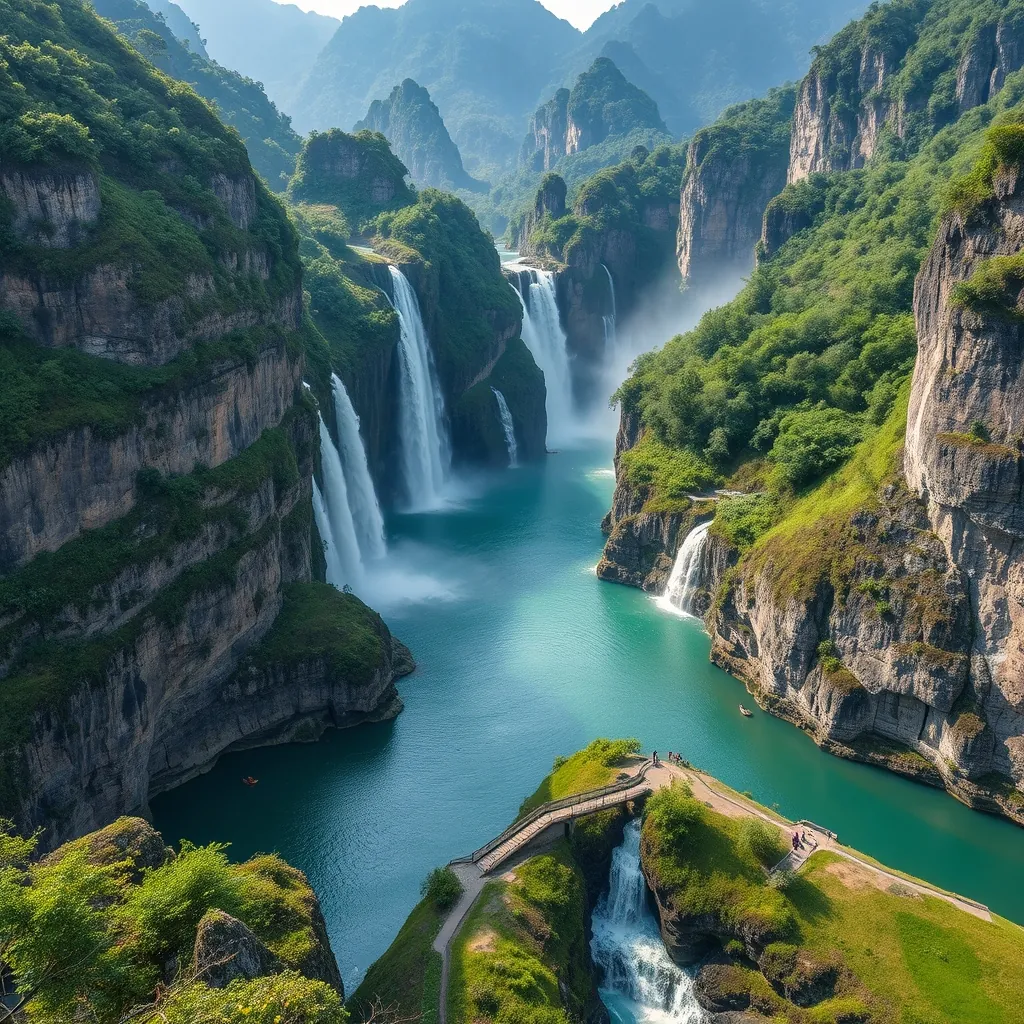
4. Ban Gioc Waterfall: A Hidden Gem on the Border
Most visitors to Vietnam never make it to the far north. That is precisely why Ban Gioc Waterfall feels so special. Tucked into the remote Cao Bang province, roughly 300 kilometers from Hanoi, this cascade sits directly on the border with China. It is not just one of Vietnam’s most spectacular natural wonders; it is one of the largest transnational waterfalls in the world, a title it shares with the Iguazu Falls on the Argentina-Brazil border and the Victoria Falls on the Zambia-Zimbabwe border.
The waterfall spans roughly 300 meters across the Quay Son River, which forms the natural boundary between the two countries. The river drops over a series of limestone ledges in multiple tiers, creating a curtain of water that thunders into turquoise pools below. The volume varies dramatically with the season. During the rainy months from June to September, the water runs brown and powerful, the roar audible from the parking area. From October to April, the flow turns clear and the cascade breaks into distinct streams that tumble over the moss-covered rocks with a gentler rhythm. Most photographers prefer the dry season for the clarity of the water and the ability to walk across the shallow sections of the riverbed.
Getting There: The Journey Is Part of the Experience
The road to Ban Gioc is long, but it is one of the most scenic drives in Vietnam. From Hanoi, the journey takes seven to eight hours by car or bus, winding through the mountains of Cao Bang province. The final stretch, a 60-kilometer road that branches off from the town of Cao Bang, passes through villages, terraced fields, and karst peaks that rival those of Ninh Binh. The road was upgraded in recent years and is now paved for most of the route, though sections remain narrow and winding. A motorbike is a popular option for experienced riders, but the distance and the mountain passes demand a full day of riding.
Public buses run from Hanoi’s My Dinh station to Cao Bang town, with departures throughout the day. The journey costs roughly 250,000 to 350,000 VND (about $10 to $14) and takes around seven hours. From Cao Bang, local minibuses and xe om services cover the remaining 80 kilometers to the waterfall. A private car with a driver is the most convenient option, and tour operators in Hanoi offer two-day packages that include stops at other sites along the way, such as the Pac Bo Cave where Ho Chi Minh lived after returning from exile in 1941.
Exploring the Waterfall and Its Surroundings
The main viewing area sits on the Vietnamese side of the river, with a paved walkway that runs along the riverbank and leads to a series of platforms overlooking the falls. A footbridge crosses the river to a small island where visitors can get closer to the cascade. The spray from the falling water keeps the air cool, and on sunny days, rainbows frequently form in the mist. The best light for photography falls in the late afternoon, when the sun angles across the falls and the karst mountains behind them glow gold.
Beyond the waterfall itself, the region rewards those who linger. The nearby Nguom Ngao Cave, discovered in 1921, stretches for roughly 3 kilometers and contains a series of chambers filled with stalactites and stalagmites. The cave is less developed than others in Vietnam, with basic lighting and walkways, which adds to its raw appeal. A guide is recommended, as the cave’s passages branch in several directions and it is easy to get turned around without one. The entrance fee is 45,000 VND (about $2), and the tour takes roughly an hour.
The village of Ban Gioc itself is small, with a handful of homestays and guesthouses that cater to the trickle of visitors who stay overnight. Staying here allows you to experience the waterfall at dawn, when the tourist groups have not yet arrived and the only sounds are the falling water and the birds. Several homestays offer meals made from locally grown ingredients, including the region’s distinctive smoked pork and river fish. A night in the village costs between $10 and $20 per person, including breakfast.
Border Formalities and Practical Tips
Because Ban Gioc sits directly on the border, a small checkpoint operates nearby. Vietnamese citizens and foreigners with valid visas can visit the waterfall without special permits, but you must carry your passport. The border crossing itself is not open to tourists; the checkpoint is for local residents and border patrol. Do not attempt to cross the footbridge to the Chinese side, as the guards on both sides take border violations seriously. The area is safe, but the presence of the border adds a layer of formality that visitors should respect.
The best time to visit is from October to April, when the weather is dry and the water is clear. The rainy season brings a more powerful flow but also muddy water and slippery paths. The waterfall is at its most photogenic in November and December, when the rice fields in the surrounding valleys have turned gold and the skies are often clear. Temperatures in winter can drop to 10°C (50°F) or lower, so pack layers even if you are traveling from the warmer south.
Ban Gioc is not an easy destination. The distance, the mountain roads, and the limited infrastructure keep it off the standard tourist circuit. That is precisely its appeal. Fewer visitors mean fewer crowds, no entrance queues, and a sense of discovery that has largely vanished from Vietnam’s more famous sites. The waterfall rewards those who make the journey with one of the most dramatic natural spectacles in Southeast Asia, a place where the landscape itself marks the boundary between nations.
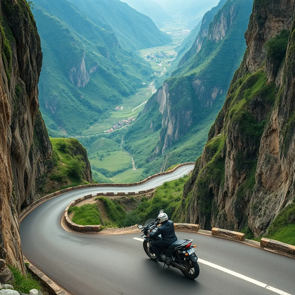
5. Ha Giang: The Ultimate Motorbike Loop
If Ban Gioc rewards the patient traveler, Ha Giang demands a different kind of commitment. This northernmost province of Vietnam is not a destination you simply visit; it is a route you conquer. The Ha Giang loop, a roughly 350-kilometer circuit that starts and ends in the provincial capital, has earned a reputation as one of the most spectacular motorcycle rides in Southeast Asia. The dramatic passes, the sheer limestone cliffs, and the deep river valleys create a landscape that feels almost theatrical in its intensity. The loop is not just about the scenery, though. It is about the people who live in the remote villages along the way, the Hmong, Dao, and Tay communities whose terraced fields and stilt houses cling to the mountainsides.
The loop typically takes three to four days to complete, depending on your pace and how many stops you make along the way. The standard route runs counterclockwise from Ha Giang city, heading north through the town of Quan Ba, then east to Yen Minh, before the road climbs toward the Dong Van Karst Plateau. From Dong Van, the route continues to the Ma Pi Leng Pass, the most dramatic section of the entire circuit, before descending to the town of Meo Vac and looping back through the mountains to Ha Giang. The total distance is manageable, but the terrain is not. The road climbs and drops continuously, with hairpin turns that demand full attention and a motorcycle with decent clearance.
Why the Loop Demands a Motorbike
The question of how to experience Ha Giang comes up in every travel forum, and the answer is almost always the same: by motorbike. Cars can technically navigate the loop, but they miss the point. The freedom of a bike allows you to stop at a moment’s notice, to pull over on a switchback and watch the clouds roll through the valley below, to feel the temperature drop as you climb toward a pass. The road itself is in surprisingly good condition, with most sections paved and well-maintained. The challenge is not the surface but the elevation changes and the sheer number of curves. A day on the loop can involve more than a thousand turns, which is why experienced riders recommend taking it slow and building in plenty of rest stops.
Renting a motorbike in Ha Giang city is straightforward. Dozens of shops offer semi-automatic and manual bikes, with prices ranging from 150,000 to 250,000 VND per day (about $6 to $10). A helmet is always included, and most shops provide basic insurance. If you are not confident riding a motorbike, the alternative is an easy rider tour, where an experienced local driver takes you on the back of their bike. This option costs more, typically $50 to $80 per day including meals and homestays, but it allows you to focus entirely on the scenery rather than the road. Many travelers who arrive without riding experience choose this route, and the local drivers are skilled at navigating the passes and know the best viewpoints and homestays along the way.
The Passes and Viewpoints That Define the Route
The first major viewpoint on the loop is Quan Ba Heaven Gate, a mountain pass that offers a sweeping panorama of the Tam Son valley below. The view from the top is a classic Ha Giang scene: jagged karst peaks rising from a patchwork of rice paddies, with small villages scattered across the valley floor. The pass sits at roughly 1,500 meters, and the air is noticeably cooler than in the valley below. A short walk from the main viewpoint leads to a smaller platform that overlooks the famous Twin Mountains, two perfectly rounded hills that locals call the fairy breasts, a reference to a legend about a goddess who left her imprint on the landscape.
Further along the route, the Dong Van Karst Plateau unfolds as a geological wonder. This UNESCO Global Geopark covers more than 2,300 square kilometers and contains fossils and rock formations dating back hundreds of millions of years. The plateau is not a flat expanse but a series of limestone ridges and valleys, with villages tucked into the folds of the landscape. The town of Dong Van itself is worth a stop, particularly its old quarter, where century-old houses with yin-yang tiled roofs line narrow streets. The Dong Van Market, held every Sunday, draws ethnic minority groups from the surrounding mountains who come to trade livestock, textiles, and local produce. It is one of the most authentic markets in Vietnam, with a raw energy that stands in contrast to the curated experiences found elsewhere.
The undisputed highlight of the loop is the Ma Pi Leng Pass, a 20-kilometer stretch of road that clings to the side of a sheer cliff above the Nho Que River. The pass reaches an elevation of roughly 2,000 meters, and the road offers uninterrupted views of the river winding through the valley below, a ribbon of turquoise cutting through the dark limestone. Several viewpoints along the pass provide places to stop and take in the scale of the landscape. The most dramatic is the Sky Path, a short walking trail that leads to a platform suspended over the edge of the cliff. For those with a head for heights, a boat tour on the Nho Que River offers a different perspective, with the valley walls rising hundreds of meters on either side. These boat trips depart from a small pier at the bottom of the pass and cost around 100,000 VND (about $4) per person.
Staying With Local Communities
The homestays along the loop are an essential part of the experience. Unlike the standardized guesthouses in Vietnam’s tourist hubs, these are family homes where you sleep on a mattress in a shared room and eat meals prepared by your hosts. The food is local and seasonal, often featuring dishes that do not appear on restaurant menus elsewhere. Expect to try thang co, a traditional Hmong stew made with horse meat and organs, which is served with corn wine and is an acquired taste. The homestays also offer a genuine window into daily life in the mountains. Evenings are spent around a fire pit, sharing stories with other travelers and the family, often with a language barrier that somehow makes the conversation more meaningful.
The cost of a homestay along the loop is remarkably low. Most charge between 100,000 and 200,000 VND (about $4 to $8) per night, including dinner and breakfast. Some of the more popular homestays, particularly those in the villages near Dong Van and Meo Vac, fill up quickly during peak season from October to December, so booking ahead is advisable. The accommodations are basic, with shared bathrooms and thin mattresses, but the warmth of the hospitality more than compensates for the lack of luxury. The experience is about connection, not comfort.
Practical Considerations for the Loop
The best time to ride the loop is from October to December, when the rice terraces have turned gold and the skies are clear. The weather is cool and dry, with daytime temperatures ranging from 15°C to 25°C (59°F to 77°F). Nights are cold, particularly at higher elevations, so a warm jacket is essential. From January to March, the region experiences its winter season, with temperatures dropping to near freezing and frequent fog that can obscure the views. The summer months bring heavy rain and the risk of landslides, which can close sections of the road. The loop is accessible year-round, but the conditions are far more pleasant in the dry season.
Riders should carry their passport at all times, as there are several police checkpoints along the loop, particularly near the Chinese border. The checkpoints are routine, and officers simply verify your documents and wave you through. An international driving permit is technically required to ride a motorcycle in Vietnam, though enforcement is inconsistent. If you are involved in an accident, the lack of a valid permit can complicate insurance claims, so it is worth obtaining one before you arrive. Travel insurance that covers motorcycle riding is also strongly recommended, as the mountain roads carry inherent risks.
The Ha Giang loop is not a gentle introduction to Vietnam. It is a demanding, raw, and unforgettable journey through one of the country’s most remote and beautiful regions. The landscape changes with every bend, from terraced valleys to limestone peaks to the deep gash of the Nho Que River. The people you meet along the way, the Hmong women selling handwoven textiles at the markets, the children waving from the roadside, the homestay hosts who share their dinner and their stories, leave an impression that lasts long after the road ends. For travelers willing to embrace the challenge, the loop delivers an experience that no other destination in Vietnam can match.
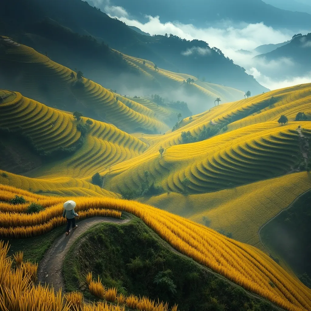
6. Mu Cang Chai: Rice Terrace Paradise
While Ha Giang rewards the adventurous rider, Mu Cang Chai offers a different kind of northern Vietnam experience. This remote district in Yen Bai Province is home to some of the most spectacular rice terraces in Southeast Asia, a landscape shaped by centuries of Hmong farming traditions. The terraces here are not the gentle, stepped fields found elsewhere. They are dramatic, gravity-defying staircases carved into mountainsides that rise at angles approaching 70 degrees. The result is a visual spectacle that shifts with the seasons, from the mirror-like flooded fields of spring to the golden waves of the autumn harvest.
Mu Cang Chai sits roughly 300 kilometers northwest of Hanoi, but the journey takes a full day by road. The winding mountain route passes through lush valleys and over high passes, with the landscape becoming increasingly dramatic as you approach the district. Most travelers base themselves in the town of Mu Cang Chai itself, a modest settlement that serves as the gateway to the surrounding terraces. From here, the most famous viewpoints are within a 20-kilometer radius, connected by a road that climbs and falls through the heart of the terrace system.
The Three Most Iconic Viewpoints
The terrace system in Mu Cang Chai covers more than 2,200 hectares and has been recognized by the Ministry of Culture, Sports, and Tourism as a national heritage site. Within this vast area, three viewpoints have become the standard stops for photographers and travelers alike. Each offers a distinct perspective on the landscape, and together they provide a comprehensive view of what makes this region so special.
The first and most accessible is the Mam Xoi viewpoint, located about 10 kilometers from the town center. The name translates to “sticky rice tray,” a reference to the way the terraces resemble a traditional offering of glutinous rice. The viewpoint sits at the top of a steep hill, and the short climb is rewarded with a panoramic view of terraces that seem to flow down the mountainside like liquid gold. The second viewpoint, known as Tu Le, is actually a valley rather than a single point. The road descends into this broad basin where the terraces are interspersed with traditional stilt houses and small hamlets. The light here is particularly beautiful in the late afternoon, when the low sun casts long shadows across the curved contours of the fields.
The third viewpoint, Che Cu Nha, is the most remote and the most rewarding. It requires a short hike from the main road, but the effort is justified. From this vantage point, the terraces stretch to the horizon, layer upon layer of golden steps climbing toward the ridgeline. The village below is small and quiet, with a handful of homestays and a single shop selling cold drinks. The sense of isolation here is profound, and it is easy to spend hours watching the light shift across the landscape without seeing another traveler.
When the Landscape Transforms
The character of Mu Cang Chai changes dramatically throughout the year. From late September to mid-October, the terraces reach their peak color, a burnished gold that draws photographers from around the world. This is the harvest season, and the fields are alive with activity as farmers cut the rice by hand and bundle it into sheaves. The most striking views come in the early morning, when the low sun illuminates the terraces from a shallow angle and the mist lingers in the valleys below.
From May to June, the terraces are flooded in preparation for planting, creating a different kind of beauty. The water reflects the sky, transforming the mountainsides into a mosaic of mirrors that change color with the clouds. This is the season for reflection shots, when the terraces appear as abstract patterns of light and shadow. The planting season follows in June and July, when the young rice shoots create a vivid green carpet that gradually deepens through the summer months.
For travelers who want to witness the harvest itself, the timing is precise. The rice is typically ready for cutting in the first two weeks of October, though the exact dates vary with the weather and the altitude of each terrace. The higher fields ripen first, so the harvest progresses from the top of the mountains downward. A visit in early October offers the best chance to see the full spectrum of colors, from the golden upper terraces to the still-green lower fields.
Getting There and Getting Around
Reaching Mu Cang Chai requires planning. The most common approach is to take a sleeper bus from Hanoi to the town of Nghia Lo, a journey of roughly five hours, and then transfer to a local bus for the final two-hour leg to Mu Cang Chai. The total cost is around 300,000 VND (about $12) per person. Alternatively, the district can be reached by motorbike from Hanoi, a full-day ride of approximately 300 kilometers that follows the Red River north before climbing into the mountains. Many travelers combine Mu Cang Chai with a broader loop through the northwest, connecting it to Sapa and Ha Giang over the course of a week or more.
Once in Mu Cang Chai, the best way to explore is by motorbike. Rentals are available in the town center for around 150,000 VND (about $6) per day, and the roads to the main viewpoints are paved and manageable for riders of moderate experience. For those who prefer not to ride, xe om (motorbike taxi) drivers can be hired for the day, with prices typically ranging from 400,000 to 600,000 VND (about $16 to $24) depending on the distance and the number of stops. The drivers are local and know the best viewpoints and the optimal times to visit each one.
Staying in the Terraces
Accommodation in Mu Cang Chai ranges from basic guesthouses in the town to homestays in the surrounding villages. The homestays offer the more memorable experience, with families welcoming guests into their stilt houses for a night of home-cooked food and conversation. The rooms are simple, with thin mattresses on the floor and shared bathrooms, but the hospitality is genuine and the setting is unbeatable. Many homestays are situated directly among the terraces, offering views that change with the light from your bedroom window.
Prices for homestays range from 100,000 to 200,000 VND (about $4 to $8) per night, including dinner and breakfast. The meals are hearty and local, featuring dishes like boiled chicken with lemongrass, stir-fried vegetables from the garden, and the region’s famous sticky rice. During the harvest season, some homestays offer the chance to join the farmers in the fields, a hands-on experience that provides a deeper connection to the landscape. The work is demanding, but the reward is a genuine understanding of the labor that goes into creating these terraces.
Photography Tips for the Golden Season
For photographers, Mu Cang Chai is a destination that demands preparation. The golden season is short, and the light is unforgiving. The best shots come in the first and last hours of daylight, when the sun is low and the terraces glow with warm tones. The midday sun flattens the landscape and washes out the colors, so plan your day around the early morning and late afternoon. The mist that often settles in the valleys at dawn can add depth and atmosphere to your images, so be ready to shoot as soon as the light breaks.
A telephoto lens is essential for capturing the details of the terraces, particularly the curved contours and the patterns created by the hand-built stone walls. A drone offers a different perspective, revealing the sheer scale of the terrace system and the way it wraps around the mountains. Drone regulations in Vietnam require registration and permission for foreign visitors, so check the current rules before you fly. For those without a drone, the elevated viewpoints provide ample opportunity for wide-angle shots that capture the full sweep of the landscape.
The terraces of Mu Cang Chai are not just a scenic backdrop. They are a living cultural landscape, shaped by generations of Hmong farmers who have cultivated these slopes for centuries. The knowledge of how to build and maintain these terraces, how to manage the water flow, and how to time the planting and harvest is passed down through families. The result is a place that rewards both the casual traveler and the dedicated photographer, offering a glimpse into a way of life that has remained largely unchanged for generations. Whether you visit during the golden harvest or the mirror-like flooding season, the landscape leaves an impression that lingers long after you descend the mountain.
7. Mai Chau: A Peaceful Valley Retreat
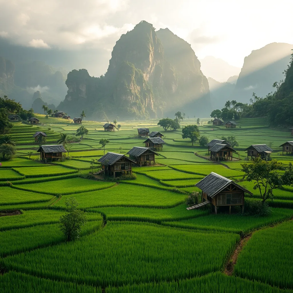
After the demanding mountain passes of Ha Giang and the high-altitude terraces of Mu Cang Chai, Mai Chau offers a gentler rhythm. This lush valley in Hoa Binh Province sits just 140 kilometers southwest of Hanoi, yet it feels a world apart from the capital’s relentless energy. The valley floor is a patchwork of emerald rice paddies, dotted with traditional stilt houses of the Thai ethnic minority. Towering limestone karsts ring the horizon, their sheer cliffs rising abruptly from the flat farmland below. The contrast is striking, and the atmosphere is one of profound calm.
Mai Chau is not a single town but a collection of small villages, with the main cluster known as Lac Village. This is where most visitors base themselves, and the village has evolved into a hub for homestay tourism without losing its essential character. The stilt houses here are built from timber and bamboo, raised on sturdy pillars to protect against flooding and wildlife. The ground floor is open, used for storage and for weaving looms where women produce the intricate brocade textiles that are a hallmark of Thai culture. The living quarters are upstairs, reached by a steep wooden ladder, and the interiors are simple but welcoming.
The Rhythm of Valley Life
Life in Mai Chau moves at the pace of the rice cycle. From May through September, the paddies are flooded and planted, creating a mirror-like surface that reflects the surrounding mountains. By October, the rice has ripened to gold, and the harvest brings the community together in a flurry of activity. The winter months, from November to February, are cooler and drier, with the valley taking on a softer, muted palette. The mornings bring a gentle mist that clings to the valley floor before burning off by mid-morning.
The best way to experience this landscape is on two wheels. Bicycles are available for rent at most homestays for around 50,000 VND (about $2) per day, and the flat valley floor makes cycling an easy and rewarding pursuit. A loop of roughly 15 kilometers takes you through Lac Village, past the neighboring Pom Coong and Van villages, and along quiet lanes lined with bamboo groves and banana plants. The terrain is gentle, and the pace allows you to notice the details: the water buffalo cooling in the irrigation channels, the elderly women weaving on their porches, the children waving as you pass.
For those who prefer to cover more ground, motorbikes can be rented for about 150,000 VND (about $6) per day. The roads are well-maintained, and a ride to the nearby Thung Khe Pass offers a dramatic change of scenery. The pass, also known as the “White Rock Pass” for the pale limestone that lines the road, climbs steeply out of the valley and rewards riders with sweeping views of the surrounding peaks. On a clear day, the panorama stretches for miles, with the valley floor far below appearing as a green carpet stitched with silver streams.
Homestays and Thai Hospitality
The homestay experience is the heart of a visit to Mai Chau. Unlike the basic accommodations found in more remote regions, the stilt houses here have been adapted for tourism with care. Rooms are clean and comfortable, with proper mattresses and mosquito nets, and the shared bathrooms are modern. The real draw, however, is the hospitality. Families open their homes to guests, sharing meals prepared over open fires and offering insights into their daily lives.
Dinner is a communal affair, served on low tables with guests seated on woven mats. The food is distinctly Thai, featuring dishes like grilled river fish wrapped in banana leaves, bamboo shoot soup, and sticky rice steamed in bamboo tubes. The flavors are earthy and fresh, and the portions are generous. After the meal, the family often brings out the traditional instruments, and the evening fills with the sounds of the khen, a bamboo mouth organ, and the deep resonance of bronze gongs. Guests are encouraged to join in the dancing that follows, and the atmosphere is one of genuine warmth rather than staged performance.
Prices for homestays in Mai Chau range from 150,000 to 300,000 VND (about $6 to $12) per night, including dinner and breakfast. The higher end of the range typically includes a private room and additional amenities like hot water and air conditioning. Given the quality of the food and the hospitality, the value is exceptional. Many homestays also offer day activities such as guided walks to nearby caves, visits to local craft villages, and cooking classes where you can learn to prepare the dishes you enjoyed the night before.
Beyond the Valley Floor
While the valley itself is the main attraction, the surrounding area offers opportunities for deeper exploration. The Pu Luong Nature Reserve, located about 40 kilometers to the west, is a protected area of limestone mountains and terraced rice fields that rivals the more famous landscapes of Sapa. The reserve is less visited than Mai Chau, and its trails wind through remote villages where the Thai and Muong ethnic minorities maintain traditional ways of life. A day trip from Mai Chau is possible, but an overnight stay in one of the reserve’s eco-lodges is the better choice for those who want to immerse themselves fully.
Closer to the valley, the Mo Luong Cave offers a cool escape from the midday heat. The cave is modest in scale, with a series of chambers connected by narrow passages, but the stalactite formations are intricate and the lighting is dramatic. The entrance is hidden behind a curtain of vines, and the walk to the cave passes through a small village where farmers still thresh rice by hand. The visit takes about an hour, and the cave is best combined with a longer walk through the surrounding countryside.
For travelers with more time, the Mai Chau area can be combined with a visit to the Hoa Binh Hydroelectric Dam, one of the largest in Southeast Asia. The dam created a vast reservoir that stretches back into the mountains, and boat trips on the lake offer a different perspective on the region. The journey from Mai Chau to the dam takes about two hours by road, and the route passes through some of the most scenic countryside in northern Vietnam. The lake itself is dotted with small islands, and the water is a deep, clear green that reflects the forested slopes.
Practical Considerations
Getting to Mai Chau is straightforward. The most common approach is to take a bus from Hanoi’s My Dinh station, with departures throughout the day. The journey takes about three and a half hours and costs around 120,000 VND (about $5) per person. The road is good, winding through the countryside before climbing over the Thung Khe Pass and descending into the valley. Alternatively, many travelers combine Mai Chau with a longer loop through the northwest, using it as a first or last stop on a journey that includes Sapa, Mu Cang Chai, and Ha Giang.
The best time to visit Mai Chau is from October to April, when the weather is dry and the temperatures are pleasant. The summer months bring heat and humidity, with frequent afternoon showers that can turn the valley trails to mud. The harvest season in October is the most visually striking, but the winter months offer a quieter experience with fewer visitors. The valley is popular with domestic tourists on weekends, so a midweek visit provides a more authentic and peaceful experience.
Mai Chau rewards those who slow down. The valley does not offer the dramatic peaks of Sapa or the adrenaline of the Ha Giang loop. What it offers is something rarer: a chance to step into a way of life that has remained largely unchanged for generations, to share a meal with a family in their home, and to wake up to the sound of birdsong and the sight of mist rising from the rice fields. For travelers seeking a respite from the intensity of Vietnam’s more famous destinations, this quiet valley is exactly what the journey calls for.

8. Ba Be National Park: Vietnam’s Largest Natural Lake
Ba Be National Park is a landscape of water and stone, where a pristine lake sits cradled in the arms of ancient limestone mountains. Located in Bac Kan Province, roughly 240 kilometers north of Hanoi, the park protects Vietnam’s largest natural mountain lake and one of the most biodiverse ecosystems in the country. The lake itself stretches about eight kilometers in length, its surface broken by small islands and framed by sheer cliffs that rise hundreds of meters from the water. This is not a manicured tourist attraction. It is a living, breathing wilderness where the rhythms of the forest and the lake dictate the pace of life.
The park covers more than 10,000 hectares, encompassing the lake, its tributaries, and the surrounding forested mountains. The biodiversity here is exceptional. Over 550 plant species have been recorded, along with more than 300 animal species, including several that are rare or endangered. The clouded leopard, the Asian black bear, and the Tonkin snub-nosed monkey all call this park home, though sightings are rare and require patience and a bit of luck. Birdwatchers will find the park especially rewarding, with over 200 species documented, including the striking red-vented barbet and the elusive crested kingfisher.
The Lake and Its Villages
The lake is formed by the confluence of three rivers: the Ta Han, the Nam Lu, and the Bo Lu. These rivers flow down from the surrounding mountains, converging in a natural basin that is held back by a massive limestone formation known as Puong Cave. The result is a body of water that is both deep and remarkably clear, its surface reflecting the forested slopes that surround it. The local Tay ethnic minority people have lived along the lake’s shores for generations, and their stilt houses are a common sight along the water’s edge.
The main settlement is Pac Ngoi Village, a cluster of stilt houses that has become the primary base for visitors. The village is home to around 40 families, many of whom have converted their homes into homestays. The accommodations are simple but comfortable, with clean rooms, shared bathrooms, and home-cooked meals featuring local specialties like grilled fish from the lake and wild vegetables gathered from the forest. The Tay people are known for their hospitality, and an evening spent with a host family, sharing stories over a meal of sticky rice and river fish, is one of the most memorable experiences the park offers.
Boat trips are the standard way to explore the lake. Traditional wooden longboats, powered by small motors, depart from Pac Ngoi and glide across the still water, passing through narrow channels where the limestone cliffs close in on either side. The boats are operated by local families, and the guides are knowledgeable about the lake’s history and ecology. A typical trip lasts four to five hours and includes stops at the main points of interest: the Dau Dang Waterfall, Puong Cave, and the floating fishing villages that dot the lake’s southern end.
Waterfalls and Caves
Dau Dang Waterfall, also known as the “Head of the Water” Waterfall, is the park’s most dramatic natural feature. The waterfall is not a single drop but a series of cascades where the Nang River forces its way through a narrow gorge of dark limestone. The water thunders over the rocks, creating a constant mist that hangs in the air and coats the surrounding vegetation. The viewing platform is reached by a short walk from the boat landing, and the roar of the water grows louder with each step. During the dry season, from November to April, the flow is reduced, revealing the sculpted rock formations beneath. In the wet season, the waterfall is a spectacle of raw power.
Puong Cave is the park’s other major geological attraction. The cave is a natural tunnel, about 300 meters long, that cuts through the limestone massif that holds back the lake. The Nang River flows directly through the cave, and boats pass through it as part of the standard lake tour. The entrance is a gaping mouth in the cliff face, and the interior is a cathedral of stalactites and stalagmites. The ceiling soars to heights of 30 meters or more in places, and the air is cool and damp. The cave is also home to a large colony of bats, and their high-pitched calls echo off the stone walls as your boat glides through the darkness.
Beyond these two main attractions, the park offers several other caves worth exploring. Ao Tien, or “Fairy Pool,” is a small lake hidden within a limestone grotto, its water a striking turquoise that seems almost unnatural. The pool is reached by a short hike through the forest, and the reward is a secluded swimming spot that feels like a secret. Hua Ma Cave, located on the eastern side of the park, is another option. This dry cave features an impressive array of stalactite formations, and the walk to the entrance passes through secondary forest where macaques are often spotted.
Hiking and Forest Trails
While the lake is the park’s centerpiece, the surrounding forest offers opportunities for land-based exploration. The park maintains a network of trails that range from easy walks to more demanding treks. The most popular route is the hike to the summit of Nui Den, or “Black Mountain,” which offers panoramic views of the lake and the surrounding valleys. The trail climbs steadily through primary forest, and the final stretch involves a scramble over exposed rock. The summit, at around 800 meters, provides a vantage point that few visitors see, and the view of the lake winding through the mountains is worth the effort.
Longer treks can be arranged with local guides, leading to remote villages where the Dao and Hmong ethnic minorities live in traditional settlements. These treks typically involve an overnight stay in a village homestay and offer a glimpse into a way of life that has changed little over the centuries. The trails are not marked, and a guide is essential. The guides are local men and women who know the forest intimately, and their knowledge of edible plants, medicinal herbs, and animal tracks adds a rich layer to the experience.
The best time for hiking is from October to April, when the weather is dry and the trails are firm. The summer months bring heavy rain, and the trails can become slippery and treacherous. The forest is at its most vibrant during the wet season, however, with the foliage a deep, saturated green and the waterfalls at their most powerful. For those willing to brave the mud, the rewards are a quieter park and a more intimate connection with the landscape.
Practical Considerations
Getting to Ba Be National Park requires a bit of effort, but the journey is part of the appeal. The most common approach is to take a bus from Hanoi to Bac Kan town, a journey of about six hours, and then transfer to a local minibus or taxi for the final 60 kilometers to the park. Many travelers choose to join an organized tour from Hanoi, which handles the logistics and includes accommodation and activities. The drive from Hanoi takes about five hours by private car, and the route passes through some of the most scenic countryside in northern Vietnam.
Accommodation options in the park range from basic homestays in Pac Ngoi Village to a small number of guesthouses and eco-lodges near the park entrance. The homestays are the most authentic option, and they offer the best value, with rates typically between 150,000 and 250,000 VND (about $6 to $10) per night including meals. The eco-lodges are more comfortable, with private rooms and en-suite bathrooms, but they are also more expensive and less atmospheric. Booking ahead is recommended, especially during the peak season from October to April.
Ba Be National Park is not a destination for those seeking luxury or convenience. The roads are rough, the amenities are basic, and the Wi-Fi is unreliable. What the park offers instead is something increasingly rare in Vietnam: a genuine wilderness experience. The lake is quiet, the forest is alive, and the local communities welcome visitors with a warmth that cannot be manufactured. For travelers willing to trade comfort for authenticity, Ba Be is a destination that rewards patience and rewards it generously.
9. Dong Van Karst Plateau: A Geological Wonder
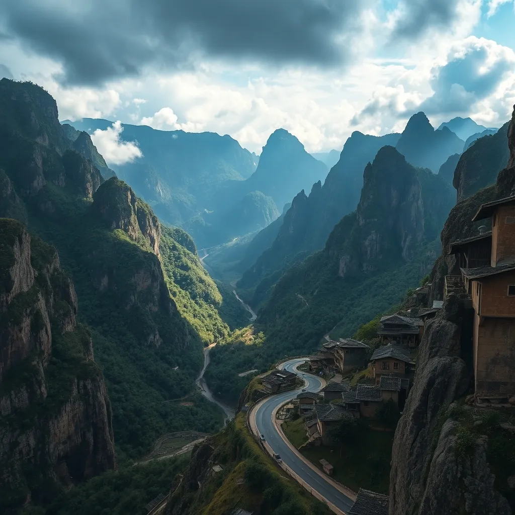
The Dong Van Karst Plateau is a landscape that defies expectation. Located in Ha Giang Province, in the far north of Vietnam, this is a place where the earth has been folded, fractured, and sculpted into a terrain of extraordinary drama. The plateau covers an area of more than 2,300 square kilometers and is recognized by UNESCO as a Global Geopark, the first of its kind in Vietnam. This is not a designation given lightly. The plateau’s geological history spans hundreds of millions of years, and its limestone formations record a story that began when this region lay beneath a warm, shallow sea.
The karst landscape is the result of millennia of erosion. Rainwater, slightly acidic from dissolved carbon dioxide, has slowly dissolved the limestone, creating a maze of deep valleys, razor-sharp ridges, and hidden caves. The result is a terrain that feels almost otherworldly. The plateau is not a flat expanse but a series of stepped terraces, each one higher than the last, rising from around 1,000 meters in the south to more than 1,600 meters in the north. The highest point, Mount Mau Son, reaches 1,800 meters and offers panoramic views that stretch across the border into China.
The Geology of the Plateau
Scientists have identified more than 40 geological heritage sites within the geopark, each one contributing to the understanding of the region’s deep history. The oldest rocks on the plateau date back approximately 400 million years, to the Paleozoic era, when the area was submerged beneath a tropical sea. Fossilized remains of ancient marine organisms, including corals, brachiopods, and trilobites, are embedded in the limestone, providing evidence of the life that once thrived in these waters. These fossils are not merely scientific curiosities. They are visible to the naked eye, and a careful observer can spot them in the rock faces along the roadsides.
The plateau’s formation continued through the Mesozoic era, when tectonic forces began to uplift the region. The collision of the Indian and Eurasian plates, which also created the Himalayas, pushed the limestone upward and folded it into the dramatic structures visible today. The result is a landscape of synclines and anticlines, where the rock layers have been bent into broad troughs and arches. Some of these folds are so large that they can be seen from space, and they create the distinctive banded appearance of the plateau’s mountains when viewed from a distance.
The karst processes that shaped the plateau are still active. Underground rivers flow through the limestone, carving out new passages and enlarging existing caves. The plateau is dotted with sinkholes, some of which are more than 100 meters deep, where the surface has collapsed into the voids below. These features are not static. They are the product of ongoing geological activity, and the landscape continues to evolve, albeit on a timescale that is imperceptible to human observation.
The Dong Van Old Quarter
At the heart of the plateau lies the town of Dong Van, a settlement that has served as a trading post for centuries. The town’s Old Quarter is a collection of narrow streets lined with buildings that blend Chinese, French, and Vietnamese architectural influences. The houses are built from a mix of rammed earth, timber, and locally quarried stone, with tiled roofs that curve gently at the eaves. Many of the buildings date from the early 20th century, when Dong Van was an important stop on the trade routes that connected Vietnam with the Chinese province of Yunnan.
The centerpiece of the Old Quarter is the Dong Van Market, which has operated on this site for over a century. The market is at its most vibrant on Sundays, when ethnic minority groups from the surrounding hills descend on the town to trade. The Hmong, Dao, Tay, and Giay peoples arrive on foot and by motorbike, bringing with them livestock, textiles, and produce. The market is a sensory assault in the best possible way. The air is thick with the smells of herbs, spices, and grilled meat. The colors of traditional clothing, particularly the indigo-dyed fabrics of the Hmong and the embroidered tunics of the Dao, create a visual spectacle that is unlike anything else in Vietnam.
Above the Old Quarter, perched on a hilltop, stands the Dong Van Citadel. The fortress was built in the early 19th century during the Nguyen Dynasty and was designed to protect the town from incursions from the north. The walls, constructed from large blocks of local stone, remain largely intact. The climb to the top is steep, but the reward is a panoramic view of the Old Quarter below and the karst peaks that surround the town on all sides. The citadel is a reminder that this remote corner of Vietnam was once a strategically important frontier post.
The Cultural Landscape
The Dong Van Karst Plateau is not just a geological wonder. It is also a living cultural landscape, home to more than 250,000 people from 17 different ethnic groups. The Hmong are the largest group, followed by the Dao, Tay, and Giay. Each group has its own language, customs, and traditional dress, and the plateau is one of the most culturally diverse regions in Vietnam. The harsh karst terrain has shaped the way these communities live. The rocky soil is difficult to farm, and the Hmong have developed a unique agricultural system that involves planting corn and other crops in the thin pockets of soil that collect between the rocks.
The traditional houses of the region are built to withstand the extremes of the climate. The Hmong typically construct their homes from rammed earth, a technique that involves compressing moist soil into wooden forms to create thick, load-bearing walls. These walls provide excellent insulation, keeping the interiors cool in summer and warm in winter. The roofs are made from a mix of clay tiles and wooden shingles, and the houses are often built into the hillsides to take advantage of the natural shelter provided by the terrain.
The plateau is also home to several cultural festivals that are deeply rooted in the agricultural calendar. The most significant is the Gau Tao Festival, celebrated by the Hmong during the first lunar month. The festival is a time for prayer and celebration, with activities that include traditional games, music, and dancing. The Khau Vai Love Market, held annually in the town of the same name, is another unique cultural event. The market is a gathering where former lovers, who have been separated by marriage or circumstance, meet once a year to renew their connection. The event is not a tourist attraction in the conventional sense. It is a genuine expression of the region’s cultural identity, and visitors are welcomed as observers rather than participants.
Practical Information for Visitors
The Dong Van Karst Plateau is best explored by motorbike. The roads are narrow and winding, and the mountain passes offer some of the most spectacular driving in Southeast Asia. The most popular route is the Ha Giang Loop, which takes travelers through the plateau and the surrounding mountains over the course of three to five days. Motorbikes can be rented in Ha Giang town, and guided tours are available for those who prefer not to ride themselves. The roads are generally in good condition, but they are steep and require a degree of confidence, particularly in wet weather.
Accommodation on the plateau is basic but adequate. Dong Van town offers a range of options, from simple guesthouses to homestays run by local families. The homestays are the more authentic choice, offering the chance to share a meal with a Hmong or Dao family and to learn about their daily lives. Prices are low, with rooms typically costing between 100,000 and 200,000 VND (about $4 to $8) per night. Meals are usually included in the price of a homestay, and the food is hearty and local, featuring dishes like thang co, a traditional Hmong stew made with horse meat, and men men, a steamed corn cake.
The best time to visit the plateau is from October to December, when the weather is dry and the landscapes are at their most dramatic. The autumn months bring the rice harvest, and the terraced fields that cling to the mountainsides turn a brilliant gold. The spring months, from February to April, are also a good time to visit, when the peach and plum blossoms are in full bloom. The summer months are hot and rainy, and the roads can become treacherous. The winter months, from December to February, can be cold, with temperatures dropping below 10 degrees Celsius at night. The cold brings its own beauty, however, with the plateau often shrouded in a mist that adds to its mysterious atmosphere.
The Dong Van Karst Plateau is a destination that demands effort. The journey is long, the roads are challenging, and the comforts are few. But the rewards are correspondingly great. This is a landscape that has been millions of years in the making, a place where the forces of geology and culture have combined to create something genuinely unique. For travelers who make the journey, the plateau offers an experience that is both humbling and unforgettable.

10. Cat Ba Island: The Gateway to Lan Ha Bay
Cat Ba Island sits at the southern edge of Ha Long Bay, a position that makes it both a destination in its own right and the natural launching point for the quieter waters of Lan Ha Bay. The island is the largest in the Cat Ba Archipelago, which comprises 367 islands and islets scattered across the Gulf of Tonkin. While the crowds of Ha Long Bay have grown denser with each passing year, Cat Ba has retained a sense of raw, untamed character. This is a place where jungle-covered mountains plunge directly into the sea, where hidden lagoons are accessible only by kayak, and where the pace of life is dictated by the tide rather than the tour bus schedule.
The island covers an area of approximately 285 square kilometers, and its terrain is dominated by a central spine of limestone mountains that rise to over 300 meters. More than half of the island is protected within the Cat Ba National Park, which was established in 1986 and later recognized by UNESCO as part of the Ha Long Bay World Heritage Site. The park is home to an extraordinary range of biodiversity, including the critically endangered Cat Ba langur, a primate species found nowhere else on Earth. Fewer than 70 individuals remain in the wild, and conservation efforts have made the island a focal point for wildlife protection in Vietnam.
Cat Ba National Park: A Biodiversity Hotspot
The national park is the island’s ecological heart. Its forests are a mix of tropical evergreen and limestone forest, a type of vegetation that has adapted to the thin soils and porous rock of the karst landscape. The park protects more than 1,500 species of plants, including several that are endemic to the island. The fauna is equally impressive. In addition to the langur, the park is home to civets, wild boar, and more than 70 species of bird, making it a rewarding destination for wildlife enthusiasts.
Several hiking trails traverse the park, ranging from short, easy walks to challenging multi-hour treks. The most popular route leads to Ngu Lam Peak, a viewpoint that requires a climb of roughly 500 steps but rewards hikers with a panoramic vista of the island’s forested mountains and the bay beyond. The summit is best visited in the early morning, when the air is cool and the views are often clear. A longer trek, the Viet Hai Village Trail, descends from the park’s interior to a remote fishing village on the eastern coast. The trail passes through primary forest, over limestone ridges, and past small waterfalls, and it offers a genuine sense of wilderness that is increasingly rare in this part of Vietnam.
The park’s rangers lead guided treks and can provide information about the local flora and fauna. A visit to the park’s interpretation center, located near the main entrance, is a good way to understand the ecological significance of the island before setting out. The center features exhibits on the langur, the karst ecosystem, and the threats facing the park’s biodiversity.
Lan Ha Bay: The Quiet Alternative
Lan Ha Bay extends south from Cat Ba Island, a body of water that shares the same dramatic karst scenery as Ha Long Bay but without the crowds. The bay encompasses more than 300 limestone islands, many of which are uninhabited and covered in dense vegetation. The waters here are calm and clear, and the bay is dotted with more than 130 pristine beaches, many of which are accessible only by boat. This is the domain of kayakers and sailors, and the best way to explore the bay is to spend a day or two on the water.
Kayaking is the quintessential Lan Ha Bay experience. Paddling through the narrow channels between the karst towers reveals hidden lagoons, sea caves, and floating fishing villages that have existed for generations. The bay’s most famous feature is the Dark and Bright Cave, a grotto that can be entered by kayak at low tide. Beyond the cave lies a circular lagoon enclosed by sheer limestone walls, a space that feels utterly removed from the outside world.
Several tour operators on Cat Ba offer kayak rentals and guided paddling tours. A typical day trip includes a transfer by boat to the bay, several hours of paddling, a stop at a remote beach for lunch, and a visit to a floating village. For those who prefer a more independent approach, kayaks can be rented by the hour from the beaches at Cat Co and from the town’s harbor. The bay’s waters are generally calm, and even novice paddlers will find the conditions manageable.
Boat tours of Lan Ha Bay are also available and range from half-day excursions to multi-day cruises. The cruises are a popular alternative to the crowded Ha Long Bay boats, offering similar itineraries with far fewer passengers. Many cruises include stops for swimming, snorkeling, and visits to the bay’s fishing villages. The sunset cruises are particularly memorable, as the low light transforms the karst towers into silhouettes against a burning sky.
Beaches and Coastal Escapes
Cat Ba’s beaches are modest in scale but generous in charm. The most accessible are the three Cat Co beaches, located a short walk or drive from the town center. Cat Co 1 and Cat Co 2 are connected by a scenic cliffside walkway, and both offer soft sand and calm swimming conditions. Cat Co 3, the smallest of the three, is a quiet spot that is often deserted on weekdays. The beaches are backed by limestone cliffs and fringed with casuarina trees, and they are the closest thing to a classic tropical beach experience on the island.
For a more secluded option, head to the beaches on the island’s eastern coast. Tung Thu Beach, located near the Viet Hai village, is a stretch of golden sand that is reached by a short hike or a boat ride. The beach is undeveloped, with no facilities, and it offers a genuine sense of isolation. The waters here are clear and inviting, and the beach is an excellent spot for a picnic lunch after a morning of hiking.
Monkey Island, a small islet just off Cat Ba’s southern coast, is another popular beach destination. The island is named for its population of macaques, which are accustomed to visitors and will happily pose for photographs. The island’s beach is small but beautiful, and the surrounding waters are ideal for swimming and snorkeling. The island can be reached by a short boat ride from Cat Ba town, and day trips typically include time for swimming and exploring the island’s trails.
The Town and Practicalities
Cat Ba Town is the island’s main settlement, a bustling waterfront community that has grown rapidly in recent years to accommodate the influx of visitors. The town is compact and walkable, with a promenade that lines the harbor and a maze of narrow streets that lead inland. The town offers a wide range of accommodation, from budget hostels to mid-range hotels, and the dining scene is dominated by seafood restaurants that serve the day’s catch. The night market, which operates in the evenings, is a good place to sample local specialties and pick up souvenirs.
The town is also the base for most of the island’s tour operators, who offer everything from kayak rentals to multi-day cruises. Booking tours through your accommodation is often the most convenient option, and the staff at most hotels and hostels can arrange transfers, tours, and activities. Prices are negotiable, and it pays to shop around for the best deals.
Getting to Cat Ba has become easier in recent years. The most common route is to take a bus from Hanoi to Hai Phong, followed by a ferry or hydrofoil to the island. The journey takes approximately four hours in total. Alternatively, direct buses now run from Hanoi to Cat Ba, including a ferry crossing, which simplifies the trip considerably. The island’s harbor is also a stop on many Ha Long Bay cruises, making it possible to combine a cruise with a stay on the island.
The best time to visit Cat Ba is from October to December, when the weather is dry and the temperatures are pleasant. The summer months, from May to August, are hot and humid, with frequent rain showers, but the waters are at their warmest for swimming. The winter months, from January to March, can be cool and misty, and some boat tours are cancelled due to rough seas. Regardless of the season, the island’s beauty is constant, and its position as the gateway to Lan Ha Bay makes it an essential stop on any Vietnam itinerary.
11. Tam Dao: A Mountain Escape Near Hanoi
Just 85 kilometers northwest of Hanoi, Tam Dao offers a dramatic shift in scenery and temperature. The town sits at an elevation of 900 meters, nestled in a valley between three mountain peaks that give the area its name. The name translates to “three islands,” a reference to the way the peaks appear to float above the clouds when viewed from the lowlands. The climate here is markedly cooler than the capital, often by as much as 10 degrees Celsius, which has made Tam Dao a favored retreat for those seeking relief from the tropical heat.
The history of Tam Dao as a resort destination stretches back to the early 20th century. During the French colonial period, the town was developed as a hill station, a place where colonial administrators and their families could escape the oppressive summer heat of Hanoi. The French built more than 200 villas in the area, along with a church, a post office, and a market. Many of these buildings remain today, albeit in varying states of repair. The weathered facades and crumbling walls of the old villas lend the town a melancholic charm, a tangible connection to a bygone era.
The Cool Climate and Scenic Setting
The primary draw of Tam Dao is its climate. The town’s elevation ensures that temperatures rarely exceed 25 degrees Celsius even in the height of summer, and the air is often thick with mist and cloud. This cool, damp environment supports a rich montane forest that covers the surrounding slopes. The forest is home to a diverse range of flora and fauna, including several species of orchids and a population of macaques that are frequently spotted along the hiking trails. The cool air is invigorating, and the constant presence of cloud and fog creates an atmosphere that is both mysterious and serene.
The town itself is compact, with a single main street that runs through the center. The street is lined with guesthouses, restaurants, and souvenir shops, and it is the hub of activity for the small community. The French colonial villas are scattered along the hillsides, many of them hidden behind overgrown gardens and rusted gates. Some have been restored and converted into hotels or cafes, while others remain abandoned, their windows boarded up and their walls covered in moss. Exploring these ruins is one of the most atmospheric experiences in Tam Dao, and the area rewards those who take the time to wander off the main street.
Hiking Trails and Mountain Peaks
The mountains that surround Tam Dao are the main attraction for outdoor enthusiasts. The highest of the three peaks, Tam Dao Peak, rises to 1,592 meters and is accessible via a well-maintained trail that begins near the town’s Catholic church. The trail climbs steadily through the forest, passing through stands of bamboo and pine before emerging above the treeline. The final section of the trail is a steep scramble over rocky terrain, but the reward is a panoramic view that stretches across the surrounding valleys and, on clear days, all the way to Hanoi. The hike takes approximately three hours each way and is best attempted in the morning, when the air is cool and the views are at their clearest.
A second trail leads to the Silver Waterfall, a cascade that plunges 50 meters down a cliff face. The trail is shorter and less demanding than the climb to the peak, making it a good option for those with limited time or fitness. The waterfall is at its most impressive after heavy rain, when the volume of water is at its peak. The trail continues beyond the waterfall to a viewpoint that overlooks the valley below, offering a different perspective on the surrounding landscape.
A third option is the trail to the Truc Lam Tam Dao Zen Monastery, a Buddhist temple that was built in 2012 on the site of a former French villa. The monastery is a place of quiet contemplation, with a simple architectural style that blends traditional Vietnamese elements with modern design. The temple grounds are beautifully landscaped, with gardens, ponds, and a large statue of the Buddha. The trail to the monastery is a gentle walk of about 30 minutes from the town center, and the temple offers a peaceful retreat from the bustle of the main street.
Practical Information for Visitors
Tam Dao is an easy day trip from Hanoi, but an overnight stay is recommended for those who want to experience the area’s atmosphere fully. The town has a range of accommodation options, from simple guesthouses to more comfortable hotels. Many of the restored French villas have been converted into boutique hotels that offer a unique blend of colonial charm and modern comfort. The dining scene is modest, with a focus on Vietnamese home cooking and local specialties. The cool climate means that hot pot is a popular choice, and several restaurants offer this warming dish.
The best time to visit Tam Dao is from October to March, when the weather is cool and dry. The summer months are wetter, with frequent afternoon thunderstorms, but the cool temperatures still make the area a pleasant escape from the lowlands. The winter months can be cold, with temperatures dropping to single digits at night, so visitors should pack accordingly. The town is accessible by bus from Hanoi’s My Dinh station, with a journey time of approximately two hours. Alternatively, a taxi or private car can make the trip in about an hour and a half.
For those who want to combine a visit to Tam Dao with other destinations in the north, the town is conveniently located on the route between Hanoi and the northwestern provinces. Many travelers stop here for a night on their way to Sapa or Ha Giang, using the cool mountain air as a refreshing interlude before continuing their journey. Whether you come for the hiking, the history, or simply the chance to escape the heat, Tam Dao offers a distinctive and memorable experience that is well worth the short journey from the capital.
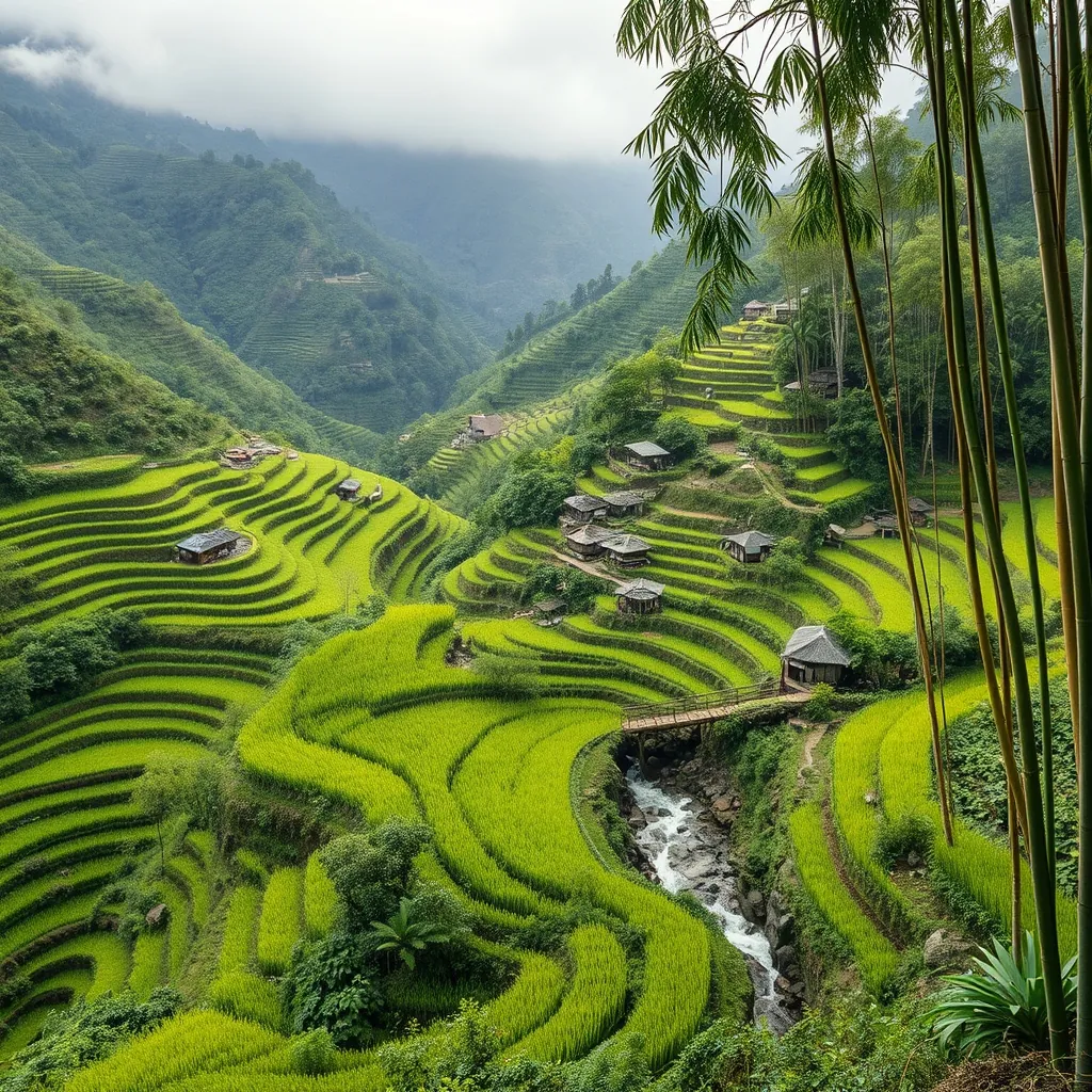
12. Pu Luong Nature Reserve: Off-the-Beaten-Path Beauty
Pu Luong Nature Reserve spreads across 17,662 hectares in Thanh Hoa province, roughly 160 kilometers southwest of Hanoi. The name derives from the Thai language and translates to “highest mountain,” a fitting designation for a landscape dominated by the Pu Luong range. The reserve encompasses a wide range of ecosystems, from lowland valleys to cloud forests, and its relative isolation has preserved both the natural environment and the traditional way of life of the ethnic minority communities that call it home. Unlike the more visited destinations in the northwest, Pu Luong remains remarkably unspoiled, a place where the rhythms of the seasons dictate the rhythm of daily life.
The terrain is dramatic. Limestone karst peaks rise abruptly from the valley floor, their sheer faces cloaked in dense vegetation. Between these peaks, narrow valleys are carved by fast-flowing streams that tumble over rocky beds on their way to the Cham River. The hillsides are sculpted into terraces, some of them centuries old, that follow the contours of the land in sweeping curves. The result is a landscape that shifts in color with the seasons, from the flooded mirrors of the planting season to the golden glow of the harvest.
Terraced Rice Fields and Mountain Valleys
The rice terraces of Pu Luong are the reserve’s defining feature. Built by the Thai and Muong ethnic groups over generations, these terraces are a remarkable feat of engineering and a testament to the ingenuity of their creators. The terraces are carved into the steepest slopes, with stone walls supporting each level and intricate irrigation channels directing water from the mountain streams. The system is a fine balance of human effort and natural processes, and it continues to function much as it has for centuries.
The best viewpoints are found in the villages of Ban Hieu and Ban Don. From these vantage points, the terraces stretch across the valley in a patchwork of greens and golds, with the karst peaks rising behind them. The views are particularly striking at sunrise, when the low angle of the light picks out the contours of the land and the mist that gathers in the valleys begins to burn off. The terraces are at their most photogenic in May and June, when they are flooded and reflect the sky, and again in September and October, when the rice is ripe and ready for harvest.
Bamboo Forests and Natural Trails
Above the terraces, the slopes are covered in primary and secondary forest, including significant stands of bamboo. These bamboo forests are a vital part of the local ecosystem, providing habitat for a wide range of wildlife and a source of building material for the local communities. The bamboo grows in dense thickets, its tall, slender stems swaying in the wind and creating a soft rustling sound that accompanies hikers along the trails. The forest floor is carpeted with fallen leaves, and the air is heavy with the scent of damp earth and vegetation.
The reserve has a network of walking trails that range from gentle strolls to challenging multi-day treks. One of the most popular routes is the trek from Ban Hieu to Ban Don, a full-day walk that crosses the valley and climbs over a low pass. The trail passes through bamboo forests, across streams, and through several villages, offering a glimpse of daily life in the reserve. Another route leads to the summit of Pu Luong Peak itself, a demanding climb that rewards hikers with panoramic views across the entire reserve and beyond.
For those who prefer not to walk, the reserve can also be explored by bicycle. The roads through the valley are mostly unpaved, but they are in reasonable condition, and cycling is a popular way to cover more ground. Bicycles can be rented from the homestays in the main villages, and the local guides are happy to suggest routes that suit different fitness levels.
Eco-Tourism and Homestay Experiences
Pu Luong is a model of community-based tourism, with a focus on sustainable practices that benefit both the environment and the local population. The reserve is home to several eco-lodges and homestays that offer visitors a chance to experience the local culture firsthand. These accommodations are typically built in the traditional stilt-house style, using locally sourced timber and bamboo, and they are run by local families who open their homes to visitors.
A homestay in Pu Luong is a far cry from a hotel stay. Guests sleep on mattresses on the floor, share meals with the family, and participate in daily activities such as cooking, farming, or weaving. The food is simple but delicious, featuring locally grown vegetables, free-range chicken, and river fish, all prepared with the distinctive flavors of Thai cuisine. The evenings are spent around the fire, with the family and other guests sharing stories and perhaps a glass of local rice wine.
The revenue from tourism provides a vital source of income for the local communities, and it creates an economic incentive to protect the natural environment. The reserve is managed by a combination of government agencies and local community groups, and there is a strong emphasis on conservation. Visitors are asked to respect the environment, to stay on the marked trails, and to support local businesses. The result is a tourism model that is both sustainable and rewarding, offering a genuine connection to the land and its people.
Practical Information for Visitors
Pu Luong is accessible by road from Hanoi, with a journey time of approximately four hours. The most common route is via Highway 6 to the town of Mai Chau, then south over the Pu Luong pass. The road is winding and narrow in places, but it is well-maintained and suitable for cars and motorbikes. Public buses run from Hanoi to the town of Cam Thuy, from where a taxi or xe om can be arranged to the reserve. Many visitors choose to hire a private car or join an organized tour, which simplifies the logistics.
The best time to visit is from October to April, when the weather is dry and the temperatures are pleasant. The summer months are hot and humid, with frequent rain, and the trails can become muddy and slippery. The harvest season in September and October is a particularly good time to visit, as the terraces are at their most colorful and the villages are busy with the work of the harvest.
Accommodation options are limited but comfortable. The eco-lodges offer a higher level of comfort, with private rooms and en-suite bathrooms, while the homestays offer a more authentic experience. Booking in advance is recommended, especially during the peak season, as the number of rooms is limited. The reserve is a popular destination for those who want to escape the crowds of the more famous northern destinations, and it offers a rare opportunity to experience the beauty of Vietnam’s highlands in a way that is both responsible and rewarding.
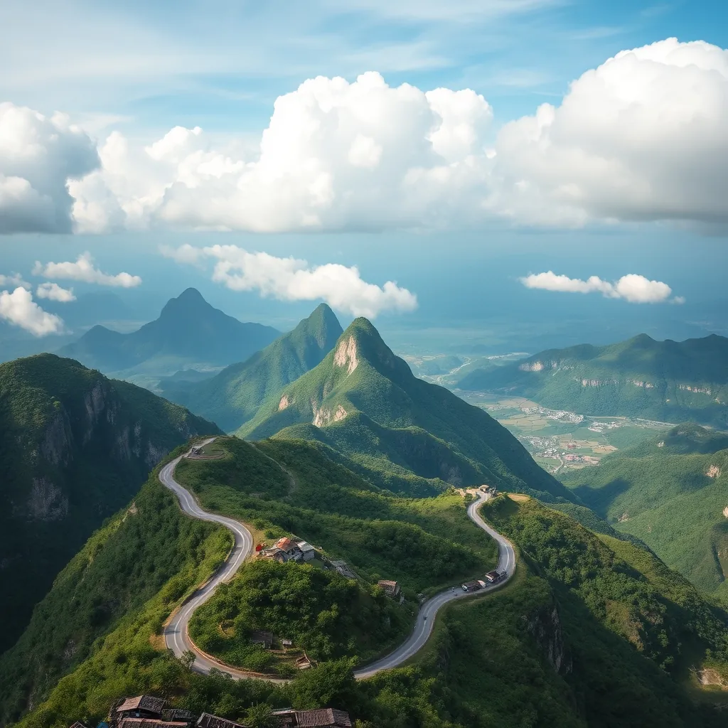
13. Quan Ba Heaven Gate: Scenic Mountain Pass
Quan Ba Heaven Gate sits at an elevation of roughly 1,500 meters on the road north from Ha Giang City. The pass marks the official entrance to the Dong Van Karst Plateau Geopark, a UNESCO-recognized region of dramatic limestone formations and deep valleys. For many travelers, the climb to the gate is the first taste of the extraordinary landscapes that define Vietnam’s far north. The road snakes upward through forested slopes, and the air grows noticeably cooler with each switchback. Then the pass levels out, and the view opens in a way that stops conversations mid-sentence.
The name “Heaven Gate” is not hyperbole. From the summit, the road drops away into a vast valley floor dotted with villages, rice paddies, and the distinctive twin peaks that have become the symbol of the region. On clear days, the visibility stretches for dozens of kilometers, with layer upon layer of karst mountains fading into the haze. The scene is one of those rare travel moments that photographs rarely do justice to, a landscape that demands to be experienced in person.
The Twin Mountains: A Geological Curiosity
The Twin Mountains, known locally as Co Tien or “Fairy Mountains,” are the defining landmark of the Quan Ba valley. Two perfectly rounded peaks rise side by side from the valley floor, their smooth, dome-like shapes standing in stark contrast to the jagged karst formations that surround them. Geologists attribute their unusual form to a process of differential erosion, where the softer rock surrounding the peaks wore away faster than the harder limestone core, leaving behind these smooth, breast-like hills.
The local Hmong people have their own explanation. Legend tells of a fairy who descended from the heavens to bathe in the valley’s streams. She left behind her breast-shaped hills as a gift to the land, a symbol of fertility and protection for the communities that settled below. Whether you prefer the geological or the mythological explanation, the Twins are an unforgettable sight. The best views are from the main viewpoint at the top of the pass, but the peaks also make a striking foreground subject for photographs of the valley at sunrise and sunset.
Panoramic Views and Photo Opportunities
The main viewing platform at Quan Ba Heaven Gate is a popular stop for photographers, and for good reason. The platform offers a sweeping panorama that encompasses the Twin Mountains, the patchwork of rice fields below, and the distant peaks of the Tay Con Linh range. The light changes dramatically throughout the day, with the morning mist often lingering in the valleys until mid-morning, and the golden hour casting long shadows across the landscape in the late afternoon.
For a different perspective, a short walk from the main platform leads to a secondary viewpoint that looks out over the valley from a higher angle. This spot is quieter and offers a more intimate view of the scene, with the sounds of the forest replacing the chatter of the crowds. The walk takes about 20 minutes each way and is well worth the effort for those who want to escape the main tourist area.
Just below the pass, the road descends into the Quan Ba valley itself, where the landscape shifts from dramatic mountain scenery to a more gentle, pastoral scene. The valley floor is a patchwork of rice paddies, corn fields, and vegetable gardens, with small villages scattered along the river. The road through the valley is one of the most scenic stretches of the Ha Giang loop, and many travelers choose to stop at one of the local homestays to spend a night surrounded by the peaceful countryside.
Practical Information for Visitors
Quan Ba Heaven Gate lies on National Highway 4C, approximately 45 kilometers north of Ha Giang City. The drive takes about an hour and a half, with the road climbing steadily through the mountains. Most travelers reach the pass as part of the Ha Giang loop, a multi-day motorbike circuit that takes in the region’s most spectacular scenery. The road is well-paved and in good condition, but the steep gradients and sharp curves require caution, especially for less experienced riders.
Public buses run from Ha Giang City to the town of Quan Ba, from where the pass is a short xe om ride away. For those who prefer not to ride a motorbike, hiring a private car with a driver is a comfortable and safe option. Many tour operators in Ha Giang City offer day trips to the pass and the surrounding area, which can be a good choice for travelers with limited time.
The best time to visit is from September to November, when the rice terraces in the valley are at their most colorful and the weather is dry and clear. The spring months of March and April are also pleasant, with the peach and plum blossoms in full bloom. The summer months are hot and humid, with frequent afternoon thunderstorms that can obscure the views. The winter months, from December to February, are cold and often cloudy, but the occasional clear day offers some of the most dramatic visibility of the year.
Accommodation options in the Quan Ba area are growing, with several homestays and guesthouses now operating in the valley below the pass. These offer a comfortable base for exploring the region, and most include meals prepared with locally grown ingredients. The town of Quan Ba itself has a small market that is worth a visit, particularly in the early morning when the local Hmong and Dao farmers gather to trade their produce. The market is a lively, colorful affair that offers a glimpse of the region’s cultural diversity.
Quan Ba Heaven Gate is more than just a scenic viewpoint. It is a threshold, a point of transition between the familiar landscapes of the lowlands and the extraordinary world of the northern highlands. The pass rewards those who pause to take it in, offering a perspective on Vietnam that stays with travelers long after they have descended into the valley below.
14. Lung Cu Flag Tower: The Northernmost Point
Lung Cu Flag Tower marks the absolute northern tip of Vietnam, a point where the country narrows to a sliver of land before meeting the Chinese border. The tower crowns Dragon Mountain, or Nui Rong, at an elevation of 1,470 meters. From its summit, travelers look out over a landscape of terraced fields, scattered villages, and the winding Lo River far below. The journey to reach this remote outpost is an adventure in itself, a test of endurance that rewards those who make the trek with one of the most symbolic views in the country.
The flag tower holds deep meaning for the Vietnamese people. It represents national sovereignty and pride, a declaration that this remote corner of the country is firmly Vietnamese soil. For international travelers, the tower offers something different: a chance to stand at the edge of the nation, to feel the vastness of the northern highlands, and to understand why this region holds such a special place in the Vietnamese imagination.
The Journey to the Northern Frontier
Lung Cu sits in the Dong Van Karst Plateau Geopark, approximately 24 kilometers north of the town of Dong Van. The road from Dong Van climbs steadily through some of the most dramatic scenery in all of Vietnam. Jagged limestone peaks rise on either side of the asphalt, their slopes covered in a patchwork of corn fields and terraced rice paddies. Small Hmong and Lo Lo villages cling to the hillsides, their distinctive earthen houses with yin-yang tile roofs blending into the landscape.
The final approach to the tower is steep. The road switchbacks up the side of Dragon Mountain, and the gradient tests even experienced motorbike riders. Those who prefer not to ride can hire a xe om from Dong Van town, or a private car with a driver. The road is paved and well-maintained, but the hairpin turns demand attention and a steady hand on the throttle. The climb takes roughly 30 minutes from the base of the mountain, and with each switchback, the views become more expansive.
At the base of the mountain, a ticket booth marks the entrance to the tower complex. From here, visitors can either climb the 389 steps to the summit or take a short electric car ride that covers part of the distance. The steps are steep but well-maintained, with rest areas along the way. The climb takes about 20 minutes at a steady pace, and the effort is rewarded with increasingly spectacular views as the elevation gains.
The Tower and Its Symbolism
The current flag tower was completed in 2010, replacing an earlier structure that had stood since 1992. The tower is an octagonal design, a nod to the eight traditional symbols of the Vietnamese nation. It rises 33 meters from its base, with the flagpole itself extending an additional 13 meters into the sky. The flag that flies from the summit measures 54 square meters, a deliberate reference to the 54 ethnic groups that call Vietnam home.
Inside the tower, a spiral staircase of 140 steps leads to the observation deck. The interior walls display historical photographs and information panels that tell the story of the region, from the ancient geological forces that shaped the karst landscape to the cultural traditions of the ethnic minorities who have lived here for centuries. The exhibits provide context for the landscape visible from the summit, helping visitors understand the deep history embedded in the terrain below.
The observation deck offers a 360-degree panorama that is nothing short of breathtaking. To the north, the border with China runs through the valleys below, marked by a fence line that stretches across the hills. To the south and west, the karst peaks of the Dong Van Plateau extend to the horizon, their layered forms fading into the haze. The Lo River winds through the valley floor, its silver ribbon contrasting with the deep greens of the terraced fields.
The Lo Lo Village at the Base
At the foot of Dragon Mountain lies the village of Lo Lo Chai, home to the Lo Lo ethnic minority. This small community of roughly 100 households is one of the most traditional in the region, with residents maintaining customs that have remained largely unchanged for generations. The village is known for its distinctive earthen houses, built with thick walls of rammed earth that keep the interiors cool in summer and warm in winter. The roofs are covered with yin-yang tiles, their curved shapes giving the houses a distinctive silhouette against the mountain backdrop.
Visitors to the village are welcome to wander the narrow lanes and observe daily life. The Lo Lo people are known for their colorful traditional clothing, particularly the women’s skirts and headscarves, which are decorated with intricate embroidery in bright reds, greens, and blues. Many families open their homes to visitors, offering a glimpse of traditional life and the opportunity to purchase locally made handicrafts. The village also has a small cultural house where performances of traditional music and dance are held for visitors.
Staying overnight in Lo Lo Chai is possible through a community-based tourism initiative that supports the local economy. The homestays are simple but comfortable, with basic amenities and home-cooked meals featuring locally grown ingredients. An overnight stay offers the chance to experience the rhythm of village life, from the early morning sounds of livestock and cooking fires to the quiet stillness of the night under a canopy of stars.
Best Time to Visit and Practical Tips
The best time to visit Lung Cu is from October to December, when the weather is dry and the skies are clear. During these months, visibility from the summit is at its best, with views extending for dozens of kilometers. The spring months of March and April are also good, with mild temperatures and the peach and plum blossoms in bloom. The summer months bring heat and humidity, with frequent afternoon thunderstorms that can obscure the views and make the climb uncomfortable. The winter months, from December to February, are cold, and temperatures at the summit can drop near freezing, so warm clothing is essential.
Plan to arrive early in the day to avoid the crowds and catch the morning light. The site opens at 7:30 AM, and the first visitors of the day often have the summit to themselves. The light in the early morning is particularly beautiful, with long shadows and a soft golden glow that brings out the textures of the karst landscape. By mid-morning, tour groups begin to arrive, and the summit can become crowded.
Lung Cu is typically visited as part of the Ha Giang loop, the multi-day motorbike circuit that is one of Vietnam’s most iconic travel experiences. The tower is usually included on the second or third day of the loop, depending on the direction of travel. For those not riding a motorbike, organized tours from Ha Giang City or Dong Van town can be arranged, with private cars and drivers available for hire.
Bring water and snacks for the climb, as there are no food stalls on the mountain itself. The ticket booth at the base has a small shop selling drinks and basic provisions, but options are limited. Sun protection is also important, as the summit is exposed and the sun at this elevation is intense, even on cooler days. A hat, sunglasses, and sunscreen are essential items to pack.
Standing at the summit of Lung Cu, looking out over the vast landscape that stretches to the border, it is easy to understand why this place holds such significance. The tower is more than a tourist attraction. It is a symbol of national identity, a marker of the country’s northernmost reach, and a testament to the enduring spirit of the people who call these mountains home. For travelers, it is a destination that rewards the journey with a perspective on Vietnam that few other places can offer.
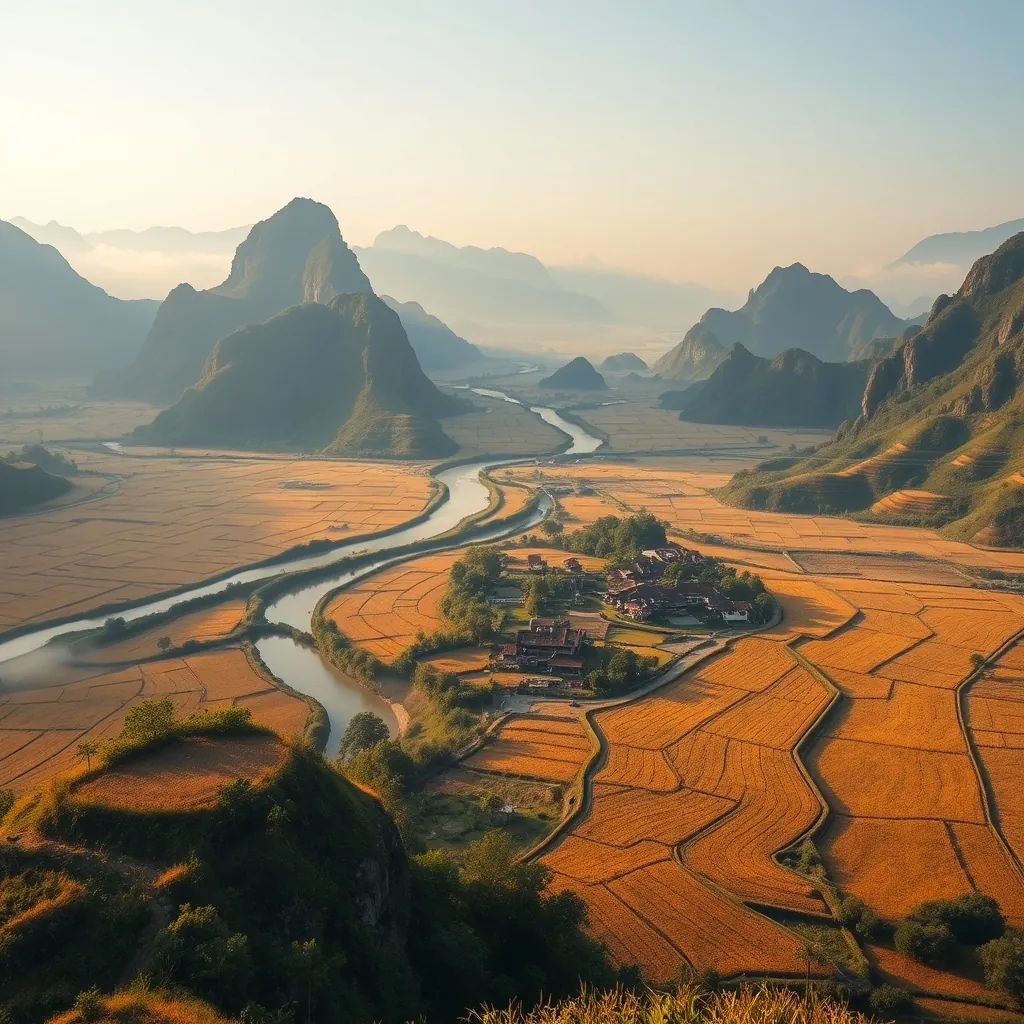
15. Bac Son Valley: A Panoramic Rice Field Vista
Bac Son Valley sits in Lang Son Province, a region that most travelers pass through on their way to the Chinese border without ever stopping. That is a mistake. The valley is one of the most visually stunning landscapes in all of Vietnam, a vast bowl of emerald rice fields ringed by jagged limestone peaks. The view from the hillside above the valley is the kind of panorama that stays in memory long after the journey ends. Unlike the crowded viewpoints of Sapa or the tourist-heavy routes of Ha Giang, Bac Son remains quiet, authentic, and largely undiscovered.
The valley’s beauty lies in its simplicity. There are no cable cars, no amusement parks, no crowds jostling for the perfect photo. What Bac Son offers is a pure, unfiltered look at rural life in northern Vietnam, where farmers tend their paddies by hand and water buffalo plod along narrow dikes. The landscape changes with the seasons, shifting from the reflective mirrors of the flooded fields in May and June to the golden waves of the harvest in September and October. Each season paints the valley in a different light, but the underlying rhythm of agricultural life remains constant.
The Viewpoint at Na Lay Hill
The primary viewpoint over Bac Son Valley is located on Na Lay Hill, a modest rise on the western edge of the valley. The climb to the top takes roughly 30 minutes, following a well-worn dirt path that switchbacks through secondary forest and scrub. The trail is not difficult, but the tropical heat can make the ascent sweaty work. Start early in the morning, before the sun climbs too high, and carry water. The reward at the summit is a sweeping panorama that encompasses the entire valley floor, with the Ky Cung River winding through the paddies like a silver thread.
The viewpoint platform at the summit is a simple concrete structure with a railing, built by the local government to accommodate the growing number of visitors. It is not elaborate, but it does not need to be. The view does all the work. From this vantage point, the valley unfolds in a patchwork of greens and golds, with the red-tiled roofs of the Tay ethnic villages scattered among the fields. The limestone karsts rise abruptly from the flat valley floor, their sheer faces catching the changing light throughout the day.
Morning is the best time to visit, when the low sun casts long shadows across the fields and a thin layer of mist often lingers in the hollows. The mist adds a layer of depth to the scene, softening the distant peaks and giving the valley an almost ethereal quality. By mid-morning, the mist burns off and the colors sharpen, revealing the full intensity of the rice greens. Sunset is the other prime viewing window, when the western sky glows orange and pink and the valley settles into the quiet of evening.
The Tay Villages Below
After descending from the viewpoint, take the time to explore the villages that dot the valley floor. The Tay people are the dominant ethnic group in Bac Son, and their traditional stilt houses, with their distinctive red-tiled roofs, are scattered throughout the valley. The houses are raised on wooden stilts to protect against flooding and animals, with the space below used for storage and livestock. The architecture is practical, but there is an undeniable aesthetic appeal to the sight of these homes nestled among the rice paddies.
Quynh Son is the main village in the valley and the most convenient base for exploring the area. The village has a handful of homestays, many of which are run by local families who have opened their homes to visitors. Staying in a Tay homestay is a cultural experience in itself. Guests sleep on futons in the traditional stilt house, eat home-cooked meals featuring locally grown vegetables and free-range chicken, and wake to the sound of roosters and the gentle murmur of village life. The hospitality is genuine, and the experience offers a window into a way of life that has remained largely unchanged for generations.
The valley floor is ideal for cycling. The terrain is flat, and the roads between villages are quiet, with only the occasional motorbike or farm vehicle passing by. A bicycle allows for a slower pace, a chance to stop and watch farmers at work, to chat with villagers, and to absorb the details that are missed from the viewpoint above. The rice paddies are crisscrossed by narrow dikes that invite exploration on foot, though visitors should be mindful not to damage the crops or disturb the farmers.
Seasonal Colors and Timing
The character of Bac Son Valley transforms dramatically with the seasons, and the timing of a visit determines what kind of landscape awaits. The rice planting season runs from late May through June, when the paddies are flooded and the young seedlings are transplanted. During this period, the valley becomes a mosaic of reflective surfaces, with the sky and mountains mirrored in the shallow water. The effect is stunning, particularly in the early morning when the light is soft and the water is still.
The harvest season, from late September through October, offers an entirely different spectacle. The rice ripens to a deep golden yellow, and the valley glows with a warmth that photographs rarely capture accurately. The harvest itself is a social event, with families working together to cut, bundle, and thresh the grain. Visitors during this period can witness the traditional methods up close, from the hand-held sickles to the wooden threshing frames. It is a reminder that this landscape is not just scenery. It is a working agricultural region, and the beauty of the valley is inseparable from the labor that sustains it.
The summer months from July to August are the least predictable, with frequent rain and the risk of storms. The rice is growing during this period, and the valley is at its greenest, but the weather can be fickle. The winter months from November to February are dry and cool, with clear skies and crisp air. The rice fields are harvested by this point, and the landscape takes on a more subdued palette of browns and stubble, but the karst scenery remains impressive, and the lack of crowds makes it a pleasant time to explore.
Getting There and Practical Considerations
Bac Son is accessible from Hanoi, though the journey takes some planning. The town of Bac Son is approximately 160 kilometers from the capital, and the drive takes around four hours by car or motorbike. The route passes through the industrial province of Bac Giang before climbing into the limestone hills of Lang Son Province. The final stretch of road is winding and scenic, with the karst peaks rising on either side as the road descends into the valley.
Public transport options are limited but workable. Buses run from Hanoi’s Gia Lam bus station to the town of Lang Son, and from there, local buses or taxis can be arranged for the 60-kilometer journey to Bac Son. A more practical option for most travelers is to join an organized tour or hire a private car with a driver. Many tour operators in Hanoi offer day trips to Bac Son, though an overnight stay is strongly recommended to experience the valley at its best. The early morning light and the quiet of the evening are the valley’s finest moments, and a day trip misses both.
For motorbike riders, Bac Son is a natural addition to a northern Vietnam loop. The valley can be combined with a route through Ha Giang, Cao Bang, or Lang Son, creating a circuit that takes in some of the region’s most spectacular scenery. The roads are well-maintained, and the traffic is light outside of the main towns. Riders should be cautious during the rainy season, when the mountain passes can become slick and visibility drops.
Accommodation options in Bac Son are limited but authentic. The homestays in Quynh Son village are the most popular choice, offering a genuine cultural experience at a reasonable price. A few basic guesthouses also operate in the town of Bac Son itself, catering to travelers who prefer a bit more privacy. Advance booking is recommended during the harvest season and national holidays, when the valley attracts its largest crowds. At other times, it is usually possible to find a room on arrival.
Bac Son Valley does not have the name recognition of Ha Long Bay or Sapa, and that is precisely its appeal. It is a place where the landscape is the attraction, where the rhythm of rural life sets the pace, and where the views reward those who make the effort to climb the hill. For travelers seeking a genuine slice of northern Vietnam, a place that feels untouched by mass tourism, Bac Son is a destination that delivers far beyond its modest reputation.
Central Vietnam: Ancient Heritage and Coastal Splendor
Central Vietnam is the country’s most diverse region, a narrow strip of land where imperial citadels, colonial towns, and world-class beaches coexist within a few hours of each other. This is the heart of Vietnamese history. The ancient capital of Hue once housed the Nguyen emperors, while the trading port of Hoi An connected Vietnamese merchants with Chinese, Japanese, and European traders for centuries. The region’s geography is equally dramatic, with the Truong Son Mountains running down the western border and the East Sea lapping at the eastern coast. The result is a landscape of extraordinary variety, from the limestone karsts of Phong Nha to the palm-fringed shores of Da Nang.
The region’s climate follows a different rhythm than the rest of the country. Central Vietnam experiences its rainy season from September to December, when typhoons occasionally sweep in from the South China Sea. The dry season, from January to August, offers the most reliable weather for beach activities and outdoor exploration. This seasonal pattern shapes the rhythm of life here, from the salt fields that glisten along the coast to the rice paddies that climb the mountain slopes. Travelers who plan around the weather will find that Central Vietnam rewards patience with some of the most memorable experiences the country has to offer.
A Region of Contrasts
Central Vietnam defies easy categorization. The region contains some of the country’s most visited attractions, including the lantern-lit streets of Hoi An and the imperial tombs of Hue, yet it also harbors vast stretches of wilderness that see few travelers. The Phong Nha-Ke Bang National Park protects one of the world’s most significant cave systems, including Son Doong, the largest cave on the planet. The park’s underground rivers and towering caverns remain largely unexplored, offering a sense of discovery that is increasingly rare in Southeast Asia.
The coastline is equally varied. My Khe Beach in Da Nang stretches for 30 kilometers of fine white sand, earning recognition from Forbes as one of the world’s most beautiful beaches. Further south, the Cham Islands rise from the turquoise waters as a marine protected area, their coral reefs teeming with marine life. Between these extremes lie fishing villages, salt flats, and lagoons that sustain local communities in ways that have changed little over the centuries.
Culinary Capital of Vietnam
Central Vietnam also claims the title of the country’s culinary heart. The imperial cuisine of Hue, developed to satisfy the refined palates of the Nguyen emperors, features hundreds of small, artfully presented dishes. Bun bo Hue, a spicy beef noodle soup, has become famous throughout Vietnam and beyond. Hoi An’s street food scene is equally celebrated, with cao lau noodles, white rose dumplings, and banh mi drawing food lovers from around the world. The region’s position along ancient trade routes brought spices, techniques, and ingredients that blended into a distinctive culinary tradition.
The food culture here is inseparable from the region’s history and geography. The fertile plains supply fresh vegetables and herbs, the rivers provide fish and shrimp, and the mountains harbor wild game and forest vegetables. This abundance, combined with the culinary sophistication of the imperial court, created a food culture that is both refined and deeply rooted in the land. A journey through Central Vietnam is as much a culinary exploration as a visual one.
Gateway to the North and South
Central Vietnam serves as the natural bridge between the country’s northern and southern halves. The Hai Van Pass, a dramatic mountain road that hugs the coastline between Da Nang and Hue, offers one of the most scenic drives in Asia. The pass was historically the boundary between the Champa and Dai Viet kingdoms, and its strategic importance is evident in the fortifications that still dot its slopes. Today, the pass is a favorite route for motorbike riders, who climb the winding road for sweeping views of the coastline and the mountains beyond.
The region’s major cities are well-connected by air, rail, and road. Da Nang International Airport receives direct flights from major Asian cities, making it a convenient entry point for international travelers. The Reunification Express railway runs along the coast, connecting Hue, Da Nang, and the towns further south. This accessibility makes Central Vietnam an ideal base for exploring the broader country, with the imperial heritage of the north and the dynamic energy of the south both within easy reach.
What Awaits in the Sections Ahead
The following sections explore the highlights of Central Vietnam in detail, from the lantern-lit streets of Hoi An to the underground wonders of Phong Nha. Each destination offers a distinct experience, whether it is the imperial grandeur of Hue, the beachside energy of Da Nang, or the untouched wilderness of the region’s national parks. Together, they form a portrait of a region that has shaped Vietnam’s identity for centuries and continues to captivate travelers with its beauty and depth.
Whether you are a history enthusiast, a beach lover, a foodie, or an adventure seeker, Central Vietnam has something to offer. The region’s compact size makes it possible to experience a remarkable variety of landscapes and cultures within a single trip. With careful planning and an open mind, a journey through Central Vietnam becomes the centerpiece of any Vietnam itinerary.
16. Hoi An Ancient Town: Lanterns and Timeless Charm

Hoi An is the kind of place that imprints itself on your memory before you even arrive. The ancient town, a UNESCO World Heritage Site since 1999, sits on the banks of the Thu Bon River in central Quang Nam Province. Its narrow streets, lined with centuries-old buildings, have survived wars, typhoons, and the passage of time with remarkable integrity. Walking through Hoi An feels like stepping into a living museum, one where daily life continues amid the architectural treasures.
What makes Hoi An extraordinary is not any single monument but the completeness of its preservation. More than 800 historic buildings remain intact, including merchant houses, assembly halls, pagodas, and the famous Japanese Covered Bridge. The architecture reflects the town’s history as a major trading port between the 15th and 19th centuries, when ships from China, Japan, and Europe anchored in the river to exchange silk, ceramics, pepper, and spices. This international heritage is written into the very walls of the town, where Vietnamese, Chinese, Japanese, and European styles blend into a cohesive whole.
A Trading Port Frozen in Time
The Thu Bon River once carried goods from the highlands to the sea, making Hoi An one of Southeast Asia’s most important commercial hubs. At its peak in the 17th and 18th centuries, the port welcomed hundreds of vessels each year. Merchants from across Asia established trading posts and built homes that doubled as warehouses and shops. The town’s prosperity attracted craftsmen, who created the silk, ceramics, and woodwork that became famous throughout the region.
When the river silted up in the 19th century, larger ships could no longer reach the port. Trade shifted to Da Nang, and Hoi An slipped into a quiet obscurity that preserved it from the rapid development that transformed other Vietnamese cities. This economic decline became the town’s salvation. The buildings remained largely untouched for over a century, preserving a snapshot of a bygone era. Today, the same streets that once bustled with international traders now draw travelers from around the world, drawn by the town’s timeless atmosphere.
Architecture That Tells a Story
The Japanese Covered Bridge, or Chua Cau, is Hoi An’s most iconic structure. Built in the 1590s by the Japanese merchant community, the bridge spans a small creek that connects the old town to the Japanese quarter. Its wooden frame, curved roof, and small temple dedicated to the weather god Tran Vo Bac De make it a masterpiece of Japanese-inspired architecture adapted to Vietnamese conditions. The bridge’s weathered patina, with its faded red lacquer and moss-covered stone, tells the story of over 400 years of continuous use.
The merchant houses are equally remarkable. The Tan Ky House, built 200 years ago, exemplifies the adaptive architecture that made Hoi An’s buildings so resilient. Its wooden beams are joined without nails, allowing the structure to flex during earthquakes and typhoons. The house’s design incorporates elements from Vietnamese, Chinese, and Japanese traditions, reflecting the multicultural influences that shaped the town. Its open courtyard brings light and air into the interior, while the upper floor once served as a warehouse for goods awaiting shipment.
The assembly halls, built by Chinese merchant communities, are among the town’s most ornate structures. The Phuc Kien Assembly Hall, constructed in 1690, is dedicated to Thien Hau, the goddess of the sea. Its elaborate entrance, decorated with ceramic figurines and carved dragons, leads to a series of courtyards and shrines. The Fujian Chinese community used these halls for meetings, festivals, and religious ceremonies, and they remain active centers of worship today.
The Lantern Festival and Nighttime Magic
As dusk falls, Hoi An undergoes a transformation. The electric lights dim, and thousands of silk lanterns glow in their place. This nightly ritual creates the town’s signature atmosphere, but the full magic unfolds on the 14th day of each lunar month. On these nights, the town turns off all electric lighting for the Lantern Festival, and the streets are illuminated solely by the warm glow of lanterns. Locals release floating candles on the river, each one carrying a prayer or wish, creating a ribbon of light on the dark water.
The lantern tradition runs deep in Hoi An’s identity. Local artisans have crafted silk lanterns for generations, and their workshops line the streets of the old town. Visitors can watch lantern makers stretch silk over bamboo frames, then paint them with intricate patterns. Many travelers choose to buy a lantern as a souvenir, and some participate in workshops to create their own. The craft is not merely decorative; it represents the town’s connection to its past and its commitment to preserving traditional skills.
The Lantern Festival also brings out the town’s culinary traditions. Street vendors set up stalls selling banh bao vac, the delicate white rose dumplings that are a Hoi An specialty, and cao lau, the chewy noodles that can only be made with water from the town’s ancient wells. The festival atmosphere, with its music, performances, and crowds, transforms the old town into a celebration of Vietnamese culture that has no equal elsewhere in the country.
Beyond the Old Town
Hoi An’s appeal extends beyond the ancient quarter. The nearby countryside offers a glimpse of rural life that has changed little over the centuries. Rice paddies, vegetable gardens, and fishing villages surround the town, connected by narrow lanes perfect for cycling. The Tra Que Vegetable Village, just a few kilometers from the center, has supplied Hoi An’s kitchens with fresh herbs and vegetables for generations. Visitors can join farmers in the fields, learning traditional cultivation techniques that have been passed down for centuries.
An Bang Beach, a short bike ride from the old town, provides a relaxed coastal escape. Its fine sand and gentle waves attract both locals and travelers seeking respite from the town’s crowds. The beach remains relatively undeveloped compared to other Vietnamese coastal resorts, with simple seafood restaurants and beach bars lining the shore. The combination of cultural immersion and coastal relaxation makes Hoi An a destination where travelers can experience the best of both worlds.
For those seeking to explore further, the Thu Bon River offers boat trips to nearby villages and the coast. A sunset cruise along the river reveals the waterborne life that has sustained the region for centuries, from fishing boats to floating markets. The river also connects to the Cham Islands, a marine protected area that offers some of Vietnam’s best snorkeling and diving. These excursions provide a natural complement to the cultural riches of the old town.
Practical Notes for Visitors
Hoi An’s old town requires an entrance ticket, which grants access to the major historic sites and museums. The ticket system helps fund preservation efforts and manages visitor numbers. The town is best explored on foot, as the narrow streets are closed to motorized vehicles during certain hours. Bicycles are available for rent throughout the town, offering an easy way to reach the surrounding countryside and beaches.
The best time to visit Hoi An is from February to May, when the weather is warm and dry. The rainy season, from October to January, brings occasional flooding that can disrupt travel plans. The Lantern Festival, held on the 14th day of each lunar month, is the most atmospheric time to experience the town, but it also draws larger crowds. Travelers who prefer a quieter experience can enjoy the lantern-lit streets on any night, as the nightly lighting ritual is a permanent feature of the town’s charm.
Hoi An rewards travelers who linger. The town’s magic reveals itself gradually, through early morning walks along the river, quiet afternoons in hidden courtyards, and evenings spent watching the lanterns glow. It is a place that invites contemplation and connection, a rare destination where the past feels present and the beauty of everyday life takes center stage. For many visitors, Hoi An becomes the highlight of their Vietnam journey, a place that lingers in the memory long after they have returned home.
17. Da Nang: The City of Bridges and Beaches
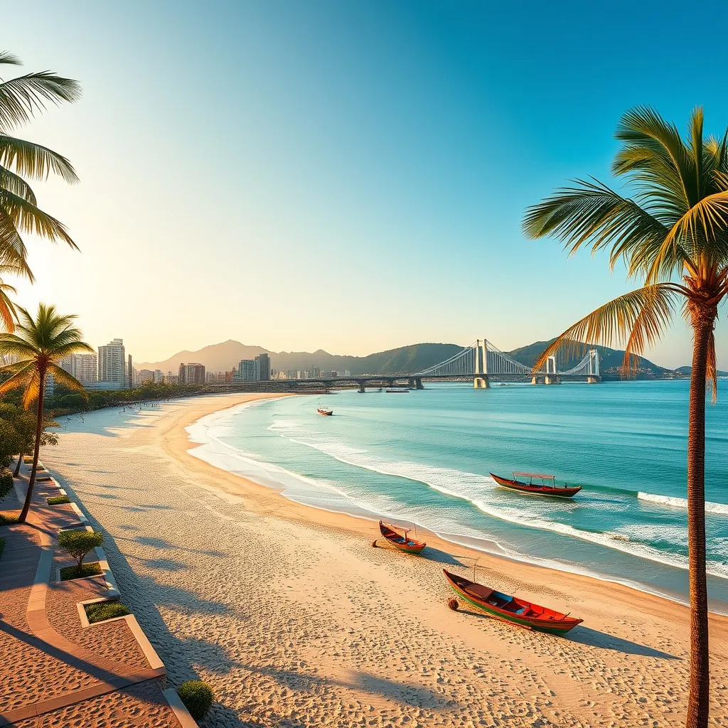
Da Nang occupies a singular position in Vietnam’s geography. It sits almost exactly halfway between Hanoi and Ho Chi Minh City, at the point where the Han River meets the East Sea. This central location has made it a natural crossroads for centuries, but the city’s transformation into one of Southeast Asia’s most livable urban centers is a recent phenomenon. The result is a destination that combines the energy of a modern metropolis with the relaxed atmosphere of a beach resort, all wrapped in a distinctive local culture that sets it apart from Vietnam’s other major cities.
The city has earned a reputation as Vietnam’s most livable urban center, a designation supported by its clean streets, efficient infrastructure, and abundant green spaces. Unlike the chaotic energy of Hanoi or the relentless pace of Ho Chi Minh City, Da Nang feels open and manageable. Its wide boulevards, modern bridges, and organized layout create an impression of order that surprises many first-time visitors. The city’s rapid development has been carefully planned, with an emphasis on creating public spaces that residents and visitors alike can enjoy.
My Khe Beach: A Coastal Masterpiece
My Khe Beach stretches for over 30 kilometers along Da Nang’s eastern edge, a sweeping arc of fine white sand that Forbes magazine named one of the world’s most beautiful beaches in 2005. The beach’s gentle slope and consistent waves make it ideal for swimming and water sports, while its width provides ample space for sunbathing and beach games. The water here is remarkably clear, with visibility that rivals more remote destinations along Vietnam’s coast.
The beach’s beauty is matched by its accessibility. Unlike many of Vietnam’s premier beaches, which require lengthy journeys from urban centers, My Khe sits just minutes from Da Nang’s city center. The beachfront promenade, lined with palm trees and modern amenities, connects directly to the city’s main thoroughfares. This proximity means visitors can combine beach time with cultural exploration, spending the morning in the water and the afternoon exploring the city’s attractions.
Local life centers on the beach in ways that visitors quickly notice. Early morning brings fishermen hauling in their overnight catches, their traditional round boats bobbing in the surf. As the day progresses, families arrive with picnic baskets and children’s toys, claiming spots under rented umbrellas. The beach is also a hub for sports, with volleyball nets, soccer goals, and kite-surfing equipment available for rent. This lively atmosphere, a blend of local custom and tourist convenience, gives My Khe a character that pure resort beaches cannot match.
The Bridges of the Han River
Da Nang’s bridges are more than infrastructure; they are symbols of the city’s ambition and creativity. The Han River, which bisects the city, is spanned by seven bridges, each with its own distinct character. The most famous is the Dragon Bridge, completed in 2013, whose steel structure forms a golden dragon arching over the water. On weekend nights, the dragon breathes fire and water in a spectacular display that draws crowds to the riverbanks.
The Golden Bridge, located in the Ba Na Hills above the city, has become one of Vietnam’s most photographed landmarks since its opening in 2018. The bridge appears to be cradled by two massive stone hands emerging from the forested hillside, creating an effect that seems drawn from mythology. The bridge’s golden walkway stretches 150 meters, offering panoramic views of the surrounding mountains and the coastline below. Despite its recent construction, the bridge has already become an icon of modern Vietnam, appearing in countless travel photographs and social media posts.
The other bridges each contribute to the city’s character. The Han River Bridge, completed in 2000, was the first bridge built across the lower Han River and remains a vital link between the city center and the eastern districts. The Thuan Phuoc Bridge, with its distinctive suspension design, offers dramatic views of the river mouth and the sea beyond. The Tran Thi Ly Bridge, with its striking sail-like tower, has become a favorite subject for photographers at sunset. Together, these bridges create a riverscape that changes character throughout the day, from the soft light of morning to the illuminated displays of night.
A Culinary Destination in Its Own Right
Da Nang’s food scene has earned national recognition, with several dishes that originated here achieving fame throughout Vietnam. The city’s signature dish is mi quang, a turmeric-colored noodle soup that combines pork, shrimp, peanuts, and fresh herbs in a rich broth. Unlike the more famous pho, mi quang is served with minimal broth, allowing the flavors of the ingredients to shine. Each family in Da Nang has its own recipe, and visitors quickly learn that the best versions are found in small, unassuming eateries rather than upscale restaurants.
The city’s location on the coast ensures an abundance of fresh seafood. The night market near the Han River offers a wide selection of grilled squid, clams, oysters, and fish, all cooked over open flames and served with dipping sauces made from lime, salt, and chili. The local specialty of banh xeo, a crispy crepe filled with shrimp and bean sprouts, is best enjoyed wrapped in rice paper with fresh herbs and dipped in fish sauce. Street food stalls throughout the city serve these dishes at remarkably low prices, making Da Nang one of Vietnam’s most accessible culinary destinations.
The city’s coffee culture adds another dimension to its food scene. Da Nang’s cafes range from traditional establishments serving strong Vietnamese coffee with condensed milk to modern specialty shops offering pour-over and cold brew. The city’s position as a coastal hub means that many cafes offer sea views, creating a relaxed atmosphere that encourages lingering. The combination of excellent food, reasonable prices, and a vibrant cafe culture makes Da Nang a destination that rewards culinary exploration.
Beyond the Beach: City Attractions
Da Nang’s appeal extends well beyond its coastline. The Marble Mountains, a cluster of five marble and limestone hills named after the five elements, rise from the coastal plain just south of the city. These hills contain caves, tunnels, and Buddhist sanctuaries that have been places of worship for centuries. Visitors can climb the steep staircases to reach panoramic viewpoints, explore the caves with their carved altars and statues, and visit the marble workshops at the mountains’ base, where artisans create sculptures and handicrafts using traditional techniques.
The Son Tra Peninsula, known locally as Monkey Mountain, forms a natural barrier between Da Nang and the open sea. Its forested slopes are home to the endangered red-shanked douc langur, a primate species found only in Vietnam and Laos. The peninsula’s Linh Ung Pagoda houses a 67-meter-tall statue of the Goddess of Mercy, which gazes out over the sea and has become a symbol of Da Nang’s spiritual heritage. The peninsula’s winding roads offer spectacular views of the coastline, and its beaches provide quieter alternatives to the more developed My Khe.
The Ba Na Hills, located about 40 kilometers from the city center, offer a completely different experience. This mountain resort, developed by a major Vietnamese corporation, features a French-inspired village, a theme park, and the famous Golden Bridge. The cable car ride to the summit, which holds the world record for the longest non-stop single-track cable car system, takes visitors from the tropical lowlands to a cooler, misty environment that feels worlds away from the coast. The contrast between the resort’s artificial charm and the natural beauty of the surrounding mountains creates a memorable experience.
Practical Notes for Visitors
Da Nang is one of Vietnam’s most accessible cities, with an international airport that receives direct flights from major Asian cities and domestic connections to all parts of the country. The city’s central location makes it an ideal base for exploring central Vietnam, with Hoi An, Hue, and the My Son Sanctuary all within easy reach. The train station connects to the national rail network, and the Hai Van Pass, which links Da Nang to Hue, is considered one of the most scenic coastal roads in the country.
The best time to visit Da Nang is from February to August, when the weather is warm and dry. The rainy season, from September to January, brings heavy downpours that can disrupt outdoor activities. The summer months, particularly June through August, are the busiest, with domestic tourists flocking to the beaches. Travelers who prefer quieter conditions should consider visiting in April or May, when the weather is still excellent but the crowds are thinner.
Da Nang offers a range of accommodation options, from budget hostels to luxury beachfront resorts. The area around My Khe Beach has the highest concentration of hotels, while the city center offers easier access to restaurants and attractions. The city’s efficient public transport system, including buses and ride-hailing services, makes it easy to explore without a car. For those who want to explore the surrounding region, motorbike rentals are widely available, though the city’s traffic, while less chaotic than Hanoi or Ho Chi Minh City, still requires caution.
Da Nang succeeds where many cities fail: it offers the amenities and attractions of a major tourist destination while maintaining the feel of a livable community. The city’s beaches are world-class, its bridges are architectural landmarks, and its food scene rewards exploration. Yet the city never feels overwhelming, and its residents maintain a warmth that makes visitors feel welcome. For travelers seeking a Vietnamese destination that combines natural beauty, modern comfort, and cultural depth, Da Nang delivers on every front.
18. Hue: The Imperial Citadel and Royal Tombs
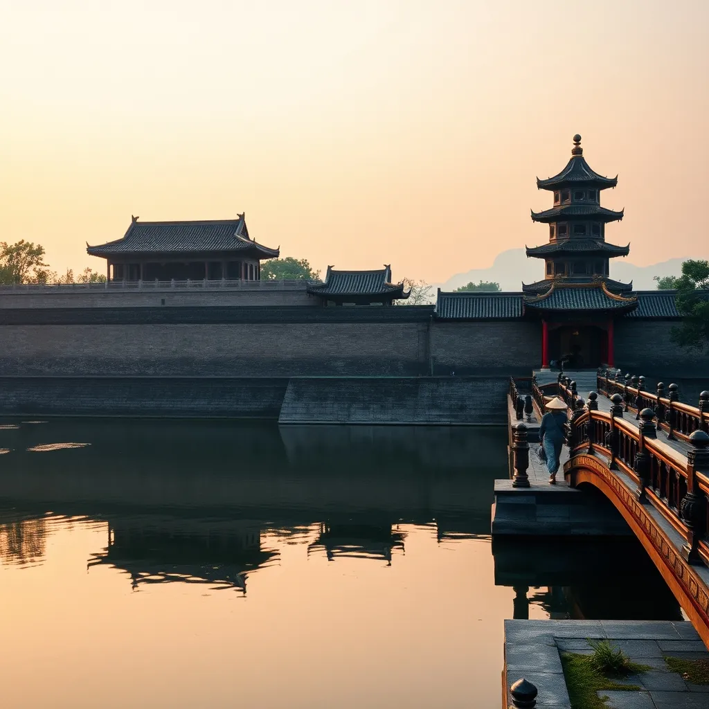
Hue occupies a unique place in Vietnam’s collective memory. For 143 years, from 1802 to 1945, this city on the banks of the Perfume River served as the capital of the Nguyen Dynasty, the last imperial family to rule a unified Vietnam. The emperors who governed from this city left behind a legacy of extraordinary architecture, from the sprawling walls of the Citadel to the elaborate tombs scattered across the surrounding countryside. The city’s historical significance earned it UNESCO World Heritage status in 1993, and its monuments continue to draw visitors who want to understand Vietnam’s imperial past.
The city’s atmosphere differs markedly from other Vietnamese destinations. Where Da Nang pulses with modern energy and Hanoi buzzes with commercial activity, Hue maintains a contemplative pace. The Perfume River, which flows through the city’s heart, sets the tone with its slow, steady current. The city’s tree-lined streets, historic buildings, and quiet gardens create an environment that encourages reflection. This is a place where history is not merely preserved in museums but woven into the daily life of the city.
The Imperial Citadel: A City Within a City
The Citadel, known locally as Dai Noi, is the centerpiece of Hue’s imperial heritage. Construction began in 1804 under Emperor Gia Long, the founder of the Nguyen Dynasty, and continued for decades as successive emperors added their own contributions. The complex covers over 520 hectares, making it one of the largest citadel complexes in Southeast Asia. Its walls, which rise up to six meters high and stretch over 10 kilometers in circumference, enclose a city that once housed the imperial court, its servants, and its guards.
The Citadel’s design follows the principles of Eastern philosophy and geomancy. The complex is oriented along a north-south axis, with the main gates facing south, the direction of honor and authority. The outer walls, built in the Vauban style with bastions and moats, reflect European military engineering adapted to Vietnamese conditions. Within these walls, a second set of walls encloses the Forbidden Purple City, the innermost sanctum where the emperor and his family lived. This layered design created a hierarchy of spaces, with access becoming increasingly restricted as one moved toward the center.
Visitors enter through the Ngo Mon Gate, a two-story structure with a distinctive five-tiered roof that has become emblematic of Hue. The gate’s design served both ceremonial and defensive purposes, with the emperor’s personal entrance reserved for his exclusive use. Beyond the gate lies the Thai Hoa Palace, where the emperor held court and received foreign dignitaries. The palace’s interior features 80 carved wooden columns, each painted with golden dragons, creating an atmosphere of imperial grandeur. The throne room, with its elevated platform and ornate decorations, remains one of the most impressive spaces in the entire complex.
The Citadel suffered significant damage during the 1968 Tet Offensive, when fierce fighting between North Vietnamese and American forces destroyed many of its buildings. Restoration efforts have been ongoing for decades, and while some structures remain in ruins, others have been painstakingly rebuilt using traditional materials and techniques. The contrast between restored buildings and crumbling walls tells a powerful story of Vietnam’s turbulent 20th century. Visitors walking through the complex encounter both the grandeur of the imperial era and the scars of more recent history.
The Royal Tombs: Monuments to Imperial Power
Scattered across the hills and plains south of the Perfume River lie the tombs of the Nguyen emperors. These are not simple graves but elaborate complexes that functioned as palaces for the afterlife. Each tomb was designed by its emperor during his lifetime, often incorporating elements that reflected his personality, interests, and reign. The tombs served multiple purposes: they honored the deceased emperor, demonstrated his power, and provided a space for rituals that would ensure his smooth passage to the next world.
The Tomb of Emperor Tu Duc, who reigned from 1847 to 1883, is perhaps the most beautiful of all. Tu Duc was a poet and scholar who preferred the arts to the affairs of state, and his tomb reflects his refined sensibility. The complex includes a lake, islands, pavilions, and a theater where the emperor’s personal troupe performed. The tomb itself, hidden behind a screen of trees, is a modest structure compared to the lavish surroundings. Tu Duc’s reign was marked by increasing French influence in Vietnam, and his retreat into art and poetry can be seen as an escape from the political pressures of his time.
The Tomb of Emperor Khai Dinh, the last emperor to build a tomb before the dynasty’s collapse, presents a striking contrast. Built between 1920 and 1931, the tomb combines traditional Vietnamese elements with French, Gothic, and even Art Deco influences. The structure is built into a hillside, with steep staircases leading to an ornate interior covered in mosaic tiles made from broken porcelain and glass. The tomb’s dark, imposing exterior gives way to a dazzling interior that showcases the eclectic tastes of its builder. Khai Dinh’s tomb is the most expensive of all the imperial tombs, a fact that contributed to the financial strain on the dynasty during its final decades.
The Tomb of Emperor Minh Mang, who reigned from 1820 to 1841, is admired for its harmonious design. The tomb complex is arranged along a central axis, with courtyards, gates, and buildings perfectly balanced on either side. A crescent-shaped lake surrounds the burial mound, reflecting the traditional belief that the deceased should be protected by water. Minh Mang was a strict Confucianist, and his tomb reflects the order and discipline he valued during his reign. The symmetry of the complex creates a sense of peace that visitors often find moving.
Thien Mu Pagoda: The Symbol of Hue
Seven kilometers from the city center, on a hill overlooking the Perfume River, stands Thien Mu Pagoda, the oldest and most revered religious site in Hue. The pagoda’s seven-story Phuoc Duyen Tower, built in 1844, has become the most recognizable symbol of the city. The tower rises 21 meters above the riverbank, its octagonal shape and tiered roofs creating a silhouette that appears in countless photographs and paintings. The pagoda’s name means “Heavenly Lady,” referring to a legend about an old woman who appeared on the hill and predicted that a lord would build a pagoda on the site to bring prosperity to the region.
The pagoda complex extends far beyond the tower. The main hall houses a bronze bell cast in 1710, which weighs over 2,000 kilograms and is said to be audible from up to 10 kilometers away. The hall also contains statues of Buddhist deities and historical figures, each with its own significance. The grounds include gardens, courtyards, and living quarters for the monks who maintain the pagoda. The site’s position on the riverbank offers panoramic views of the Perfume River and the surrounding countryside, making it a popular spot for both pilgrims and tourists.
Thien Mu Pagoda also holds a significant place in modern Vietnamese history. In 1963, the monk Thich Quang Duc drove from the pagoda to Saigon, where he immolated himself in protest against the South Vietnamese government’s persecution of Buddhists. The car he used is still displayed at the pagoda, a reminder of the intersection between religious devotion and political resistance. The pagoda’s role in this pivotal moment adds a layer of historical depth to its spiritual significance.
The Perfume River: The City’s Lifeline
The Perfume River, known locally as Huong Giang, gives Hue its distinctive character. The river’s name derives from the fragrant flowers that fall from orchards upstream, filling the water with a subtle scent during certain seasons. The river flows from the Truong Son Mountains through the city and into the South China Sea, providing both transportation and irrigation for the surrounding region. For centuries, the river was the primary route for moving goods and people, and its banks became the natural location for markets, pagodas, and imperial structures.
A boat trip along the river is one of the essential experiences in Hue. Traditional wooden boats, painted in bright colors with carved dragon heads at the prow, offer cruises that range from short excursions to full-day journeys. The most popular route takes visitors from the city center to Thien Mu Pagoda and beyond, passing through a landscape of rice paddies, fishing villages, and riverbank gardens. The river’s calm waters reflect the changing light throughout the day, from the soft gold of sunrise to the deep orange of sunset. Evening cruises offer a different perspective, with the illuminated towers of the Citadel and pagodas creating a magical atmosphere.
The river also supports a vibrant riverine culture. Floating markets, where vendors sell fresh produce, fish, and household goods from their boats, operate along the river’s length. Fishermen cast nets from small boats, their movements precise and practiced. Children swim in the shallows during the hot season, while water buffalo cool themselves in the mud along the banks. This daily life continues largely unchanged from generation to generation, providing visitors with a glimpse of a way of life that has persisted for centuries.
Cuisine: The Refined Flavors of the Imperial Court
Hue’s culinary tradition is distinguished by its imperial heritage. The Nguyen emperors employed hundreds of chefs who developed elaborate dishes designed to please the royal palate. These dishes emphasized visual presentation as much as flavor, with food arranged in artistic patterns and colors. The tradition of royal cuisine has been preserved and adapted for modern diners, with several restaurants in Hue offering “imperial banquets” that recreate the dining experience of the Nguyen court.
The city’s most famous dish is bun bo Hue, a spicy beef noodle soup that differs significantly from the more familiar pho. The broth is made with beef bones, lemongrass, and shrimp paste, giving it a deep, complex flavor with a noticeable kick of chili. The soup is served with thick round noodles, slices of beef, pork hock, and fresh herbs. Unlike pho, which is typically eaten for breakfast, bun bo Hue is enjoyed throughout the day. The dish’s popularity has spread throughout Vietnam, but the best versions are still found in its home city.
Hue is also known for its banh beo, small steamed rice cakes topped with shrimp powder, crispy shallots, and scallion oil. These delicate morsels are served in small ceramic dishes, with diners eating them directly from the dish using a spoon. Another local specialty is banh khoai, a crispy pancake filled with shrimp, pork, and bean sprouts, served with a tangy dipping sauce. The city’s imperial heritage is also reflected in its desserts, which include sweet soups made with beans, lotus seeds, and coconut milk, often served in ornate bowls that echo the aesthetics of the royal court.
Practical Notes for Visitors
Hue is accessible by air, rail, and road. Phu Bai International Airport, located about 15 kilometers from the city center, receives domestic flights from Hanoi and Ho Chi Minh City, with some international connections. The train station is served by the main north-south railway line, with the journey from Da Nang taking approximately three hours. The Hai Van Pass, which connects Hue to Da Nang, offers one of the most scenic drives in Vietnam, though the route is winding and requires careful driving. Many visitors choose to travel between the two cities by motorbike to experience the coastal views firsthand.
The best time to visit Hue is from January to August, when the weather is relatively dry and temperatures are moderate. The city experiences a rainy season from September to December, with October and November bringing the heaviest rainfall. The city’s location between the mountains and the sea creates a microclimate that can produce sudden weather changes, so visitors should pack layers and be prepared for occasional showers even during the dry season. The summer months can be hot and humid, with temperatures often exceeding 35 degrees Celsius.
Hue offers a range of accommodation options, from budget guesthouses in the city center to luxury resorts along the Perfume River. The area around the Citadel and the central market has the highest concentration of budget options, while the riverfront offers more upscale choices. Many visitors choose to stay in the old town, which provides easy access to the main attractions and the best restaurants. The city is compact enough to explore on foot, though bicycles and motorbikes are popular alternatives for reaching the tombs and pagodas outside the city center.
A visit to Hue is a journey into Vietnam’s imperial past. The Citadel’s massive walls, the elaborate tombs of the emperors, and the serene pagodas along the Perfume River all speak to a civilization that valued beauty, order, and spiritual devotion. The city’s cuisine, with its refined flavors and artistic presentation, continues the traditions of the royal court. For travelers seeking to understand Vietnam beyond its beaches and bustling cities, Hue offers a depth of history and culture that few destinations can match. The city’s quiet elegance, its unhurried pace, and its profound sense of place create an experience that lingers long after departure.
19. Phong Nha-Ke Bang National Park: Cave Kingdom
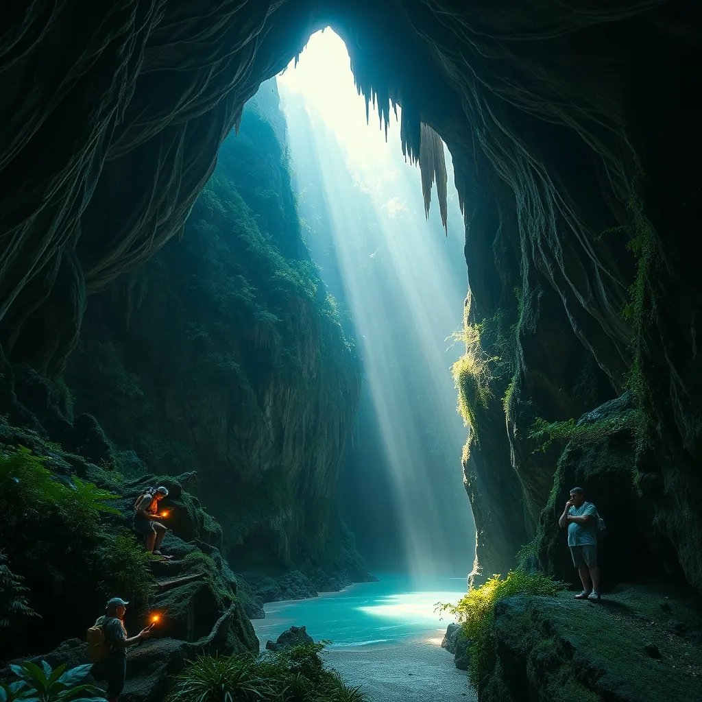
Deep in Quang Binh Province, along Vietnam’s narrow central waist, lies a landscape that defies imagination. Phong Nha-Ke Bang National Park extends across 123,326 hectares of limestone karst mountains, primary forest, and underground rivers. This is not merely a park with caves. It is a subterranean kingdom, a world beneath the world, where entire ecosystems exist in permanent darkness and chambers stretch so vast they contain their own weather systems. UNESCO recognized the park as a World Heritage Site in 2003, and subsequent discoveries have only strengthened its claim to being the most significant cave system on Earth.
The park’s geological history spans hundreds of millions of years. The limestone here is among the oldest in Asia, formed during the Paleozoic era when this region lay beneath a shallow tropical sea. Over eons, acidic groundwater dissolved the limestone, carving channels that grew into the caverns we see today. The result is a labyrinth of over 300 caves, many still unexplored. The park’s karst landscape is so complete that geologists consider it a textbook example of tropical karst formation. For visitors, this translates into an otherworldly experience that has no equal anywhere else on the planet.
Son Doong Cave: The Largest Cave in the World
Son Doong Cave holds a record that no other cave can challenge. It is the largest natural cave on Earth, a title it has held since its full exploration in 2009. The cave’s main passage measures over 5 kilometers in length, with sections reaching 200 meters in height and 150 meters in width. To put that in perspective, a 40-story building could fit inside the largest chambers, and the cave’s volume is estimated at 38.5 million cubic meters. The sheer scale is difficult to comprehend until you stand inside it, reduced to a tiny figure against walls that disappear into darkness above.
The cave was discovered in 1991 by a local farmer named Ho Khanh, who stumbled upon the entrance while seeking shelter from a storm. He marked the location but could not find it again for years. It was not until 2009 that a British caving expedition, guided by Khanh’s memory, located the entrance and conducted the first full survey. The cave’s name, which means “Mountain River Cave,” comes from the underground river that carved it and continues to flow through its depths.
Son Doong’s interior is unlike any other cave on Earth. The collapse of the cave ceiling in several places has created enormous skylights, or “dolines,” where sunlight pours into the underground world. These openings have allowed jungle to grow inside the cave, creating a unique ecosystem where trees, vines, and ferns thrive in the filtered light. The cave even has its own weather system, with clouds forming in the vast chambers and fog rolling through the passages. Visitors have reported seeing mist rise from the underground river and condense into clouds that drift through the cavern.
Access to Son Doong is strictly limited. The park authorities, in partnership with a licensed tour operator, allow only a small number of visitors each year. The expedition takes four days and three nights, requiring participants to trek through jungle, wade across rivers, and camp inside the cave. The cost is substantial, reflecting the logistical complexity of the expedition and the commitment to preserving the cave’s fragile environment. For those who can secure a spot, the experience is transformative. Standing in the vastness of Son Doong, surrounded by ancient rock and the sound of rushing water, creates a perspective on human scale that few places on Earth can offer.
Paradise Cave: A Cathedral of Stalactites
For travelers who cannot secure a spot on the Son Doong expedition, Paradise Cave offers a more accessible glimpse into the park’s wonders. Discovered in 2005 by members of the British Cave Research Association, Paradise Cave extends for 31 kilometers, making it the longest dry cave in Asia. The cave’s entrance, hidden in the jungle-covered slopes of a limestone mountain, opens into a chamber that immediately overwhelms the senses. Stalactites hang from the ceiling like frozen waterfalls, while stalagmites rise from the floor in towering formations that resemble ancient trees, pagodas, and abstract sculptures.
The cave’s name, Thien Duong in Vietnamese, reflects its ethereal beauty. The first 1.1 kilometers are open to visitors via a wooden walkway that winds through the chambers. The walkway allows close inspection of the formations while protecting them from damage. Electric lighting, carefully positioned to minimize ecological impact, illuminates the cave’s features with a soft glow. The effect is that of walking through a cathedral built by nature over millions of years, each chamber more awe-inspiring than the last.
Paradise Cave’s formations are remarkable for their size and variety. The stalactites in the main chamber reach up to 20 meters in length, their surfaces glistening with mineral deposits that catch the light. Some formations resemble cascading curtains, while others twist into spirals and columns. The cave’s colors range from pure white to deep amber, depending on the mineral content of the water that created them. The silence inside the cave is profound, broken only by the occasional drip of water and the footsteps of visitors on the wooden walkway.
Phong Nha Cave: The Water Cave
Phong Nha Cave, the park’s namesake, offers a different experience. Unlike the dry passages of Paradise Cave, Phong Nha is a water cave, entered by boat along the Son River. The river flows directly into the cave’s mouth, and visitors travel upstream through the darkness in traditional wooden boats. The cave’s name means “Wind and Teeth,” referring to the stalactites that hang from the entrance like fangs and the cool breeze that flows from the cave’s depths.
The boat journey into Phong Nha Cave is an experience in itself. The river narrows as it enters the cave, and the boat glides through passages where the ceiling drops low before opening into vast chambers. The boatmen, skilled in navigating the underground river, use their hands to push off the rock walls as the boat drifts through the darkness. The cave’s main chamber, known as the “Giant Hall,” measures 200 meters in length and 100 meters in height, its roof lost in shadow above. The river’s water is remarkably clear, reflecting the cave’s formations and creating the illusion of floating through a mirror.
Phong Nha Cave contains some of the most spectacular formations in the park. The “Lion,” the “Fairy,” and the “Royal Court” are among the named stalactites that have captured visitors’ imaginations for generations. The cave was used as a hideout during the Vietnam War, and remnants of that era, including a field hospital and supply depot, can still be seen in some chambers. The combination of natural beauty and historical significance makes Phong Nha Cave a compelling destination for visitors who want to understand both the park’s geology and its role in Vietnam’s modern history.
Other Caves Worth Exploring
While Son Doong, Paradise, and Phong Nha dominate the headlines, the park contains many other caves that reward exploration. Hang En Cave, the third-largest cave in the world, requires a trek through jungle and across rivers to reach. Its entrance, a massive opening in a limestone cliff, leads to a chamber that contains a beach of fine sand and a turquoise lake. The cave’s scale is breathtaking, and its relative inaccessibility means visitors often have it to themselves.
Dark Cave, known locally as Hang Toi, offers an adventure experience that differs from the other caves. Visitors don life jackets and headlamps before swimming through an underground river, then explore the cave’s muddy passages on foot. The cave’s name comes from its complete darkness, and the experience is as much about physical challenge as visual appreciation. The mud baths inside the cave, rich in minerals, are said to have therapeutic properties. The combination of swimming, trekking, and caving makes Dark Cave a popular choice for active travelers.
For those seeking a more contemplative experience, the park’s quieter caves offer solitude and beauty. Hang Tien Cave, discovered in 2013, contains fossilized shells and coral embedded in its walls, evidence of the region’s ancient marine past. Tu Lan Cave, part of a system of over 20 caves, requires a multi-day trek that includes swimming through underground passages and camping in jungle clearings. These less-visited caves provide a sense of discovery that the more popular sites cannot match.
Beyond the Caves: The Park’s Surface World
The park’s above-ground landscape is as remarkable as its underground wonders. The karst mountains rise abruptly from the surrounding plains, their limestone cliffs covered in dense tropical forest. The park is home to over 2,500 species of plants and more than 700 species of animals, including several found nowhere else on Earth. The endangered Ha Tinh langur, one of the rarest primates in the world, lives in the park’s limestone cliffs. The park’s forests also shelter Asian black bears, clouded leopards, and a rich diversity of bird species.
The Son River, which flows through the park, offers its own scenic beauty. Boat trips along the river provide views of the karst mountains reflected in the water, with local fishermen casting nets from small wooden boats. The river’s banks are lined with rice paddies and vegetable gardens, where farmers continue traditional cultivation methods. The town of Son Trach, the park’s gateway, has grown to accommodate the influx of visitors, with guesthouses, restaurants, and tour operators lining its main street. Despite this development, the town retains a relaxed, rural atmosphere that contrasts with Vietnam’s larger tourist centers.
Planning Your Visit
The best time to visit Phong Nha-Ke Bang National Park is from February to August, when the weather is dry and the rivers are at their most manageable levels. The rainy season, from September to January, brings heavy rainfall that can flood the caves and make trekking dangerous. The park’s location in central Vietnam means it experiences a distinct wet-dry cycle, and visitors should plan accordingly. The dry season also offers the clearest views of the karst landscape, with the limestone mountains standing out against the blue sky.
The park is accessible by road from several directions. The nearest major city is Dong Hoi, about 50 kilometers to the southeast, which has an airport with flights from Hanoi and Ho Chi Minh City. The park is also well-connected by bus and train, with the Reunification Express stopping at Dong Hoi station. Many travelers combine a visit to Phong Nha with the nearby cities of Hue and Da Nang, creating a central Vietnam itinerary that covers both cultural and natural highlights. The drive from Hue takes approximately three hours, passing through some of Vietnam’s most scenic countryside.
Accommodation in the Son Trach area ranges from budget hostels to mid-range hotels and eco-lodges. The town has grown rapidly in recent years, and new options continue to appear. The park’s remote location means that most visitors stay at least one night, and many choose to base themselves here for several days to explore the caves and surrounding countryside. The town’s restaurants serve local specialties, including the region’s famous Quang Binh noodles and fresh river fish.
Phong Nha-Ke Bang National Park represents the pinnacle of Vietnam’s natural wonders. The park’s caves, from the record-breaking Son Doong to the accessible beauty of Paradise Cave, offer experiences that cannot be found anywhere else on Earth. The karst landscape, with its dramatic peaks and hidden valleys, provides a backdrop of stunning beauty. For travelers who want to witness the power of nature and the scale of geological time, this park is essential. The underground world of Phong Nha-Ke Bang is not merely a collection of caves. It is a complete and separate universe, waiting to be explored.
20. My Son Sanctuary: Ruins of the Champa Kingdom
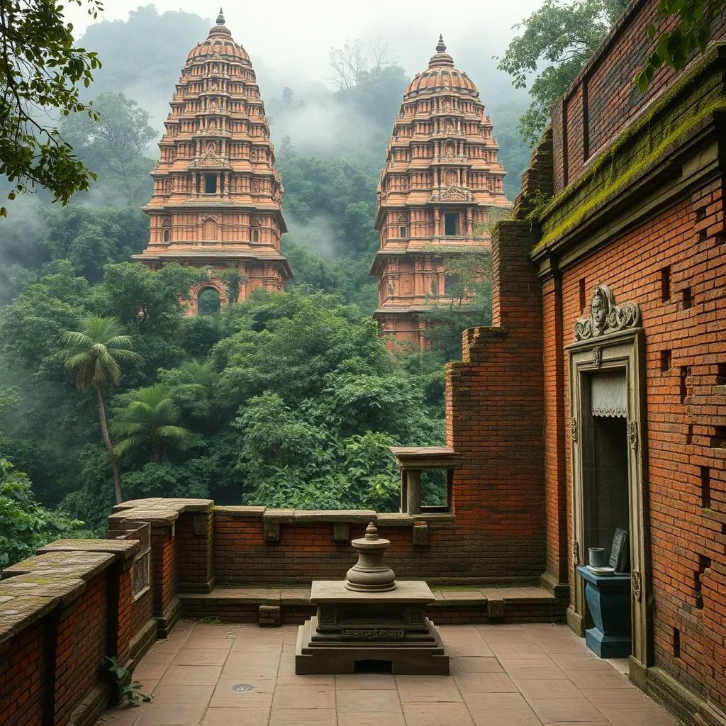
Deep in a narrow valley surrounded by mountains in Quang Nam Province lies one of Southeast Asia’s most significant archaeological sites. My Son Sanctuary is not a city or a fortress. It is a religious complex, a sacred space where the kings of the Champa Kingdom honored their gods and buried their rulers for over a thousand years. The site’s name, pronounced “Mee Sun” and meaning “Beautiful Mountain,” refers to the mountain that dominates the valley and was itself considered sacred. Today, the ruins stand as a testament to a civilization that flourished for centuries before fading into history, their red brick towers rising from the jungle like ghosts of a forgotten age.
The Champa Kingdom emerged in the second century AD along the coast of central Vietnam. The Cham people, of Austronesian origin, built a maritime kingdom that controlled trade routes between China, India, and the Indonesian archipelago. Their culture drew heavily from Indian civilization, adopting Hinduism as the state religion and Sanskrit as a sacred language. The kings of Champa built temples to honor the Hindu gods, particularly Shiva, who was considered the protector of the kingdom and the source of royal power. My Son became the spiritual heart of this kingdom, a place where kings came to perform rituals, celebrate victories, and ensure the prosperity of their realm.
The Sacred Valley of the Cham Kings
The location of My Son was carefully chosen. The valley is surrounded by mountains, with a river flowing through it, creating a natural amphitheater that the Cham considered sacred. The central mountain, known as Mahaparvata in ancient inscriptions, was believed to be the earthly manifestation of Mount Meru, the mythical center of the universe in Hindu cosmology. The temples were built to align with this sacred mountain, their towers pointing toward it as a gesture of devotion. The valley’s isolation also provided protection, hiding the temples from view and creating a sense of mystery that enhanced their religious significance.
The construction of My Son spanned more than ten centuries, from the fourth to the fourteenth century. Each dynasty of Cham kings added to the complex, building new temples and restoring old ones. The result is a layered history written in brick and stone, with structures from different periods standing side by side. The earliest temples were simple structures, while later ones became more elaborate, with intricate carvings and complex architectural forms. The kings of Champa spared no expense in honoring their gods, importing skilled artisans and using the finest materials available.
The temples at My Son were built primarily of red brick, a material that has proven remarkably durable over the centuries. The Cham developed a unique construction technique that remains a mystery to modern engineers. The bricks were laid without mortar, fitted together so precisely that they have survived centuries of tropical weather. The surface of the bricks was then polished to create a smooth, uniform finish. Some researchers believe the Cham used a plant-based adhesive or a special firing technique that fused the bricks together. The exact method remains unknown, adding to the site’s intrigue and demonstrating the advanced engineering skills of this ancient civilization.
Architecture and Symbolism
The temples at My Son follow a consistent architectural pattern. Each temple consists of a tower, known as a kalan, which houses the sanctuary where the deity’s image was placed. The tower is typically square, with a stepped roof that rises in tiers to a point. The roof is often decorated with carvings of mythical creatures, including lions, elephants, and the serpent god Naga. The doorways face east, toward the rising sun, and are flanked by carved sandstone pillars. The entire structure is designed to represent Mount Meru, with the tower serving as a symbolic link between the earthly realm and the divine.
The interior of each temple is simple and dark, designed to focus attention on the deity’s image. The central sanctum, known as the garbhagriha, houses a lingam, a cylindrical stone symbol of Shiva. The lingam is typically mounted on a yoni, a square base representing the female principle and the source of creative energy. Together, the lingam and yoni symbolize the union of masculine and feminine forces that creates and sustains the universe. The sanctum’s darkness is intentional, creating an atmosphere of mystery and reverence that enhances the religious experience.
The carvings at My Son are among the finest examples of Cham art. The sandstone reliefs depict scenes from Hindu mythology, including the gods Shiva, Vishnu, and Brahma, as well as scenes from the Ramayana and Mahabharata. The carvings are notable for their grace and detail, with figures that appear to move and breathe despite being carved from stone. The Cham artists had a distinctive style, with figures that are more elongated and stylized than their Indian counterparts. The carvings also include inscriptions in Sanskrit and Old Cham, providing valuable information about the kingdom’s history, religion, and royal dynasties.
Discovery and Destruction
My Son was abandoned in the fifteenth century as the Champa Kingdom declined and eventually fell to the expanding Vietnamese state. The jungle slowly reclaimed the site, covering the temples with vegetation and hiding them from view. The ruins were rediscovered in 1898 by a French archaeologist named Henri Parmentier, who recognized their significance and conducted the first systematic study. Parmentier’s work revealed the extent of the complex, which includes over 70 structures built between the fourth and fourteenth centuries. His documentation remains a valuable resource for understanding the site’s history and architecture.
The twentieth century brought both destruction and preservation to My Son. During the Vietnam War, the site was used as a base by the Viet Cong, and it suffered heavy bombing by American forces. The bombing destroyed several temples and damaged many others, leaving scars that are still visible today. The site was also affected by theft, with some carvings and artifacts removed and sold on the black market. Despite these losses, the majority of the complex survived, and in 1999, UNESCO recognized My Son as a World Heritage Site. The designation brought international attention and resources, leading to extensive restoration efforts that continue to this day.
Exploring My Son Today
Visitors to My Son enter through a modern visitor center, where they can learn about the site’s history and significance. From there, an electric shuttle carries them into the valley, following the river that the Cham considered sacred. The path winds through the jungle, and the first glimpse of the towers is a moment that stays with visitors. The red brick structures rise from the green vegetation, their surfaces weathered by centuries of tropical rain and sun. The atmosphere is quiet and contemplative, a stark contrast to the bustling cities and beaches that dominate most Vietnam itineraries.
The main groups of temples, designated by letters from A to H, are spread across the valley floor. Each group contains a central temple surrounded by smaller auxiliary structures. The most impressive is Group A, which contains the largest temple at the site. Group B and C, located near the river, contain some of the best-preserved carvings. Group E, the oldest, dates from the seventh century and shows the evolution of Cham architecture. Visitors can walk freely among the ruins, though some areas are roped off to protect fragile structures. The site is compact, and most visitors spend two to three hours exploring.
The best time to visit My Son is early morning, when the light is soft and the crowds are thin. The site opens at 6:00 AM, and the first shuttle leaves shortly after. The morning light brings out the warm tones of the brick, and the valley is often shrouded in mist, creating an ethereal atmosphere that enhances the sense of stepping back in time. The site is also less crowded in the morning, allowing visitors to experience the ruins in relative solitude. By mid-morning, tour groups arrive, and the site becomes busier.
My Son is located about 40 kilometers southwest of Hoi An, making it an easy day trip from that popular tourist destination. The drive takes approximately one hour, passing through rural countryside and small villages. The site is also accessible from Da Nang, about 60 kilometers away. Many visitors combine a visit to My Son with other attractions in the region, such as the Marble Mountains or the Cham Museum in Da Nang, which houses a collection of Cham artifacts. The combination provides a comprehensive understanding of Cham culture and its legacy in central Vietnam.
The Legacy of the Champa Kingdom
My Son is more than a collection of ancient ruins. It is a window into a civilization that shaped the history and culture of central Vietnam. The Cham people developed a sophisticated society with its own language, art, and religious traditions. Their maritime trade network connected them with cultures across Asia, and their artistic achievements rival those of their more famous contemporaries. The decline of the Champa Kingdom did not erase its legacy. Cham culture survives in the descendants of the Cham people, who continue to live in central and southern Vietnam, preserving their language, traditions, and religious practices.
The site’s preservation is an ongoing challenge. The tropical climate, with its high humidity and frequent rain, takes a toll on the ancient structures. The brick towers are particularly vulnerable, as moisture seeps into the porous material and causes it to deteriorate. Restoration efforts use traditional techniques and materials, but the work is slow and painstaking. The site’s popularity also creates pressure, as the footfall of thousands of visitors each day contributes to wear and tear. The challenge is to balance accessibility with preservation, allowing visitors to experience the site while protecting it for future generations.
For travelers, My Son offers a different perspective on Vietnam. The country is often associated with its beaches, cities, and natural wonders, but its history is equally rich and complex. My Son tells the story of a civilization that flourished for over a thousand years, leaving behind a legacy that continues to inspire. The ruins are not merely old buildings. They are the remains of a living faith, a place where kings once communed with their gods and where the fate of a kingdom was decided. Standing among the towers, with the jungle pressing in from all sides, it is easy to feel the weight of that history and the presence of those who came before.
My Son Sanctuary deserves a place on any Vietnam itinerary. Its combination of historical significance, architectural beauty, and atmospheric setting makes it a unique destination. The site is accessible, affordable, and can be visited in a half day, making it an easy addition to a trip that includes Hoi An or Da Nang. For those who take the time to explore its ruins and understand its history, My Son offers a reward that few other sites can match: a genuine connection to a civilization that shaped the course of Southeast Asian history. The red brick towers, rising from the jungle floor, are a reminder that even the greatest kingdoms eventually fade, but their achievements endure in the stones they left behind.
21. Son Tra Peninsula: The ‘Monkey Mountain’
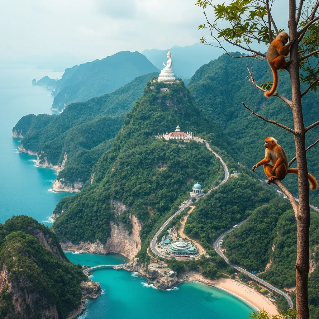
Just a short drive from the bustling streets of Da Nang lies a world apart. The Son Tra Peninsula, known locally as Nui Con Khỉ or Monkey Mountain, rises dramatically from the East Sea, its jungle-covered slopes visible from the city’s beaches. This 4,400-hectare peninsula is a protected nature reserve, a spiritual sanctuary, and one of the most biodiverse areas in Vietnam. It is also home to a population of endangered primates found nowhere else on Earth. The peninsula offers a rare combination of natural wonders and cultural landmarks, all within easy reach of one of Vietnam’s most dynamic cities.
The peninsula’s nickname comes from the troops of macaque monkeys that inhabit its forests. But the true stars of Son Tra are the red-shanked douc langurs, a species so striking that conservationists often call them the “queen of primates.” With their grey bodies, white faces, and vivid orange-red legs, these langurs are among the most beautiful monkeys in the world. They are also critically endangered, with an estimated population of only 1,000 to 1,500 individuals remaining in the wild. Son Tra is their last stronghold, home to the largest known population of this rare species.
The Red-Shanked Douc Langur: A Living Treasure
The red-shanked douc langur, scientifically known as Pygathrix nemaeus, is endemic to the forests of Laos, Cambodia, and central Vietnam. The species was once widespread across the region, but habitat loss and hunting have driven it to the brink of extinction. Son Tra’s protected status has made it a refuge, and the peninsula now supports a population of roughly 300 to 400 individuals. This makes Son Tra the most reliable place in the world to see these remarkable primates in their natural habitat.
Douc langurs are leaf-eaters, spending most of their time in the forest canopy where they feed on young leaves, fruits, and flowers. They live in groups of 5 to 20 individuals, led by a dominant male. Their social structure is complex, with strong bonds between females and elaborate grooming rituals. Observing them is a privilege. They move through the trees with surprising grace, their long limbs and tails allowing them to leap between branches with ease. The sight of a group of douc langurs, their orange legs flashing against the green canopy, is an experience that stays with visitors long after they leave.
The best time to see the langurs is early morning or late afternoon, when they are most active. The most reliable viewing spots are along the road to the summit, particularly near the Linh Ung Pagoda and the forest trails that branch off from the main road. Local guides and conservation volunteers can help visitors spot them and provide information about their behavior and conservation status. Patience is essential, as the langurs are shy and easily startled. But for those willing to wait, the reward is a close encounter with one of the rarest primates on Earth.
Conservation efforts on the peninsula are ongoing. The Son Tra Nature Reserve was established in 1977, and the area has been designated a national park. However, the langurs face ongoing threats from development, as the peninsula’s strategic location and scenic beauty attract investors. Conservation groups are working to protect the langurs’ habitat, monitor their population, and raise awareness about their plight. Visitors can support these efforts by respecting the rules of the reserve, staying on designated trails, and avoiding any actions that might disturb the wildlife.
Linh Ung Pagoda and the Lady Buddha
The spiritual heart of Son Tra is Linh Ung Pagoda, one of the largest and most impressive Buddhist temples in central Vietnam. The pagoda complex is perched on a hillside overlooking the sea, its white and gold structures gleaming against the green jungle. The centerpiece is a 67-meter-tall statue of the Goddess of Mercy, known as Lady Buddha, which stands on a lotus-shaped platform and gazes out over the ocean. The statue is visible from Da Nang’s beaches and has become a symbol of the city. It is also one of the tallest Buddha statues in Vietnam.
The pagoda complex includes a main hall, a bell tower, and numerous smaller shrines and gardens. The architecture is a blend of traditional Vietnamese and Buddhist styles, with curved roofs, intricate carvings, and colorful murals depicting scenes from Buddhist scripture. The grounds are meticulously maintained, with manicured gardens, bonsai trees, and lotus ponds. The atmosphere is serene, a stark contrast to the energy of the city below. Many visitors come to pray, while others come simply to enjoy the peaceful surroundings and the panoramic views.
The Lady Buddha statue is particularly striking at sunset, when the setting sun casts a golden glow over the white figure. The statue’s face is serene, with a gentle smile and downcast eyes. It is said to offer protection to fishermen and sailors, guiding them safely home. The statue is hollow, and visitors can climb a narrow staircase to the top for a closer view of the figure’s face and a bird’s-eye view of the surrounding area. The climb is not for the faint of heart, but the views are worth the effort.
The pagoda is also home to a small community of monks and nuns who live and study there. Visitors may see them going about their daily routines, chanting, meditating, or tending to the gardens. The monks are generally welcoming and may offer blessings or guidance to visitors. It is important to dress respectfully when visiting the pagoda, covering shoulders and knees, and to remove shoes before entering the main hall. Photography is allowed in most areas, but visitors should be mindful of worshippers and avoid disrupting their prayers.
A Peninsula of Beaches and Scenic Drives
Beyond the pagoda and the langurs, Son Tra offers a wealth of natural attractions. The peninsula is ringed by beaches, some of which are among the most beautiful in the Da Nang area. My Khe Beach, on the southern edge of the peninsula, is the most famous, but smaller, more secluded coves dot the coastline. These hidden beaches are perfect for swimming, sunbathing, and simply enjoying the sound of the waves. The water is clear and warm, and the beaches are generally uncrowded, especially on weekdays.
The road that circles the peninsula is one of the most scenic drives in Vietnam. It winds along the coastline, offering stunning views of the sea, the mountains, and the city of Da Nang in the distance. The road is well-maintained and suitable for cars, motorbikes, and bicycles. Along the way, there are several viewpoints and picnic areas where visitors can stop and take in the scenery. The road is particularly beautiful at sunrise, when the light illuminates the mountains and the sea sparkles in the morning sun.
The interior of the peninsula is covered in dense tropical forest, home to a rich diversity of plant and animal life. Over 1,000 plant species have been recorded, including many that are endemic to the region. The forest is also home to a variety of birds, reptiles, and mammals, including several other primate species. Birdwatchers can spot hornbills, pittas, and a variety of raptors. The forest trails range from easy walks to challenging hikes, and several lead to waterfalls and viewpoints. Exploring the forest is a rewarding way to experience the peninsula’s natural beauty and to understand its importance as a conservation area.
Practical Information for Visitors
Son Tra Peninsula is located about 10 kilometers from the center of Da Nang, making it an easy day trip. The most convenient way to get there is by motorbike or car, and parking is available at the main attractions. Taxis and ride-hailing services are also available, and some hotels offer tours of the peninsula. The entrance to the peninsula is free, though some attractions, such as the cable car to the summit, may charge a fee. The peninsula can also be explored by bicycle, though the steep roads require a good level of fitness.
The best time to visit is during the dry season, from February to August, when the weather is sunny and the skies are clear. The peninsula can be visited year-round, but the rainy season, from September to January, brings heavy downpours and occasional storms. The early morning is the best time to see the langurs and to enjoy the beaches before the crowds arrive. The late afternoon is ideal for visiting the pagoda, as the light is softer and the temperatures are cooler.
Visitors should be prepared for the heat and humidity, especially during the summer months. Sunscreen, insect repellent, and plenty of water are essential. The forest trails can be slippery, so sturdy footwear is recommended. It is also important to respect the wildlife and the environment. Do not feed the monkeys, as this can make them aggressive and dependent on humans. Keep a safe distance from the langurs and other animals, and do not disturb their natural behavior. Take all rubbish with you and leave no trace of your visit.
Son Tra Peninsula is a place where nature and culture coexist in harmony. It is a sanctuary for endangered species, a center of spiritual devotion, and a haven for those seeking peace and natural beauty. For travelers who want to experience the best of Vietnam, a visit to Son Tra is essential. It offers a glimpse of the country’s wild side, a chance to connect with nature, and an opportunity to witness the beauty of a species that exists nowhere else on Earth. The peninsula is a reminder that Vietnam is not just a country of bustling cities and ancient temples, but also a land of extraordinary natural diversity, waiting to be explored and protected.
22. Marble Mountains: Five Elements of Nature
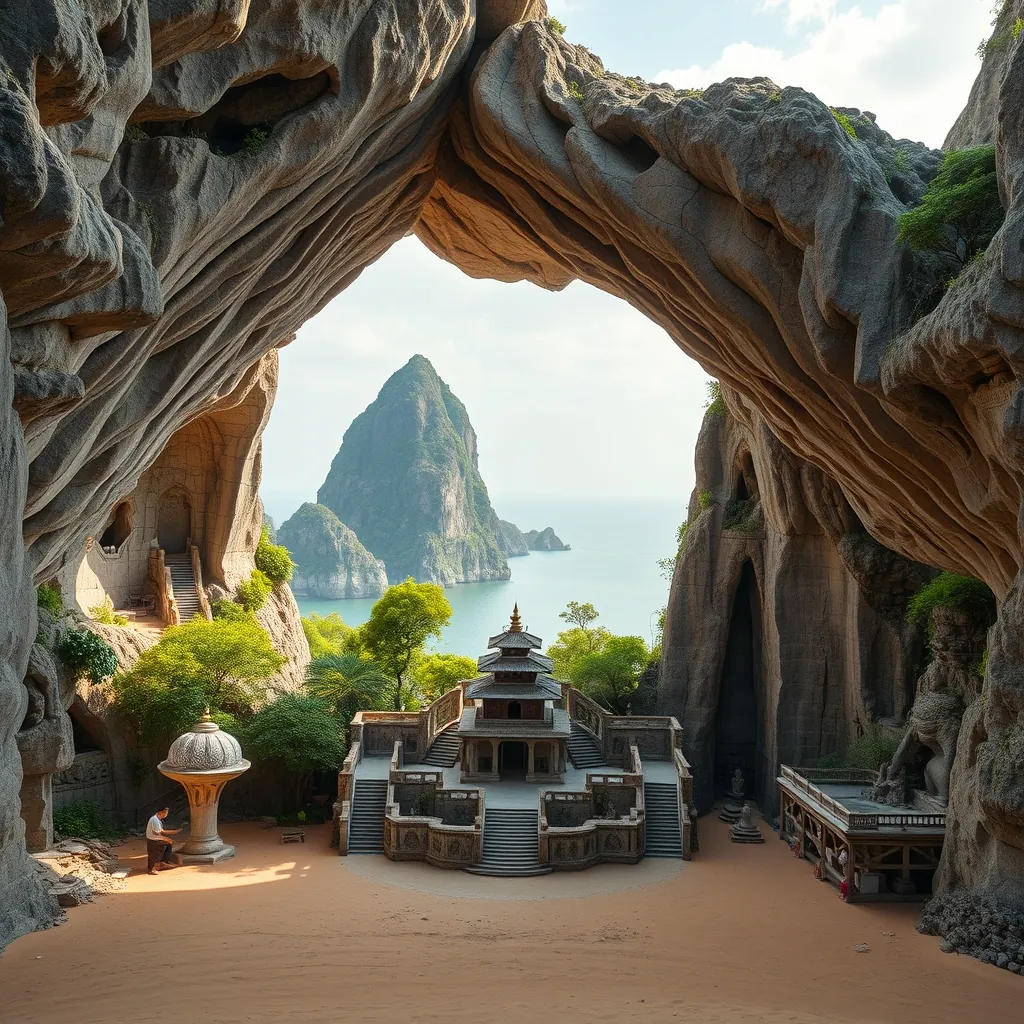
Five marble hills rise abruptly from the coastal plains south of Da Nang, their pale stone faces catching the morning light. The Marble Mountains, known locally as Ngu Hanh Son, are a cluster of five peaks named after the five elements of Eastern philosophy: Kim (metal), Moc (wood), Thuy (water), Hoa (fire), and Tho (earth). Each hill holds its own character, its own caves, and its own sacred sites. Together they form one of central Vietnam’s most fascinating destinations, a place where geology, spirituality, and craftsmanship converge.
The mountains are not natural formations in the traditional sense. They are marble and limestone outcrops that rose from the seabed millions of years ago, shaped by tectonic activity and erosion. The result is a landscape of dramatic cliffs, hidden grottoes, and intricate cave systems. For centuries, the Marble Mountains have been a site of religious significance. Hindu and Buddhist pilgrims have climbed these hills for over a thousand years, leaving behind a legacy of temples, shrines, and carved statues that still draw visitors today.
Thuy Son: The Water Mountain and Its Caves
Thuy Son, the Water Mountain, is the largest and most visited of the five peaks. It is also the only one with a developed tourist infrastructure, with stone staircases, paved paths, and viewing platforms. The climb to the summit takes about 30 minutes, winding past caves, pagodas, and lookout points. The effort is rewarded with panoramic views of Da Nang, the East Sea, and the surrounding countryside. On clear days, the Cham Islands are visible on the horizon.
The caves of Thuy Son are its main attraction. The largest, Huyen Khong Cave, is a vast cavern with a natural skylight that illuminates the interior with shafts of sunlight. The cave has been used as a place of worship for centuries, and its walls are lined with Buddhist altars, statues, and incense burners. During the Vietnam War, the cave served as a hospital and shelter for the Viet Cong, a fact that adds a layer of historical significance to its spiritual character. The acoustics inside the cave are remarkable, and the atmosphere is both solemn and awe-inspiring.
Other notable caves on Thuy Son include Tang Chon Cave, which contains a series of natural rock formations that resemble animals and mythical creatures, and Van Thong Cave, which leads to a hidden grotto with a small pond. The caves are connected by narrow passages and steep staircases, and exploring them is an adventure in itself. Visitors should bring a flashlight, as some areas are dimly lit. The paths can be slippery, especially after rain, so sturdy footwear is essential.
At the summit of Thuy Son stands Tam Thai Pagoda, a Buddhist temple that has been rebuilt and expanded over the centuries. The pagoda’s origins date to the 17th century, and its architecture reflects a blend of Vietnamese and Chinese influences. The main hall houses a large bronze Buddha statue, and the grounds include a bell tower, a garden, and a small museum displaying artifacts from the mountain’s history. The pagoda is still an active place of worship, and the sound of chanting and incense smoke often fills the air.
The Other Four Mountains
While Thuy Son dominates the visitor experience, the other four mountains each have their own attractions. Kim Son, the Metal Mountain, is the smallest of the five. It contains a single cave, Bong Lai Cave, which is reached by a steep and narrow staircase. The cave is relatively undeveloped, offering a more rugged and intimate experience than the caves of Thuy Son. The views from Kim Son’s summit are limited by the surrounding trees, but the climb is rewarding for those seeking solitude.
Moc Son, the Wood Mountain, is named for the dense vegetation that covers its slopes. It is the least visited of the five, and its trails are rough and unmarked. There are no caves or temples on Moc Son, and the summit offers limited views. For most visitors, Moc Son is best appreciated from a distance, its green slopes providing a contrast to the pale stone of the other hills. The mountain is home to a variety of bird species, making it a quiet spot for birdwatching.
Hoa Son, the Fire Mountain, is named for the reddish hue of its rock and the hot springs that once existed at its base. The mountain contains two caves, Am Phu Cave and Hoa Nghiem Cave. Am Phu Cave, also known as the Cave of Hell, is a narrow and dark passage that descends into the mountain’s interior. The cave is associated with Buddhist beliefs about the afterlife, and its walls are lined with statues depicting the punishments of hell. The descent is steep and claustrophobic, and the cave is not suitable for those with mobility issues or a fear of confined spaces. Hoa Nghiem Cave, in contrast, is a more open and airy space, with a natural opening that allows light to filter in.
Tho Son, the Earth Mountain, is the smallest of the five and the least developed. It contains a single cave, which is used for storage by local farmers. The mountain is not open to the public, and its slopes are covered with scrub vegetation. Tho Son’s significance is more symbolic than practical, representing the element of earth in the five-element cosmology that gives the mountains their name.
Marble Carving Villages and Local Crafts
At the base of the Marble Mountains lies a community of skilled artisans who have practiced the craft of marble carving for generations. The village of Non Nuoc, located at the foot of the mountains, is home to hundreds of workshops and showrooms where visitors can watch craftsmen transform raw stone into intricate sculptures, statues, and decorative objects. The craft dates back to the 18th century, when local artisans began using the marble from the mountains to create religious icons and architectural elements.
The carving process is labor-intensive and requires a high level of skill. Artisans begin with a block of raw marble, which they shape using chisels, hammers, and electric tools. The rough form is then refined with finer tools, and the final details are added by hand. The finished pieces range from small figurines and jewelry to life-sized statues of Buddha, dragons, and mythical creatures. The quality of the work is exceptional, and the prices reflect the time and skill involved. Visitors can purchase pieces directly from the workshops, and many artisans offer custom commissions.
The marble carving village is also a place where visitors can learn about the history and cultural significance of the craft. Some workshops offer demonstrations and hands-on experiences, allowing visitors to try their hand at carving under the guidance of a master artisan. This is a unique opportunity to connect with a tradition that has shaped the local community for centuries. The village is also home to a number of restaurants and cafes, where visitors can sample local specialties and rest after exploring the mountains.
Practical Information for Visitors
The Marble Mountains are located about 8 kilometers south of Da Nang’s city center, making them an easy day trip from the city. The most convenient way to get there is by taxi or ride-hailing service, and many hotels offer organized tours. The entrance fee is modest, and additional fees apply for the elevator that carries visitors to the summit of Thuy Son. The elevator is a good option for those who prefer not to climb the stairs, but the walk is manageable for most visitors with a reasonable level of fitness.
The best time to visit is during the dry season, from February to August, when the weather is sunny and the paths are dry. The early morning is the best time to explore, as the crowds are smaller and the temperatures are cooler. The late afternoon is also a good option, as the light is softer and the views are particularly beautiful. The mountains can be visited year-round, but the rainy season, from September to January, brings heavy downpours that can make the paths slippery and the caves damp.
Visitors should dress respectfully, as the mountains are a place of worship. Shoulders and knees should be covered, and shoes should be removed before entering the pagodas and caves. Photography is allowed in most areas, but visitors should be mindful of worshippers and avoid using flash in the caves. The caves can be dark and uneven, so a flashlight and sturdy footwear are recommended. Visitors should also be prepared for the heat and humidity, and should carry water and sunscreen.
The Marble Mountains are a testament to the enduring connection between nature and culture in Vietnam. They are a place of geological wonder, spiritual significance, and artistic achievement. For travelers seeking to understand the country’s rich heritage, a visit to the Marble Mountains is essential. The mountains offer a unique blend of natural beauty, historical depth, and living tradition, and they remain one of the most rewarding destinations in central Vietnam.
23. Ba Na Hills: A French Village in the Sky
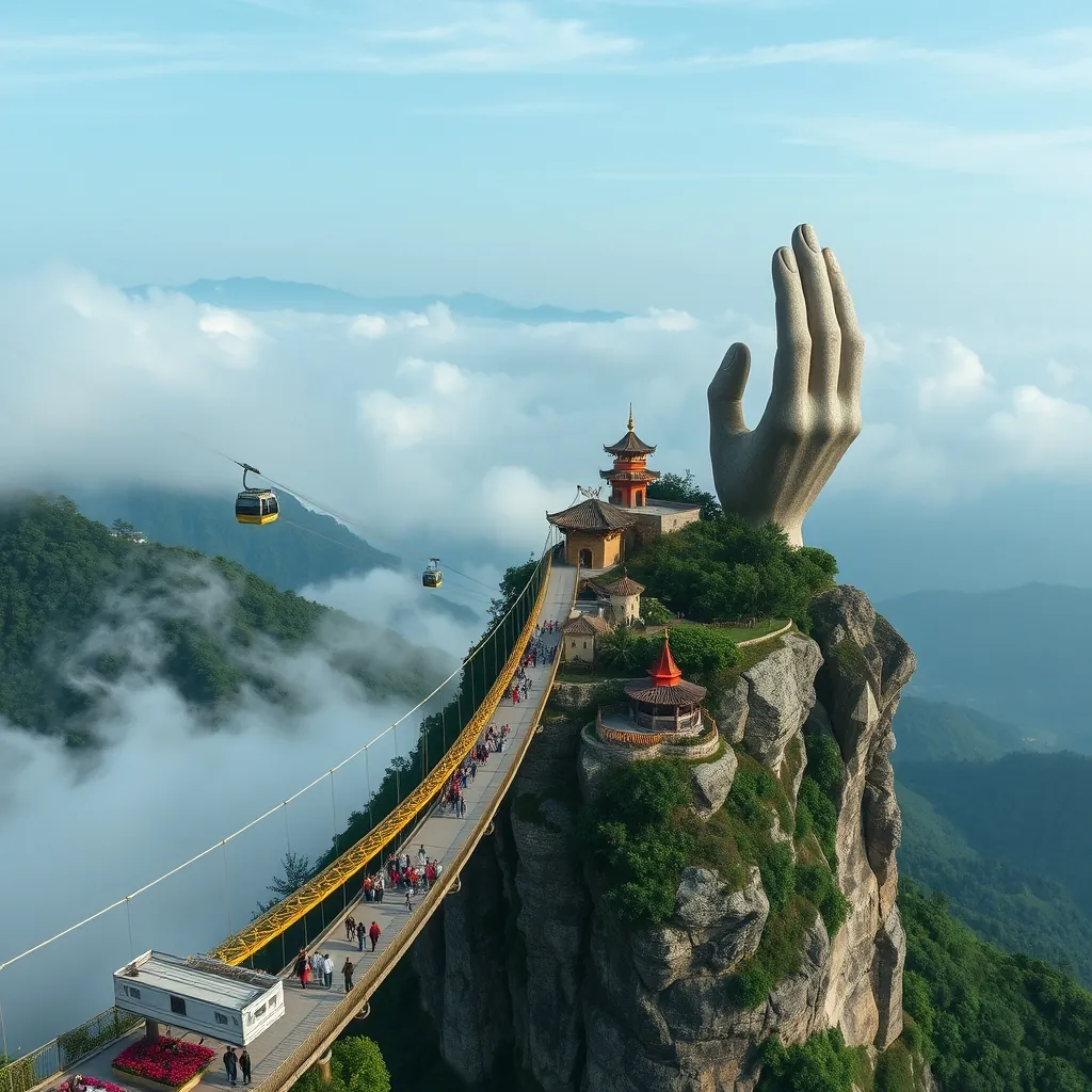
Ba Na Hills sits 1,487 meters above sea level in the Truong Son Mountains, roughly 25 kilometers west of Da Nang. What began as a French colonial hill station in 1919 has evolved into one of Vietnam’s most ambitious resort complexes. The journey to the summit is an experience in itself, involving one of the world’s longest and highest cable car systems. The ride spans nearly 5.8 kilometers and takes about 20 minutes, ascending through layers of cloud and forest before emerging at a hilltop that feels entirely removed from the tropical lowlands below.
The cable car system at Ba Na Hills holds multiple world records. It achieved the longest non-stop single-track cable car at 5,801 meters and the greatest height difference at 1,368 meters. The cabins climb at a steady pace, offering sweeping views of the surrounding jungle and, on clear days, the East Sea. As the car rises, the air cools noticeably, and the vegetation shifts from dense tropical forest to misty highland greenery. The transition is dramatic, and the sense of anticipation builds as the summit comes into view.
The Golden Bridge: An Architectural Icon
The Golden Bridge, or Cau Vang, opened in June 2018 and immediately became one of Vietnam’s most photographed landmarks. The bridge is a 150-meter-long pedestrian walkway that curves through the forest canopy, supported by two enormous stone hands that appear to rise from the mountainside. The hands are designed to look aged and weathered, with moss and cracks adding a sense of ancient permanence. The effect is surreal, as if the bridge is being cradled by the hands of a giant emerging from the earth.
The bridge’s design was conceived by TA Landscape Architecture, a Ho Chi Minh City-based firm. The structure is painted a golden yellow that contrasts sharply with the green of the surrounding forest and the blue of the sky. The bridge is elevated about 23 meters above the ground, and walking across it feels like floating among the treetops. On misty days, the bridge appears to emerge from the clouds, adding to its otherworldly atmosphere. The best time to visit is early morning, when the crowds are thinner and the light is soft.
The Golden Bridge is more than a visual spectacle. It is a masterful blend of engineering and artistry that has put Ba Na Hills firmly on the global tourism map. The bridge was designed to be a symbol of the connection between nature and humanity, and its success has inspired similar projects across the region. For visitors, it is the highlight of any trip to Ba Na Hills, and it is worth arriving early to experience it without the crowds.
The French Village and Its Attractions
Beyond the Golden Bridge, Ba Na Hills is home to a meticulously crafted French village that recreates the atmosphere of a European town in the early 20th century. The village features cobblestone streets, stone facades, and ornate architecture inspired by French provincial style. The buildings house restaurants, cafes, souvenir shops, and entertainment venues, creating a lively and immersive environment. The attention to detail is remarkable, from the street lamps to the flower boxes on the windowsills.
The village is anchored by a central square, where visitors can watch street performances, including music, dance, and theatrical shows. The square is surrounded by cafes and restaurants offering a range of cuisines, from Vietnamese specialties to French pastries and coffee. The atmosphere is festive, and the village is particularly charming in the evening, when the buildings are illuminated and the streets take on a warm, golden glow.
One of the most striking structures in the village is the Linh Ung Pagoda, a Buddhist temple that stands in contrast to the European architecture around it. The pagoda is home to a 27-meter-tall statue of the Goddess of Mercy, which overlooks the surrounding mountains and valleys. The statue is visible from the cable car, and it serves as a reminder of the spiritual heritage of the region. The pagoda is an active place of worship, and visitors are welcome to explore its grounds and offer prayers.
The village also features a range of other attractions. The Fantasy Park, an indoor amusement park, offers rides, games, and a 4D cinema, making it a popular destination for families. The Wax Museum displays lifelike figures of celebrities and historical figures, and the Debay Wine Cellar, originally built by the French in 1923, offers tours and tastings of locally produced wines. The cellar is carved into the mountainside and maintains a constant temperature, making it ideal for wine storage.
The Flower Gardens and Le Jardin d’Amour
Ba Na Hills is renowned for its meticulously maintained flower gardens, which add vibrant color to the mountain landscape. The most famous of these is Le Jardin d’Amour, a series of themed gardens that celebrate love in its many forms. Each garden has its own design and character, from the formal French-style gardens with geometric hedges and fountains to the wilder, more naturalistic areas with native plants and winding paths.
The gardens are planted with a rotating selection of flowers, ensuring that something is always in bloom regardless of the season. In spring, the gardens are filled with cherry blossoms and tulips. In summer, roses and hydrangeas take center stage. In autumn, the foliage turns to shades of gold and red, and in winter, the gardens are adorned with poinsettias and other festive plants. The variety and quality of the displays are exceptional, and the gardens are a favorite spot for photographers.
Le Jardin d’Amour is divided into several distinct areas, each with its own theme. The Garden of Love features heart-shaped topiaries and romantic sculptures. The Garden of Faith includes a small chapel and a series of stone arches. The Garden of Peace is a quiet, contemplative space with a reflecting pool and shaded seating areas. The gardens are connected by paved paths, and visitors can wander at their own pace, taking in the views and the fragrance of the flowers.
Practical Information for Visitors
Ba Na Hills is open year-round, but the best time to visit is during the dry season, from February to August, when the weather is clear and the views are at their best. The summit is often cooler than the lowlands, and visitors should bring a light jacket or sweater, even in summer. The weather can change quickly, and fog and rain are common, so it is wise to check the forecast before booking a trip.
The cable car operates from early morning until late evening, and tickets can be purchased at the base station or online in advance. The ticket price includes the cable car ride and access to most attractions, including the Golden Bridge, the French Village, and the flower gardens. Some attractions, such as the wax museum and the wine cellar, require an additional fee. The cable car can get crowded, especially on weekends and public holidays, so arriving early is recommended.
Getting to Ba Na Hills is straightforward. Many visitors take a taxi or ride-hailing service from Da Nang, a journey of about 45 minutes. Others join organized tours that include transportation, a guide, and sometimes meals. The base station has ample parking for those who choose to drive, and there are restaurants and shops at the base for those waiting for the cable car.
Ba Na Hills is a destination that defies easy categorization. It is part theme park, part botanical garden, part architectural showcase, and part spiritual retreat. The combination is unusual, but it works. The Golden Bridge alone justifies the trip, and the surrounding attractions ensure that visitors can easily spend a full day exploring the summit. For travelers seeking a unique and memorable experience in central Vietnam, Ba Na Hills delivers in spectacular fashion.
24. Cham Islands: A Marine Protected Area
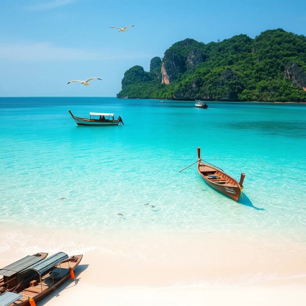
Eight kilometers off the coast of Hoi An, the Cham Islands form an archipelago of eight islands that have quietly become one of Vietnam’s most significant marine conservation success stories. Known locally as Cu Lao Cham, this cluster of granite and jungle-covered islands was designated a UNESCO Biosphere Reserve in 2009. The recognition was not ceremonial. It came with strict protections that have preserved coral reefs, seagrass beds, and a way of life that has endured for centuries.
The archipelago’s main island, Hon Lao, is the only one with permanent residents. Around 3,000 people live in Bai Lang village, the island’s principal settlement, where fishing remains the economic backbone. The island’s isolation has preserved traditions that have disappeared elsewhere along Vietnam’s coast. Women still weave the distinctive bamboo and rattan baskets used for fishing, and the island’s communal house, or dinh, remains the spiritual center of village life. Visitors who take the time to wander beyond the beach will find a community that is welcoming but not performative.
Marine Biodiversity and Conservation
The waters surrounding the Cham Islands harbor more than 270 species of coral and over 200 species of reef fish. The seagrass beds provide nursery grounds for juvenile fish and support populations of dugongs, though these shy marine mammals are rarely seen. The coral reefs are among the healthiest in Vietnam, a direct result of the protections established under the biosphere reserve designation. Fishing is strictly regulated, and the use of destructive methods such as dynamite and cyanide has been eliminated through community-based enforcement.
The conservation efforts extend beyond regulation. Local fishermen have been trained in sustainable fishing practices, and many have transitioned to eco-tourism as an alternative livelihood. The result is a model of community-based conservation that has attracted attention from marine biologists across the region. For visitors, the payoff is immediate. Snorkeling and diving here reveal reefs that are vibrant and teeming with life, a stark contrast to the degraded reefs found at many other popular destinations in Southeast Asia.
Snorkeling and Diving: The Underwater World
The best snorkeling and diving sites are concentrated around the islands of Hon Mun and Hon Tai, where the coral formations are most diverse. Water visibility ranges from 5 to 15 meters depending on the season, with the clearest conditions occurring between March and August. The reefs are home to clownfish, parrotfish, moray eels, and occasional sea turtles. The coral formations include massive brain corals, branching staghorn corals, and delicate soft corals that sway with the current.
Snorkeling trips typically depart from Bai Lang and last between two and four hours. Operators provide masks, fins, and life jackets, and guides are knowledgeable about the reef ecosystems. For certified divers, there are several dive shops that offer guided dives to deeper sites. The diving here is not as dramatic as in Nha Trang or Phu Quoc, but the health of the reef makes it a rewarding experience for those interested in marine biology. The lack of large crowds is a significant advantage, and it is common to have a reef entirely to yourself.
Beaches and Island Exploration
Bai Lang Beach, the main beach on Hon Lao, is a crescent of golden sand lined with coconut palms. The water is calm and clear, making it ideal for swimming. The beach is not developed in the way that Vietnam’s resort beaches are. There are no high-rise hotels or beach clubs. Instead, visitors will find simple seafood restaurants and a handful of homestays that offer basic but comfortable accommodation. The pace is slow, and the lack of development is precisely what makes the island so appealing.
Beyond Bai Lang, the island offers several other beaches worth exploring. Bai Chong, on the western side of the island, is smaller and more secluded, with excellent snorkeling just offshore. Bai Huong, on the southern coast, is a fishing village with a pebble beach and a laid-back atmosphere. The island’s interior is covered in dense tropical forest, and a network of trails leads to viewpoints that offer panoramic views of the surrounding sea and islands. The highest point, on the island’s eastern side, rises to over 500 meters and rewards hikers with sweeping vistas.
Cultural Heritage and Local Life
The Cham Islands have a rich cultural heritage that predates the modern conservation efforts. The islands were an important stop on the maritime silk route, and the remains of ancient Cham temples have been found on Hon Lao. The island’s inhabitants practice a form of ancestor worship that is unique to the archipelago, and the annual Cau Ngu festival, held in the third lunar month, honors the whale god and prays for a bountiful fishing season. The festival includes boat races, offerings, and traditional music, and visitors are welcome to observe.
The island’s cuisine is centered on seafood, and the quality is exceptional. The waters around the islands are clean, and the fish and shellfish are harvested daily. Grilled squid, steamed clams, and fish cooked in a clay pot are local specialties. The island is also known for its dried fish and fish sauce, which are produced using traditional methods. Visitors should try the local specialty of banh it, a type of glutinous rice cake filled with mung bean and shrimp, which is unique to the region.
Getting There and Practical Tips
Access to the Cham Islands is by boat from Cua Dai port in Hoi An. Fast speedboats make the journey in about 30 minutes, while the slower wooden boats take around an hour and a half. The speedboat is the more practical option for day trips, but the slower boat offers a more scenic and relaxed journey. Boats operate daily from early morning, and the last return boat typically departs in the late afternoon. During the storm season, from October to December, boat services are often suspended, so it is essential to check conditions before planning a visit.
The islands have limited accommodation, and most visitors come on day trips from Hoi An. However, staying overnight is recommended for those who want to experience the islands after the day-trippers leave. Homestays in Bai Lang offer simple rooms with fans and shared bathrooms, and some have upgraded to include air conditioning and private bathrooms. The cost is modest, and the experience of falling asleep to the sound of waves and waking to the calls of seabirds is well worth the basic amenities.
Visitors should note that the Cham Islands are a protected area, and there are rules designed to preserve the environment. Reef-safe sunscreen is strongly recommended, as regular sunscreen damages coral. Littering is strictly prohibited, and visitors are encouraged to take their waste back to the mainland. The island has a ban on single-use plastics, and visitors should bring a reusable water bottle. These measures are taken seriously, and the health of the reef is a testament to their effectiveness.
The Cham Islands offer something increasingly rare in Vietnam’s coastal destinations: an authentic, unspoiled environment where conservation and community coexist. The reefs are alive with color, the beaches are uncrowded, and the local culture remains vibrant. For travelers who want to experience Vietnam’s marine beauty without the crowds and commercialization found elsewhere, the Cham Islands are an essential addition to any itinerary. The journey is short, the impact is lasting, and the memories will endure long after the boat returns to the mainland.
25. Lang Co Bay: A Scenic Lagoon and Beach
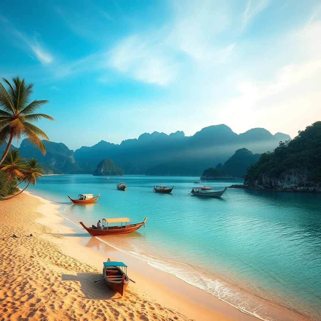
Lang Co Bay occupies a privileged position on Vietnam’s central coast, where the Truong Son Mountains meet the East Sea. The bay’s setting is almost theatrical in its beauty. A crescent of white sand stretches for ten kilometers, backed by a lagoon of still, emerald water and framed by the dark green slopes of the Bach Ma range. This combination of mountain, lagoon, and sea is rare, and it has not gone unnoticed. The bay has been voted one of the most beautiful bays in the world, joining an exclusive list that includes Ha Long Bay and Nha Trang.
The bay sits at the base of the Hai Van Pass, the mountain road that separates Da Nang from Hue. This location gives Lang Co a dual character. It is both a tranquil beach destination and a strategic stopping point on one of Vietnam’s most scenic drives. Many travelers pass through on their way between the two cities, but few stop to explore what the bay has to offer. Those who do are rewarded with a landscape that feels untouched by the rapid development seen elsewhere along the coast.
The Lagoon: A Unique Ecosystem
The lagoon that gives the bay its name is a shallow body of water separated from the sea by a narrow sandbar. It is one of the largest coastal lagoons in Southeast Asia, covering roughly 16 square kilometers. The lagoon’s waters are calm and brackish, a mix of saltwater from the sea and freshwater from the rivers that flow down from the mountains. This unique environment supports a rich ecosystem of fish, shrimp, and crabs, and the lagoon has been an important fishing ground for local communities for generations.
Visitors can explore the lagoon by boat, and local fishermen are often willing to take travelers on tours of their fishing grounds. These trips offer a glimpse into a way of life that has remained largely unchanged for centuries. Fishermen use traditional net-casting techniques, and the lagoon’s shallow waters allow for a style of fishing that is both sustainable and visually striking. The best time to visit the lagoon is at sunrise, when the water is glassy and the mountains are reflected in its surface.
Beach Life and Water Activities
Lang Co Beach is wide, clean, and remarkably uncrowded. The sand is fine and white, and the water is clear and warm for most of the year. The beach slopes gently into the sea, making it safe for swimming, and the lack of strong currents means it is suitable for families with children. Unlike the more developed beaches at Da Nang or Nha Trang, Lang Co has no high-rise hotels or beach clubs. The atmosphere is relaxed, and the beach is lined with simple seafood restaurants and a handful of mid-range resorts that have been built with respect for the natural surroundings.
Water sports are available but low-key. Kayaking is a popular way to explore both the lagoon and the open sea, and paddleboards can be rented from several operators along the beach. Snorkeling is possible at the northern end of the bay, where a small reef attracts a variety of fish. The reef is not as extensive as those found at the Cham Islands or Phu Quoc, but it offers a pleasant introduction to Vietnam’s marine life. For those who prefer to stay dry, the beach itself is perfect for long walks, and the views of the Hai Van Pass from the sand are spectacular.
The Hai Van Pass Connection
Lang Co Bay’s position at the foot of the Hai Van Pass is an essential part of its appeal. The pass, which rises to over 400 meters, offers some of the most dramatic coastal scenery in Vietnam. The road winds through jungle-covered mountains, with sheer drops to the sea below. The views from the summit are breathtaking, encompassing the entire curve of Lang Co Bay, the lagoon, and the mountains beyond. The pass was famously described by a French engineer as “the most beautiful natural wonder in Vietnam,” and it is easy to see why.
For travelers, the pass offers two options. The first is the modern road tunnel, which cuts through the mountain and reduces travel time between Da Nang and Hue to under an hour. The second is the old mountain road, which takes longer but rewards drivers and motorcyclists with unforgettable views. The old road is in good condition and is a popular route for motorbike tours. Many travelers choose to ride the pass and stop at Lang Co Bay for lunch or an overnight stay, breaking the journey between the two cities.
Local Cuisine and Seafood
Lang Co Bay is known throughout central Vietnam for its seafood. The waters of the bay and lagoon are rich in fish, squid, shrimp, and crabs, and the local restaurants serve them at their freshest. The simplest preparations are often the best. Grilled squid, steamed clams, and whole fish cooked in a light broth are local specialties. The bay is also known for its oysters, which are farmed in the lagoon and served raw or grilled with a garlic and lemongrass sauce.
The seafood restaurants along the beach are family-run and offer excellent value. A meal for two, including several dishes and drinks, typically costs less than a single dish at a resort restaurant in Da Nang. The restaurants are casual, with plastic tables and chairs set out on the sand, and the service is friendly and unpretentious. For a more substantial meal, the nearby town of Lang Co offers a few restaurants that serve regional specialties such as banh beo, a steamed rice cake topped with shrimp and scallions, and bun bo Hue, the spicy beef noodle soup that originated in the nearby city of Hue.
Practical Information for Visitors
Lang Co Bay is easily accessible by road, rail, or air. The nearest airport is Da Nang International Airport, about 30 kilometers to the south. The train station at Lang Co is on the main north-south railway line, and several daily trains stop here, making it a convenient stop on a longer journey. The bay is also well connected by road, with the national highway running along its edge. Buses between Da Nang and Hue stop at Lang Co, and private cars or motorbikes can be hired for the journey.
The best time to visit is between February and August, when the weather is dry and the sea is calm. From September to November, the region experiences heavy rainfall and occasional typhoons, and the bay can be rough. The water is warmest between May and August, making this the ideal time for swimming and water sports. Accommodation options range from budget guesthouses in the town to comfortable resorts on the beach. The resorts offer swimming pools, restaurants, and easy access to the beach, while the guesthouses provide a more authentic experience at a fraction of the cost.
Lang Co Bay rewards those who take the time to stop. It is a place of quiet beauty, where the mountains meet the sea and the pace of life is dictated by the tides rather than the clock. The bay’s inclusion on the list of the world’s most beautiful bays is justified, but its true appeal lies in its simplicity. There are no crowds, no queues, and no manufactured attractions. There is only the bay, the lagoon, and the mountains, and the sense that you have found a place that has not yet been discovered by the masses. For travelers seeking a moment of peace on Vietnam’s central coast, Lang Co Bay is a destination worth seeking out.
26. Quang Binh’s Hidden Caves: Beyond Phong Nha
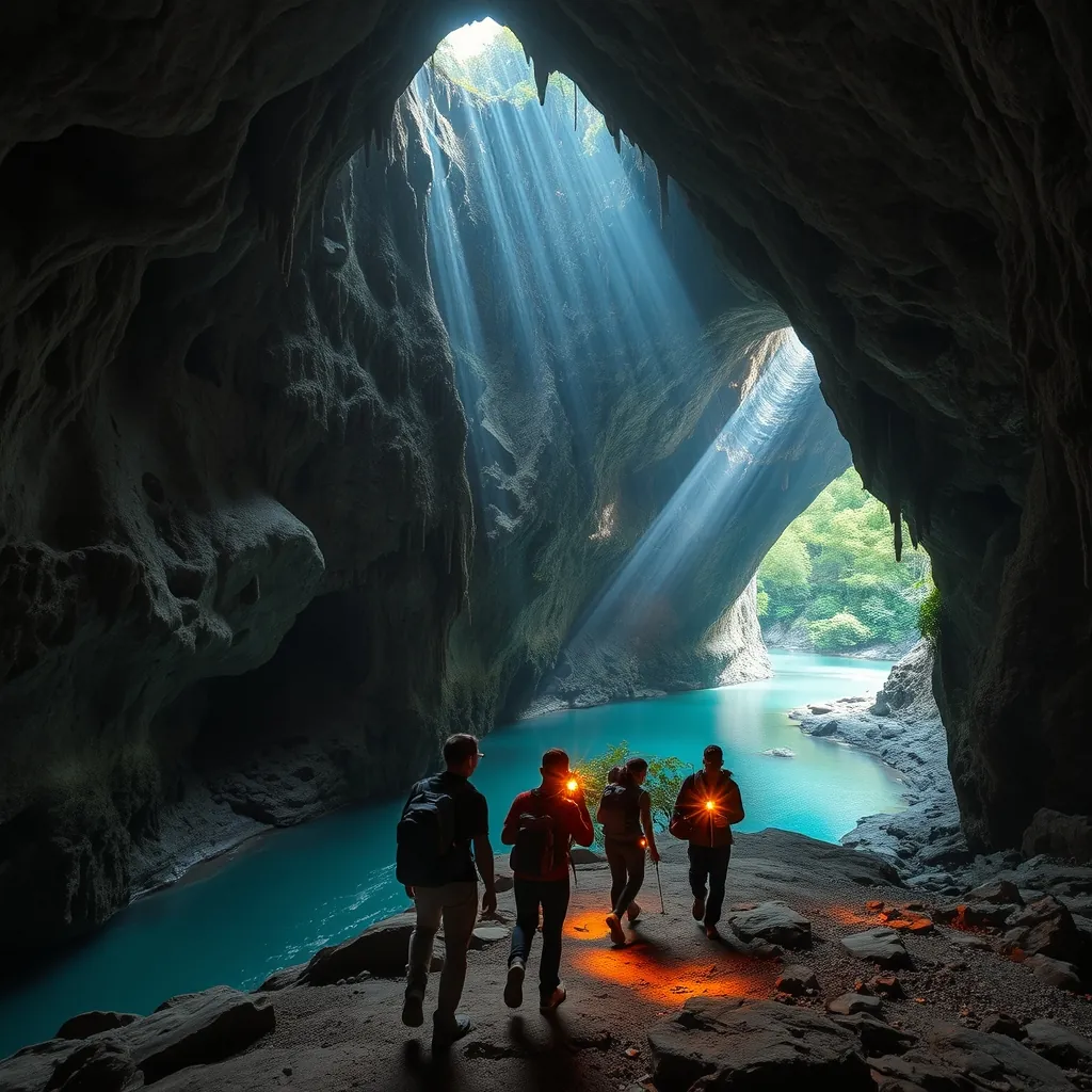
Phong Nha-Ke Bang National Park has earned its reputation as the cave capital of the world. Son Doong, the largest cave on the planet, draws headlines and adventurous travelers from every corner of the globe. But the park’s fame has created a curious paradox. Most visitors come for Phong Nha Cave and Paradise Cave, the two most accessible options, and then move on. They miss the dozens of other caverns that make this region extraordinary. The hidden caves of Quang Binh offer something that the famous sites cannot: solitude, genuine exploration, and the thrill of discovery.
The province contains more than 300 caves, many of which were only discovered in the last two decades. British cave explorers have been mapping the system since 1990, and they continue to find new passages every year. The scale of the underground network is staggering. Rivers disappear into mountains, emerge kilometers away, and carve cathedral-like chambers beneath the jungle floor. For travelers willing to venture beyond the well-trodden paths, Quang Binh reveals a world that feels untouched by human hands.
Tu Lan Cave System: The Adventurer’s Choice
The Tu Lan cave system sits about 60 kilometers from Phong Nha town, deep in the jungle of the western highlands. The system was only fully explored in 2012, and it remains one of the most remote cave networks in Vietnam. Tu Lan is not a single cave but a complex of more than 20 separate caverns, connected by underground rivers and linked by trekking routes through the forest. The terrain is demanding. Expect river crossings, steep climbs, and sections where you wade through waist-deep water in the dark.
The reward for this effort is an experience that few travelers have. Tu Lan’s chambers are vast, with ceilings that disappear into darkness and formations that have been growing for millions of years. The system’s signature feature is its series of dry caves, which can be walked through without technical equipment. These passages open into enormous chambers where sunlight streams through collapsed ceilings, illuminating underground rivers and creating an atmosphere that is both eerie and beautiful. The swimming holes within the caves are a highlight. The water is cold, clear, and impossibly blue, and a dip after hours of trekking is one of the most refreshing experiences Vietnam has to offer.
Several tour operators run expeditions into Tu Lan, ranging from one-day adventures to multi-day treks with overnight camping. The longer tours are the better option. They allow time to explore multiple caves, camp in the jungle, and experience the system at a relaxed pace. The tours are physically demanding and not suitable for young children or travelers with limited mobility. But for those who are fit and prepared, Tu Lan delivers an adventure that ranks among the best in Southeast Asia.
Hang En Cave: The World’s Third Largest
Hang En is a name that appears on few itineraries, yet it holds an impressive title. It is the third largest cave in the world by volume, surpassed only by Son Doong and a cave in Malaysia. Hang En’s entrance is a dramatic sight. A massive opening in the mountainside, over 100 meters high, reveals a cavern that extends deep into the darkness. The cave is so large that a Boeing 747 could comfortably fit inside its main chamber.
The trek to Hang En takes about two hours through jungle and over limestone terrain. The trail follows the Rao Thuong River, crossing it several times, and ends at the cave’s vast entrance. Inside, the cave opens into a series of chambers connected by a subterranean river. The main chamber is a cathedral of stone, with towering formations and a beach of fine sand that serves as a campsite for overnight expeditions. The ceiling of this chamber has collapsed in several places, creating skylights that let in beams of sunlight. The effect is otherworldly, like standing in a natural cathedral built over millions of years.
Camping inside Hang En is an unforgettable experience. The overnight tour includes a night in the main chamber, with dinner cooked by guides and sleeping under the stars visible through the collapsed ceiling. The sounds of the underground river provide a constant backdrop, and the darkness is absolute once the headlamps are switched off. The tour is moderately challenging, suitable for travelers with a reasonable level of fitness, and is considerably easier than the Son Doong expedition. It offers a taste of the underground world without the extreme commitment required by the larger cave.
Other Hidden Gems Worth Exploring
Beyond Tu Lan and Hang En, Quang Binh holds a wealth of lesser-known caves that reward independent exploration. Hang Toi, or Dark Cave, offers a different kind of experience. The cave is accessed by zip line across the Chay River, and visitors spend hours swimming through its dark passages and sliding through mud tunnels. The cave’s name comes from its lack of natural light, and the experience is more playful than the serious expeditions at Tu Lan. It is an excellent option for families and travelers who want a taste of cave exploration without the physical demands of a multi-day trek.
Hang Va, discovered in 2015, is notable for its unique formations. The cave contains a series of rimstone pools, terraced formations that look like frozen waterfalls made of mineral deposits. The pools are filled with crystal-clear water, and the effect is surreal. Access to Hang Va is limited to a small number of visitors per day, and the tour involves a challenging trek and a swim through a narrow passage to reach the main chamber. The effort is justified by the formations, which are unlike anything found in the more accessible caves.
Nuoc Nut Cave, also known as the Eight Ladies Cave, offers a historical dimension. The cave was used as a field hospital during the Vietnam War, and its entrance is marked by a memorial to eight female volunteers who died in an American bombing raid in 1972. The cave is smaller than the others, but its historical significance makes it a moving stop for travelers interested in the region’s wartime past. The site is accessible by boat along the Son River, and the journey to the cave passes through some of the most scenic countryside in Quang Binh.
Planning Your Cave Adventure
The best time to explore Quang Binh’s caves is between February and August, when the weather is dry and river levels are low. From September to January, heavy rainfall can make caves inaccessible, and some tours are suspended entirely. The dry season also offers better visibility in the caves, as water levels in the underground rivers are lower and the passages are less likely to flood.
Booking through a reputable operator is essential. The caves are remote, and the terrain is genuinely dangerous for those without proper equipment and local knowledge. Several companies in Phong Nha town run cave tours, and they employ experienced guides who know the systems intimately. Prices vary depending on the length and difficulty of the tour, but a day trip to a lesser-known cave typically costs between $50 and $100 per person. Multi-day expeditions to Tu Lan or Hang En cost more, but they include meals, camping equipment, and the services of porters who carry supplies through the jungle.
Physical preparation matters. The treks are demanding, with steep climbs, river crossings, and long distances covered in tropical heat. Good hiking boots, quick-drying clothing, and a waterproof bag for personal items are essential. Tour operators provide helmets, headlamps, and life jackets, but travelers should bring their own sunscreen, insect repellent, and a refillable water bottle. The caves are pristine environments, and visitors are expected to leave no trace. This means carrying out all waste, avoiding touching formations, and respecting the fragile ecosystem that has taken millions of years to develop.
Quang Binh’s hidden caves offer an experience that the famous sites cannot match. They provide a sense of exploration that has become rare in the age of mass tourism. The caves are not polished or commercialized. They are raw, dark, and genuinely wild. For travelers who are willing to push beyond their comfort zone, the province reveals a subterranean world of extraordinary beauty, a landscape shaped by water and time that remains one of Vietnam’s greatest secrets.
27. Khe Sanh: A Historical and Scenic Stop
Khe Sanh sits in the western highlands of Quang Tri province, a place that most travelers pass through without a second thought. The town is small, quiet, and unassuming, a cluster of buildings along Highway 9 near the border with Laos. Yet this modest settlement carries a weight that few locations in Vietnam can match. Khe Sanh was the site of one of the most dramatic confrontations of the Vietnam War, a 77-day siege in 1968 that captured global attention and shaped the course of the conflict. Today, the area offers a rare combination of historical gravity and scenic beauty, with the Truong Son mountains providing a dramatic backdrop to a landscape that has slowly reclaimed its peace.
The journey to Khe Sanh is part of the experience. The route from Dong Ha follows Highway 9, a road that winds through the Dakrong Valley and climbs into the foothills of the Annamite Range. The scenery is striking. Dense forests cover the slopes, rivers cut through the valleys, and small villages appear at intervals, their wooden houses and vegetable gardens a reminder of the region’s resilient communities. The drive takes about two hours, and it passes through some of the most beautiful countryside in central Vietnam. For travelers coming from Hue or Da Nang, Khe Sanh can be combined with a visit to the Vinh Moc Tunnels and the demilitarized zone, creating a full day of historical exploration.
The Historical Significance of Khe Sanh Combat Base
The Khe Sanh Combat Base was established in 1962 as a Special Forces camp, positioned to monitor activity along the Ho Chi Minh Trail and to serve as a forward operating base for operations in the region. The base was expanded over the following years, and by early 1968 it housed approximately 6,000 American and South Vietnamese troops. The surrounding hills were fortified with artillery positions, and the base’s airstrip was one of the busiest in Vietnam, receiving supplies and reinforcements around the clock.
The siege began on January 21, 1968, when North Vietnamese forces launched a series of attacks on the base’s outer defenses. For the next 77 days, the garrison was subjected to relentless artillery bombardment and infantry assaults. The base was surrounded, and resupply became a constant challenge. American forces responded with one of the most intense bombing campaigns of the war, dropping more ordnance on the surrounding jungle than had been used in the entire Pacific theater during World War II. The siege finally ended in April 1968, when a ground operation broke through the North Vietnamese lines and relieved the garrison.
The strategic significance of Khe Sanh remains a subject of debate among military historians. Some argue that the siege was a diversion, designed to draw American forces away from the cities during the Tet Offensive. Others contend that the base’s defense prevented a major North Vietnamese offensive into the northern provinces. What is beyond dispute is the human cost. The siege claimed the lives of hundreds of American and South Vietnamese soldiers, and the bombing campaign devastated the surrounding countryside. The base was abandoned and dismantled in the months following the siege, and the jungle began to reclaim the land.
Visiting the Khe Sanh Combat Base Today
The Khe Sanh Combat Base is now a memorial site, preserved as a museum and a place of remembrance. The original airstrip remains, a long stretch of cracked concrete that serves as a landing zone for the occasional helicopter. The museum houses a collection of photographs, documents, and artifacts from the siege, including weapons, uniforms, and personal items recovered from the battlefield. The exhibits are presented in both Vietnamese and English, and they offer a sobering account of the events that took place on this remote plateau.
A walk around the base reveals the remains of bunkers, trenches, and gun emplacements, their concrete walls pockmarked with shrapnel damage. Several artillery pieces and a decommissioned aircraft are on display, silent monuments to the violence that once defined this place. The site is surprisingly peaceful. The surrounding hills are covered in grass and scrub, and the only sounds are the wind and the occasional bird. It is difficult to reconcile the tranquility of the present with the chaos of the past, but that contrast is precisely what makes Khe Sanh so affecting.
The memorial site is free to enter, and visitors are welcome to explore at their own pace. A small donation box supports the maintenance of the grounds. The site is not heavily commercialized, and there are no gift shops or tourist restaurants nearby. This restraint is appropriate. Khe Sanh is a place for reflection, not consumption, and the lack of tourist infrastructure allows visitors to engage with the history without distraction.
The Scenic Surroundings of Khe Sanh
Beyond its historical significance, Khe Sanh is surrounded by landscapes of considerable beauty. The town sits in a valley between the Truong Son mountains, and the views in every direction are dominated by forested ridges and misty peaks. The Lang Vang plateau, just north of the base, offers panoramic vistas of the surrounding countryside. The plateau is covered in coffee plantations and pepper farms, and the orderly rows of crops provide a striking contrast to the wild forest of the higher slopes.
The Dakrong River flows through the valley, its waters clear and cool even during the dry season. The river is a popular spot for local families, who come to swim and picnic on its banks. For travelers, the river offers a chance to cool off after a morning of historical exploration. The surrounding hills are crisscrossed with trails, and a short hike provides views that stretch all the way to the Laos border on a clear day. The area is also home to several ethnic minority communities, including the Bru-Van Kieu and Ta Oi peoples, whose villages dot the valleys and hillsides.
The nearby Dakrong Bridge, which spans the river about 20 kilometers from Khe Sanh, is another site of historical interest. The bridge was a key point on the Ho Chi Minh Trail, and it was repeatedly bombed and repaired during the war. The current structure is a modern replacement, but the surrounding area retains a sense of the past. The bridge offers excellent views of the river and the mountains, and it is a popular stop for photographers.
Practical Information for Your Visit
Khe Sanh is best visited as part of a broader exploration of Quang Tri province. The site is approximately 60 kilometers west of Dong Ha, the provincial capital, and 170 kilometers north of Hue. The most convenient way to reach Khe Sanh is by private car or motorbike, as public transportation is limited. Several tour operators in Hue and Da Nang offer day trips that include Khe Sanh, the Vinh Moc Tunnels, and other sites along the demilitarized zone. These tours typically cost between $40 and $70 per person, depending on the operator and the size of the group.
The best time to visit is between February and April, when the weather is dry and the temperatures are moderate. From May to August, the region can be hot and humid, with afternoon thunderstorms common. The rainy season, from September to January, brings heavy rainfall and occasional flooding, which can make the roads to Khe Sanh difficult to navigate. The site itself is open daily from 7:00 AM to 5:00 PM, and the museum is staffed throughout the day.
For travelers interested in the history of the Vietnam War, Khe Sanh is an essential stop. The site is not as polished or as heavily visited as the Cu Chi Tunnels near Ho Chi Minh City, but it offers a more authentic and contemplative experience. The lack of crowds allows visitors to absorb the atmosphere and to reflect on the events that took place here. The combination of historical significance and natural beauty makes Khe Sanh a destination that rewards those who make the journey.
The plateau that once witnessed months of relentless bombardment now stands in silence. The bunkers have crumbled, the trenches have filled, and the grass has grown over the scars of war. But the memory of what happened here remains, preserved in the museum’s exhibits, in the memorials that dot the landscape, and in the stories told by the local community. Khe Sanh is a place where the past and the present coexist, where the beauty of the mountains and the weight of history create an experience that stays with visitors long after they leave.
28. Dakrong Nature Reserve: Untouched Wilderness
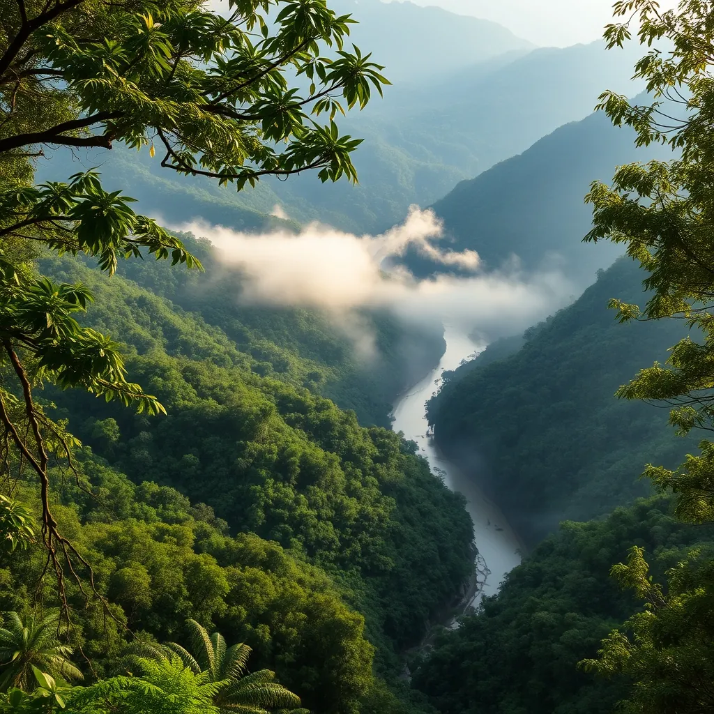
Just a short drive from the historical sites of Khe Sanh lies one of central Vietnam’s most significant natural treasures. The Dakrong Nature Reserve spans more than 37,000 hectares of protected forest in the Truong Son mountain range, a biodiversity hotspot that scientists consider among the most important conservation areas in the country. Established in 1996, the reserve was created to protect the region’s rich ecosystems and the endangered species that call them home. For travelers seeking genuine wilderness, this is a destination that rewards patience and curiosity with encounters that few tourists ever experience.
The reserve’s location along the border with Laos places it within a larger transboundary conservation corridor, one of the last remaining continuous forest tracts in mainland Southeast Asia. This connectivity is crucial for wildlife populations that require vast territories to survive. The forests here are classified as tropical evergreen and semi-deciduous, with elevations ranging from 50 meters in the river valleys to over 1,700 meters at the highest peaks. This vertical diversity creates a remarkable range of habitats, each supporting its own distinct community of plants and animals.
Biodiversity: A Sanctuary for Rare Species
Dakrong’s forests harbor an extraordinary array of wildlife, including several species found nowhere else on Earth. The reserve is home to the Truong Son muntjac, a small deer species first described by scientists in 1997, and the Annamite striped rabbit, which was only discovered in the 1990s. These recent discoveries highlight how much remains unknown about the region’s biodiversity. The forests also support populations of the critically endangered saola, a rare bovine species so elusive that it was not documented by scientists until 1992. Conservationists estimate that fewer than 100 saola survive in the wild, making every sighting a momentous event.
Birdwatchers will find Dakrong exceptional. The reserve hosts more than 200 recorded bird species, including the crested argus, the white-winged magpie, and several species of pheasant and hornbill. The dense canopy and remote location make the reserve a stronghold for forest birds that have disappeared from more disturbed areas. The best time for birdwatching is early morning, when the forest comes alive with calls and movement. Local guides can identify the calls and lead visitors to known nesting and feeding areas.
The botanical diversity is equally impressive. Botanists have cataloged over 1,400 plant species within the reserve, including numerous orchids, medicinal plants, and timber trees. Some of the oldest trees in the forest are estimated to be several centuries old, their massive trunks supporting entire ecosystems of epiphytes, mosses, and climbing vines. The forest structure is complex, with multiple canopy layers that filter sunlight and create a cool, humid microclimate beneath the trees.
The Dakrong River: Lifeline of the Reserve
The Dakrong River flows through the heart of the reserve, carving a path through the limestone mountains and creating a landscape of dramatic contrasts. The river’s clear waters support diverse aquatic life, including several endemic fish species. During the dry season, the river runs low and slow, revealing sandbars and rocky outcrops. The wet season transforms the river into a powerful force, with rapids and swirling currents that shape the surrounding terrain.
The river valley provides access routes into the forest and serves as a natural corridor for wildlife. Elephants, though rare, have been recorded crossing the river, and the banks show signs of regular animal traffic. For visitors, the river offers opportunities for swimming, kayaking, and photography. The water is clean and cool, fed by springs in the surrounding mountains. Local communities use the river for fishing and for transporting goods, and their traditional boats add a cultural element to the landscape.
Eco-Tourism Opportunities and Community Engagement
Dakrong Nature Reserve is not a conventional tourist destination. There are no paved trails, no visitor centers with multimedia exhibits, and no souvenir shops. What the reserve offers instead is the chance to experience a genuine wilderness area with the guidance of local experts. Several eco-tourism initiatives operate in the region, run in partnership with the reserve’s management board and local communities. These programs focus on sustainable practices and ensure that tourism revenue directly benefits conservation efforts and local livelihoods.
Guided treks range from half-day walks along the river to multi-day expeditions into the deeper forest. The shorter treks follow established paths through secondary forest, offering opportunities to observe birds, butterflies, and smaller mammals. The longer expeditions require permits and are led by experienced guides who know the terrain and the wildlife. These treks involve camping in the forest, cooking over open fires, and navigating by compass and local knowledge. They are physically demanding but provide an immersive experience that few travelers ever have the chance to enjoy.
The reserve also supports community-based tourism initiatives in the surrounding villages. The Pa Co and Van Kieu ethnic minority communities have lived in this region for generations, and their traditional knowledge of the forest is invaluable. Visitors can stay in homestays, learn about traditional crafts and farming practices, and participate in cultural exchanges. These experiences provide income for local families and create economic incentives for forest protection. The homestays are simple but comfortable, offering an authentic glimpse into rural life in central Vietnam.
Conservation Challenges and the Future of Dakrong
Despite its protected status, Dakrong Nature Reserve faces significant threats. Illegal logging, poaching, and encroachment by agricultural expansion all pressure the forest and its wildlife. The demand for wildlife products, particularly in traditional medicine markets, drives poaching of endangered species. Conservation organizations work with the reserve’s management to conduct patrols, monitor wildlife populations, and engage local communities in protection efforts. These programs have had measurable success, but the challenges remain constant.
Climate change adds another layer of uncertainty. Shifts in temperature and rainfall patterns could alter the forest’s composition and affect species that are adapted to specific conditions. The reserve’s location in a mountainous region provides some resilience, as species can move to higher elevations as temperatures rise. However, the pace of change may exceed the ability of some species to adapt.
For visitors, responsible tourism can contribute to conservation. Choosing eco-tourism operators that employ local guides, respecting wildlife by maintaining distance and not feeding animals, and following Leave No Trace principles all help minimize the impact of travel. The reserve’s management encourages visitors to report any signs of illegal activity they encounter, and several hotlines are available for this purpose. These small actions, multiplied across many visitors, make a meaningful difference.
Practical Information for Visiting Dakrong
The reserve is accessible from Khe Sanh, which serves as the main gateway. The drive from Khe Sanh to the reserve’s core areas takes approximately 30 to 45 minutes, depending on road conditions. The roads are unpaved in places, and a motorbike or high-clearance vehicle is recommended. Public transportation is limited, so arranging transport through a tour operator or hiring a local driver is the most practical option.
The best time to visit is during the dry season, from February to August. During this period, the trails are more accessible, and wildlife is easier to observe near water sources. The rainy season, from September to January, brings heavy rainfall that can make roads impassable and trails treacherous. However, the forest is at its most lush during this time, and the rivers are full and dramatic. For experienced trekkers with appropriate gear, the wet season offers a different but rewarding experience.
Permits are required for overnight treks and for entering the reserve’s core zones. These can be arranged through the reserve’s management office in Khe Sanh or through licensed tour operators. The cost is minimal, typically around $10 per person, and the process takes about a day. Guides are mandatory for overnight treks, and their fees vary depending on the duration and difficulty of the expedition. Budget approximately $30 to $50 per day for guide services, food, and camping equipment.
Dakrong Nature Reserve is not for every traveler. It demands physical effort, patience, and a willingness to embrace uncertainty. There are no guarantees of seeing rare wildlife, and the forest can be challenging to navigate. But for those who make the effort, the rewards are profound. The experience of walking through a forest that has remained largely unchanged for centuries, of hearing the calls of birds that exist nowhere else on Earth, and of connecting with communities that have lived in harmony with this landscape for generations, is something that no other destination in Vietnam can offer. Dakrong is a reminder that the most meaningful travel experiences are often found far from the crowds, in places where nature still rules.
29. Vinh Moc Tunnels: A Coastal Underground Village
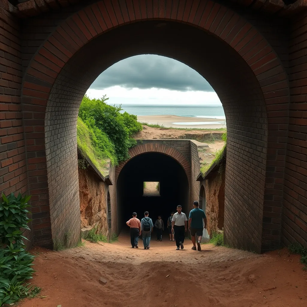
Few places in Vietnam illustrate the resilience of the human spirit as powerfully as the Vinh Moc Tunnels. Located in Quang Tri province, roughly 40 kilometers north of Dong Ha and just a few kilometers from the coast, this underground complex served as a complete village for over 300 people during the Vietnam War. While the more famous Cu Chi Tunnels near Ho Chi Minh City were designed for guerrilla warfare, Vinh Moc was built for survival. Families lived, worked, gave birth, and raised children entirely underground for nearly two years. The tunnels stand today as one of the most remarkable testaments to civilian endurance in modern history.
The tunnels sit within the former Demilitarized Zone, the buffer area that once divided North and South Vietnam along the Ben Hai River. This location placed Vinh Moc directly in the path of intense bombing campaigns. Between 1966 and 1972, the area received an extraordinary volume of ordnance, as American forces sought to disrupt supply routes along the Ho Chi Minh Trail and halt movement across the border. The villagers of Vinh Moc, rather than abandoning their homes, dug deeper into the earth. Their solution was not a temporary shelter but a permanent underground settlement designed to withstand the most intense bombardment in military history.
The Architecture of Survival: A Village Beneath the Earth
The tunnel complex extends for nearly 2 kilometers, with three separate levels reaching depths of up to 30 meters. The deepest sections were designed to protect residents from even the largest bombs. The tunnels were dug entirely by hand, using simple tools like hoes, shovels, and baskets. The villagers worked in shifts, with teams of 10 to 12 people digging continuously. The soil in this region, a mixture of clay and laterite, proved stable enough to support the tunnels without extensive reinforcement, though wooden supports were used in softer sections.
The complex functioned as a complete village. Thirteen entrances led into a network of rooms that included living quarters, a meeting hall, a clinic, and even a maternity room. Records indicate that 17 children were born inside the tunnels during the period of heaviest bombing, a fact that speaks to the determination of the community to maintain normal life under extraordinary circumstances. The tunnels also contained wells, storage areas for food and weapons, and ventilation shafts that drew fresh air from the surface. The design was sophisticated, with curved passages that absorbed blast waves and multiple exits that allowed residents to escape if one section collapsed.
The tunnels connected directly to the beach, providing access to the sea for fishing and for receiving supplies. This coastal connection was vital, as it allowed the villagers to maintain a source of fresh food and to receive goods that could not be produced underground. The beach also served as a landing point for small boats bringing weapons and supplies to support the North Vietnamese forces operating in the region. The dual purpose of the tunnels, civilian survival and military logistics, made them a target, yet the complex was never successfully destroyed despite the intensity of the bombing.
Life Underground: Daily Routines in Extraordinary Circumstances
Life in the tunnels followed a rhythm dictated by the bombing patterns. During daylight hours, when American aircraft were most active, residents remained underground. The tunnels were cool and dark, with temperatures averaging around 25 degrees Celsius regardless of the season. Families occupied small alcoves carved into the tunnel walls, with sleeping platforms made of bamboo and thatch. Privacy was limited, and the close quarters demanded cooperation and mutual support from all residents.
As evening fell and the bombing subsided, villagers emerged to tend crops, fish, and socialize. The surface world, though dangerous, remained essential for survival. The villagers grew sweet potatoes, cassava, and vegetables in the surrounding fields, and they maintained livestock in hidden pens. The sea provided fish, crabs, and seaweed, which supplemented the limited rations available during the war. The combination of agricultural work and fishing meant that the community was largely self-sufficient, a factor that contributed to their ability to remain in place.
The tunnels also served as a logistical hub. The Ho Chi Minh Trail, the network of roads and paths that carried supplies from North to South Vietnam, passed near Vinh Moc. The tunnels provided a secure storage area for weapons, ammunition, and food, and they offered shelter for soldiers passing through the region. This military function made the village a legitimate target, yet the distinction between military and civilian infrastructure was impossible to maintain in a conflict where the entire population was mobilized. The villagers accepted this reality and continued their dual existence above and below ground.
Visiting the Tunnels: What to Expect
Today, the Vinh Moc Tunnels are preserved as a historical site, managed by the Quang Tri provincial government. The site has been maintained with the cooperation of surviving villagers, many of whom still live in the area and serve as guides. Visitors can explore approximately 100 meters of the tunnel network, a section that has been reinforced and equipped with lighting for safety. The remaining sections are sealed off to protect their structural integrity. The experience of walking through the narrow passages, some barely a meter wide and less than two meters high, gives a visceral sense of the conditions that residents endured.
The entrance to the tunnels is marked by a small museum that displays photographs, documents, and artifacts from the period. The exhibits include personal items used by the villagers, tools employed in the tunnel construction, and models showing the layout of the complex. The museum provides essential context for understanding the site, and visitors should allow at least 30 minutes to review the displays before descending into the tunnels. The staff are knowledgeable and can answer questions about the history and the daily life of the community.
Visitors should be prepared for the physical experience of the tunnels. The passages are narrow, and the ceilings are low in places, requiring stooping or crouching. The temperature underground is cool, even on hot days, so a light jacket is advisable. The floor is uneven, and sturdy footwear is essential. The tunnels are not suitable for those with mobility issues or claustrophobia, though the main tourist section is more spacious than the original tunnels and includes emergency exits. The entire visit takes approximately one to two hours, depending on the level of interest and the number of questions.
Connecting the Dots: The DMZ Historical Circuit
Vinh Moc Tunnels are typically visited as part of a broader tour of the Demilitarized Zone. The historical circuit includes several other significant sites, each offering a different perspective on the war. The Hien Luong Bridge and Ben Hai River, which marked the division between North and South Vietnam, lie just 15 kilometers to the north. The Vinh Moc Tunnels themselves are the most dramatic of these sites, offering the most immersive experience of wartime conditions. The nearby Truong Son National Cemetery honors the soldiers who died on the Ho Chi Minh Trail, and the Khe Sanh Combat Base provides insight into one of the war’s most famous battles.
Quang Tri province has invested significantly in developing this historical circuit as a coherent tourist experience. Roads have been improved, signage is clear, and the sites are well-maintained. A full DMZ tour typically takes a full day, with transportation arranged from Dong Ha or Hue. The tours are conducted in both Vietnamese and English, and the guides are generally well-informed and capable of providing detailed historical context. For travelers interested in understanding the war from a Vietnamese perspective, this circuit is essential.
The location of Vinh Moc, close to the coast and within easy reach of the main highway, makes it accessible for independent travelers as well. From Dong Ha, the tunnels are approximately a 40-minute drive by motorbike or car. From Hue, the drive takes about two hours. Public transportation is limited, so hiring a driver or joining a tour is the most practical option. The site is open daily, and the entrance fee is modest, typically around $2 to $3 per person.
Practical Considerations and Responsible Tourism
The best time to visit Vinh Moc is during the dry season, from February to August. The roads are in better condition, and the weather is more predictable. The site is less crowded than many of Vietnam’s more famous attractions, though it receives a steady stream of visitors during peak season. Mornings are generally quieter, and the cooler temperatures make the walk through the tunnels more comfortable. The site can be visited year-round, but the rainy season, from September to January, can make travel more difficult and the experience less pleasant.
Responsible tourism at Vinh Moc means engaging with the history respectfully. The tunnels are a site of immense suffering and resilience, and visitors should approach them with the gravity they deserve. Photography is permitted, but the use of flash inside the tunnels is discouraged, as it can damage the historic fabric. Visitors should also be mindful that the tunnels are a memorial to a painful period in Vietnamese history, and the tone of conversation should reflect this. The site is not a theme park, and the experience should be one of reflection and learning.
The tunnels also offer an opportunity to support the local community. The guides, museum staff, and vendors at the site are all local residents, many of whom are descendants of the original tunnel dwellers. Purchasing souvenirs, hiring local guides, and eating at nearby restaurants all contribute to the local economy. The region around Vinh Moc remains one of the poorer areas of Vietnam, and tourism provides a vital source of income. By visiting responsibly, travelers can help ensure that this remarkable site is preserved for future generations.
Vinh Moc Tunnels may lack the natural beauty of Vietnam’s beaches and mountains, but they offer something equally valuable: a direct connection to a defining moment in the nation’s history. The experience of walking through the earth, imagining the lives of the families who called this underground world home, and understanding the extraordinary lengths people will go to protect their communities, is profoundly moving. For travelers seeking to understand Vietnam beyond its scenic landscapes, the tunnels are an essential destination. They are a reminder that the country’s beauty is matched by its resilience, and that the stories of its people are as compelling as its geography.
30. Thien Mu Pagoda: Hue’s Iconic Landmark
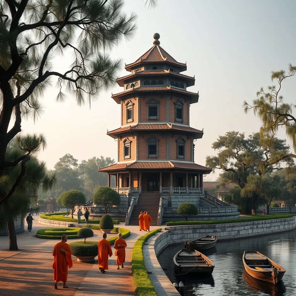
Rising from the northern bank of the Perfume River, the Thien Mu Pagoda stands as the unofficial symbol of Hue. The seven-story Phuoc Duyen Tower, with its distinctive octagonal shape and weathered brick facade, has watched over the river for nearly two centuries. The pagoda is not merely a tourist attraction; it remains an active center of Buddhist worship, a repository of imperial history, and a place of profound spiritual significance. For travelers exploring central Vietnam, the pagoda offers an accessible and deeply rewarding introduction to the country’s religious traditions.
The name Thien Mu translates to “Celestial Lady,” a reference to a local legend dating to the 16th century. According to the story, an elderly woman appeared to the regional lord Nguyen Hoang and predicted that a ruler would come to the area to build a pagoda and establish a dynasty. The prophecy proved accurate, as the Nguyen lords went on to control central and southern Vietnam for over two centuries. The pagoda was established on the site where the woman appeared, and it grew in importance as the Nguyen dynasty consolidated its power in Hue.
History: From Royal Patronage to National Symbol
The pagoda’s history is intertwined with the fortunes of the Nguyen dynasty. The original structure, built in 1601, was modest, but successive rulers expanded and embellished it over the centuries. Emperor Thieu Tri, who reigned from 1841 to 1847, ordered the construction of the Phuoc Duyen Tower, which remains the pagoda’s most recognizable feature. The tower was built in 1844 and stands 21 meters tall, with seven levels, each dedicated to a different Buddha. The octagonal design is unusual among Vietnamese pagodas and reflects the influence of both Buddhist and Confucian architectural traditions.
The pagoda has weathered periods of destruction and renewal. In 1842, a fire damaged several structures, and the complex was rebuilt under imperial patronage. The pagoda also played a role in the political upheavals of the 20th century. During the Vietnam War, the pagoda became a center of Buddhist activism, and it was here that the monk Thich Quang Duc lived before his famous self-immolation in Saigon in 1963. The car that carried him to that fateful act is preserved on the pagoda grounds, a sobering reminder of the intersection of faith and politics in modern Vietnamese history.
The pagoda survived the Tet Offensive of 1968, when much of Hue was destroyed in intense fighting. The main structures, including the tower, escaped significant damage, though the grounds bear scars from the conflict. The pagoda was designated a national historical and cultural relic in 1993, and it has been carefully maintained ever since. The current complex reflects the architectural styles of the 19th century, with later additions that blend harmoniously with the original design.
Architecture: A Study in Imperial Buddhist Design
The pagoda complex is arranged along a central axis, a layout that reflects traditional Vietnamese temple design. Visitors enter through a triple-gated entrance, known as the Tam Quan, which symbolizes the three gates of liberation in Buddhist philosophy. Beyond the gates, a wide courtyard leads to the Phuoc Duyen Tower, which dominates the space. The tower is constructed of brick and stone, with each level featuring arched windows and a tiled roof that curves gracefully at the corners. The structure is a masterpiece of proportion, appearing both solid and delicate at the same time.
Behind the tower lies the main sanctuary, a large hall that houses numerous statues and religious artifacts. The central altar is dedicated to Amitabha Buddha, flanked by statues of other bodhisattvas and guardian figures. The interior is dimly lit, with incense smoke drifting through the air, creating an atmosphere of quiet devotion. The walls are decorated with lacquered panels and calligraphic inscriptions, many of which date to the imperial period. The sanctuary is a working place of worship, and visitors should observe the etiquette expected in Buddhist temples, including removing shoes before entering and dressing modestly.
The pagoda grounds extend along the riverbank, with gardens, courtyards, and auxiliary buildings arranged around the main structures. A bell tower houses the Dai Hong Chung, a massive bell cast in 1710 during the reign of Lord Nguyen Phuc Chu. The bell weighs approximately 2 tons and is considered one of the most important cultural artifacts in central Vietnam. Legend holds that the bell can be heard from as far away as the tombs of the Nguyen emperors, several kilometers downstream. The grounds also contain a garden of bonsai trees, a collection of ancient steles, and the original stone turtle that once supported a now-lost stele.
The Perfume River Setting: A Landscape of Serenity
The pagoda’s location on the Perfume River is integral to its character. The river, which takes its name from the fragrant flowers that once fell into its waters from orchards upstream, winds through Hue with a slow, deliberate grace. The pagoda sits on a bluff above the river, offering panoramic views of the water and the surrounding countryside. The setting is particularly beautiful at sunset, when the last light of day catches the tower’s brick facade and the river reflects the changing colors of the sky.
The river also provides the most memorable way to reach the pagoda. A boat trip from Hue’s city center takes approximately 30 minutes, passing beneath the Truong Tien Bridge and along the tree-lined banks. The boats are traditional wooden vessels, many of which have been operated by the same families for generations. The journey offers a perspective on Hue that is impossible to gain from the road, with the pagoda appearing gradually as the boat rounds a bend in the river. The boat trip is not merely transportation; it is an essential part of the Thien Mu experience.
For those who prefer to travel by land, the pagoda is approximately 4 kilometers from Hue’s city center, a short drive or a pleasant bicycle ride. The road follows the river, passing through residential neighborhoods and past the grounds of the Imperial Citadel. Cycling is a popular option, as the route is flat and the traffic is manageable. The pagoda is also a common stop on the dragon boat tours that operate from the city, and most tour operators include it in their itineraries.
Visiting the Pagoda: Practical Information
The pagoda is open daily from early morning until late afternoon, and admission is free. The site is a working temple, so visitors should be respectful of worshippers and observe the rules of conduct. Modest clothing is expected, and shoulders and knees should be covered. Photography is permitted in most areas, but visitors should avoid taking photos of monks or worshippers without permission. The pagoda can become crowded during peak tourist season, particularly in the late morning when tour groups arrive. Early morning visits are recommended for those seeking a quieter experience.
The grounds are relatively compact, and a thorough visit takes approximately one hour. The main sanctuary deserves careful attention, as the statues and artifacts are of significant historical and artistic value. The bell tower and the car used by Thich Quang Duc are also worth seeing. The gardens provide a peaceful setting for reflection, and the riverbank offers excellent photo opportunities. Visitors should be prepared for the steps leading up to the pagoda from the river, which number several dozen and can be steep in places.
The pagoda is best combined with other attractions in the Hue area. The Imperial Citadel, the royal tombs, and the other pagodas of the city can all be visited in a single day, though doing so requires efficient planning. The pagoda is also a natural starting point for a boat trip along the Perfume River, which can include stops at the Hon Chen Temple and the royal tombs of Tu Duc and Minh Mang. The combination of river travel and historical exploration makes for one of the most rewarding days in central Vietnam.
Cultural Significance: Faith, History, and Identity
Thien Mu Pagoda occupies a unique place in the Vietnamese imagination. For the people of Hue, the pagoda is a source of local pride, a symbol of their city’s imperial heritage and spiritual depth. For Buddhists across Vietnam, it is a pilgrimage site of considerable importance, associated with the revival of Buddhism in the 20th century. For historians, it is a living archive, a place where the layers of Vietnamese history are visible in the architecture, the artifacts, and the stories that surround the site.
The pagoda also serves as a reminder of the complex relationship between religion and politics in Vietnam. The Buddhist activism of the 1960s, which had its roots in places like Thien Mu, played a significant role in shaping the country’s modern history. The pagoda’s role in that movement is not hidden; it is presented as part of the site’s story, a testament to the courage of those who stood for their beliefs. For visitors, this layer of history adds depth to what might otherwise be a purely aesthetic experience.
Thien Mu Pagoda is more than a beautiful building on a scenic river. It is a place where the spiritual, the historical, and the cultural converge, offering visitors a window into the soul of Vietnam. The pagoda’s longevity, its survival through war and change, and its continued vitality as a center of worship all speak to the enduring strength of Vietnamese Buddhism and the resilience of the Vietnamese people. A visit to Thien Mu is not just a stop on a tour; it is an encounter with the living heart of Hue.
31. An Bang Beach: A Relaxed Coastal Escape
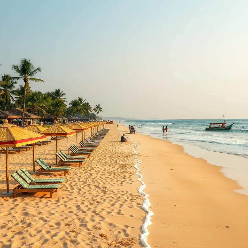
Just four kilometers from the ancient streets of Hoi An lies a different world entirely. An Bang Beach offers the kind of unpretentious coastal charm that has largely disappeared from Vietnam’s more developed shorelines. Where other beaches have surrendered to high-rise resorts and crowded promenades, An Bang has held onto its village character. The result is a stretch of golden sand where fishermen still launch their boats at dawn and travelers spend entire days doing nothing more ambitious than reading a book under a bamboo umbrella.
The beach has earned a loyal following among both international visitors and Vietnamese families. Its reputation rests on a simple formula: clean sand, warm water, excellent seafood, and an atmosphere that encourages lingering. Unlike the party-oriented beaches further south, An Bang rewards those who come to slow down. The rhythm here follows the tide, not the clock.
Why An Bang Stands Apart from Nearby Beaches
Hoi An’s proximity to several beaches makes the choice of where to swim a matter of some consideration. Cua Dai Beach, once the area’s most famous stretch of sand, has suffered significant erosion over the past decade. An Bang has largely escaped this fate, thanks in part to its location and the protective measures taken by the local community. The beach remains wide and inviting, with soft sand that slopes gently into the sea.
What truly sets An Bang apart, however, is the absence of mass tourism. The beach has no large hotels, no beach clubs with thumping music, no vendors aggressively hawking souvenirs. Instead, visitors find a collection of family-run seafood restaurants, each with its own patch of sand and a row of loungers. The arrangement is informal and genuinely welcoming. Restaurant staff are happy to serve you a meal, then let you occupy a lounger for the rest of the day without pressure to order more.
The water at An Bang is generally calm, particularly during the dry season from February to August. The beach is well-suited to swimming, though visitors should always heed the warning flags posted by lifeguards. During the wet season, from September to January, the sea can become rough, and swimming is sometimes prohibited. Even then, the beach remains pleasant for walks, and the sunsets are consistently spectacular.
The Seafood Scene: Eating at An Bang
An Bang’s restaurants are the heart of the beach experience. The seafood is caught locally, often by the very families who run the restaurants, and served with minimal fuss. The menu at most establishments follows a familiar pattern: grilled squid, steamed clams, fried fish, and prawns cooked in a dozen different ways. The quality is consistently high, and the prices are reasonable, particularly compared to Hoi An’s old town restaurants.
One dish worth seeking out is the grilled fish wrapped in banana leaves, a local specialty that appears on most menus. The fish is marinated in a mixture of lemongrass, turmeric, and chili, then grilled over charcoal until the flesh is flaky and infused with smoke. It is served with rice paper, fresh herbs, and a tangy fish sauce for dipping. The combination of flavors is quintessentially Vietnamese, and the setting, with sand between your toes and the sound of waves in the background, makes it taste even better.
For a more casual option, the beachfront stalls sell freshly grilled corn on the cob, fried spring rolls, and cold drinks. Coconut water, served straight from the shell, is the classic beach refreshment. Many visitors also develop a fondness for the local coffee, which is brewed strong and served over ice with condensed milk. The caffeine kick provides a pleasant counterpoint to the languid beach atmosphere.
A Day at An Bang: What to Expect
Mornings at An Bang belong to the fishermen. The local fleet, consisting mostly of small wooden boats, returns to shore with the night’s catch, and the beach becomes a bustling marketplace for a few hours. Visitors who rise early can watch the fish being sorted and sold, a glimpse of traditional coastal life that has largely vanished elsewhere. The local fish market is not organized for tourists, which is precisely what makes it so fascinating.
As the morning progresses, the beach fills with sunbathers. The loungers, which belong to the restaurants, are free for customers, and most people settle in for a long session of swimming and dozing. The water temperature is pleasant throughout the year, though it peaks in the summer months when the sea feels like a warm bath. The beach is popular with families, and the shallow water near the shore is safe for children.
Afternoon brings the day’s best swimming conditions, as the tide rises and the waves become more playful. This is also the time when the beach is at its busiest, though “busy” at An Bang means something different than it does at more developed resorts. Even at peak times, there is room to spread out. The atmosphere remains relaxed, and the sound of the waves is rarely interrupted by anything more disruptive than the occasional ice cream vendor.
As the sun begins to sink toward the horizon, the beach takes on a golden glow. This is the most photogenic time of day, and the restaurants fill up with diners eager to watch the sunset over the water. The evening meal at An Bang is a leisurely affair, with tables lingering over grilled seafood and cold beer long after the last light has faded. The beach empties quickly after dark, and the restaurants close by ten, leaving the shore to the sound of the waves and the occasional fisherman checking his nets.
Getting There and Getting Around
An Bang Beach is easily accessible from Hoi An. A taxi from the old town takes approximately 15 minutes and costs around 100,000 to 150,000 VND, depending on traffic. Bicycle rental is a popular alternative, as the route is flat and passes through scenic rice paddies and small villages. The ride takes about 30 minutes and offers a pleasant introduction to the countryside surrounding Hoi An. Many visitors choose to cycle to the beach in the morning and return by taxi after dark.
Motorbike rental is another option, and the beach has ample parking. Visitors driving themselves should be aware that the roads in the area can be busy with tourist traffic, particularly during peak season. For those staying in Hoi An’s old town, some hotels offer shuttle services to the beach, and the local bus route passes within walking distance of the shore.
The beach is also worth visiting as part of a broader exploration of the Hoi An area. The nearby Tra Que Vegetable Village, where farmers have cultivated herbs and vegetables for generations, is a short bicycle ride away and offers a fascinating glimpse into rural life. The combination of a morning at the vegetable village and an afternoon at the beach makes for a satisfying day trip.
Practical Considerations for Your Visit
The best time to visit An Bang Beach is during the dry season, from February to August, when the weather is sunny and the sea is calm. The months of May through August offer the warmest water and the most reliable sunshine, though they also bring the largest crowds. Shoulder months like February, March, and September provide a good balance of pleasant weather and manageable crowds.
Facilities at the beach are basic but adequate. Public restrooms are available, and the restaurants provide showers for customers. Sunscreen is essential, as the tropical sun is intense even on overcast days. Visitors should also bring insect repellent, particularly for the evening hours when mosquitoes become active. The beach has no ATMs, so cash should be arranged in advance.
An Bang is not the place for those seeking water sports or nightlife. The beach has no jet skis, no parasailing, no beach parties. Its appeal lies in its simplicity, its authenticity, and its refusal to become something it is not. For travelers who appreciate these qualities, An Bang offers one of the most genuinely relaxing beach experiences in Vietnam. It is a place to disconnect, to eat well, and to remember what a beach is supposed to feel like.
32. Hai Van Pass: A Scenic Coastal Road
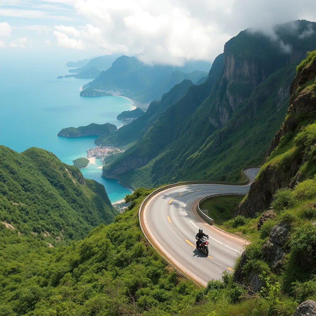
Stretching roughly 21 kilometers between the coastal cities of Da Nang and Hue, the Hai Van Pass is one of Southeast Asia’s most celebrated stretches of road. The pass cuts through the Truong Son mountain range, reaching an elevation of about 500 meters at its highest point. From this vantage, the view is nothing short of spectacular: the coastline curves away in both directions, the South China Sea stretches to the horizon, and the mountains plunge dramatically into the water below.
The name Hai Van translates to “Sea Cloud,” a fitting description for a route where ocean and mist frequently converge. The pass has served as a strategic and commercial link between northern and southern Vietnam for centuries. Its historical importance is visible in the remnants of fortifications and watchtowers that dot the slopes, remnants of conflicts that once defined this region. Today, the pass is better known for its beauty than its military history, though both remain part of its character.
Why the Hai Van Pass Demands Your Attention
For decades, the Hai Van Pass was the primary route between Da Nang and Hue, a winding, often treacherous road that demanded careful driving. The opening of the Hai Van Tunnel in 2005 changed the calculus of travel in the region. The tunnel, which stretches over 6 kilometers, cut travel time significantly and provided a safer alternative for trucks and buses. Many travelers now pass beneath the mountains without ever seeing the view above.
Those who make the journey over the pass, however, are rewarded with an experience no tunnel can replicate. The road offers a sequence of sweeping curves, each revealing a new perspective on the coastline below. The views are particularly striking in the early morning, when the light is soft and the sea shimmers with a silver sheen. By late afternoon, the golden hour casts long shadows across the mountains, and the water takes on a deep sapphire hue.
The pass has gained international recognition in recent years, thanks in part to its appearance in the British television program Top Gear, which described it as “a deserted ribbon of perfection.” That characterization captures the essence of the route, though the word “deserted” requires qualification. The pass is popular with motorbike tour groups and self-drive travelers, particularly during the dry season. On any given day, you will encounter fellow travelers, but the road rarely feels crowded.
Driving the Pass: What to Expect
Most visitors tackle the Hai Van Pass by motorbike, either self-driven or as part of an organized tour. The road surface is generally good, though it narrows in places and requires attention, particularly on the tightest curves. The gradient is manageable for most riders, and the pass can be completed in about an hour, though most travelers take considerably longer to stop for photos and enjoy the views.
Several viewpoints along the route offer places to pull over and take in the scenery. The summit area, near the old French watchtower, provides the most comprehensive panorama. From this vantage point, you can see the entire sweep of the coastline, from Da Nang’s beaches in the south to the lagoons and fishing villages of Lang Co in the north. On clear days, the Cham Islands are visible in the distance, a faint outline on the horizon.
The weather on the pass is famously changeable. Fog can roll in without warning, reducing visibility to a few meters and turning the road into a gray, featureless corridor. Rain is common during the wet season, from September to January, and the road becomes slippery and hazardous. Travelers should check the forecast before setting out and be prepared to turn back if conditions deteriorate. The pass is at its most rewarding during the dry season, from February to August, when clear skies are the norm and the views are unobstructed.
The Descent to Lang Co Bay
The northern side of the pass descends toward Lang Co Bay, one of Vietnam’s most scenic coastal areas. The bay, which was recognized as one of the world’s most beautiful bays by a UNESCO-affiliated organization, offers a gentle landing after the drama of the pass. The water here is calm and shallow, protected by a long sand spit that separates the bay from the open sea. The fishing village of Lang Co is a modest settlement, its economy still rooted in the sea rather than tourism.
For many travelers, the descent to Lang Co is the emotional highlight of the journey. The road winds down through forested slopes, occasionally opening up to reveal the bay below in its entirety. The contrast between the rugged mountains and the tranquil water is striking. It is easy to understand why this stretch of coastline has inspired poets and painters for centuries.
At the base of the pass, travelers face a choice: continue north toward Hue or turn back toward Da Nang. The pass can be driven in either direction, and each offers a different experience. Heading north, the light is behind you in the morning, illuminating the coastline ahead. Heading south in the afternoon, the sun paints the sea in shades of gold and orange. Many travelers choose to drive the pass in both directions, enjoying the different perspectives.
Practical Advice for Your Journey
If you plan to drive the pass yourself, a motorbike with good brakes and adequate engine capacity is essential. The descent requires careful braking, and underpowered scooters can struggle on the steeper gradients. Rental shops in both Da Nang and Hue offer suitable bikes, and most will provide helmets and basic safety equipment. Travel insurance that covers motorbike riding is strongly recommended.
Alternatively, organized motorbike tours offer a more relaxed approach. Local guides know the road intimately, can point out viewpoints and historical sites, and handle the logistics of the journey. Tours typically depart from either Da Nang or Hue and can be customized to include stops at the Marble Mountains, Lang Co Bay, or the fishing village of Binh Hai. The cost is reasonable, and the experience is enhanced by the guide’s local knowledge.
For those who prefer not to ride, private cars with drivers can be arranged through hotels or travel agencies. The journey over the pass takes approximately 1.5 hours by car, including stops. The drivers are experienced with the road and will pull over at the best viewpoints. This option is particularly suitable for families or travelers who lack motorbike experience.
The pass is accessible year-round, but the dry season offers the most reliable conditions. Morning departures are recommended, as the light is better and the weather tends to be clearer before the heat of the day builds. Early starts also allow you to avoid the tour groups that arrive later in the morning. A full day should be allocated if you plan to combine the pass with exploration of Lang Co Bay or the nearby fishing villages.
Fuel is available at both ends of the pass, but there are no petrol stations along the route itself. Ensure your tank is full before setting out. Food and drink are similarly limited, so carry water and snacks. The summit area has a small cafe, but its hours are irregular and its offerings basic. The best strategy is to plan your meals for either end of the journey.
The Hai Van Pass is more than a road. It is a journey through Vietnam’s coastal geography, a ribbon of asphalt that connects two distinct regions and offers a perspective on the country that no city tour can replicate. The views are magnificent, the driving is engaging, and the sense of accomplishment upon reaching the other side is genuine. For travelers seeking to understand why Vietnam’s central coast is so celebrated, the pass is an essential experience.
33. Binh Hai Village: A Hidden Fishing Village
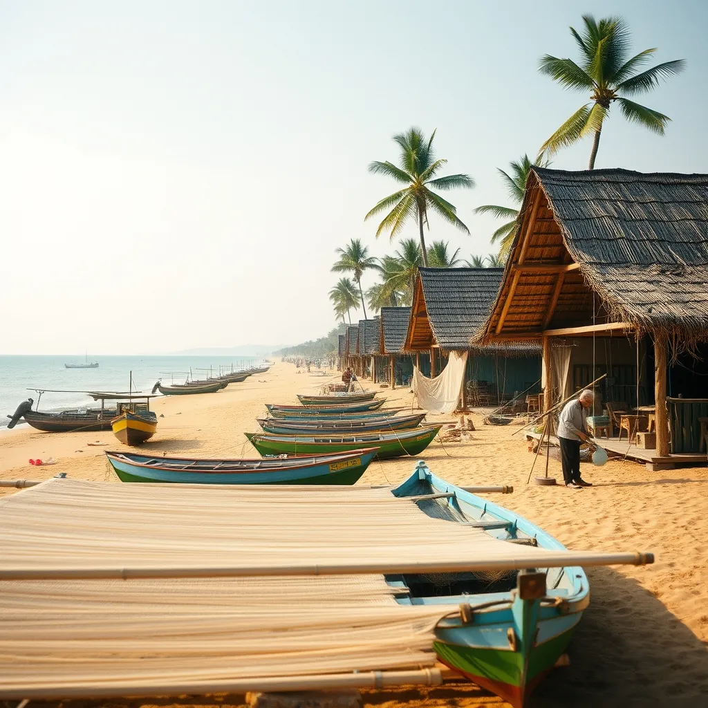
Just a short drive from the lantern-lit streets of Hoi An lies a world apart. Binh Hai Village is a working fishing community that has largely escaped the attention of mass tourism. The village sits along the coast north of Hoi An, its modest homes and boat shelters clustered near the water’s edge. For travelers seeking an authentic glimpse of Vietnam’s coastal life, this small settlement offers something increasingly rare: a place that exists for its own sake, not for visitors.
The village economy revolves entirely around the sea. Each morning, before sunrise, fishing boats head out from the shore to cast their nets. By mid-morning, the boats return, and the beach becomes a bustling scene of activity as catches are sorted, weighed, and loaded onto motorbikes for transport to markets in Hoi An and Da Nang. The rhythm of this daily cycle has remained largely unchanged for generations.
What Makes Binh Hai Different
Vietnam’s coastline is dotted with fishing villages, many of which have been transformed by tourism into commercialized attractions. Binh Hai has avoided this fate, partly due to its modest size and partly due to its location away from main transport routes. The village receives a trickle of visitors, mostly travelers who have heard about it through word of mouth or stumbled upon it while exploring the coast.
This lack of tourist infrastructure is precisely its appeal. There are no souvenir shops, no entrance fees, and no staged cultural performances. What you find instead is a community going about its daily business, welcoming curious visitors with genuine hospitality. The absence of commercial pressure creates an atmosphere of authenticity that is difficult to find elsewhere in Vietnam’s increasingly developed coastal regions.
The beach itself is a stretch of golden sand that rivals more famous beaches in the area. The water is clean and swimmable, though the currents can be strong in places. Unlike the crowded beaches of Da Nang or the tourist-oriented shores of An Bang, Binh Hai’s beach offers solitude and a sense of connection to the natural environment. On most days, you will share the sand with a handful of local fishermen rather than crowds of sunbathers.
The Fishing Fleet and Daily Life
The village’s fishing boats are a sight in themselves. Painted in vivid blues, greens, and reds, they are decorated with large eyes on their bows, a traditional feature believed to help the boats navigate safely and spot fish. The boats range from small coracles, woven bamboo baskets that have been used for centuries, to larger wooden vessels capable of venturing further out to sea.
Visitors who arrive in the late morning can observe the catch being sorted on the beach. The variety depends on the season and the weather, but typically includes small sardines, mackerel, squid, and various crustaceans. Much of the catch is sold directly to middlemen who transport it to local markets. Some is dried on racks along the beach, a preservation method that has been used for centuries.
The village’s women play a central role in the fishing economy. While the men are at sea, the women manage the shore-based activities: mending nets, preparing bait, and processing the catch. In the afternoon, many women gather in small groups to repair the large fishing nets that are essential to the village’s livelihood. This communal activity is a social occasion as much as a practical one, with conversation flowing as freely as the work.
Exploring the Village
A walk through Binh Hai takes less than an hour, but the experience lingers much longer. The village’s narrow lanes wind between houses built in the traditional style, with tiled roofs and wooden facades. Many homes double as workshops, with fishing equipment stored in front yards and boats pulled up on the beach nearby. The smell of fish sauce and salt hangs in the air, a reminder of the village’s connection to the sea.
The village temple, dedicated to the Whale God, is a focal point of community life. Whale worship is a tradition along Vietnam’s central coast, where fishermen believe that whales are divine protectors who rescue sailors in distress. The temple houses the bones of beached whales, treated with reverence and ceremony. Visitors are welcome to observe the temple, though modest dress and respectful behavior are expected.
At the northern end of the village, a small promontory offers views along the coast in both directions. To the south, the coastline curves toward Hoi An, with the Cham Islands visible on the horizon. To the north, the beach stretches toward Da Nang, with the Marble Mountains rising in the distance. The viewpoint is particularly rewarding at sunset, when the fishing boats return and the sky turns shades of orange and pink.
Eating Like a Local
Binh Hai has no restaurants in the conventional sense, but several village homes offer simple meals to visitors. These informal eateries serve whatever the boats have brought in that day, prepared in the local style. The menu might include grilled fish with herbs, squid stir-fried with garlic, or a simple seafood soup with rice. The ingredients could not be fresher, and the prices are a fraction of what you would pay in Hoi An’s tourist restaurants.
To arrange a meal, ask at the village’s small general store or simply approach one of the homes with a sign indicating food service. The villagers are accustomed to occasional visitors and are generally happy to accommodate them. Communication may require patience, as English is limited, but the universal language of good food bridges most gaps. A phrasebook or translation app will help with basic requests.
The local specialty is banh xeo, a crispy rice pancake filled with shrimp, bean sprouts, and herbs. Unlike the version served in restaurants, the village preparation uses smaller, fresher shrimp caught that morning. The pancakes are eaten wrapped in rice paper with fresh lettuce and dipped in a tangy fish sauce. It is a simple dish, but one that captures the essence of the region’s cuisine.
Getting There and Practical Tips
Binh Hai is located approximately 15 kilometers north of Hoi An, just off the coastal road that connects Hoi An to Da Nang. The most convenient way to reach the village is by motorbike, which takes about 30 minutes from Hoi An’s old town. Bicycles are also a viable option for fit travelers, as the terrain is flat and the route is scenic. Taxis and ride-hailing services are available but more expensive.
The village is best visited in the morning, when the fishing activity is at its peak. Arrive by 7:00 AM to see the boats return and the beach come alive. The early morning light is also the best for photography, casting a warm glow over the boats and the village. By midday, the heat becomes intense, and much of the village retreats indoors for the afternoon rest period.
There is no entrance fee to visit Binh Hai, and no official tourism infrastructure. Visitors should come with realistic expectations: this is a working village, not a curated attraction. There are no cafes, no gift shops, and no guided tours. What you get instead is an unfiltered view of a way of life that has sustained Vietnam’s coastal communities for centuries.
Respect for local customs is essential. Ask permission before photographing villagers, particularly the fishermen and their families. The village is home to a close-knit community, and visitors who approach with genuine curiosity and respect are welcomed warmly. Those who treat the village as a backdrop for their own entertainment are likely to be met with polite but firm indifference.
Binh Hai offers something that no guidebook can fully capture: the sense of being present in a place that has not been shaped by tourism. The village’s beauty lies not in dramatic landscapes or architectural wonders, but in the quiet dignity of its daily life. For travelers willing to venture beyond the familiar, this hidden fishing village provides an experience that will remain in memory long after more famous sights have faded.
34. Cu Lao Cham: Diving and Snorkeling Paradise

Eighteen kilometers off the coast of Hoi An, the Cham Islands rise from the South China Sea like a cluster of emerald jewels. Known locally as Cu Lao Cham, this archipelago of eight islands forms a UNESCO-recognized biosphere reserve. The waters surrounding these islands harbor some of Vietnam’s most vibrant coral reefs, making the destination a magnet for divers and snorkelers seeking underwater encounters that rival those found in far more commercialized locations.
The islands have been inhabited for centuries, with evidence of human settlement dating back over 3,000 years. Today, the main island, Hon Lao, supports a community of roughly 3,000 residents who live in the small village of Bai Lang. The island’s dual identity as both a living community and a protected marine reserve creates a unique travel experience that balances ecological preservation with sustainable tourism.
The Marine Protected Area
The waters around Cu Lao Cham were designated as a marine protected area in 2005, a status that has proven transformative for the local ecosystem. The protection status has allowed coral reefs to recover from decades of overfishing and destructive fishing practices. The result is a thriving underwater environment that supports over 270 species of coral and more than 200 species of fish.
Divers and snorkelers will find visibility ranging from 5 to 15 meters depending on the season and weather conditions. The reefs are accessible at relatively shallow depths, making them suitable for beginners and experienced divers alike. The coral formations include both hard corals, which form the structural foundation of the reef, and soft corals, which add splashes of color and movement to the underwater landscape.
The marine reserve is divided into zones with different levels of protection. Some areas are strictly off-limits to visitors, serving as breeding grounds and nursery habitats for marine life. Other zones are open for diving and snorkeling under controlled conditions. This zoning system ensures that the reef can continue to thrive while still providing opportunities for visitors to experience its beauty.
Diving and Snorkeling Spots
The most popular diving site is located off the southeastern coast of Hon Lao, where a series of rocky outcrops create dramatic underwater topography. Here, divers can explore coral-covered walls that drop to depths of 20 meters or more. The site is home to schools of barracuda, occasional reef sharks, and a dazzling array of reef fish including butterflyfish, angelfish, and clownfish.
For snorkelers, the shallow reefs near Bai Lang beach offer easy access to the underwater world. The coral gardens begin just meters from the shore, with sandy patches separating distinct coral formations. Snorkelers can float above the reef and observe the bustling activity of the marine community below. The calm conditions in this area make it suitable for children and less confident swimmers.
A second notable dive site lies near the island of Hon Dai, the second largest in the archipelago. This location features a series of underwater pinnacles that rise from deeper water, attracting pelagic species that are less common around the main island. Divers may encounter trevally, tuna, and on rare occasions, manta rays. The site is best suited to experienced divers due to stronger currents and greater depths.
Night diving is available through the island’s dive operators, offering a completely different perspective on the reef. As daylight fades, nocturnal species emerge from their hiding places. Octopus, moray eels, and hunting squid become active, while bioluminescent plankton create a magical display of natural light. Night dives require additional certification but are among the most memorable experiences the islands offer.
The Island’s Rustic Charm
Above the waterline, Cu Lao Cham retains a character that feels refreshingly untouched. The main village of Bai Lang is a collection of modest houses, small shops, and family-run guesthouses arranged around a crescent-shaped beach. There are no high-rise resorts, no international restaurant chains, and no nightlife to speak of. The island’s appeal lies in its simplicity and the genuine warmth of its residents.
The island’s economy has traditionally been based on fishing and agriculture. In recent years, tourism has become an increasingly important source of income, but it has developed in a way that respects the island’s character. Many families have converted spare rooms into simple guesthouses, while others operate small eateries serving freshly caught seafood. The pace of life remains slow, and visitors quickly adapt to the island’s unhurried rhythm.
Beyond the village, the island offers several walking trails that lead through tropical forest to viewpoints overlooking the sea. The highest point on Hon Lao, approximately 500 meters above sea level, provides panoramic views of the entire archipelago. The trail passes through areas of dense vegetation, where visitors may spot monkeys, civets, and a variety of bird species that call the island home.
Cultural Heritage and Traditions
The Cham Islands have a rich cultural heritage that predates the arrival of the Vietnamese. The islands were an important stop on ancient maritime trade routes, and artifacts recovered from the surrounding waters suggest contact with cultures from across Southeast Asia and beyond. The local museum in Bai Lang houses a collection of these artifacts, including ceramics, coins, and pottery recovered from shipwrecks.
The island’s main temple, dedicated to the sea goddess Thien Hau, is an important site of local worship. The temple dates back over 200 years and features intricate carvings and decorative elements that reflect the island’s maritime heritage. During the annual festival, held in the third lunar month, the island’s residents gather to honor the goddess and pray for safe voyages and bountiful catches.
The traditional boat-building craft is still practiced on the island, with skilled artisans constructing wooden vessels using techniques passed down through generations. Visitors can observe the boatyard near the harbor, where the distinctive curved hulls take shape under the hands of master craftsmen. The boats are not merely functional objects but works of art, decorated with intricate patterns and protective symbols.
Practical Considerations
Access to Cu Lao Cham is primarily by speedboat from Hoi An’s Cua Dai port, with the journey taking approximately 30 minutes. A slower wooden boat service also operates, taking about two hours and offering a more relaxed approach to the islands. The speedboat service runs multiple times daily during peak season, though schedules can be affected by weather conditions.
The best time to visit for diving and snorkeling is from March to September, when the seas are calmest and visibility is at its highest. During this period, water temperatures range from 25 to 29 degrees Celsius, making extended time in the water comfortable without a wetsuit. The dry season brings clear skies and sunny conditions, though afternoon showers are possible even during the driest months.
Dive operators on the island offer equipment rental, guided dives, and certification courses. For those who prefer to stay dry, glass-bottom boat tours provide a window into the underwater world without getting wet. Kayak rentals allow independent exploration of the coastline, with several small beaches and coves accessible only from the water.
Overnight accommodation is available in the village, ranging from basic guesthouses to slightly more comfortable options with air conditioning. Electricity is available throughout the day, though the island’s generators may cause occasional interruptions. There are no ATMs on the island, so visitors should bring sufficient cash for their stay. Mobile phone coverage is generally reliable, and some guesthouses offer Wi-Fi, though the connection can be slow.
The island’s protected status means that visitors must follow certain rules. Single-use plastics are banned on the islands, and visitors are encouraged to bring reusable water bottles and shopping bags. Coral and shells must not be removed from the water or the beach, and feeding or touching marine life is prohibited. These regulations are enforced, and fines can be substantial for violations.
Cu Lao Cham offers a rare combination of accessible marine beauty and authentic island culture. The reefs are among the healthiest in Vietnam, the community is welcoming, and the pace of life encourages genuine relaxation. For travelers who want to experience Vietnam’s underwater world without the crowds and commercialization of more developed destinations, the Cham Islands deliver an experience that is both enriching and restorative.
35. Phong Dien and Quang Dien: Rural Landscapes
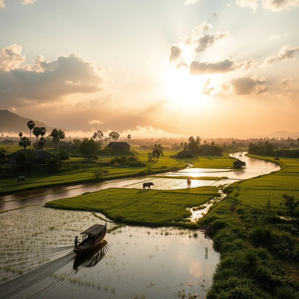
Just thirty kilometers northwest of Hue, the districts of Phong Dien and Quang Dien offer a version of Vietnam that moves at a different pace. This is the countryside in its purest form: rice paddies stretching to the horizon, rivers winding lazily through villages, and communities whose daily rhythms follow the sun rather than the clock. For travelers seeking an escape from the well-trodden tourist circuits, these neighboring districts reward those who venture beyond the imperial city with landscapes that feel untouched by time.
The region sits along the lower reaches of the O Lau River and the northern bank of the Perfume River, where the waterways have shaped both the land and the lives of its inhabitants for centuries. The fertile alluvial soil supports intensive rice cultivation, while the rivers provide both transportation and sustenance. The result is a landscape that is simultaneously productive and profoundly beautiful, a working countryside where agriculture and daily life unfold against a backdrop of exceptional natural scenery.
The Riverine Landscape
The defining feature of Phong Dien and Quang Dien is the network of rivers and canals that crisscross the low-lying terrain. The O Lau River, which flows from the Truong Son mountains to the sea, forms the boundary between the two districts. Along its banks, water coconut palms line the shore, their distinctive fan-shaped leaves creating a lush green border that contrasts with the deep blue of the water.
Boat travel remains an essential part of daily life in this region. Many villages are accessible only by water, and the rivers serve as the primary thoroughfares for transporting goods, livestock, and people. Visitors who hire a local boat can spend hours drifting past scenes of rural life: fishermen casting nets from small wooden skiffs, women washing clothes on stone steps at the water’s edge, children swimming in the shallows during the heat of the afternoon.
The riverbanks are dotted with small landing stages where villagers gather to trade, exchange news, and watch the boats pass. These informal meeting points offer visitors a window into the social fabric of the countryside. The pace is unhurried, and conversations flow as slowly as the current. For those who speak some Vietnamese, these encounters can become genuine exchanges rather than transactional tourist interactions.
Traditional Villages and Architecture
Phong Dien and Quang Dien are home to several villages that have preserved their traditional character despite the changes sweeping through much of modern Vietnam. The most notable is Phuoc Tich, a village that dates back over 500 years and has been recognized as a national heritage site. Its narrow lanes are lined with ancient houses built from jackfruit wood, their dark timber facades weathered by centuries of tropical climate.
Phuoc Tich’s architecture follows the traditional Vietnamese house form: a rectangular structure with a tiled roof, wooden pillars, and a central courtyard. The houses are arranged along the river, their facades facing the water that has sustained the community for generations. Many of the buildings remain in use, their ground floors serving as living spaces while the upper levels are reserved for ancestral altars and storage. The village is remarkably quiet, with few visitors and no commercial development, allowing an authentic glimpse into a way of life that has largely disappeared elsewhere.
Beyond Phuoc Tich, the countryside is scattered with smaller hamlets where daily life continues much as it has for generations. Houses of brick and timber sit among fruit orchards and vegetable gardens, their yards populated by chickens, ducks, and the occasional water buffalo. The architecture is modest but functional, designed to cope with the region’s hot summers and frequent rain. The absence of modern construction allows the landscape to remain visually cohesive, with the built environment harmonizing with the natural surroundings.
Agricultural Rhythms and Local Life
Agriculture dominates the economy of both districts, and the seasonal cycle of rice cultivation structures the year. Visitors who time their arrival to coincide with the planting or harvesting seasons will witness the countryside at its most dynamic. During transplanting, the paddies fill with bent figures in conical hats, moving in coordinated rows as they press young rice shoots into the mud. At harvest, the golden fields hum with the sound of threshing machines and the chatter of workers gathering the crop.
Beyond rice, the region produces a variety of other crops. The orchards that line the riverbanks yield tropical fruits including pomelo, rambutan, and jackfruit, while vegetable gardens supply the markets of Hue. The O Lau River is also known for its freshwater fish, and fishing remains an important supplement to agricultural income. Visitors may see fishermen using traditional methods, including cast nets and bamboo fish traps, techniques that have changed little over the centuries.
Local markets provide the most direct insight into the region’s economy. The markets of Phong Dien and Quang Dien towns are bustling affairs that begin before dawn and wind down by mid-morning. Vendors display their produce on woven mats or simple wooden tables: piles of greens, baskets of live crabs, stacks of rice cakes, and jars of fermented fish sauce. The markets serve as social hubs where news travels fast and the boundaries between buyer and seller blur into long-standing relationships.
Historical Significance
The region’s history extends far beyond its agricultural heritage. Phong Dien district was once home to the ancient Cham civilization, and archaeological sites in the area have yielded artifacts dating back over a thousand years. The Cham people, who controlled much of central Vietnam before the Vietnamese expansion southward, left behind temples, sculptures, and inscriptions that attest to their sophisticated culture.
During the Vietnam War, the area saw significant military activity. The districts’ location between the Demilitarized Zone to the north and Hue to the south placed them in the path of major troop movements and supply routes. The remnants of this period include bomb craters that have since filled with water and become ponds, as well as the occasional concrete bunker half-hidden by vegetation. For visitors interested in the region’s more recent history, local guides can point out these sites and explain their significance.
Getting There and Getting Around
Phong Dien and Quang Dien are easily accessible from Hue by road. National Highway 1A runs through the region, connecting it to the former imperial capital to the south and to Quang Tri province to the north. Public buses depart regularly from Hue’s northern bus station, with the journey to Phong Dien town taking approximately 45 minutes. Renting a motorbike offers the greatest flexibility for exploring the countryside at your own pace.
Cycling is an excellent option for those who prefer a slower approach. The flat terrain and low traffic volumes make the region ideal for two-wheeled exploration. Several guesthouses in Hue rent bicycles, and the ride from the city to Phong Dien takes roughly two hours along quiet country roads. The journey itself is part of the experience, passing through villages and past rice fields that gradually give way to the more open landscapes of the countryside.
For those who want to experience the rivers, boat trips can be arranged through local operators or the guesthouses in Hue. A typical excursion follows the Perfume River downstream from Hue, passing through the northern reaches of Quang Dien before joining the O Lau River. These trips typically last a full day and include stops at villages along the way. The boats are simple wooden vessels with shaded seating, and the journey offers a perspective on the landscape that is impossible to appreciate from the road.
The best time to visit is from February to August, when the weather is generally dry and the temperatures are manageable. During this period, the rice fields pass through their most photogenic phases: the emerald green of young shoots in early spring and the golden glow of the harvest in summer. The months of September through January bring heavier rainfall, which can make travel more challenging but also transforms the landscape into a lush, verdant expanse.
Accommodation options in the region are limited but sufficient. A handful of small guesthouses operate in Phong Dien and Quang Dien towns, offering basic rooms at modest prices. The most compelling option is a homestay in one of the traditional villages, where visitors can experience rural life firsthand. These homestays typically include meals prepared by the host family, using ingredients sourced from the surrounding fields and gardens.
Phong Dien and Quang Dien offer a perspective on Vietnam that many travelers miss entirely. The landscape is not dramatic in the way of Ha Long Bay or the mountain passes of the north. Its beauty is quieter, more subtle, found in the rhythm of daily life and the harmony between people and their environment. For those willing to slow down and observe, the rewards are considerable: a genuine connection to the rural heart of central Vietnam, offered without pretense or performance.
Southern Vietnam: Dynamic Cities and River Life
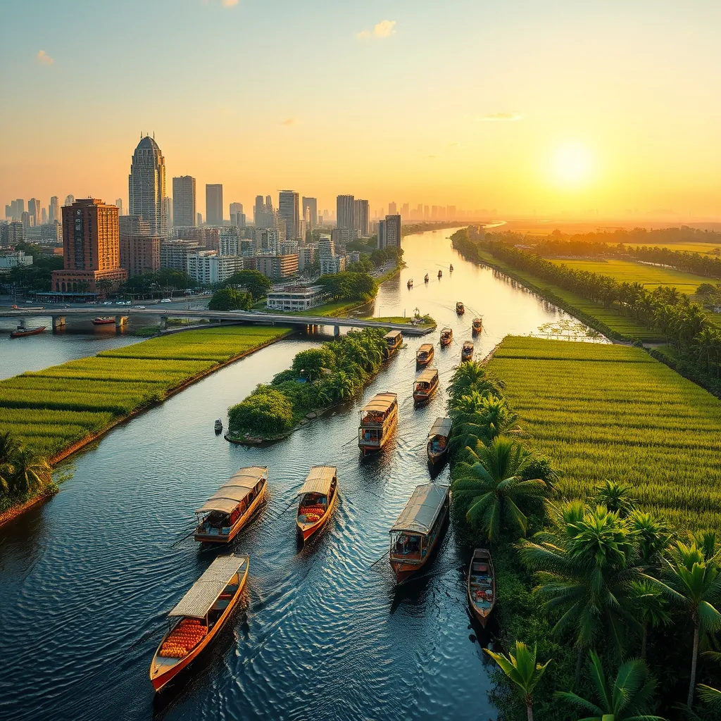
The southern third of Vietnam presents a world apart from the terraced mountains of the north and the imperial heritage of the center. This is a region defined by water: the sprawling Mekong Delta, the coastal estuaries, and the rivers that thread through the country’s largest metropolis. Here, the climate runs hotter, the pace quickens, and the landscapes shift from dense urban canyons to emerald rice paddies to island shores fringed with white sand.
Southern Vietnam rewards travelers who embrace its contrasts. Ho Chi Minh City, still called Saigon by most locals, surges with the energy of nine million people moving through markets, motorbike-choked streets, and colonial-era boulevards. Just a few hours away, the Mekong Delta slows to the rhythm of the tide, where life unfolds on the water and the land yields fruit, rice, and fish in astonishing abundance. Beyond the mainland, islands like Phu Quoc and Con Dao offer tropical escapes that rival any in Southeast Asia.
A Region of Contrasts
The south delivers extremes that few countries can match within a single region. In the morning, you can sip strong Vietnamese coffee at a sidewalk cafe in Saigon’s District 1, watching the city roar to life. By afternoon, you can be drifting through the narrow canals of the Mekong Delta, where the only sounds are birdsong and the dip of oars. The transition takes hours, yet the shift feels like crossing into another country entirely.
This diversity extends to the landscape itself. The Mekong Delta, often called Vietnam’s rice bowl, produces more than half of the country’s rice and a substantial share of its fruit, seafood, and aquaculture. The region’s nine branches of the Mekong River spread across roughly 40,000 square kilometers of flat, fertile land, creating a labyrinth of waterways that serves as both highway and lifeline. To the south and west, the coast offers beaches, islands, and fishing villages that remain largely untouched by mass tourism.
Ho Chi Minh City: The Economic Engine
No visit to southern Vietnam is complete without time in Ho Chi Minh City. The metropolis serves as the region’s transportation hub, with Tan Son Nhat International Airport connecting directly to major cities across Asia and beyond. The city’s energy is palpable from the moment you arrive: motorbikes stream through intersections like schools of fish, vendors grill skewers on street corners, and the air hums with the constant motion of commerce.
The city rewards exploration on foot and by motorbike taxi. The historic center holds landmarks like the Notre-Dame Cathedral Basilica, the Central Post Office designed by Gustave Eiffel, and the Reunification Palace, where the Vietnam War effectively ended in 1975. The War Remnants Museum offers a sobering but essential perspective on the conflict, while the Ben Thanh Market provides a sensory overload of produce, textiles, and street food.
Beyond the tourist sites, Saigon’s neighborhoods reveal different facets of the city. District 5, the historic Chinatown, is a maze of narrow lanes, herbal medicine shops, and bustling markets. The backpacker district around Pham Ngu Lao Street pulses with budget guesthouses and street-side bars. The newer developments in District 2 and Thu Duc City showcase glass towers, craft breweries, and a growing expat community. The city is not a museum piece; it is a living, evolving organism that changes block by block.
The Mekong Delta: Life on the Water
Venturing southwest from Saigon, the landscape flattens and the roads narrow as they thread between rice paddies and orchards. The Mekong Delta encompasses twelve provinces and one municipality, each with its own character. The most accessible destinations for travelers include My Tho and Ben Tre, reached in under two hours from the city, while deeper exploration reveals the floating markets of Can Tho, the bird sanctuaries of Tra Su, and the remote channels of the Ca Mau peninsula.
The delta’s defining experience is the floating market, where vendors gather at dawn to trade goods directly from their boats. The largest, Cai Rang near Can Tho, attracts hundreds of vessels each morning. Sellers tie a sample of their wares to a tall pole, allowing buyers to identify what they offer from a distance. The market peaks between five and eight in the morning, so an early start is essential. The reward is a glimpse of commerce conducted exactly as it has been for generations.
Beyond the markets, the delta offers homestays in orchard villages, bicycle rides along canal paths, and boat trips through narrow waterways shaded by water coconut palms. The region’s cuisine centers on freshwater fish, particularly the snakehead fish and the giant river prawn, along with tropical fruits that vary by season. The pace is unhurried, the people welcoming, and the landscape endlessly green.
Islands and Coastal Escapes
The south’s coastline and offshore islands provide the region’s most dramatic scenery. Phu Quoc, Vietnam’s largest island at 574 square kilometers, has developed rapidly into a resort destination while retaining stretches of untouched forest and beach. Its southern tip is dominated by new luxury developments, while the north and east remain quieter, with fishing villages and pepper farms offering a different perspective. The island’s national park covers more than half its area, protecting tropical forest and the wildlife within.
Con Dao, an archipelago of 16 islands off the southern coast, offers a more remote alternative. The main island served as a prison during the French colonial period and the Vietnam War, and the remnants of those facilities now stand as a memorial to the prisoners who suffered there. Beyond the history, Con Dao’s beaches rank among Vietnam’s most beautiful, and the surrounding waters are a marine protected area with healthy coral reefs and a significant turtle nesting population.
Closer to the mainland, the coastal city of Vung Tau provides a quick beach escape from Saigon, reachable by ferry in about 90 minutes. The city’s long beaches, seafood restaurants, and the distinctive Jesus Christ statue atop a small mountain make it a popular weekend destination for locals. Further up the coast, Nha Trang offers a full-service beach resort experience with diving, island hopping, and a vibrant nightlife scene.
Planning Your Time in the South
Most travelers allocate between five and ten days to southern Vietnam. A typical itinerary begins with two or three days in Ho Chi Minh City, followed by a two-day excursion into the Mekong Delta, and concludes with three or four days on an island. Those with less time can compress the experience by choosing one primary destination beyond the city, while travelers with more flexibility can explore the delta in greater depth or combine a beach stay with a visit to the Cu Chi Tunnels.
The dry season from December to April offers the most reliable weather for beach visits and delta exploration. Temperatures remain high throughout the year, typically ranging from 27 to 35 degrees Celsius, with the hottest months falling between March and May. The rainy season from May to November brings afternoon downpours that usually pass quickly, leaving the landscape refreshed and the temperatures slightly cooler.
Southern Vietnam delivers a different experience from the rest of the country, one built on energy, water, and warmth. The region’s cities pulse with ambition, its rivers sustain millions, and its islands offer respite from both. For travelers willing to embrace the heat and the pace, the south rewards with some of Vietnam’s most memorable experiences.
36. Ho Chi Minh City: The Vibrant Metropolis
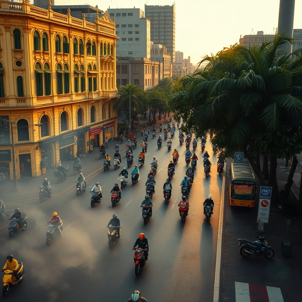
Ho Chi Minh City does not whisper. It roars. With a population approaching nine million and a motorbike fleet that seems to double by the year, this metropolis moves at a pace that can overwhelm first-time visitors. Yet beneath the chaos lies a city of remarkable order, where centuries of history, rapid modernization, and deep-rooted traditions coexist on every block.
The city has worn two names and two identities. Officially renamed Ho Chi Minh City in 1976 after the fall of Saigon, it remains “Saigon” to most residents and travelers alike. The name carries weight: Saigon evokes the French colonial era, the Vietnam War, and the resilient spirit of a city that has rebuilt itself repeatedly. Understanding both names means understanding the layers of history that give this city its texture.
The Historic Heart: District 1 and Beyond
Most exploration begins in District 1, the historic core where French colonial architecture stands alongside gleaming skyscrapers. The Notre-Dame Cathedral Basilica, built between 1863 and 1880, anchors the city center with its red brick facade and twin bell towers. Across the square, the Central Post Office, designed by Gustave Eiffel, still operates as a working post office beneath its vaulted iron ceiling. The building’s arched windows and intricate tile work make it one of the city’s most photographed landmarks.
A short walk away, the Reunification Palace preserves the moment when the Vietnam War ended. On April 30, 1975, a North Vietnamese tank crashed through the palace gates, marking the fall of Saigon. The building remains frozen in time, its rooms furnished as they were on that day, offering visitors a tangible connection to a pivotal moment in modern history. The War Remnants Museum, located nearby, presents a more sobering perspective through its extensive collection of photographs, military equipment, and documentation of the war’s human cost.
The city’s religious architecture reflects its multicultural heritage. The Jade Emperor Pagoda, built in 1909, houses a remarkable collection of statues depicting figures from Chinese mythology and Taoist tradition. The Central Mosque in District 1 serves the city’s Muslim community with its elegant minaret and peaceful courtyard. The Bitexco Financial Tower, standing 262 meters tall, offers a striking contrast with its helipad-shaped observation deck and 360-degree views of the sprawling metropolis below.
The Cu Chi Tunnels: History Beneath the Surface
Just 40 kilometers northwest of the city center lies one of Vietnam’s most remarkable historical sites. The Cu Chi Tunnels stretch over 250 kilometers, a vast underground network that served as a base for Viet Cong fighters during the Vietnam War. The tunnels included living quarters, hospitals, kitchens, storage rooms, and meeting spaces, all carved into the red clay earth at depths reaching ten meters.
Visitors today can explore a section of the tunnel system, crawling through the narrow passages that once accommodated soldiers moving between combat positions. The experience is physically demanding; the tunnels were designed for people of smaller stature, and the heat and confined spaces give a visceral sense of the conditions endured by those who lived there. Above ground, the site includes exhibits of booby traps, bomb craters, and the remains of an American base, providing context for the guerrilla warfare that defined the conflict.
The tunnels merit a half-day excursion from the city. Tours typically depart in the morning to avoid the midday heat, and most include transportation, a guide, and the opportunity to sample the simple tapioca root that sustained tunnel residents. The site draws visitors from around the world, yet it retains a solemn atmosphere that invites reflection on the cost of war and the resilience of the Vietnamese people.
A Culinary Capital Without Equal
Saigon’s food scene ranks among the finest in Southeast Asia, and eating your way through the city is an essential part of any visit. The streets themselves serve as the city’s greatest restaurant, with vendors cooking everything from pho to banh mi to seafood on portable grills and gas burners. The sheer variety can be overwhelming, but a few dishes define the city’s culinary identity.
Pho, the iconic Vietnamese noodle soup, reaches its peak in Saigon. The southern style differs from the northern version: the broth is sweeter, the noodles wider, and the accompaniments more generous. A bowl of pho at a street stall, eaten on a plastic stool while watching the city stream past, delivers an experience no restaurant can replicate. The broth, simmered for hours with beef bones, star anise, cinnamon, and ginger, rewards those who seek out the busiest stalls, where turnover guarantees freshness.
Banh mi, the Vietnamese baguette sandwich, represents the country’s French colonial legacy transformed into something entirely Vietnamese. The crisp baguette is filled with grilled pork, pate, pickled carrots and daikon, fresh cilantro, cucumber, and chili, all bound together with a smear of mayonnaise and soy sauce. Saigon’s banh mi stalls sell these sandwiches for less than a dollar, making them the city’s best value meal.
The city’s culinary landscape extends well beyond these classics. Com tam, broken rice with grilled pork chops, eggs, and pickles, is a Saigon specialty. Hu tieu, a pork and seafood noodle soup, reflects Chinese and Cambodian influences. Bun bo Hue, a spicy beef noodle soup from the central city of Hue, has found a devoted following in Saigon. Seafood restaurants along the outskirts serve clams, snails, and prawns grilled with lemongrass and chili. The city’s dessert culture includes che, a sweet soup made with beans, coconut milk, and tropical fruits, and the ubiquitous Vietnamese coffee, served iced with condensed milk.
Markets and Neighborhoods
Ben Thanh Market, the city’s most famous market, occupies a central location near the historic district. The market’s main hall dates to 1914 and houses hundreds of stalls selling everything from silk and lacquerware to fresh produce and street food. The daytime market caters primarily to tourists, with prices inflated accordingly, but the evening food section transforms into a lively open-air dining hall where locals and visitors alike gather for grilled seafood and cold beer.
For a more authentic market experience, head to District 5, the historic Chinatown. The Binh Tay Market, housed in a distinctive yellow and green building, serves as the neighborhood’s commercial heart. Here, vendors trade in herbs, spices, dried seafood, and traditional medicines, often in transactions conducted in Cantonese. The surrounding streets contain temples, medicine shops, and family businesses that have operated for generations, offering a glimpse of a community that has maintained its identity for over two centuries.
The city’s neighborhoods each possess a distinct character. District 3, adjacent to the center, contains quiet residential streets, French-era villas, and some of the city’s best coffee shops. The backpacker district around Pham Ngu Lao Street in District 1 offers budget accommodation, street-side bars, and a constant flow of travelers from around the world. The newer developments in District 2 and Thu Duc City showcase modern apartment towers, craft breweries, and a growing international community, while the outer districts reveal a more traditional way of life with their markets, temples, and family homes.
Practical Considerations
Getting around Ho Chi Minh City requires strategy. Motorbike taxis, known locally as xe om, offer the fastest way through traffic and are widely available on street corners. Ride-hailing apps like Grab provide a safer and more regulated alternative, with fares displayed before booking. Taxis are plentiful but require vigilance; stick to reputable companies like Vinasun and Mai Linh to avoid scams.
The city’s heat and humidity demand respect. Temperatures typically range from 27 to 35 degrees Celsius year-round, with the hottest months falling between March and May. The rainy season from May to November brings daily afternoon downpours that usually pass within an hour. Lightweight clothing, comfortable walking shoes, and a good hat are essential. Tap water is not safe to drink, but bottled water is inexpensive and available everywhere.
Two or three days in Ho Chi Minh City provides enough time to explore the historic center, sample the street food, and take a half-day trip to the Cu Chi Tunnels. Those with additional time can venture further afield to the Mekong Delta or the coastal city of Vung Tau. The city serves as the region’s transportation hub, with Tan Son Nhat International Airport offering direct connections to major cities across Asia, Europe, and Australia.
Ho Chi Minh City is not a place to be merely visited; it is a place to be experienced. The city demands engagement, rewards curiosity, and leaves an impression that lingers long after departure. Its energy is relentless, its food unforgettable, and its history profound. For travelers willing to embrace the chaos, Saigon delivers an experience that ranks among the most memorable in all of Southeast Asia.
37. Cu Chi Tunnels: A Historical Underground Network
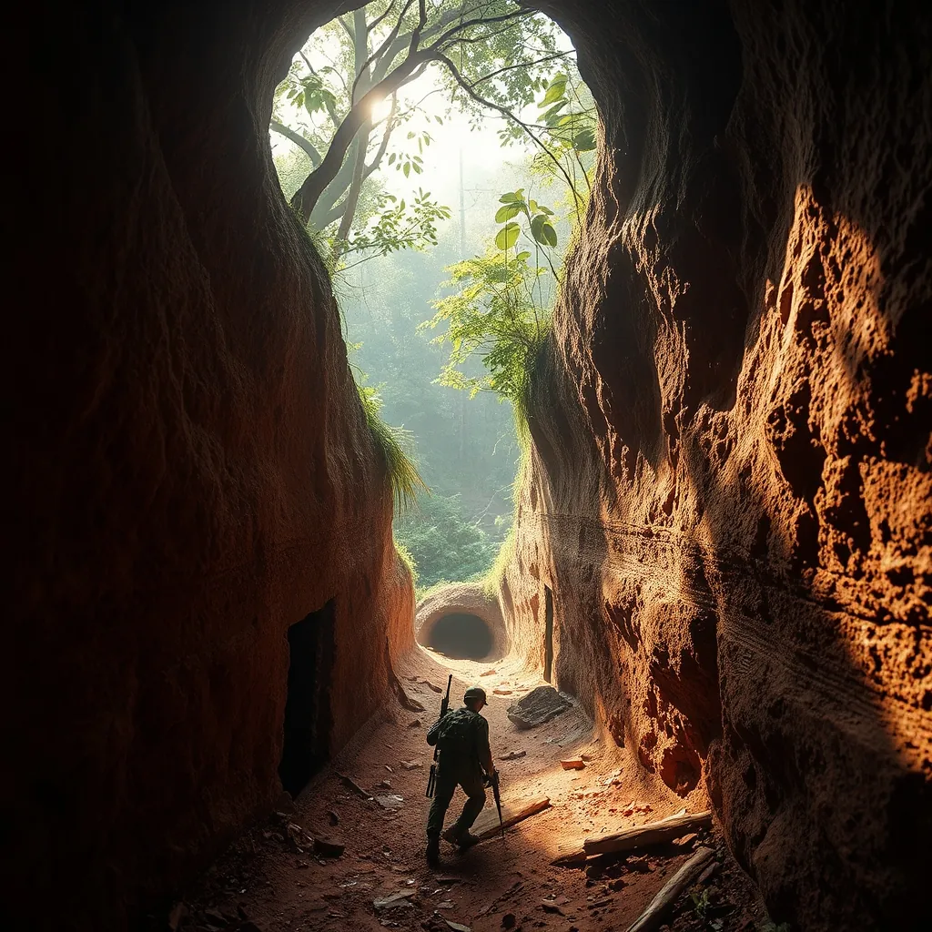
Few places on earth demonstrate human resilience quite like the Cu Chi Tunnels. Located roughly 40 kilometers northwest of Ho Chi Minh City, this 250-kilometer network of underground passages once housed an entire community of Viet Cong fighters. The tunnels functioned as living quarters, hospitals, kitchens, storage facilities, and command centers, all hidden beneath the red clay soil of the Vietnamese countryside.
The scale of the operation defies comprehension. At its peak during the Vietnam War, the tunnel system connected villages, allowed troops to move undetected, and supported surprise attacks on American and South Vietnamese forces. The tunnels reached depths of up to ten meters in some sections, deep enough to withstand bomb blasts and armored vehicle traffic above.
Engineering Against All Odds
The tunnels were not carved by machines. Soldiers and local villagers dug them by hand, using simple tools like hoes and shovels. The red clay soil of the region proved ideal for tunneling; it held its shape without collapsing and could be worked with relative ease. The excavated earth was dispersed into bomb craters and rice paddies, leaving no trace of the massive construction effort below.
Life underground required extraordinary adaptation. The tunnels included ventilation shafts disguised as termite mounds, trapdoors concealed beneath leaves and dirt, and booby traps designed to deter tunnel-seeking soldiers. The narrow passages, typically just 60 to 80 centimeters wide, forced anyone moving through them to crawl or crouch. The design served a dual purpose: it conserved space and prevented larger American soldiers from easily entering the tunnels.
Living conditions were brutal. The confined spaces, lack of fresh air, and constant threat of discovery created an environment of perpetual stress. Malaria, dysentery, and skin infections plagued tunnel residents. Yet the system sustained thousands of people for years, complete with rudimentary operating theaters, classrooms, and even entertainment areas where propaganda performances were staged.
Strategic Significance
The tunnels served as a base for the Tet Offensive in 1968, one of the largest military campaigns of the Vietnam War. From these underground positions, Viet Cong forces launched attacks on Saigon, demonstrating that no area was beyond their reach. The tunnels also protected supply lines that moved weapons and provisions from the Ho Chi Minh Trail through the region.
American forces responded with “tunnel rats,” soldiers specially trained to enter the underground passages and engage the enemy in close quarters. These missions were among the most dangerous of the war. The tunnels’ narrow confines rendered conventional weapons nearly useless, and encounters often devolved into hand-to-hand combat in total darkness. The psychological toll on tunnel rats was immense, and their stories remain some of the most harrowing accounts of the conflict.
Visiting the Tunnels Today
The Cu Chi Tunnels have been preserved as a war memorial and tourist attraction, drawing hundreds of thousands of visitors annually. The site includes a reconstructed section of the tunnel network, allowing visitors to experience, in a sanitized form, the conditions endured by those who lived below ground. The crawl spaces have been widened slightly for modern visitors, yet the experience remains claustrophobic and physically demanding.
Visitors can choose between two tunnel sections: the Ben Dinh site, which is closer to the city and more heavily visited, and the Ben Duoc site, which is larger and less crowded. Both offer guided tours, historical exhibits, and the opportunity to crawl through the tunnels. The Ben Duoc site includes a memorial temple honoring the soldiers who died in the region, adding a solemn dimension to the visit.
The surface exhibits provide essential context. Displays of booby traps, many of them ingeniously cruel, demonstrate the lengths to which tunnel defenders went to protect their underground world. Bomb craters, some still visible in the landscape, testify to the intensity of the bombing campaigns that attempted to destroy the network. A documentary film shown at the site offers a historical overview, though it presents the war from the Vietnamese perspective, which visitors should understand before watching.
Practical Tips for Your Visit
Plan at least half a day for the Cu Chi Tunnels. Most tours depart from Ho Chi Minh City in the morning, when temperatures are more bearable, and return by early afternoon. The journey takes about an hour and a half each way, depending on traffic. Tours typically include transportation, an English-speaking guide, and entrance fees. Budget options using local buses and motorbike taxis are possible but require more effort and navigation.
Wear lightweight, breathable clothing and sturdy shoes. The tunnel crawl is hot, humid, and dirty; you will emerge covered in red clay dust. The site provides a small shooting range where visitors can fire AK-47s and other weapons from the war era for an additional fee. This activity draws mixed reactions, with some visitors finding it educational and others finding it distasteful. Decide in advance whether you want to participate.
The tunnels are not suitable for everyone. Claustrophobic visitors, those with mobility issues, or anyone with respiratory conditions should skip the crawl and focus on the surface exhibits instead. The guides will accommodate visitors who prefer not to enter the tunnels, and the above-ground displays offer substantial historical value on their own.
Beyond the Tunnels
The area around Cu Chi offers additional points of interest for those who want to extend their visit. The nearby Saigon River provides opportunities for boat trips, and the surrounding countryside retains a rural character that contrasts sharply with the urban density of Ho Chi Minh City. Some tours combine the Cu Chi Tunnels with a visit to the Cao Dai Temple in Tay Ninh, the headquarters of a unique Vietnamese religion that blends elements of Buddhism, Christianity, and Confucianism.
The Cu Chi Tunnels occupy a complex place in Vietnam’s national narrative. For the Vietnamese, they represent resistance, ingenuity, and sacrifice. For international visitors, they offer a visceral connection to a war that shaped modern Southeast Asia. The experience is not entertainment; it is education. The tunnels demand respect, and those who approach them with an open mind leave with a deeper understanding of the human cost of conflict and the extraordinary lengths to which people will go to defend their homes.
A visit to Cu Chi is emotionally demanding but essential for anyone seeking to understand the Vietnam War beyond the pages of history books. The tunnels have been preserved not as a celebration of war, but as a testament to survival. Walking through those dark, narrow passages, you will feel the weight of history pressing in from all sides, and you will not soon forget it.
38. Mekong Delta: Floating Markets and River Life
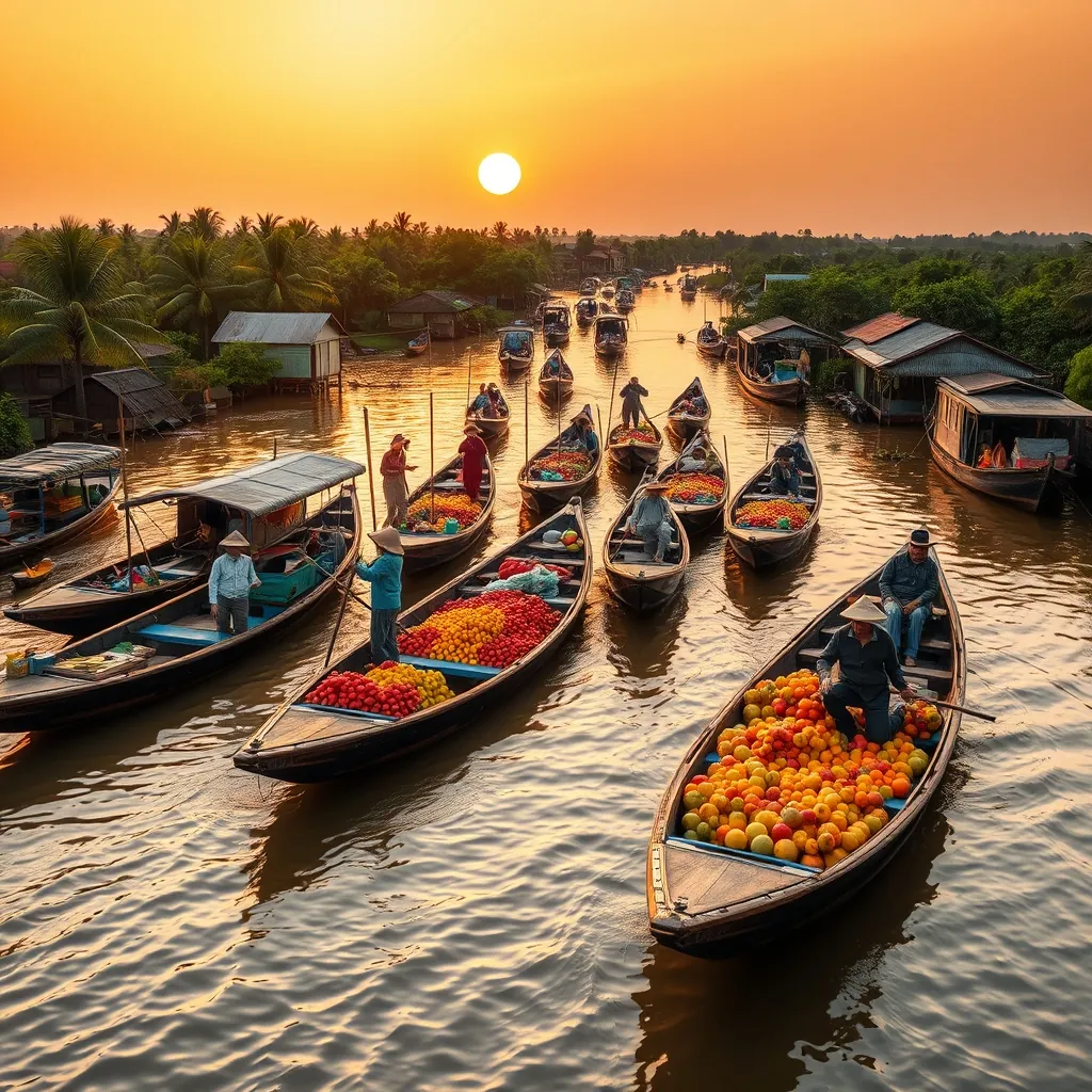
The Mekong Delta unfolds like a liquid tapestry across southern Vietnam. Nine branches of the mighty Mekong River fan out across more than 40,000 square kilometers of flat, fertile land, creating a region where water defines every aspect of life. This is not a place you visit; it is a place you float through.
The delta produces more than half of Vietnam’s rice and a substantial share of its fruit, fish, and shrimp. The river deposits nutrient-rich silt across the floodplains, allowing farmers to harvest three rice crops per year. Orchards heavy with dragon fruit, rambutan, mangosteen, and durian line the waterways, their branches bending toward the brown water that sustains them.
Cai Rang: The Delta’s Most Famous Floating Market
Just outside Can Tho, the largest city in the delta, lies Cai Rang Floating Market. This is the quintessential floating market experience, the image that comes to mind when travelers think of the Mekong Delta. The market reaches its peak between 5:00 and 8:00 in the morning, when hundreds of boats converge on the confluence of the Can Tho and Hau rivers.
The market operates on a simple visual code. Each vendor attaches a sample of their goods to a tall wooden pole, called a cay beo, so buyers can identify what they sell from a distance. A pole topped with a pineapple signals a fruit boat. A pole with a pot of steaming noodles marks a floating pho vendor. The system allows business to proceed with remarkable efficiency across the crowded waterway.
Large wholesaler boats anchor at the center of the market, their hulls piled high with watermelons, pumpkins, and sacks of rice. Smaller boats weave between them, collecting goods for resale at smaller markets or delivering directly to restaurants and households. The transactions happen quickly, with goods passed from boat to boat by hand, money changing hands across gunwales, and negotiations conducted in the rapid, musical tones of the southern Vietnamese dialect.
Visitors should arrive early. By mid-morning, the market begins to disperse, and by noon, the river returns to its quieter rhythms. Most tours depart from Can Tho before sunrise, and the early start is worth the effort. The morning light over the river, with the mist rising from the water and the silhouettes of boats emerging from the haze, creates one of the most memorable scenes in all of Vietnam.
Beyond the Market: Everyday Life on the Water
The floating markets are the most famous expression of delta life, but they are only one part of a complex aquatic world. The region’s transportation network runs on water. Children travel to school by boat. Farmers transport their harvests by boat. Families live in houses built on stilts above the riverbanks, their daily activities unfolding within arm’s reach of the water.
Visitors can experience this world through a variety of boat tours. Small wooden sampans, powered by quiet electric motors, navigate the narrow canals that thread through the orchards and villages. These excursions offer a more intimate view of delta life than the larger tourist boats that ply the main rivers. You will see women washing clothes on the riverbank, children waving from school boats, and fishermen casting nets from their small vessels.
The delta’s canals also support a thriving aquaculture industry. Fish farms, enclosed in bamboo cages beneath floating houses, raise catfish and other species for domestic consumption and export. The cages are visible from the water, their dark shapes barely discernible beneath the surface. The industry is a major economic driver for the region, though it has raised environmental concerns in recent years due to water pollution from concentrated fish waste.
Orchards and Village Life
Beyond the waterways, the delta’s islands and riverbanks support some of Vietnam’s most productive fruit-growing areas. The island of Cai Be, located in Tien Giang province, is particularly renowned for its orchards. Visitors can walk through gardens heavy with longan, pomelo, and star apple, sampling fruit directly from the trees.
Many orchard tours include stops at local workshops where traditional delta products are made. You might watch coconut candy being cooked in large woks, see rice paper being dried on bamboo racks, or observe the production of puffed rice, a local specialty. These small-scale operations offer a window into the craft traditions that persist alongside the region’s agricultural economy.
Village homestays provide the most immersive way to experience delta life. Many families along the river have opened their homes to travelers, offering simple accommodations, home-cooked meals, and the opportunity to participate in daily activities. Guests might help harvest fruit, feed fish in the aquaculture cages, or learn to cook regional specialties like ca kho to, a caramelized fish dish, or banh xeo, a crispy savory pancake.
These homestays also address a growing demand for sustainable tourism. By staying with local families and eating locally produced food, visitors direct their spending directly into the community. The delta faces significant economic pressures, including the effects of climate change and upstream dam construction on the Mekong River, and tourism revenue provides an increasingly important supplement to agricultural income.
Practical Guidance for Exploring the Delta
Can Tho serves as the most practical base for exploring the delta’s floating markets. The city offers a full range of accommodation options, from budget guesthouses to riverside resorts, and its location on the Hau River places it within easy reach of Cai Rang and the smaller Phong Dien market. Most visitors arrive by bus from Ho Chi Minh City, a journey of roughly three to four hours.
Day trips from Ho Chi Minh City are possible but rushed. The round trip consumes most of a day, leaving limited time on the water. A two or three night stay in the delta allows for a more relaxed pace, with time to explore the markets, visit the orchards, and experience the rhythm of river life. The delta rewards patience; the longer you stay, the more you see.
Consider combining a visit to the delta with a trip to Tra Su Cajuput Forest, a flooded forest reserve in An Giang province that attracts a remarkable variety of birdlife. The forest, covered in cajuput trees and lotus blooms, is best explored by small boat, with a bird-watching tower offering panoramic views over the canopy. The reserve represents a different side of the delta, one where nature, not commerce, takes center stage.
The Mekong Delta faces an uncertain future. Rising sea levels, saltwater intrusion, and the construction of dams upstream on the Mekong River all threaten the region’s ecological balance and agricultural productivity. The delta is one of the most climate-vulnerable regions on earth, and its challenges are intensifying.
Yet the delta endures, as it has for centuries. The markets still gather at dawn. The orchards still bear fruit. The boats still move along the waterways, carrying goods and people and stories from one village to the next. To visit the Mekong Delta is to witness a way of life that has adapted to the water for generations, and to understand the deep connection between the river and the people who call its banks home.
39. Phu Quoc Island: Tropical Paradise
Phu Quoc sits in the Gulf of Thailand, closer to Cambodia than to the Vietnamese mainland. At 574 square kilometers, it is Vietnam’s largest island, a teardrop of tropical forest and white sand that has become the country’s most ambitious beach destination. The island has transformed rapidly in recent years, yet it still offers stretches of coastline that feel genuinely wild.
The island’s west coast is where most visitors gather. Long Beach, known locally as Bai Truong, runs for nearly 20 kilometers along the southwestern shore, its gentle slope and calm waters making it ideal for swimming. The beach faces directly toward the sunset, and the evening light draws crowds to the sand for one of the most reliable rituals on the island: watching the sun drop below the Gulf of Thailand.
The National Park and the Island’s Interior
Beyond the beaches, Phu Quoc’s interior remains largely forested. The Phu Quoc National Park covers more than half of the island, protecting a tropical forest ecosystem that shelters several endemic species. The most famous resident is the Phu Quoc ridgeback, a rare dog breed distinguished by a ridge of hair running along its spine in the opposite direction of its coat. The breed is one of only three ridgeback varieties in the world, and the islanders have bred them for generations as hunting dogs.
Several trekking routes wind through the park, ranging from short walks to full-day hikes. The most rewarding is the climb to Mount Chua, the island’s highest peak at 603 meters. The trail passes through dense secondary forest, past vines thick as arms and trees festooned with orchids, before opening onto a summit view that takes in the island’s green interior and the blue expanse of the gulf beyond. The hike requires reasonable fitness and sturdy shoes, but the reward justifies the effort.
The park also protects a significant area of mangrove forest along the island’s eastern coast. These mangroves serve as critical nursery grounds for fish and crustaceans, and they provide habitat for the dugong, a shy marine mammal that grazes on seagrass beds in the surrounding waters. Dugong sightings are rare, but the seagrass meadows that sustain them are protected within the park’s boundaries.
Beaches Beyond the Crowds
While Long Beach draws the crowds, the island’s other beaches reward those who venture further. Sao Beach, on the southeastern coast, is widely regarded as the island’s most beautiful stretch of sand. The beach faces east, so the water is calmest in the morning, and the sand here is exceptionally fine and white, composed of crushed coral and shell that gives it a soft, powdery texture.
On the northern end of the island, Bai Dai Beach stretches for miles with barely a soul in sight. This is the island as it was before the resorts arrived: empty sand, coconut palms leaning over the shore, and water in shades of turquoise that shift to deep blue as the bottom drops away. The beach is exposed to the open gulf, so the water can be rougher than on the sheltered western coast, but the solitude more than compensates.
The island’s smaller beaches, like Bai Thom and Bai Vong, offer quiet anchorages where local fishing boats pull up at midday and families spread picnic blankets under the trees. These beaches rarely appear in guidebooks, and they remain the domain of islanders rather than tourists. A motorbike is the best way to reach them, and the island’s roads, while not always smoothly paved, are generally in good enough condition for two-wheeled exploration.
Diving, Snorkeling, and the Marine World
The waters around Phu Quoc support a healthy coral reef system, particularly around the small islands that cluster off the southern coast. The An Thoi archipelago, a group of 15 islands and islets, offers the island’s best snorkeling and diving. The reefs here are home to a colorful array of marine life, including clownfish, parrotfish, moray eels, and occasional sea turtles.
Dive operators run trips from the main town of Duong Dong to the archipelago, with most excursions including two or three snorkel stops and a beach lunch. Visibility varies with the season, ranging from 5 to 15 meters, and the water temperature stays warm enough for comfortable swimming year-round. The reefs show signs of stress from rising water temperatures and increased boat traffic, but they remain among the healthiest in Vietnamese waters.
For those who prefer to stay dry, glass-bottom boat tours offer a window into the underwater world without getting wet. These tours are particularly popular with families, and they provide a gentle introduction to the island’s marine environment.
The Night Market and Local Flavors
As the sun sets, the island’s culinary scene comes alive. The Phu Quoc Night Market in Duong Dong is the island’s gastronomic heart, a warren of stalls selling everything from fresh seafood to local sweets. The market is at its liveliest between 6:00 and 9:00 in the evening, when the narrow lanes fill with the smoke of charcoal grills and the chatter of diners.
Seafood dominates the market’s offerings. Grilled squid, butter-basted lobster, and whole fish cooked over open flames are the headline attractions, with vendors calling out their prices and beckoning passersby to their tables. The island’s signature product, however, is fish sauce. Phu Quoc’s fish sauce has been produced for over a century, made from anchovies fermented in wooden barrels for up to a year. The sauce is so highly regarded that it received protected geographical indication status from the European Union in 2012, the first Vietnamese product to receive the designation.
Visitors can tour the fish sauce factories on the island’s eastern side, where rows of massive wooden barrels sit in open-air warehouses, their contents slowly transforming under the tropical sun. The tours are brief and functional, but they offer insight into an industry that has defined the island’s economy for generations.
The island also produces a distinctive black pepper, grown on small farms in the interior. The pepper vines climb tall poles, their clusters of green berries ripening to red before being harvested and dried to black. The pepper is more aromatic than most commercial varieties, with a complex, citrusy note that reflects the island’s volcanic soil. Visitors can buy it directly from the farms at prices well below those in the mainland markets.
Getting There and Getting Around
Phu Quoc International Airport receives direct flights from Hanoi, Ho Chi Minh City, and several Asian cities, including Singapore, Bangkok, and Kuala Lumpur. The flight from Ho Chi Minh City takes about an hour, making the island an easy addition to any Vietnam itinerary. Ferries also connect the island to the mainland port of Rach Gia, with the crossing taking about two and a half hours.
Once on the island, a motorbike offers the greatest flexibility. Rental shops line the streets of Duong Dong, and the island’s main roads are well maintained. Taxis are plentiful and reasonably priced, and ride-hailing apps operate on the island. For those who prefer not to drive, organized tours cover the island’s main attractions in a single day, though the pace can feel rushed.
The island’s rapid development has brought new resorts, golf courses, and even a safari park, transforming Phu Quoc from a backpacker outpost into a full-service destination. The construction has not been without controversy; environmental groups have raised concerns about the impact of large-scale development on the island’s forests and reefs. Visitors can minimize their footprint by choosing smaller, locally owned accommodations, eating at family-run restaurants, and booking tours with operators who respect the marine environment.
Phu Quoc rewards those who look beyond the resort pools and find the island’s quieter corners. The empty beaches of the north, the forest trails of the interior, and the simple pleasure of watching a fishing boat return at dusk with its catch still glistening, these are the experiences that linger. The island has grown up fast, but its wild heart still beats beneath the surface.
40. Con Dao Islands: Pristine Beaches and History
Sixteen islands scattered across the South China Sea, the Con Dao archipelago sits roughly 230 kilometers off the southern coast of Vietnam. This is a place of profound contrasts. The beaches rank among the most pristine in Southeast Asia, with powder-soft sand and water so clear it appears liquid turquoise. Yet the islands carry a heavy history. For over a century, they served as a prison system that held generations of political prisoners under brutal conditions.
The largest island, Con Son, anchors the archipelago. It is a place where jungle-covered mountains rise directly from the sea, where sea turtles nest on protected beaches, and where the infrastructure remains deliberately modest. The Vietnamese government has restricted development here, preserving the islands as a national park and a site of historical memory. The result is a destination that feels suspended in time, far removed from the resort culture of Phu Quoc or Nha Trang.
The Prison System and Its Legacy
The French colonial administration established the first prison on Con Son in 1862. The island’s isolation made it an ideal location for exiling political dissidents, and the prison system expanded over the following decades. The most notorious facility, Phu Hai Prison, opened in 1862 and operated continuously until 1975. Its walls contain some of the darkest chapters of Vietnam’s modern history.
The prison complex includes the infamous “tiger cages,” which were added by the South Vietnamese government in the 1960s. These were underground cells with barred roofs, where prisoners were held in cramped conditions and subjected to systematic abuse. The cages were hidden from international observers until 1970, when two American journalists, Don Luce and Gloria Emerson, documented their existence with photographs that sparked global outrage.
Visitors today can walk through the prison grounds, now preserved as a museum. The cells remain largely as they were, with rusted bars, cramped dimensions, and the oppressive weight of history pressing down on every corridor. The museum also displays photographs, documents, and personal effects of former prisoners, offering a sobering counterpoint to the island’s natural beauty. It is a necessary visit, one that grounds the archipelago’s serene landscapes in the reality of human suffering and resilience.
The prison system extended beyond the main compound. The Hang Duong Cemetery on Con Son holds the graves of thousands of prisoners who died on the islands. Among them is Vo Thi Sau, a young revolutionary who was executed in 1952 at the age of 19. Her grave has become a pilgrimage site, and visitors often leave incense and flowers at the simple stone marker. The cemetery is a place of quiet reflection, its rows of headstones stretching beneath the shade of ancient trees.
Beaches That Rival Any in Vietnam
The archipelago’s beaches have earned international recognition. Dam Trau Beach, located on the northern tip of Con Son, is the most accessible and arguably the most beautiful. The sand is fine and white, the water shallow and warm, and the beach is backed by a fringe of casuarina trees that provide natural shade. The beach faces east, catching the morning light in a way that makes the water glow with shades of jade and sapphire.
Further south, An Hai Beach offers a more sheltered swimming experience. The beach sits within a small bay protected by headlands, keeping the water calm even when the open sea is rough. The beach is popular with local families on weekends, but on weekdays it is often nearly empty, offering a sense of solitude that has become increasingly rare in Vietnam’s coastal destinations.
The smaller islands in the archipelago hold even more remote beaches. Bay Canh Island, a short boat ride from Con Son, is home to some of the region’s most important sea turtle nesting sites. Between May and October, green turtles and hawksbill turtles come ashore at night to lay their eggs in the sand. The park service runs conservation programs that protect the nests, and visitors can participate in guided night patrols during the nesting season, an experience that few other destinations in Vietnam can offer.
Diving and the Marine Environment
The waters around Con Dao support a rich marine ecosystem, protected within the boundaries of the Con Dao National Park. The park covers more than 14,000 hectares of sea, including extensive coral reefs that remain in remarkably good condition. The reefs here are home to over 200 species of hard coral and more than 1,300 species of marine fish, including several that are found nowhere else in Vietnamese waters.
Diving conditions are best between February and July, when visibility can reach 20 meters or more. The dive sites are scattered around the smaller islands, with walls, drop-offs, and coral gardens that attract a diverse range of marine life. Divers regularly encounter barracuda, trevally, and schools of fusiliers, while lucky visitors may spot manta rays or whale sharks during the plankton-rich months.
Snorkeling requires less commitment and offers its own rewards. The shallow reefs near Bai Nhat Beach and around the small islets off Con Son’s eastern coast are accessible from shore or by short boat trips. The coral here is dense and healthy, with clownfish darting among anemones and parrotfish grazing on the reef surface. The water is warm year-round, and even beginners can explore the reefs comfortably.
The park’s management has implemented strict regulations to protect the marine environment. Fishing is prohibited within the park boundaries, and dive operators must follow guidelines that limit the number of visitors at each site. These measures have helped maintain the reefs’ health, a testament to the value of conservation in a region where unchecked tourism has damaged ecosystems elsewhere.
Getting There and Practical Considerations
Con Dao is accessible by air and by sea. Con Dao Airport receives daily flights from Ho Chi Minh City, with the flight taking approximately 50 minutes. The airport is small, and flights are operated by Vietnam Airlines and Bamboo Airways. During peak season, tickets sell out well in advance, so booking early is essential.
Ferries also connect Con Son to the mainland port of Soc Trang, but the crossing takes over 12 hours and can be rough in poor weather. Most visitors choose to fly, despite the higher cost, to maximize their time on the islands. Once on Con Son, the island is small enough to explore by motorbike, and rental shops are available near the main town. Taxis are limited, so arranging transport in advance is advisable.
Accommodation on Con Son ranges from simple guesthouses to a few mid-range hotels. The island has no large resorts, and the government has imposed restrictions on new construction to preserve the archipelago’s character. This means that even the most comfortable options are modest by international standards, but the trade-off is a destination that retains its authentic, unspoiled atmosphere.
The best time to visit Con Dao is between November and April, when the weather is dry and the seas are calm. From May to October, the southwest monsoon brings rain and rougher conditions, though the turtle nesting season during these months offers a unique draw. The island’s isolation means that even during peak season, the beaches and trails rarely feel crowded, a luxury that has largely disappeared from Vietnam’s more accessible destinations.
Con Dao demands more effort to reach than most of Vietnam’s beach destinations. The reward is an archipelago where history and nature coexist in a fragile balance, where the scars of the past are preserved alongside some of the most beautiful coastline in the country. The islands ask visitors to engage with their complexity, to appreciate the beauty while acknowledging the suffering that came before. Few places in Vietnam offer such a profound and memorable experience.
41. Nha Trang: Beach Resort City
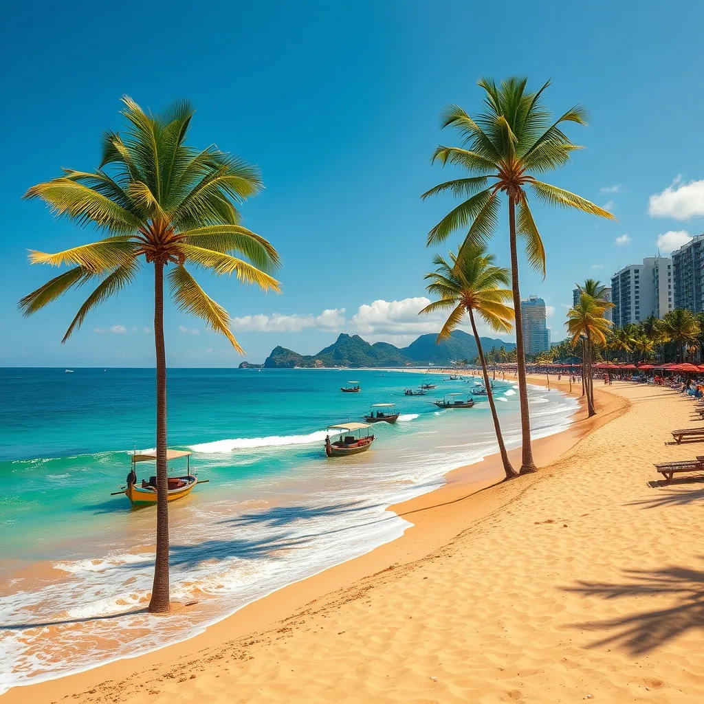
Nha Trang occupies a privileged position on Vietnam’s south-central coast. The city sits in a sweeping bay protected by a chain of offshore islands, creating calm waters and a remarkably consistent climate. The beach runs for over six kilometers along the city’s eastern edge, a broad sweep of golden sand that has anchored the city’s reputation as the country’s premier beach resort destination. For decades, this stretch of coastline has drawn both international visitors and Vietnamese families seeking sun, sea, and the energetic atmosphere of a purpose-built resort town.
The city’s appeal extends beyond its main beach. The bay contains 19 islands, many of which are reachable by short boat rides and offer their own beaches, snorkeling sites, and seafood restaurants. The surrounding province of Khanh Hoa adds further variety, with hot springs, mud baths, and rural landscapes that contrast with the urban energy of the city center. Nha Trang delivers the full resort package, and it does so with an efficiency that few other Vietnamese destinations can match.
The Main Beach and Promenade
Tran Phu Beach, the city’s main stretch of sand, runs parallel to the seafront promenade of the same name. The beach is wide, the sand is fine, and the water is generally calm thanks to the protective offshore islands. The city maintains the beach meticulously, with regular cleaning and landscaping along the promenade. Palm trees provide intermittent shade, and the beach is lined with restaurants, cafes, and bars that cater to a mix of tourists and locals.
The promenade itself is a social hub, especially in the early morning and late afternoon. Locals practice tai chi at dawn, joggers work along the paved path, and families gather on the sand as the sun begins to set. The beach is also the venue for regular events, including the annual Nha Trang Sea Festival, which brings music performances, street parades, and fireworks displays to the waterfront. The festival, held every two years, draws large crowds and transforms the promenade into a celebration of coastal culture.
The beach’s accessibility is one of its greatest strengths. Unlike many resort destinations where the beach is reserved for hotel guests, Nha Trang’s main beach is entirely public. Visitors can walk directly from the street onto the sand, and the city provides free public changing rooms and showers at several points along the promenade. This openness gives the beach a democratic character that is refreshing, and it means the sand is always alive with activity.
The Offshore Islands
The islands scattered across Nha Trang Bay are a major draw, and boat tours depart daily from the city’s port. Hon Mun Island is the most famous, protected as a marine park since 2001. The island’s name translates to “Ebony Island,” a reference to the dark rocks that form its coastline. The waters around Hon Mun support some of the best coral reefs in Vietnam, with over 350 species of hard coral recorded in the marine protected area. Snorkeling and diving trips bring visitors to the island’s sheltered coves, where the visibility can reach 15 meters and the reef life is abundant.
Hon Tam Island, also known as “Silk Island,” offers a more developed beach experience. The island is home to a resort that occupies much of the coastline, but day visitors are welcome to use the beach facilities for a fee. The sand here is finer than on the mainland, and the water is exceptionally clear. The island’s eastern side faces the open sea, while the western side is sheltered, offering different swimming conditions depending on the wind direction.
Hon Tre Island is the largest in the bay and hosts the massive VinWonders Nha Trang amusement park. The park includes a water park, an aquarium, a cable car that connects the island to the mainland, and a range of rides and attractions. For families, the park is a full-day destination in its own right. The cable car ride, which spans over three kilometers across the bay, offers spectacular views of the coastline and the islands, and it is worth the trip even for visitors who skip the park itself.
The smaller islands, including Hon Mieu and Hon Mot, are popular stops on the standard boat tour circuit. These tours typically include snorkeling, a seafood lunch on a floating platform, and time to relax on the small beaches. The tours are affordable and well-organized, making them the easiest way to experience the islands without arranging independent transport. The quality of the experience varies with the operator, so reading reviews and choosing a reputable company is worthwhile.
Mud Baths and Hot Springs
Nha Trang’s thermal springs and mud baths are a defining feature of the local wellness scene. The mineral-rich mud from the region’s hot springs is believed to have therapeutic properties, and the city has developed several facilities that combine mud baths, mineral pools, and spa treatments. Thap Ba Hot Spring Center, located about five kilometers north of the city center, is the most established of these facilities. Visitors can soak in warm mud baths, rinse off in mineral pools, and enjoy massage services in a garden setting.
The experience is more than a novelty. The mud is naturally heated to around 40 degrees Celsius, and the mineral content includes magnesium, calcium, and other elements that are said to benefit the skin and muscles. The process typically involves a 20-minute soak in the mud, followed by a thorough rinse and time in the mineral pools. The facilities are well-maintained, and the staff are experienced in guiding first-time visitors through the process.
I-Resort, another popular option, offers a more modern take on the thermal experience. The complex includes outdoor mineral pools, a waterfall area, and private mud bath rooms for couples or small groups. The setting is more landscaped than Thap Ba, with tropical gardens and wooden walkways creating a resort-like atmosphere. Both facilities are popular with Vietnamese tourists, and they offer a distinctly local experience that goes beyond the beach and the islands.
Nightlife and Dining
As the sun sets, Nha Trang shifts into a different gear. The city has the most developed nightlife on Vietnam’s central coast, with a concentration of bars, clubs, and live music venues along the beachfront and in the streets behind the promenade. Sailing Club Nha Trang, one of the city’s most iconic venues, sits directly on the beach and offers a relaxed bar scene during the day and a lively club atmosphere after dark. The venue hosts regular events, including fire shows and themed parties, and its beachfront location makes it a popular spot to watch the sunset with a drink in hand.
The dining scene in Nha Trang reflects the city’s coastal location. Seafood is the obvious specialty, and the city’s restaurants serve everything from simple grilled fish to elaborate multi-course feasts. The Cho Dam Market is the best place to sample local produce and street food, with vendors selling fresh seafood, tropical fruits, and regional specialties. The market is busiest in the morning, and visitors who arrive early can watch the daily catch being unloaded and prepared.
The city also has a growing international dining scene, with restaurants serving Korean, Japanese, Russian, and Western cuisine. The large Russian expatriate community has left a particular mark, and several restaurants offer authentic Russian dishes alongside Vietnamese classics. The result is a dining scene that feels cosmopolitan without losing its local character.
Practical Information
Nha Trang is well-connected and easy to navigate. Cam Ranh International Airport, located about 30 kilometers south of the city, receives domestic flights from Hanoi and Ho Chi Minh City, as well as international flights from several Asian cities. The airport is modern and efficient, and taxis and shuttle buses connect it to the city center in about 45 minutes. The main train station, Ga Nha Trang, sits on the Reunification Express line, making the city a convenient stop on a north-south rail journey.
The best time to visit Nha Trang is between January and September, when the weather is dry and the sea is calm. The hottest months are June through August, when temperatures regularly exceed 30 degrees Celsius and the sun is intense. From October to December, the northeast monsoon brings rain and rougher seas, though the city’s indoor attractions, including the mud baths and the amusement park, remain open throughout the year.
Accommodation in Nha Trang ranges from budget hostels to five-star resorts. The beachfront is lined with hotels at every price point, and the streets behind the promenade are filled with guesthouses and mid-range options. The city is compact enough to explore on foot, and motorbike rentals are widely available for those who want to venture further afield. The combination of accessibility, variety, and sheer energy makes Nha Trang a destination that rewards both first-time visitors and returning travelers.
42. Mui Ne: Sand Dunes and Coastal Breezes
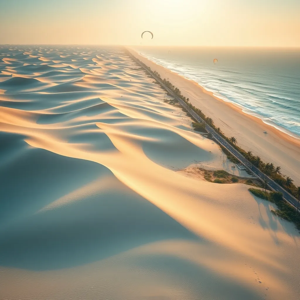
Mui Ne began as a quiet fishing village. It has since transformed into one of Vietnam’s most distinctive coastal destinations, yet it retains an atmosphere that feels entirely different from the resort polish of Nha Trang. The fishing village of Phan Thiet, the district’s administrative center, still operates along the shore, and the daily rhythm of boats departing and returning anchors the area in its maritime traditions. The landscape, however, is what sets Mui Ne apart. Nowhere else in Vietnam can you find desert-like sand dunes meeting a tropical coastline, and this unusual geography has turned the area into a magnet for photographers, adventure seekers, and travelers looking for something beyond the standard beach holiday.
The town of Mui Ne itself stretches along a single coastal road, with resorts and guesthouses lining the beach on one side and the dunes rising on the other. The strip is compact and walkable, and the relaxed pace of life here stands in contrast to the busier destinations further north. The area’s most famous attractions, the white dunes and the red dunes, lie a short drive from the town center, and they reward visitors who make the trip with landscapes that feel almost otherworldly.
The White Sand Dunes
The White Sand Dunes, known locally as Bau Trang, sit about 25 kilometers northeast of Mui Ne town. The name translates to “White Lake,” a reference to the small freshwater lakes that nestle among the dunes. The drive takes about 40 minutes by motorbike or taxi, and the road passes through rural landscapes of dragon fruit farms and cashew orchards before the sand begins to appear on the horizon.
The dunes themselves are vast, stretching for several kilometers and rising to heights of over 20 meters in places. The sand is fine and pale, almost white in the bright midday sun, and the wind constantly reshapes the surface into ripples and waves. The effect is mesmerizing, and the dunes feel less like a beach and more like a miniature desert dropped onto the Vietnamese coast. The freshwater lakes, shaded by casuarina pines, provide a striking contrast to the surrounding sand, and they attract a surprising variety of birdlife.
Visitors can explore the dunes on foot, but the most popular way to cover the terrain is by quad bike or on the back of a motorbike driven by a local guide. The quad bikes are available for rent at the entrance, and they offer a thrilling way to climb the steep slopes and descend into the valleys between the dunes. For a more traditional experience, the local guides who hang around the parking area offer rides on the back of their motorbikes, navigating the sand with practiced skill. The ride is exhilarating, and the guides know exactly where to stop for the best views.
The dunes are at their most spectacular at sunrise and sunset. The low angle of the light creates long shadows across the sand, and the colors shift from white to gold to pink as the sun moves. Sunset is the busier time, with visitors gathering on the highest ridges to watch the sun drop below the horizon. Sunrise is quieter, and the early morning light is arguably even more beautiful. The journey from Mui Ne takes about 40 minutes, so a sunrise visit requires an early start, but the reward is a landscape that feels almost entirely yours.
The Red Sand Dunes
The Red Sand Dunes, located just five kilometers from Mui Ne town, offer a different experience. The sand here has a distinct reddish-orange hue, the result of iron oxide in the soil, and the dunes are smaller than their white counterparts. They rise to perhaps 15 meters at their highest point, but the compact size makes them easy to explore on foot, and the color alone justifies the visit.
The red dunes are particularly popular with families and travelers who want a quick dose of the desert landscape without the longer journey to the white dunes. The sand is fine and soft, and children enjoy sliding down the slopes on plastic sleds that vendors rent for a small fee. The sleds are simple sheets of plastic, but they work surprisingly well on the smooth sand, and the activity has become a beloved tradition for Vietnamese tourists in particular.
The dunes also offer one of the area’s most photographed views. From the top of the highest ridge, the sand stretches toward the ocean, with the fishing village of Mui Ne visible in the distance. The contrast between the red sand, the blue sea, and the green vegetation of the coastal strip creates a composition that seems almost designed for a camera. The light is best in the late afternoon, when the red tones of the sand are most intense and the shadows add depth to the landscape.
Like the white dunes, the red dunes are best visited at sunrise or sunset. The sunset view from the top is particularly memorable, as the sun sinks into the sea and the sand glows with a warm, amber light. The dunes are free to enter, and the only costs are the optional sled rentals and parking fees. This accessibility makes them one of the most budget-friendly attractions on Vietnam’s entire coast.
The Fishing Village and Local Life
The Mui Ne fishing village remains the beating heart of the local community, despite the rapid development of the surrounding resort area. The village sits along the harbor, where hundreds of colorful wooden boats are moored in the shallow water. The boats are painted in bright blues, reds, and greens, and their reflections in the calm water create a scene that draws photographers from around the world.
The daily rhythm of the village follows the tide and the fishing cycle. Boats depart in the late afternoon and return in the early morning, and the most dramatic time to visit is at dawn, when the catch is being unloaded and the beach becomes a bustling marketplace. The fishermen haul their nets ashore, women sort the catch into baskets, and buyers negotiate prices on the sand. The scene is raw and authentic, a reminder that Mui Ne’s identity is rooted in the sea rather than in tourism.
The village is also famous for its basket boats, the round coracle-like vessels that are unique to Vietnam’s central coast. These woven boats, traditionally made from bamboo and waterproofed with resin, are used for fishing in the shallow waters close to shore. Visitors can take rides in the basket boats, and the experience offers a glimpse into a way of life that has remained largely unchanged for generations. The boatmen are skilled at maneuvering the round vessels, spinning them in circles and gliding across the water with surprising grace.
The seafood at the village is exceptional. Several restaurants line the harbor, serving the day’s catch simply grilled or steamed, with little more than salt, lime, and chili for seasoning. The restaurants are unpretentious, and the prices are far lower than at the tourist-oriented establishments along the main beach road. For travelers willing to venture away from the resort strip, the fishing village offers the most authentic dining experience in the Mui Ne area.
Kite Surfing and Water Sports
Mui Ne has earned a global reputation as one of Asia’s premier kite surfing destinations. The combination of consistent winds, shallow water, and a long stretch of open beach creates ideal conditions for the sport, and the season runs from November to March, when the northeast monsoon brings steady onshore breezes. During this period, the sky above Mui Ne fills with colorful kites, and the beach becomes a launch pad for riders of all skill levels.
The main kite surfing area stretches along the beach in front of the resort strip, with the most popular launch points near the southern end of the bay. The water here is shallow for several hundred meters, which provides a forgiving surface for beginners learning to control their kites. The wind is consistent and predictable, typically blowing at 15 to 25 knots during the peak season, and the waves are small enough to keep the conditions manageable.
Several kite schools operate along the beach, offering lessons for beginners and rental equipment for experienced riders. A typical beginner course covers the basics of kite control, safety procedures, and body dragging before progressing to board work. The lessons are structured and professional, and the instructors are certified by international kiteboarding organizations. For experienced riders, the rental shops offer a range of kite sizes and board types, and the staff can provide advice on the day’s conditions.
The kite surfing community in Mui Ne is international and welcoming. Visitors from Europe, Australia, and North America mix with Vietnamese riders, and the beachfront bars and cafes serve as informal gathering spots where riders share stories and advice. The atmosphere is relaxed and friendly, and even non-riders enjoy watching the colorful kites dance across the sky. The spectacle alone is worth the trip, and the sport has become so central to Mui Ne’s identity that the town’s tourism marketing now features kite surfers prominently.
Beyond kite surfing, the area offers other water sports and activities. Stand-up paddleboarding is available from several beachfront operators, and the calm morning waters are ideal for a gentle paddle along the coast. Jet skiing and parasailing are also on offer, and the fishing village organizes boat trips for those who want to explore the coastline from the water. The range of activities ensures that Mui Ne appeals to more than just the kite surfing crowd.
Practical Information
Mui Ne is located in Binh Thuan Province, about 200 kilometers northeast of Ho Chi Minh City. The most common way to reach the area is by bus from Ho Chi Minh City, with the journey taking approximately five hours. Several bus companies operate daily services, and the sleeper buses are comfortable enough for the trip. Alternatively, travelers can take the train to Phan Thiet station and then a short taxi ride to Mui Ne, a journey that takes slightly longer but offers more scenic views along the coast.
The best time to visit Mui Ne is from November to April, when the weather is dry and the winds are at their strongest. This period offers the best conditions for kite surfing and the most comfortable temperatures for exploring the dunes. From May to October, the weather is hotter and more humid, with occasional rain showers, but the area remains visitable and the resorts offer lower rates during the off-season.
Accommodation in Mui Ne ranges from budget guesthouses to mid-range resorts, with a few luxury options along the beachfront. The resort strip is concentrated along the main road, and most properties offer direct beach access or are within a short walk of the sand. The town is easy to navigate on foot, and motorbike rentals are available for those who want to explore the dunes and the surrounding countryside independently. The combination of unique landscapes, authentic local culture, and world-class water sports makes Mui Ne a destination that rewards both short visits and extended stays.
43. Da Lat: The City of Eternal Spring
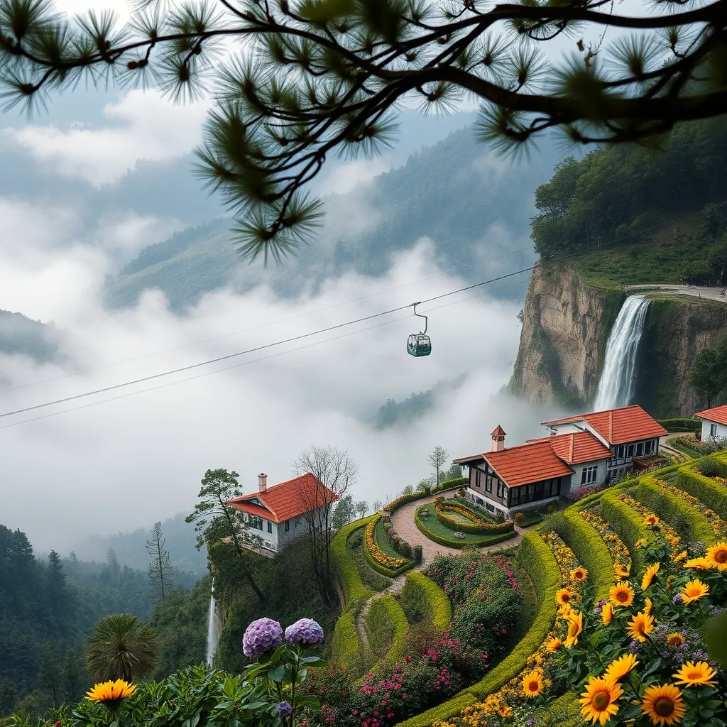
Da Lat sits 1,500 meters above sea level in the Central Highlands, and that altitude changes everything. The city enjoys a temperate climate that rarely exceeds 25 degrees Celsius, even at the height of summer. The air is cool and crisp, the mornings often begin with a light mist, and the afternoons may bring a brief shower that freshens the pine-scented air. This is Vietnam’s most un-Vietnamese city, a place where French colonial architects once built alpine villas and where the surrounding hills are blanketed with flowers, coffee plantations, and vegetable farms.
The city was developed as a hill station by the French in the early 20th century. They chose the location for its cool climate, a relief from the tropical heat of the lowlands, and they built a town that resembled the alpine resorts of their homeland. The legacy remains visible throughout Da Lat. Grand villas with steep roofs and shuttered windows line the winding streets, and the city’s central lake, Xuan Huong, is ringed by pine trees and walking paths that could easily belong to a Swiss lakeside town. The French influence, combined with the natural beauty of the surrounding highlands, has made Da Lat a favorite destination for Vietnamese honeymooners, domestic tourists, and international travelers seeking a different side of Vietnam.
The Cool Climate and Its Appeal
The climate is Da Lat’s defining feature. Temperatures average between 15 and 24 degrees Celsius year-round, with the coolest months falling between November and March. The dry season runs from December to March, offering clear skies and comfortable days, while the wet season from May to October brings frequent but short-lived showers. Even during the wettest months, the rain rarely lasts all day, and the cool temperatures make outdoor exploration pleasant throughout the year.
The cool air has practical benefits beyond comfort. Da Lat is the center of Vietnam’s flower industry, and the temperate climate allows for the cultivation of flowers that cannot grow in the tropical lowlands. Hydrangeas, roses, sunflowers, and orchids thrive in the cool highland air, and the surrounding countryside is a patchwork of flower farms and vegetable gardens. The city supplies much of Vietnam’s fresh produce, and the local markets overflow with strawberries, avocados, artichokes, and a remarkable variety of flowers. Visitors can tour the flower farms, pick strawberries at local gardens, and sample the region’s famous artichoke tea.
The climate also shapes the city’s rhythm. Mornings are cool and often misty, making them ideal for exploring the lakeside paths and the flower gardens. Afternoons may bring a passing shower, a natural cue to duck into a cafe or visit one of the city’s museums. Evenings are cool enough for a light jacket, and the city’s restaurants and bars are often filled with travelers and locals alike enjoying the comfortable night air.
French Colonial Architecture
Da Lat’s French colonial heritage is one of its greatest draws. The city is home to hundreds of villas built between the 1920s and 1940s, and many have been beautifully preserved. The villas are characterized by their steep pitched roofs, wooden balconies, and ornate facades, and they are scattered throughout the city, often hidden among pine trees and flower gardens.
The most famous example is the Bao Dai Summer Palace, the former residence of Vietnam’s last emperor. The palace is a striking example of French Art Deco architecture, with a clean white facade and spacious interiors that have been preserved with their original furnishings. Visitors can wander through the reception rooms, the private quarters, and the emperor’s study, gaining a glimpse into the life of Vietnam’s royal family during the mid-20th century. The palace is set on a hill overlooking the city, and the surrounding gardens offer panoramic views of the pine-covered hills.
Another notable example is the Da Lat Railway Station, built in 1938 and considered one of the most beautiful railway stations in Southeast Asia. The station’s distinctive architecture combines French colonial style with local highland motifs, and its three gabled roofs are said to represent the three peaks of the Lang Biang mountain range. The station still operates a tourist train that runs to the nearby village of Trai Mat, and the journey offers a nostalgic glimpse into the region’s railway history.
The city’s villas are not all open to the public, but many have been converted into guesthouses, cafes, and restaurants. Staying in a renovated villa is one of the best ways to experience Da Lat’s colonial charm, and several properties offer comfortable rooms within walking distance of the city center. The combination of historic architecture, cool climate, and scenic surroundings makes Da Lat a destination that rewards slow exploration.
Waterfalls Around Da Lat
The highlands surrounding Da Lat are dotted with waterfalls, and several are easily accessible from the city center. The most famous is Datanla Waterfall, located just five kilometers from the city. The waterfall is reached by a steep path or a thrilling alpine coaster that descends through the forest to the base of the falls. The water cascades over mossy rocks into a deep pool, and the surrounding vegetation creates a cool, shaded atmosphere that is perfect for a refreshing break on a warm day.
Pongour Waterfall, about 50 kilometers south of Da Lat, is considered one of the most beautiful waterfalls in Vietnam. The falls are wide and tiered, with water flowing over a series of natural steps before plunging into a large pool below. The setting is dramatic, with the waterfall framed by dense forest and the surrounding hills. The best time to visit is during the rainy season, when the water volume is at its peak and the falls are at their most impressive.
Elephant Waterfall, located about 30 kilometers from the city, offers a different experience. The waterfall is named for the shape of a rock formation that resembles an elephant, and the falls themselves are powerful and dramatic. The path to the base of the falls is steep and can be slippery, but the reward is a close-up view of the water thundering into a deep gorge. The surrounding area is also home to a coffee plantation and a silk factory, making it a worthwhile stop for those interested in the region’s local industries.
For travelers who prefer to avoid the more touristy waterfalls, the Prenn Waterfall offers a quieter alternative. Located just 10 kilometers from the city, the falls are smaller but no less beautiful, and the surrounding pine forest provides a peaceful setting for a picnic or a short hike. The waterfall is also home to a cable car that offers panoramic views of the surrounding countryside.
Flower Gardens and Botanical Beauty
Da Lat’s flower gardens are among the city’s most beloved attractions. The Valley of Love, located about five kilometers from the city center, is a sprawling park filled with flower beds, ornamental gardens, and scenic viewpoints. The park is popular with couples, and its manicured lawns and colorful flower displays create a romantic atmosphere that has made it a favorite spot for wedding photos and honeymooners.
The Da Lat Flower Park, located near Xuan Huong Lake in the city center, is a more compact but equally beautiful option. The park features a rotating display of seasonal flowers, and the carefully curated beds showcase the region’s floral diversity. The park is free to enter and offers a pleasant stroll through the heart of the city, with views of the lake and the surrounding hills.
The Hydrangea Gardens on the outskirts of the city are a more recent addition to Da Lat’s floral attractions. These private farms have opened their gates to visitors, offering the chance to walk through fields of hydrangeas in shades of blue, purple, and pink. The flowers are at their peak from October to December, and the farms have become popular photo spots for both domestic and international visitors.
Beyond the formal gardens, the entire region is a botanical wonderland. The Lang Biang Mountain, located about 12 kilometers north of the city, offers hiking trails through pine forests and grasslands, with panoramic views from the summit. The mountain is sacred to the local K’Ho people, and the trek to the top is a rewarding way to experience the natural beauty of the highlands. The area is also home to a variety of endemic plant and animal species, making it a destination for nature lovers and birdwatchers.
Practical Information
Da Lat is located in Lam Dong Province, about 300 kilometers northeast of Ho Chi Minh City. The most convenient way to reach the city is by air, with daily flights from Hanoi and Ho Chi Minh City landing at Lien Khuong Airport, about 30 kilometers south of the city. Alternatively, travelers can take a bus from Ho Chi Minh City, with the journey taking approximately six to seven hours through the scenic highlands. The winding mountain roads can be challenging for those prone to motion sickness, but the views along the way are worth the discomfort.
The best time to visit Da Lat is from December to March, when the weather is dry and the temperatures are at their most comfortable. This period coincides with the peak flower season, and the city is at its most colorful. The wet season from May to October offers lower prices and fewer crowds, but visitors should be prepared for frequent rain showers and cooler temperatures.
Accommodation in Da Lat ranges from budget guesthouses to luxury resorts, with many options housed in renovated French villas. The city center is compact and walkable, and the main attractions are within easy reach. Motorbike rentals are available for those who want to explore the surrounding countryside, and organized tours can be arranged for visits to the more distant waterfalls and gardens. The combination of cool climate, colonial charm, and natural beauty makes Da Lat a destination that offers a refreshing change of pace from the rest of Vietnam.
44. Can Tho: The Heart of the Mekong Delta
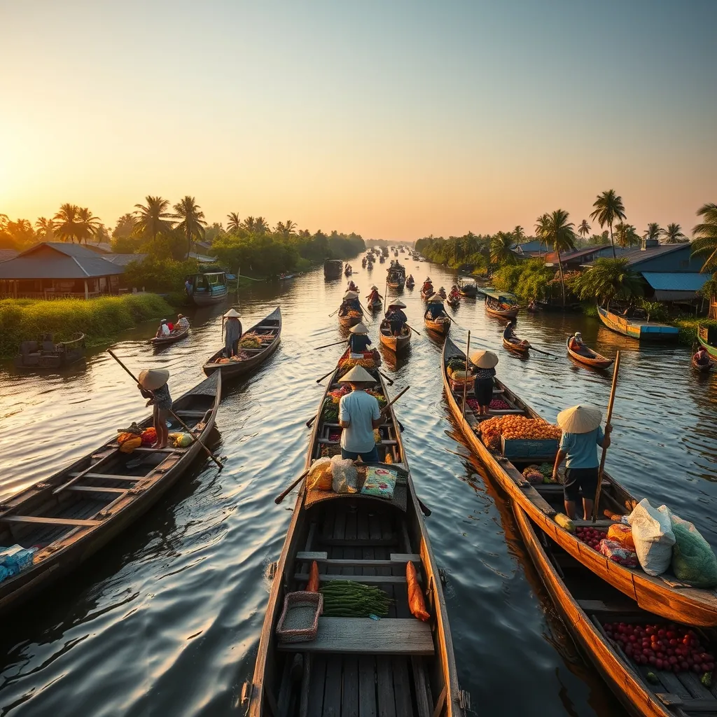
Can Tho is the largest city in the Mekong Delta, and it serves as the region’s commercial and cultural hub. The city sits on the southern bank of the Hau River, a branch of the mighty Mekong, and its identity is inseparable from the water. The river defines daily life here. Boats carry goods, people, and produce along the waterways, and the city’s most famous attractions are found not on land but on the water itself.
The city is often described as the gateway to the Mekong Delta, and for good reason. Can Tho is the most convenient base for exploring the region’s famous floating markets, orchards, and canal networks. The city itself is lively and modern, with a bustling waterfront promenade, a vibrant night market, and a growing selection of restaurants and cafes. But the true magic of Can Tho lies just beyond the city limits, where the river narrows into canals and the daily rhythm of delta life unfolds.
Cai Rang Floating Market: A Morning Spectacle
The Cai Rang Floating Market is the largest and most famous floating market in the Mekong Delta. It is located about six kilometers from Can Tho’s city center, and it operates at its peak in the early morning hours. The market begins to stir around 5 a.m., when the first boats arrive from the surrounding provinces. By 7 a.m., the river is crowded with hundreds of vessels, each laden with produce from the delta’s farms and orchards.
The market operates on a simple but effective system. Each boat displays its goods on a long pole, called a cay beo, which rises from the bow. A boat selling pineapples will hoist a pineapple on its pole; a boat selling watermelons will hoist a watermelon. Buyers can identify the merchandise from a distance and pull alongside to inspect the goods. This visual signaling system has been used for generations, and it remains the most efficient way to navigate the crowded marketplace.
The goods on offer reflect the agricultural wealth of the delta. The boats carry mangoes, bananas, pineapples, dragon fruit, rambutans, and a dozen other tropical fruits. Vegetables, rice, and flowers also make their way to the market, along with prepared foods such as noodle soups, coffee, and fresh fruit smoothies. Many of the larger boats serve as floating kitchens, offering breakfast to the traders and visitors who gather on the river each morning.
Visitors to Cai Rang should arrive early. The market is most active between 6 and 8 a.m., and by mid-morning, much of the trading has concluded. The best way to experience the market is by boat, and numerous operators in Can Tho offer early morning tours that include the journey from the city center to the market. The boat ride itself is a highlight, passing through narrow canals lined with stilt houses, fruit orchards, and riverside villages before emerging into the wide river where the market is held.
For those who prefer a more intimate experience, the smaller Phong Dien Floating Market offers a quieter alternative. Located about 20 kilometers from Can Tho, Phong Dien is smaller and less commercialized than Cai Rang. The market is frequented primarily by locals, and the goods are sold from smaller boats that navigate the narrow canals. Visitors can hire a small rowboat to explore the market and the surrounding waterways, gaining a more authentic glimpse into delta life.
The Riverside City: Can Tho’s Urban Charm
Can Tho’s city center is compact and walkable, and the waterfront is the natural starting point for any visit. The Ninh Kieu Wharf, located at the heart of the city, is a lively promenade that runs along the Hau River. The wharf is lined with statues, gardens, and shaded walkways, and it offers panoramic views of the river and the boats that ply its waters. In the evening, the wharf comes alive with street food vendors, souvenir stalls, and families enjoying the cool river breeze.
One of the most distinctive landmarks on the waterfront is the Can Tho Bridge, which spans the Hau River and connects the city to the surrounding provinces. The bridge is one of the longest cable-stayed bridges in Southeast Asia, and it is illuminated at night, creating a striking reflection on the water below. The bridge is best viewed from the wharf or from one of the river cruises that depart from the city center.
The city’s night market, located near the wharf, is a popular destination for food lovers. The market is a maze of stalls selling grilled seafood, noodle dishes, and local specialties such as banh xeo, a crispy Vietnamese pancake filled with pork and shrimp. The market is also a good place to sample the region’s famous fruit, which is fresher and more affordable here than in most other parts of Vietnam.
For a taste of the delta’s cultural heritage, the Ong Pagoda in the city center is worth a visit. The pagoda was built in the 19th century by the city’s Cantonese community, and it is dedicated to the goddess of mercy. The interior is richly decorated with intricate carvings, colorful ceramics, and ornate altars, and the pagoda remains an active place of worship for the local Chinese-Vietnamese community.
Exploring the Canals and Orchards
Beyond the city center, the Mekong Delta’s network of canals and waterways offers endless opportunities for exploration. The Con Son Islet, located just a short boat ride from Can Tho, is a peaceful island that is home to a small farming community. The island is crisscrossed by narrow paths that wind through fruit orchards, vegetable gardens, and fish farms. Visitors can walk or cycle through the island, stopping at local homes to sample fresh fruit and learn about traditional farming methods.
The My Khanh Tourist Village, located about 10 kilometers from the city, offers a more curated experience of delta life. The village features a traditional southern Vietnamese house, fruit orchards, and a network of canals that can be explored by rowboat. Visitors can participate in cooking classes, watch traditional music performances, and sample local specialties such as ca loc nuong trui, a grilled snakehead fish that is a regional delicacy.
The surrounding countryside is also home to numerous fruit orchards that welcome visitors during the harvest season. The delta is Vietnam’s fruit basket, producing mangoes, durians, rambutans, longans, and pomelos in abundance. Many orchards offer guided tours that include tastings, and some allow visitors to pick their own fruit. The best time to visit is during the peak harvest season, which runs from May to August, when the orchards are at their most productive.
For those who want to venture further afield, the Tra Su Cajuput Forest, located about 80 kilometers from Can Tho, offers a completely different landscape. The forest is a flooded cajuput tree reserve that is home to a remarkable variety of birdlife, including storks, herons, and egrets. Visitors can explore the forest by boat, gliding through narrow channels beneath the canopy of trees, and climb a watchtower for panoramic views of the flooded landscape. The forest is best visited during the wet season, from August to November, when the water levels are at their highest and the bird population is at its peak.
Practical Information
Can Tho is located about 170 kilometers southwest of Ho Chi Minh City, and it is the most accessible city in the Mekong Delta. The city has its own airport, with daily flights from Hanoi and Ho Chi Minh City, and it is also well connected by bus. The bus journey from Ho Chi Minh City takes approximately three to four hours, with frequent departures from the Mien Tay bus station. The journey is comfortable and offers views of the delta’s rice paddies and orchards along the way.
The best time to visit Can Tho is during the dry season, which runs from December to April. The weather is warm and sunny, and the river levels are lower, making it easier to navigate the canals and explore the orchards. The wet season, from May to November, brings higher water levels and more frequent rain, but it also brings the delta’s fruit harvest to its peak. The floating markets operate year-round, but the early morning hours are essential for experiencing them at their liveliest.
Accommodation in Can Tho ranges from budget guesthouses to riverside resorts. The city center is the most convenient base, with the wharf, night market, and main attractions within walking distance. Many hotels offer boat tours to the floating markets, and private boat charters can be arranged for those who prefer a more personalized experience. The combination of vibrant markets, scenic waterways, and warm local hospitality makes Can Tho an essential stop on any journey through the Mekong Delta.
45. Vung Tau: A Coastal City Near Saigon
Vung Tau sits on a narrow peninsula jutting into the South China Sea, just 125 kilometers southeast of Ho Chi Minh City. The city occupies a prime position on Vietnam’s southeastern coast, and its proximity to the country’s largest metropolis makes it the most accessible beach destination for travelers based in Saigon. The journey takes roughly two hours by bus, ferry, or hydrofoil, which means a day trip is entirely feasible, though the city rewards those who stay longer.
Vung Tau’s character is shaped by its dual identity. On one hand, it is a working port city, home to Vietnam’s offshore oil industry and a busy shipping harbor. On the other, it is a laid-back seaside resort, with wide beaches, seafood restaurants, and a promenade that fills with families and couples in the late afternoon. The combination gives the city an energy that pure resort towns often lack. The oil industry has brought a degree of prosperity, and the city’s waterfront is lined with modern hotels and apartment blocks. But the beaches remain the main draw, and the city’s relaxed coastal atmosphere prevails.
Beaches: Front Beach, Back Beach, and the In-Between
Vung Tau is unusual in that it has beaches on both sides of its peninsula. The two main beaches, Front Beach and Back Beach, offer distinctly different experiences, and the choice between them depends on what you are looking for.
Front Beach, known locally as Bai Truoc, faces the city center and the South China Sea to the west. The beach is narrow and the water is calm, protected by the headland that extends into the sea. The beach is backed by a wide promenade, the Bai Truoc Park, which is lined with statues, gardens, and shaded benches. This is the beach for strolling, not swimming. The water is shallow and the sand is a bit coarse, and the beach is more of a scenic backdrop than a swimming destination. In the evening, the promenade comes alive with families, street food vendors, and couples watching the sunset over the water.
Back Beach, or Bai Sau, is the main swimming beach. Located on the eastern side of the peninsula, facing the open sea, the beach is wide and the sand is fine and golden. The water is clean and the waves are gentle, making it suitable for families with children. The beach stretches for several kilometers, and it is lined with resorts, restaurants, and beachside cafes. The atmosphere is lively, especially on weekends, when the beach fills with locals from Ho Chi Minh City escaping the urban heat. Umbrellas and loungers are available for rent, and the beach is well maintained with showers and changing facilities.
A third option, Pineapple Beach, known locally as Bai Dau, is located at the northern tip of the peninsula, near the ferry terminal. The beach is smaller and quieter than Back Beach, and it offers views of the mountains that rise behind the city. The water is calm and the sand is soft, and the beach is a good choice for those who prefer a more relaxed setting. The beach is also the starting point for hikes up the nearby mountains, which offer panoramic views of the coastline.
The Jesus Christ Statue: A Landmark of Faith and Views
The most iconic landmark in Vung Tau is the Jesus Christ Statue, which stands on the summit of a small hill called Nui Nho, or Small Mountain. The statue, which was completed in 1994, stands 32 meters tall, and with its pedestal, it reaches a total height of 40 meters. The statue’s arms are outstretched in a gesture of blessing, and it is one of the largest statues of Jesus Christ in the world. The statue is visible from much of the city, and it serves as a navigational landmark for ships approaching the port.
Reaching the statue requires a climb. The hill is accessible by a long staircase that winds up from the base, with over 800 steps to the summit. The climb is steep but manageable, and the path is shaded by trees for much of the way. The effort is rewarded with sweeping views of the city, the coastline, and the South China Sea. From the summit, visitors can see the entire peninsula, from the port in the north to the beaches in the south, and on a clear day, the distant islands of the Con Dao archipelago are visible on the horizon.
The statue itself is hollow, and visitors can climb a narrow spiral staircase inside the structure to reach the arms. The climb is not for the claustrophobic, as the passage is tight and dark, but those who make it are rewarded with a unique perspective from the statue’s outstretched arms. The openings at the wrists provide framed views of the city and the sea below. The statue is a popular pilgrimage site for Vietnamese Catholics, and the hill is also home to a small chapel and a series of stations of the cross.
Seafood: The City’s Culinary Heart
Vung Tau’s location on the coast means that seafood is the star of the local cuisine. The city’s fishing fleet brings in a daily catch, and the seafood is served fresh at dozens of restaurants along the waterfront and in the city center. The most popular way to enjoy the catch is at one of the seafood markets, where visitors can select live crabs, prawns, clams, and fish, and have them prepared to order at nearby restaurants.
The Vung Tau seafood market, located near the port, is the best place to experience this. The market is a bustling scene of tanks and buckets filled with live seafood, and the vendors are happy to explain the different species and their preparation methods. The market is busiest in the early morning, when the fishing boats return with their catch, and in the late afternoon, when the restaurants come to stock up. Visitors can buy seafood to take away, or they can choose their items and have them cooked at one of the small restaurants that surround the market.
Several local specialties are worth seeking out. The banh khot, a small savory pancake made with rice flour and topped with shrimp, is a Vung Tau signature. The pancakes are cooked in small molds, giving them a crispy edge and a soft center, and they are served with fresh herbs and a sweet and sour fish sauce. Another local favorite is lau ca, a hot pot made with fish, vegetables, and herbs, which is cooked at the table and shared among diners. The hot pot is a social dish, and it is a popular choice for groups.
For a more casual meal, the night market on the waterfront offers a wide range of street food. Grilled squid, skewered prawns, and fried spring rolls are among the most popular options, and the market is a good place to sample a variety of dishes in one sitting. The market is also a good place to try banh mi, the Vietnamese baguette sandwich, which is filled with a combination of meats, pickled vegetables, and fresh herbs.
Practical Information
Vung Tau is the easiest beach destination to reach from Ho Chi Minh City. The most convenient option is the hydrofoil, which departs from the Bach Dang wharf in District 1 and arrives in Vung Tau in about 90 minutes. The hydrofoil is fast and comfortable, with air conditioning and comfortable seating, and it offers views of the coastline along the way. The ferry is a slower but cheaper alternative, taking about two and a half hours, and it departs from the same wharf.
Buses also connect Ho Chi Minh City to Vung Tau, with departures from the Mien Dong bus station. The journey takes about two hours, and the buses are comfortable and air conditioned. For those who prefer to drive, the journey takes about two hours via the expressway, and the road passes through the industrial provinces of Dong Nai and Ba Ria-Vung Tau. The drive is straightforward, and the expressway is well maintained.
The best time to visit Vung Tau is during the dry season, which runs from November to April. The weather is warm and sunny, and the sea is calm, making it ideal for swimming and beach activities. The wet season, from May to October, brings more rain and higher humidity, but the beaches are less crowded and the seafood is just as fresh. The city is a popular weekend destination for locals, so the beaches and restaurants are busiest on Saturdays and Sundays. For a quieter experience, plan to visit during the week.
Accommodation in Vung Tau ranges from budget guesthouses to luxury resorts. The area around Back Beach has the widest selection of hotels, with many offering sea views and direct beach access. The city center is a good option for those who want to be close to the restaurants and the night market, while the area near the ferry terminal is convenient for day trips. The combination of accessible beaches, a distinctive landmark, and excellent seafood makes Vung Tau a rewarding stop on any journey through southern Vietnam.
46. Ben Tre: The Coconut Kingdom
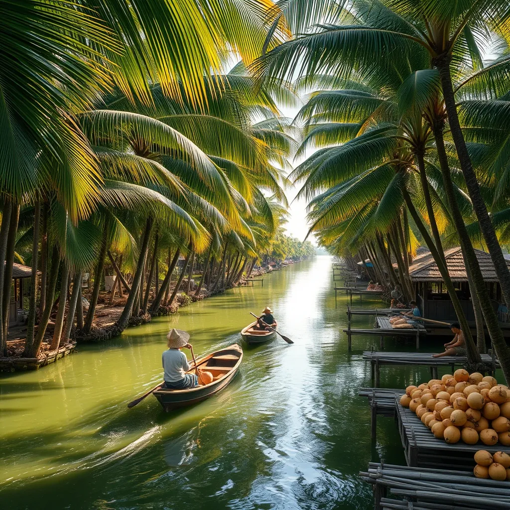
Ben Tre province spreads across the southern edge of the Mekong Delta, where the great river splits into a network of tributaries before reaching the sea. The province is known throughout Vietnam as the Coconut Kingdom, and for good reason. The province produces more coconuts than any other region in the country, and the palm trees that line the riverbanks and fill the countryside are the backbone of the local economy. The coconut is not just a crop here; it is woven into the fabric of daily life, appearing in the food, the crafts, and the very identity of the province.
The provincial capital, also called Ben Tre, sits on the banks of the Ben Tre River, a tributary of the mighty Mekong. The town itself is modest, with a riverside promenade, a bustling market, and a handful of colonial-era buildings. But the real appeal of Ben Tre lies in the countryside, where the coconut groves stretch as far as the eye can see and the river channels provide a network of waterways that connect the villages. This is the Mekong Delta at its most authentic, a landscape shaped by water and palms.
The Coconut Economy: From Fruit to Handicraft
The coconut is the lifeblood of Ben Tre. The province is home to over 40,000 hectares of coconut groves, and the industry employs a significant portion of the local population. The fruit is harvested year-round, and every part of the coconut is put to use. The meat is dried and processed into coconut milk, oil, and desiccated flakes. The husk is turned into coir, which is used for ropes, mats, and brushes. The shell is carved into bowls, spoons, and decorative items. And the leaves are woven into thatch for roofs and baskets.
Visitors can see this industry in action at the many coconut workshops scattered throughout the province. The workshops are small, family-run operations, and they offer a glimpse into the traditional methods of coconut processing. At a typical workshop, workers crack open coconuts by hand, scrape out the meat, and spread it on large trays to dry in the sun. The dried coconut is then pressed to extract the oil, or ground into a fine powder. The entire process is manual, and the workers move with the practiced efficiency of a lifetime of experience.
The most famous product of Ben Tre is coconut candy, a soft, chewy sweet made from coconut milk, sugar, and malt. The candy is cooked in large woks over open fires, then poured into molds and cut into bite-sized pieces. The candy is a popular souvenir, and visitors can watch the entire process at the many candy factories that line the river. The factories are open to visitors, and most offer free samples and the opportunity to purchase fresh candy at factory prices. The candy comes in a variety of flavors, including pandan, durian, and chocolate, but the original coconut flavor remains the most popular.
River Cruises: Exploring the Waterways
The best way to experience Ben Tre is from the water. The province is crisscrossed by a network of rivers and canals, and the waterways are the primary means of transport for many of the villages. A river cruise is the classic Ben Tre experience, and it offers a unique perspective on the coconut kingdom.
The typical cruise departs from Ben Tre town and heads into the countryside along the Ben Tre River. The river is wide and calm, and the banks are lined with coconut palms, water coconut trees, and the occasional stilt house. The cruise passes through small villages, where children wave from the riverbank and women wash clothes in the water. The pace is slow and relaxed, and the scenery is a constant reminder of the importance of the river to daily life.
At several points along the route, the cruise stops at riverside villages where visitors can experience the local way of life. The stops typically include a visit to a coconut candy factory, a honey farm, and a fruit orchard. The honey farm is a particular highlight, as it offers the chance to taste fresh honey and see the beehives up close. The fruit orchards are equally rewarding, with tropical fruits such as rambutan, mangosteen, and dragon fruit hanging from the trees.
The most memorable part of the cruise is the sampan ride through the narrow canals. The sampans are small, flat-bottomed wooden boats, and they are rowed by local women using a single oar. The canals are narrow, often just wide enough for a single boat, and they are shaded by the overhanging branches of the coconut palms. The water is still and dark, and the only sounds are the splash of the oar and the calls of the birds. The ride is a peaceful, meditative experience, and it is the highlight of any visit to Ben Tre.
Local Crafts: The Art of the Coconut
Beyond the candy and the oil, Ben Tre is also known for its coconut handicrafts. The artisans of the province have developed a range of skills for working with the coconut, and their products are sold throughout Vietnam and exported overseas.
The most common handicraft is coconut shell carving. The shells are hard and durable, and they are carved into a variety of items, including bowls, spoons, vases, and decorative ornaments. The carving is done by hand, using small chisels and knives, and the designs range from simple geometric patterns to intricate scenes of rural life. The finished products are polished to a smooth, glossy finish, and they make unique and attractive souvenirs.
Another local craft is coconut leaf weaving. The leaves are dried and then woven into a variety of items, including mats, baskets, hats, and even thatched roofing. The weaving is done by hand, and the finished products are both functional and beautiful. The mats are particularly popular, as they are durable and naturally resistant to moisture, making them ideal for use in the humid climate of the delta.
A more recent innovation is coconut button making. The shells are cut into small discs, which are then drilled and polished to create buttons. The buttons are used in the garment industry, and they are prized for their natural look and durability. The button factories are a fascinating place to visit, as they offer a glimpse into a modern industry that has grown out of a traditional craft.
The Local Cuisine: More Than Just Coconut Candy
The coconut is a key ingredient in the local cuisine, and it appears in a wide range of dishes. The most famous local specialty is banh xeo, a crispy savory pancake made with rice flour and coconut milk. The pancake is filled with shrimp, pork, and bean sprouts, and it is served with fresh herbs and a sweet and sour fish sauce. The coconut milk gives the pancake its distinctive flavor and its crispy texture.
Another local specialty is goi cuon, or fresh spring rolls. The rolls are made with rice paper, which is filled with shrimp, pork, herbs, and vermicelli noodles. The rolls are served with a peanut sauce, and they are a light and refreshing appetizer. The coconut is also used in desserts, such as che, a sweet soup made with coconut milk, beans, and fruit. The soup is served cold, and it is a popular way to cool down in the heat of the afternoon.
The Ben Tre market, located in the center of town, is the best place to sample the local cuisine. The market is a bustling scene of stalls selling fresh produce, cooked food, and household goods. The food stalls offer a wide range of dishes, from pho and banh mi to more local specialties. The market is busiest in the early morning, when the vendors are setting up their stalls and the locals are doing their daily shopping.
Practical Information
Ben Tre is easily accessible from Ho Chi Minh City. The most common route is to take a bus from the Mien Tay bus station, which takes about two and a half hours. The bus drops passengers in Ben Tre town, and from there, the river cruises depart from the main wharf. Alternatively, visitors can take a bus to My Tho, the capital of the neighboring Tien Giang province, and then take a ferry across the river to Ben Tre. The ferry is a short and scenic ride, and it offers views of the river and the coconut groves.
The best time to visit Ben Tre is during the dry season, which runs from December to May. The weather is warm and sunny, and the river levels are lower, which makes the canals more navigable. The wet season, from June to November, brings more rain, but the landscape is lush and green, and the fruit orchards are at their most productive.
Accommodation in Ben Tre is limited, but there are a few options. The town has a handful of small hotels and guesthouses, which are basic but comfortable. For a more immersive experience, visitors can stay at one of the homestays in the countryside. The homestays are family-run, and they offer the chance to experience rural life firsthand. Guests are typically served home-cooked meals, and they can participate in daily activities such as farming, fishing, and cooking. The homestays are a popular choice for travelers who want to get off the beaten path and experience the real Mekong Delta.
Ben Tre is a destination that rewards those who take their time. The province is not home to any grand monuments or spectacular natural wonders. Its appeal lies in its simplicity, its authenticity, and its deep connection to the coconut palm. The river cruises, the workshops, and the homestays all offer a glimpse into a way of life that has remained largely unchanged for generations. For travelers seeking a genuine experience of the Mekong Delta, Ben Tre is an essential stop.
47. Tra Su Cajuput Forest: A Birdwatcher’s Haven
Deep in the Mekong Delta, near the Cambodian border, lies a flooded forest unlike anything else in Vietnam. The Tra Su Cajuput Forest covers just over 800 hectares in An Giang province, and it represents one of the last remaining wetland ecosystems of its kind in the region. The forest is a seasonal floodplain, inundated by the Mekong River during the wet season, and it transforms into a lush, waterlogged wilderness that supports an extraordinary range of wildlife.
The forest takes its name from the cajuput tree, a species of paperbark that thrives in flooded conditions. The trees grow in dense stands, their slender trunks rising straight from the water, their canopies forming a continuous green ceiling. The water below is dark and still, stained by the tannins released from the decomposing leaves. The effect is both serene and slightly otherworldly, a quiet world of water and trees that feels far removed from the busy delta outside.
The Flooded Forest Ecosystem
Tra Su is not a natural forest in the strictest sense. The area was originally cleared for rice cultivation, but the land proved too flood-prone for reliable farming. In the 1980s, the area was reforested with cajuput trees, and the land was allowed to return to its natural wetland state. The result is a managed ecosystem that has become a vital habitat for a remarkable diversity of species.
The forest is home to over 140 species of birds, making it one of the premier birdwatching destinations in southern Vietnam. The bird population includes several species that are rare or endangered elsewhere in the country, including the spot-billed pelican, the painted stork, and the black-headed ibis. The forest also supports a significant population of herons, egrets, and cormorants, which nest in the cajuput trees in large numbers.
The bird population is at its most active during the dry season, from December to May, when the water levels recede and the fish become concentrated in the remaining pools. This is the best time for birdwatching, as the birds gather in large numbers to feed. The early morning hours are particularly rewarding, as the birds are most active at dawn and the light is at its best for photography.
Beyond the birds, the forest is also home to a variety of other wildlife. The water is teeming with fish, including several species that are unique to the Mekong basin. The forest also supports a population of water snakes, which are often seen swimming between the trees. Otters have been spotted in the deeper channels, and the forest is home to a number of bat species, which roost in the hollow trunks of the cajuput trees.
Exploring the Forest by Boat
The only way to explore the interior of Tra Su is by boat. The forest is crisscrossed by a network of narrow channels, and the waterways are the lifelines of the ecosystem. The boat tours depart from the visitor center, which is located at the edge of the forest, and they follow a fixed route through the heart of the wetland.
The boats are small, flat-bottomed vessels, powered by a small outboard motor. They are operated by local guides, who know the waterways intimately and can point out the various species of birds and other wildlife. The tours typically last about an hour, and they follow a circular route that takes in the highlights of the forest.
The first section of the tour passes through a wide, open channel, where the views are dominated by the dense stands of cajuput trees. The water here is covered in a thick layer of duckweed, a small aquatic plant that forms a green carpet across the surface. The duckweed is a vital part of the ecosystem, providing food and shelter for a variety of aquatic species, but it also creates a striking visual effect, turning the water into a solid green expanse.
As the boat moves deeper into the forest, the channels narrow and the canopy closes overhead. The light filters through the leaves, creating a dappled pattern on the water. The air is cool and still, and the only sounds are the hum of the motor and the calls of the birds. The atmosphere is peaceful and contemplative, and it is easy to lose track of time as the boat glides through the silent forest.
The tour includes a stop at a wooden observation tower, which rises several stories above the canopy. The climb to the top is steep, but the view is worth the effort. From the tower, visitors can see the entire forest stretching to the horizon, a vast expanse of green broken only by the winding channels and the occasional flash of white from a bird in flight. The tower is the best spot in the forest for birdwatching, as it offers a vantage point above the trees.
The Surrounding Area
Tra Su is located in the Tinh Bien district of An Giang province, an area that is home to a significant Khmer population. The region is known for its cultural diversity, and visitors can explore the nearby Khmer temples, which are distinct from the Vietnamese pagodas found elsewhere in the delta. The most notable of these is the Chua Xoi, or the Xoi Pagoda, which is located just a short drive from the forest.
The forest is also close to the Chau Doc area, which is a popular base for exploring the region. Chau Doc is located on the banks of the Hau River, a tributary of the Mekong, and it is known for its floating fish farms, its bustling market, and its proximity to the Cambodian border. The town is also home to the Sam Mountain, a low peak that offers panoramic views of the surrounding countryside and is home to several pagodas and shrines.
Many visitors combine a trip to Tra Su with a visit to the Chau Doc floating market, which is smaller and less touristy than the more famous Cai Rang market in Can Tho. The market is held on the river, with vendors selling their goods from boats, and it is a fascinating glimpse into the river-based economy of the delta.
Practical Information
Tra Su is accessible by road from Chau Doc, which is about 30 kilometers away. The most common way to reach the forest is by motorbike or taxi, and the journey takes about 45 minutes. The road passes through a landscape of rice paddies and sugar palm groves, and it offers a glimpse of rural life in the delta. Alternatively, visitors can take a bus from Chau Doc to Tinh Bien and then hire a motorbike taxi for the final leg to the forest.
The forest is open daily from early morning until late afternoon. The entrance fee is modest, and it includes the boat tour. The boat tours operate on a continuous basis, with boats departing as soon as they are full. During the peak season, from December to May, the forest can get busy, and it is advisable to arrive early to avoid the crowds and to catch the birds at their most active.
The best time to visit Tra Su is during the dry season, from December to May. The water levels are lower, which makes the channels more navigable and concentrates the fish, attracting larger numbers of birds. The wet season, from June to November, brings higher water levels, which can make some of the channels impassable. However, the forest is still worth visiting during the wet season, as the landscape is at its most lush and the bird population is still significant.
Visitors should come prepared for the conditions. The forest is hot and humid, and the boat tours offer little shade. Sunscreen, a hat, and insect repellent are essential. Binoculars are also recommended for birdwatching, as many of the species are shy and keep their distance. The forest has a small restaurant near the visitor center, which serves basic Vietnamese dishes, but visitors may prefer to bring their own food and water.
Tra Su Cajuput Forest is a reminder that the Mekong Delta is more than just rice paddies and floating markets. It is a region of surprising ecological diversity, and the forest is one of its most precious natural assets. The flooded forest is a haven for birds and a sanctuary for anyone seeking a moment of peace in the midst of the bustling delta. For nature lovers and birdwatchers, it is an essential stop on any journey through southern Vietnam.
48. Hon Khoi Salt Fields: A Unique Landscape
Most visitors to Nha Trang come for the beaches and the islands. Few realize that just 40 kilometers north of the city lies one of Vietnam’s most unusual landscapes. The Hon Khoi salt fields are a vast network of shallow evaporation ponds that stretch across the coastal plain of Khanh Hoa province, and they offer a glimpse into an industry that has shaped this region for generations.
The salt fields are not a natural wonder in the traditional sense. They are a working industrial landscape, a place where the sun, the sea, and human labor combine to produce one of the most essential commodities in the world. But there is a stark, minimalist beauty to the scene that has made it increasingly popular with photographers and travelers seeking something beyond the standard tourist trail.
The Salt Harvesting Process
The salt production at Hon Khoi follows a method that has remained largely unchanged for centuries. The process begins with the intake of seawater into a series of shallow ponds. The water is guided through a network of channels and gates, which allow the salt farmers to control the flow with precision.
The ponds are arranged in a graduated sequence. The seawater first enters the largest ponds, where it is allowed to sit and evaporate under the intense tropical sun. As the water level drops, it is transferred to progressively smaller and shallower ponds. Each transfer concentrates the brine further, increasing the salinity until the water is saturated with dissolved salt.
The final stage takes place in the crystallization ponds, where the brine is left to evaporate completely. As the water disappears, the salt begins to precipitate out of the solution, forming a crust on the surface of the pond. The crust grows thicker over several days, until it is ready for harvesting.
The harvesting season runs from January to August, when the weather is dry and sunny. The salt farmers work in the early morning and late afternoon, when the heat is less intense. They use wooden rakes to scrape the salt into small piles, which are then left to drain and dry before being collected.
The work is physically demanding. The salt farmers spend hours bent over in the shallow ponds, their legs submerged in the brine, their backs exposed to the sun. The brine is corrosive, and the workers wear protective clothing and rubber boots to protect their skin. Despite the hardships, the salt farming communities of Hon Khoi take pride in their craft, and the knowledge of the trade is passed down from parent to child.
The Landscape of the Salt Fields
The visual impact of the salt fields is striking. The ponds are arranged in a geometric grid, with narrow dikes separating the individual cells. The dikes are made of packed earth, and they are just wide enough for a single person to walk along. The effect is a patchwork of white and blue, the white of the salt crust contrasting with the blue of the water in the ponds that are still in the evaporation stage.
The color of the ponds changes throughout the harvesting cycle. Freshly flooded ponds have a clear, blue quality, reflecting the sky like mirrors. As the water evaporates, the color shifts to a pale green, and then to a milky white as the salt begins to crystallize. The most dramatic views come during the harvesting period, when the ponds are covered in a thick layer of brilliant white salt.
The salt fields are best photographed in the golden hours, shortly after sunrise or just before sunset. The low angle of the sun creates long shadows across the ponds, and the light brings out the texture of the salt crust. The reflections in the water are also at their most vivid during these times, creating a sense of symmetry and calm.
The surrounding landscape adds to the appeal. The salt fields are located on a flat coastal plain, with the Hon Khoi peninsula rising to the south and the distant mountains of the Truong Son range visible to the west. The contrast between the flat, white expanse of the salt fields and the rugged, green mountains is visually compelling.
The People of Hon Khoi
The salt fields are not just a landscape; they are a community. The salt farmers of Hon Khoi live in small villages scattered around the edge of the fields. Their homes are simple, single-story structures, built from concrete and corrugated metal, with large courtyards where the salt is stored before being transported to market.
The salt industry supports a network of related trades. There are the salt merchants, who buy the salt from the farmers and sell it to wholesalers. There are the transport workers, who load the salt onto trucks and boats for distribution across Vietnam. And there are the craftsmen, who maintain the wooden rakes and the other tools of the trade.
Visitors to the salt fields are often struck by the hospitality of the local people. The salt farmers are generally happy to talk about their work, and they are accustomed to visitors taking photographs. A small gesture of respect, such as a smile or a greeting in Vietnamese, goes a long way. Some farmers may even offer a taste of the freshly harvested salt, which has a clean, mineral flavor that is quite different from the processed table salt found in supermarkets.
Practical Information
Hon Khoi is located in Ninh Hoa district, about 40 kilometers north of Nha Trang. The most common way to reach the salt fields is by motorbike, and the journey takes about an hour along National Highway 1A. The road is well-maintained, and the drive offers views of the coastline and the surrounding countryside. Alternatively, visitors can hire a taxi or join a guided tour from Nha Trang.
The salt fields are best visited during the harvesting season, from January to August. The weather is driest and sunniest during this period, which means the salt is actively being produced and the fields are at their most photogenic. The wet season, from September to December, brings rain and cloud, which can make the salt production grind to a halt.
There is no entrance fee to visit the salt fields, as they are working land rather than a managed tourist attraction. Visitors are free to walk along the dikes and explore the ponds, but they should be respectful of the workers and the work in progress. Walking on the salt crust should be avoided, as it can damage the crystallization process.
Visitors should come prepared for the conditions. The salt fields offer no shade, and the sun can be intense. Sunscreen, a hat, and plenty of water are essential. The dikes are narrow and can be slippery, so sturdy footwear is recommended. Binoculars are not necessary, but a camera with a good zoom lens is useful for capturing the details of the landscape.
There are a few small restaurants in the nearby villages, which serve simple Vietnamese dishes. The local specialty is a dish called banh xeo, a crispy crepe filled with pork, shrimp, and bean sprouts, which is a popular lunch option for the salt workers. Visitors can also find fresh seafood in the coastal villages, which is caught daily by the local fishing boats.
The Hon Khoi salt fields offer a unique perspective on Vietnam, a country that is often celebrated for its natural beauty but less often recognized for its industrial landscapes. The salt fields are a testament to the ingenuity and hard work of the Vietnamese people, a place where the forces of nature are harnessed to produce something essential and beautiful. For travelers seeking to understand the real Vietnam, beyond the beaches and the tourist attractions, a visit to Hon Khoi is an unforgettable experience.
49. Binh Quoi Village: A Suburban Escape
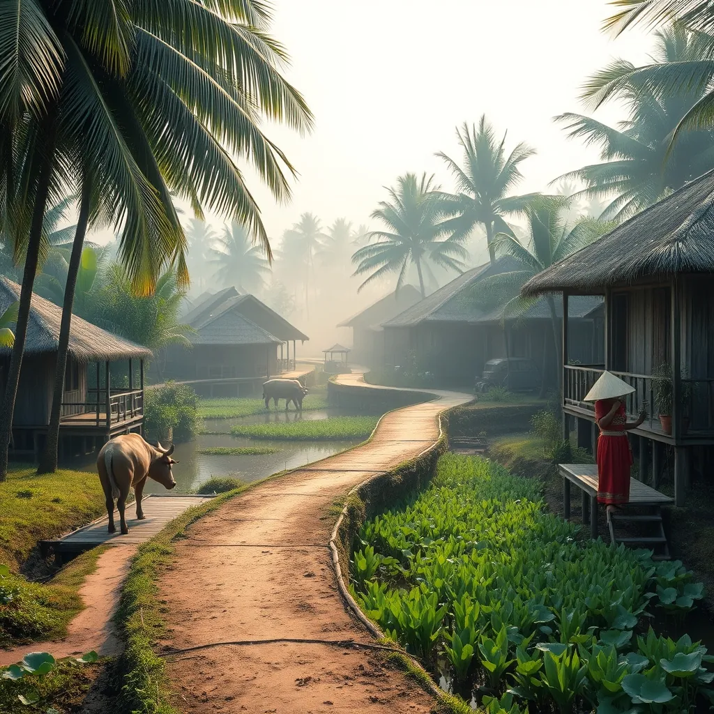
Just seven kilometers from the center of Ho Chi Minh City lies a place that feels decades removed from the urban rush. Binh Quoi Village is a carefully preserved slice of rural southern Vietnam, a pocket of traditional life that offers visitors a chance to experience the rhythms of the countryside without leaving the city limits.
The village sits on the banks of the Saigon River, in the Binh Thanh district. It is not a single village in the traditional sense, but rather a collection of interconnected areas, including Binh Quoi 1 and Binh Quoi 2, that have been developed as cultural tourism sites. The result is a hybrid space, part working village and part open-air museum, where visitors can observe traditional architecture, sample regional cuisine, and participate in cultural activities.
The Setting and Atmosphere
The first thing visitors notice about Binh Quoi is the greenery. The village is shaded by mature coconut palms, banana trees, and a variety of tropical fruit trees. The paths between the buildings are lined with flowering shrubs, and the air is filled with the sound of birds and insects. The contrast with the noise and pollution of the nearby city is immediate and striking.
The traditional architecture is the centerpiece of the village. The buildings are constructed in the style of the southern Vietnamese countryside, with thatched roofs, bamboo walls, and raised wooden floors. The stilt houses are designed to keep the living quarters cool and dry, and they are elevated above the ground to protect against flooding and pests. The craftsmanship is authentic, and the buildings have a weathered, lived-in quality that adds to their charm.
The village is arranged around a series of ponds and canals, which are connected to the Saigon River. The water is a constant presence, reflecting the sky and the surrounding vegetation. The ponds are stocked with fish, and they are used for a variety of purposes, from aquaculture to recreation. Visitors can take a small boat trip along the canals, which offers a different perspective on the village and its surroundings.
Experiencing Traditional Life
Binh Quoi is designed to be interactive. Visitors are not just observers; they are invited to participate in the daily activities of the village. The most popular activities include rice planting, fishing, and cooking classes, where participants can learn to prepare traditional southern Vietnamese dishes.
The cooking classes are a highlight for many visitors. The classes are held in the open-air kitchens of the village, and they focus on the cuisine of the Mekong Delta region. Participants learn to make dishes such as banh xeo, the crispy savory crepe that is a staple of southern Vietnamese cooking, and goi cuon, the fresh spring rolls that are served with a peanut dipping sauce. The classes are hands-on, and participants get to eat the results of their labor.
The village also hosts cultural performances throughout the day. The performances include traditional music, dance, and theater, with the artists dressed in the colorful costumes of the southern Vietnamese tradition. The performances are held in a dedicated amphitheater, and they are a popular attraction for both domestic and international visitors.
For those who prefer a more relaxed experience, the village offers plenty of quiet corners to sit and observe. Hammocks are strung between the trees, and visitors can lie back and watch the world go by. The ponds are stocked with fish, and visitors can rent a fishing rod and try their luck. The village is a place to slow down, to disconnect from the digital world, and to reconnect with a simpler way of life.
The Binh Quoi Tourist Village
The most developed part of the area is the Binh Quoi Tourist Village, which is a managed attraction with a range of facilities. The village includes a restaurant that serves traditional Vietnamese cuisine, with a focus on the dishes of the southern region. The restaurant is housed in a large, open-sided building that overlooks the river, and it is a popular spot for both lunch and dinner.
The tourist village also offers accommodation in the form of traditional stilt houses. The rooms are simple but comfortable, with modern amenities such as air conditioning and private bathrooms. Staying overnight allows visitors to experience the village after the day-trippers have left, when the pace of life slows even further and the sounds of the countryside become more prominent.
The village is also a popular venue for events and celebrations. The open spaces and the traditional setting make it an attractive location for weddings, corporate events, and family gatherings. The village can accommodate large groups, and the staff can arrange catering, entertainment, and other services.
Practical Information
Binh Quoi is easily accessible from Ho Chi Minh City. The most convenient way to reach the village is by taxi or ride-hailing service, which takes about 30 minutes from the city center depending on traffic. Visitors can also take a bus to the nearby Binh Thanh district and walk the remaining distance, although the walk can be hot and dusty in the dry season.
The village is open daily from early morning until late evening. The best time to visit is in the morning, when the temperatures are cooler and the light is softer. The village is at its most atmospheric in the late afternoon, when the sun begins to set over the river and the lanterns are lit.
There is a modest entrance fee for the tourist village, which includes access to the grounds and the cultural performances. The cooking classes and other activities are charged separately. The restaurant is reasonably priced, and the food is of good quality.
Visitors should dress appropriately for the tropical climate. Light, breathable clothing is recommended, along with comfortable walking shoes. Mosquito repellent is essential, especially in the evening, as the village is surrounded by water and vegetation. Visitors should also bring sunscreen and a hat for protection from the sun.
Binh Quoi Village offers a unique opportunity to experience the traditional culture of southern Vietnam without the time and expense of traveling to the countryside. It is a place where the past is preserved and presented, a living museum that allows visitors to step back in time and experience a way of life that is rapidly disappearing. For travelers who want to understand the cultural roots of Ho Chi Minh City, a visit to Binh Quoi is an essential part of the journey.
50. Nam Du Island: An Emerging Archipelago
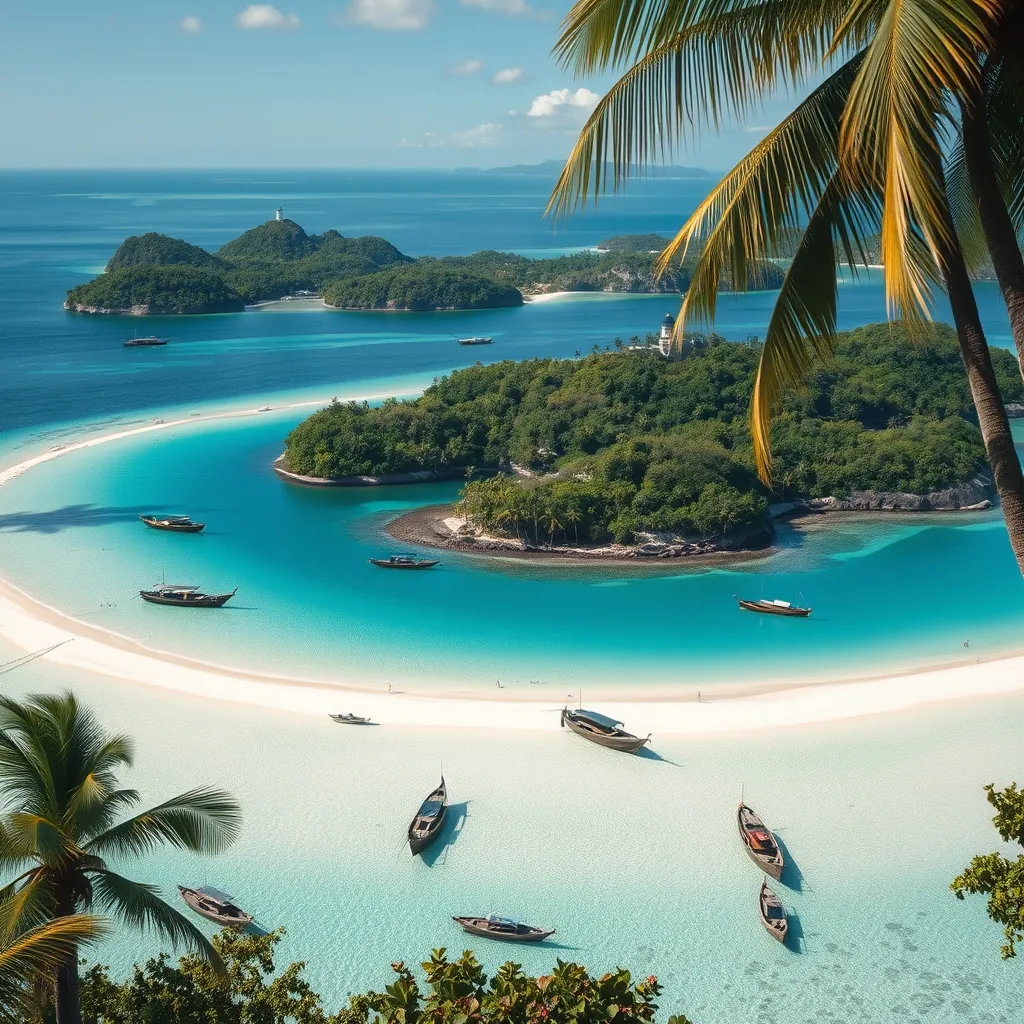
The final destination on this journey is one that most travelers have never heard of. Nam Du Island is an archipelago of 21 islands located in the Gulf of Thailand, about 90 kilometers from the coast of Rach Gia in Kien Giang Province. It is a place that has remained largely outside the tourist circuit, a collection of islands where the beaches are empty, the water is clear, and the pace of life is dictated by the tides rather than the clock.
The islands are part of the same geological formation as Phu Quoc, but they have developed at a fraction of the pace. While Phu Quoc has been transformed by resorts and international tourism, Nam Du has remained a working fishing community. The main island, Hon Lon, is home to a small population that makes its living from the sea, and the surrounding islands are largely uninhabited. This is the appeal of Nam Du: it offers a glimpse of what Phu Quoc was like before the developers arrived.
The Islands and Their Character
Each of the islands in the Nam Du archipelago has its own character. Hon Lon is the largest and the most developed, with a small town, a fishing port, and a few guesthouses. Hon Dau is known for its white sand beach and its calm, shallow waters, which make it ideal for swimming. Hon Mau is the site of the archipelago’s iconic lighthouse, which offers panoramic views of the surrounding islands. Hon Ngang and Hon Dung are largely covered in tropical forest and are popular with hikers.
The beaches are the main attraction. The sand is fine and white, and the water is a shade of turquoise that rivals anything in the region. The beaches are not developed, which means there are no sun loungers, no beach bars, and no jet skis. Instead, there are coconut palms, fishing boats, and the occasional local fisherman mending his nets. It is a raw, unpolished version of a tropical paradise.
The coral reefs around the islands are healthy and vibrant. Snorkelers can explore the reefs with a simple mask and fins, and they will be rewarded with a variety of tropical fish, sea anemones, and hard and soft corals. The best snorkeling spots are around the smaller islands, where the water is calm and the reefs are less disturbed.
The Fishing Village Experience
The main settlement on Hon Lon is a working fishing village, and this is where the authentic character of Nam Du is most evident. The harbor is filled with fishing boats, and the daily catch is unloaded and sorted on the docks. The fish market operates in the early morning, and visitors who wake early can watch the auction and see the variety of seafood that comes from these waters.
The village is a community that lives with the sea. The houses are built along the waterfront, and many of them are on stilts over the water. The daily rhythms are tied to the tides and the weather. The people are friendly and welcoming, and visitors who show an interest in their way of life are often rewarded with warm hospitality and genuine conversation.
The local seafood is exceptional. The restaurants in the village serve whatever the boats have brought in that day, which means the menu changes constantly. The ghẹ, or mud crab, is a local specialty, as is cá mú, the grouper that is found in the waters around the islands. The seafood is simply prepared, usually grilled or steamed, and served with rice and fresh vegetables.
The Lighthouse and the Views
The Nam Du lighthouse on Hon Mau is the most iconic landmark in the archipelago. The lighthouse was built by the French colonial administration in the early 20th century, and it still guides ships through the waters of the Gulf of Thailand. The climb to the lighthouse takes about 30 minutes, and the path winds through tropical forest and past small shrines.
The view from the top is worth the effort. From the lighthouse, visitors can see the entire archipelago spread out below, a scattering of green islands in a sea of blue. On a clear day, the view extends to the horizon, and the only signs of human activity are the small fishing boats moving between the islands. It is a perspective that makes the scale of the archipelago clear, and it is the best way to appreciate the natural beauty of Nam Du.
Practical Information
Getting to Nam Du requires time and patience. The most common route is to take a high-speed ferry from Rach Gia, which takes about two and a half hours. The ferries run daily, but the schedule can be affected by the weather, and it is advisable to check the forecast before making the journey. There are also slower ferries that take longer but are cheaper.
The best time to visit is during the dry season, which runs from November to April. During this period, the seas are calm and the skies are clear. The wet season, from May to October, brings rough seas and frequent rain, and many of the guesthouses close during this period.
Accommodation on Nam Du is basic. There are a handful of guesthouses on Hon Lon, and they offer simple rooms with fans and cold-water showers. There is no luxury accommodation, and there are no international-standard resorts. This is part of the appeal of the islands, but it is not for everyone. Visitors who require modern amenities should consider staying on Phu Quoc and taking a day trip to Nam Du instead.
Visitors should bring cash, as there are no ATMs on the islands. There are a few small shops that sell basic supplies, but the selection is limited. Visitors should also bring their own sunscreen, insect repellent, and any personal medications, as these items may not be available.
Nam Du is an emerging destination, and its character will inevitably change as more travelers discover it. For now, it remains a place of simple beauty, where the beaches are empty, the water is clear, and the fishing boats still outnumber the tourist boats. It is a fitting final destination for this journey through Vietnam, a reminder that the country’s most beautiful places are often the ones that require the most effort to reach.
Sustainable Travel Tips for Vietnam’s Beautiful Locations

The beauty of Vietnam comes with a responsibility. The places that draw millions of visitors each year are fragile ecosystems, and the way you travel determines whether they remain beautiful for the next generation. Sustainable travel in Vietnam is not about sacrifice. It is about making choices that benefit both the traveler and the destination.
Choose Responsible Tour Operators
Not all tour operators are created equal. Some prioritize profit over preservation, while others invest directly in local communities and conservation efforts. Before booking a tour, research the operator’s environmental policies and their relationship with local communities. Look for operators that employ local guides, use small groups, and follow established trails and paths.
In Ha Long Bay, for example, some cruise operators have adopted waste treatment systems and limit their routes to reduce pressure on the most visited areas. In Phong Nha-Ke Bang National Park, several tour companies work directly with the park authorities to ensure that cave tours do not damage the delicate formations. Choosing these operators over cheaper alternatives makes a measurable difference.
Minimize Single-Use Plastic
Vietnam faces a significant plastic waste problem, and tourism contributes to it. The solution starts with simple habits. Carry a reusable water bottle with a built-in filter, and you can safely refill it at most hotels and guesthouses. Many accommodations now offer free filtered water refills, and some have eliminated single-use plastic bottles entirely.
Bring a reusable shopping bag for markets and street food stalls. Decline plastic straws and ask for drinks without them. When buying snacks or souvenirs, choose items with minimal packaging. These small choices add up, especially in remote areas where waste management infrastructure is limited.
Support Local Communities
The most sustainable form of tourism is the kind that puts money directly into local hands. Stay in family-run homestays rather than international hotel chains. Eat at local restaurants and street food stalls. Buy handicrafts directly from artisans rather than from souvenir shops that import mass-produced goods.
In Sapa, the homestay model has transformed the local economy. Ethnic minority families open their homes to travelers, providing authentic experiences while earning a sustainable income. In Hoi An, community-based tourism initiatives allow visitors to learn traditional crafts from local artisans, with the proceeds going directly to the craftspeople.
When you book a tour, ask where the money goes. A responsible operator will be transparent about how much of your payment stays in the local community. If the answer is vague, consider whether your money is supporting the destination or just extracting from it.
Respect Wildlife and Natural Areas
Vietnam’s natural attractions are under pressure from overtourism. Stay on marked trails when hiking, and do not touch or feed wildlife. In marine areas like the Cham Islands and Con Dao, use reef-safe sunscreen and do not stand on coral. Choose snorkeling and diving operators that follow responsible practices.
The elephant tourism industry in Vietnam has a troubled history. Avoid venues that offer elephant rides or performances. Instead, support sanctuaries where elephants are allowed to live naturally, and where viewing is done from a respectful distance.
Offset Your Carbon Footprint
Getting to Vietnam requires a long-haul flight, and that has an environmental cost. Carbon offset programs allow you to compensate for your emissions by funding renewable energy projects or reforestation efforts. Several reputable organizations offer verified offsets, and the cost is often less than a single meal.
Once you are in Vietnam, choose low-carbon transportation where possible. Trains are more environmentally friendly than domestic flights. Buses and shared vans are better than private cars. Cycling is the best option for short distances, and many destinations like Hoi An and Ninh Binh are ideal for exploring on two wheels.
Travel During Shoulder Seasons
The most popular destinations in Vietnam are overwhelmed during peak season. Traveling during shoulder seasons reduces the pressure on infrastructure and natural areas, and it also gives you a more authentic experience. The weather is still good, but the crowds are thinner, and prices are lower.
In Ha Long Bay, for example, the period from March to May offers pleasant weather with fewer boats on the water. In Sapa, September and October bring the golden rice harvest with far fewer visitors than the summer months. Shoulder season travel is a win for you and a win for the destination.
Leave No Trace
The principle is simple: take nothing but photographs, leave nothing but footprints. Pack out all your rubbish, especially in remote areas where waste collection is limited. Do not remove shells, rocks, or plants from natural areas. Respect local customs and dress codes, particularly when visiting temples and rural communities.
Sustainable travel is not a trend. It is the only way to ensure that Vietnam’s beauty endures. The choices you make as a traveler have consequences, and those consequences either protect or degrade the places you came to see. Choose to protect.
Practical Travel Tips: Best Time to Visit, Visas, and Getting Around

Planning the logistics of a Vietnam trip can feel overwhelming. The country stretches over 1,600 kilometers from north to south, and the climate varies dramatically between regions. Getting the timing right, securing the correct visa, and understanding your transport options will determine how smoothly your journey unfolds.
Best Time to Visit Each Region
Vietnam does not have a single best travel season. The country spans multiple climate zones, and the ideal time to visit one region may be the worst time for another. Understanding the regional weather patterns is the key to planning a successful itinerary.
Northern Vietnam experiences four distinct seasons. The period from March to May offers mild temperatures, low humidity, and clear skies, making it the optimal window for Ha Long Bay, Sapa, and Ninh Binh. September to November is equally pleasant, though October brings the tail end of the rainy season. Summers from June to August are hot and humid, with frequent afternoon downpours. Winters from December to February can be cold, especially in Sapa and Ha Giang, where temperatures occasionally drop below 10 degrees Celsius.
Central Vietnam has a different rhythm. The dry season runs from January to August, with the hottest months being June and July. This is the ideal time for Hoi An, Da Nang, and the beaches of Quang Binh. The rainy season from September to December brings heavy rainfall and occasional typhoons, particularly in October and November. Hue and Hoi An have experienced severe flooding during this period, so check weather forecasts carefully if you plan to visit in late autumn.
Southern Vietnam follows a simpler pattern with just two seasons. The dry season from December to April offers sunny days and low humidity, perfect for Ho Chi Minh City, the Mekong Delta, and Phu Quoc Island. The rainy season from May to November brings daily afternoon showers, but they rarely last more than an hour or two. The benefit of the wet season is lower prices, fewer crowds, and lush green landscapes.
For a full north-to-south itinerary, the spring months of March and April are your safest bet. The weather is favorable in most regions, and you avoid the peak tourist crowds of the summer holidays.
Vietnam Visa Requirements
Vietnam has simplified its visa process in recent years, but the requirements still depend on your nationality. The most significant change came in August 2023, when Vietnam introduced an e-visa system that is now available to citizens of all countries and territories.
The e-visa allows a stay of up to 90 days with single or multiple entries. The application is completed entirely online through the official Vietnamese government portal. You will need a passport valid for at least six months, a digital passport photo, and a credit card for the processing fee. The standard processing time is three to five working days, though it can take longer during peak periods. The cost is approximately 25 USD for a single entry and 50 USD for multiple entries.
Citizens of several countries, including Japan, South Korea, and many European nations, are eligible for visa exemptions ranging from 15 to 45 days. These exemptions are subject to change, so always verify the current rules with the Vietnamese embassy in your country before booking flights.
If you plan to stay longer than 90 days or need a visa type not covered by the e-visa system, you will need to apply through a Vietnamese embassy or consulate. This process takes longer and requires more documentation, so start at least a month in advance.
One critical detail: your passport must have at least one blank page for the entry stamp. Border officials are strict about this requirement, and travelers have been turned away for having insufficient space. Check your passport well before your departure date.
Getting Around: Domestic Flights
Vietnam is a long, narrow country, and domestic flights are the fastest way to cover large distances. Vietnam Airlines, VietJet Air, and Bamboo Airways operate frequent flights between major cities. The most popular routes are Hanoi to Da Nang, Hanoi to Ho Chi Minh City, and Da Nang to Ho Chi Minh City, all of which take around one to two hours.
Budget carriers like VietJet offer competitive fares, especially if you book several weeks in advance. A typical one-way domestic flight costs between 30 and 80 USD, depending on the route and how far ahead you book. Be aware that budget airlines charge extra for checked luggage, so factor that into your comparison.
For island destinations, Phu Quoc and Con Dao are served by direct flights from both Hanoi and Ho Chi Minh City. These routes are popular, so book early during peak season. Flights to Con Dao are limited, and cancellations due to weather are not uncommon, so allow flexibility in your schedule.
Getting Around: Trains
The reunification Express runs the length of the country, connecting Hanoi and Ho Chi Minh City over a journey of approximately 1,700 kilometers. The full trip takes about 30 to 36 hours, so most travelers break it into segments. The most scenic stretch is between Hue and Da Nang, where the track hugs the coastline and crosses the Hai Van Pass.
Trains offer several classes. Soft sleeper berths in four-bed compartments are the most comfortable option for overnight journeys. Hard sleepers are cheaper but less comfortable, with six berths per compartment. Seating options range from hard seats to soft reclining seats, with the latter being the better choice for daytime travel.
Booking train tickets can be done online through the official Vietnam Railways website or through third-party agents. Book at least a few days in advance for sleeper berths, especially on popular overnight routes like Hanoi to Sapa or Hanoi to Da Nang. Prices are reasonable, with a soft sleeper berth costing between 25 and 40 USD for a typical overnight journey.
One note on comfort: Vietnamese trains are functional rather than luxurious. The carriages can be noisy, and the tracks are not always smooth. If you are a light sleeper, bring earplugs and an eye mask. The experience, however, is part of the adventure, and the views from the window are often spectacular.
Getting Around: Buses and Minivans
For budget travelers, long-distance buses are the most economical way to get around Vietnam. The open bus system, popular with backpackers, allows you to buy a ticket that covers multiple stops along the main tourist routes. You can hop on and off as you please, with the ticket remaining valid for up to a month.
Companies like The Sinh Tourist and Hung Long operate comfortable sleeper buses with reclining seats, air conditioning, and onboard Wi-Fi. Overnight buses are common on routes like Hanoi to Sapa, Da Nang to Nha Trang, and Ho Chi Minh City to Mui Ne. A typical overnight bus journey costs between 10 and 20 USD.
Minivans are a faster alternative for shorter routes. They are used extensively for connections between smaller towns and cities, such as Hoi An to Da Nang or Ninh Binh to Ha Long. Minivans are quicker than buses but less comfortable, and they often depart when full rather than on a fixed schedule.
For the Mekong Delta, buses and minivans are the primary transport options. The roads are good, and the journey from Ho Chi Minh City to Can Tho takes about three hours. From Can Tho, you can connect to smaller towns like Ben Tre and Tra Vinh, though schedules become less frequent the further you go from the main routes.
Getting Around: Motorbikes
Renting a motorbike gives you the freedom to explore at your own pace, and it is the preferred way to experience destinations like the Ha Giang Loop and the Hai Van Pass. Renting a semi-automatic or manual motorbike costs between 5 and 10 USD per day, with discounts for longer rentals. Automatic scooters are slightly more expensive but easier to ride.
Before you commit to riding in Vietnam, assess your experience level honestly. Traffic in Hanoi and Ho Chi Minh City is chaotic, and the rules of the road are often more like suggestions. If you are not a confident rider, stick to less congested areas or hire a driver. Many homestays and hostels can arrange a motorbike driver for day trips at reasonable rates.
For the Ha Giang Loop, consider joining an organized motorbike tour. These tours provide a guide, a well-maintained bike, and support vehicles for luggage. The cost ranges from 50 to 100 USD per day, depending on whether you ride yourself or ride pillion with a guide. The safety margin is worth the extra expense on the steep mountain passes.
If you do ride independently, wear a helmet at all times. It is the law, and it could save your life. Carry your international driving permit if you have one, though enforcement is inconsistent. Most rental shops will not ask for one, but police checkpoints do occur, especially in tourist areas.
Getting Around: Taxis and Ride-Hailing
In cities, Grab is the dominant ride-hailing app. It works like Uber, allowing you to book cars and motorbike taxis through your smartphone. Prices are transparent, and the app eliminates the need to negotiate fares. A typical short ride within a city costs between 1 and 3 USD.
Traditional taxis are still widely available, but you need to be cautious. Mai Linh and Vinasun are the most reliable companies, with meters that are generally accurate. Avoid unmarked taxis or drivers who insist on a flat fare before you get in. Always ask the driver to use the meter, and have small bills ready for payment.
In smaller towns and rural areas, taxis are less common. Your homestay or hotel can usually arrange a car and driver for day trips or airport transfers. Agree on the price before you depart, and confirm whether it covers the entire journey or just one way.
Practical Tips for a Smooth Journey
Carry small denominations of Vietnamese dong for markets, street food, and bus fares. Many vendors cannot break large notes, and ATMs often dispense 500,000 dong notes, which can be difficult to use in rural areas.
Download offline maps before you travel. Google Maps works well in Vietnam, but you will not always have reliable internet access, especially in mountain regions and remote islands. The Vietmap app is a useful alternative, with detailed coverage of local roads.
Learn a few basic Vietnamese phrases. “Xin chao” (hello) and “cam on” (thank you) go a long way. While English is spoken in tourist areas, a little effort in the local language opens doors and earns goodwill.
Finally, build buffer time into your itinerary. Flights get delayed, buses break down, and weather changes plans. A flexible schedule is your best insurance against the unexpected. Vietnam rewards the traveler who adapts.
Budget Travel Guide: Affordable Stays and Activities
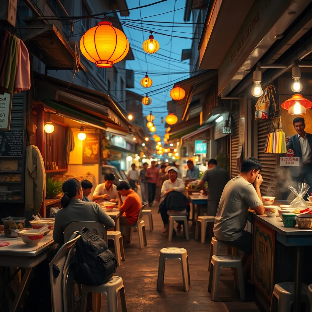
Vietnam remains one of Southeast Asia’s best value destinations. A daily budget of 30 to 50 USD covers comfortable accommodation, three meals of excellent street food, and a full schedule of activities. With careful planning, you can stretch that figure even further. The key is knowing where the bargains hide and which expenses deserve your money.
Where to Stay Without Breaking the Bank
Accommodation is where budget travelers find the biggest savings. Vietnam offers an extraordinary range of affordable options, from dorm beds under 5 USD to private rooms in family-run guesthouses for 15 to 25 USD per night.
Hostels are concentrated in the main tourist hubs: Hanoi’s Old Quarter, Ho Chi Minh City’s Pham Ngu Lao Street, and Hoi An’s ancient town. A bed in a well-reviewed dormitory costs between 4 and 8 USD, often including breakfast, Wi-Fi, and laundry service. Many hostels organize free walking tours, family dinners, and pub crawls, making them excellent bases for solo travelers.
Homestays offer better value and a more authentic experience. In Sapa, Mai Chau, and the Mekong Delta, local families open their homes to travelers for 10 to 20 USD per night, with meals included. The food alone justifies the price. You will eat home-cooked regional specialties that never appear on restaurant menus, and your hosts will often arrange transport, trekking guides, and boat trips at local rates.
In rural areas, look for stilt houses run by ethnic minority families. These simple accommodations provide a mattress on the floor, a shared bathroom, and unforgettable hospitality. The Thai villages around Mai Chau and the Hmong communities near Sapa are particularly welcoming. Book through local tour agencies or homestay platforms, and confirm whether meals are included in the rate.
For longer stays, consider monthly rentals in cities like Da Nang or Nha Trang. Furnished studio apartments rent for 200 to 350 USD per month, a fraction of the nightly rate at any hotel. This option works best for digital nomads or travelers planning to stay in one place for several weeks.
Eating Well on a Shoestring
Street food is the heart of Vietnamese cuisine, and it is remarkably cheap. A filling bowl of pho costs between 1 and 2 USD at any local stall. Banh mi, the iconic Vietnamese sandwich, sells for under 1 USD. Com tam (broken rice with grilled pork) and bun cha (grilled pork with noodles) rarely exceed 2.50 USD.
The best strategy is to eat where the locals eat. Follow the crowds at lunchtime, when office workers queue at their favorite stalls. A busy vendor is a reliable sign of fresh ingredients and good cooking. Avoid restaurants with English menus and laminated photos, which typically charge double or triple the local price.
Breakfast is often included in hostel and homestay rates. If not, a banh mi or xoi (sticky rice) from a street cart costs less than a dollar. For lunch, seek out com binh dan, the casual rice shops that serve a plate of rice with your choice of meats and vegetables for about 1.50 USD. These family-run eateries are everywhere in cities and towns.
Dinner is where you can splurge without guilt. A sit-down meal at a mid-range restaurant with a few dishes and drinks will still cost under 10 USD per person. For a special occasion, splurge on a seafood feast in Nha Trang or a fine dining experience in Hoi An, where multi-course tasting menus start at around 25 USD.
Stay hydrated with fresh coconut water (about 0.50 USD) or sugarcane juice (0.30 USD) from street vendors. Bottled water costs 0.20 to 0.40 USD at convenience stores, but many hostels and homestays provide free drinking water. Vietnamese coffee, whether iced with condensed milk or brewed with egg, costs between 1 and 2 USD at local cafes.
Free and Low-Cost Activities
Some of Vietnam’s best experiences cost nothing at all. Walking tours of Hanoi’s Old Quarter, Hoi An’s ancient town, and Hue’s Imperial Citadel allow you to soak in the atmosphere without spending a dong. The architecture, street life, and local markets are free to explore.
Public parks and lakes offer peaceful escapes in every city. Hoan Kiem Lake in Hanoi, the promenade along the Han River in Da Nang, and the parks around Ho Chi Minh City’s Notre Dame Cathedral are all free. Early morning is the best time to visit, when locals practice tai chi, play badminton, and socialize.
Beaches are free throughout Vietnam. My Khe Beach in Da Nang, Nha Trang’s central beach, and the shores of Phu Quoc Island require no entrance fee. Bring your own towel and sunscreen, and you have a full day of relaxation for the cost of a bus ride.
Temples and pagodas generally welcome visitors without charge, though donations are appreciated. The Thien Mu Pagoda in Hue, the Tran Quoc Pagoda in Hanoi, and the Giac Lam Pagoda in Ho Chi Minh City are all free to enter. Dress modestly and remove your shoes before entering the main halls.
For a few dollars, you can access some of Vietnam’s best attractions. Museum entry fees range from 1 to 3 USD. The War Remnants Museum in Ho Chi Minh City charges about 2 USD. Hoi An’s ancient town requires a ticket for the heritage sites, but the lantern-lit streets themselves are free to wander after 5 PM.
Day hikes are another budget-friendly option. The trails around Sapa, Ninh Binh, and Ba Be National Park can be explored independently with a map and a bottle of water. Local guides are worth hiring for more challenging treks, but the basic routes are manageable without one.
Transportation on a Budget
The open bus system remains the cheapest way to travel between cities. A ticket from Hanoi to Hoi An costs between 15 and 25 USD for an overnight journey. The reunification Express train is slightly more expensive but more comfortable, with soft sleeper berths starting around 30 USD for the same route.
Within cities, public buses cost 0.20 to 0.50 USD per ride. They are not always tourist-friendly, but they are cheap and reliable in Hanoi and Ho Chi Minh City. Grab motorbike taxis are the most convenient option for short trips, with fares starting around 1 USD. Walking is free and often the best way to discover hidden corners of a city.
For the Ha Giang Loop, renting a motorbike costs 5 to 10 USD per day. If you do not ride, joining a group tour with a guide costs 50 to 100 USD per day, including bike, fuel, accommodation, and meals. The organized option is safer and removes the hassle of navigating remote mountain roads.
Budget-Friendly Destinations
Some parts of Vietnam are noticeably cheaper than others. Ninh Binh, Mai Chau, and the Mekong Delta offer the best value for accommodation and food. Hoi An and Da Nang are moderately priced, with excellent budget options. Ha Long Bay and Phu Quoc are the most expensive destinations, largely due to the cost of boat tours and island transport.
For the best value, focus your itinerary on rural areas and smaller cities. The homestays in Mai Chau cost half of what you would pay for a comparable room in Hanoi. The street food in Can Tho is cheaper and often better than in Ho Chi Minh City. The beaches of Quy Nhon and Mui Ne rival those of Nha Trang but at lower prices.
Money-Saving Tips That Actually Work
Carry cash in small denominations. Many vendors, especially in rural areas, do not accept cards, and breaking large notes can be a problem. ATMs dispense 500,000 dong notes, so ask your hotel to break them into smaller bills.
Book accommodation with breakfast included. A hostel or homestay that includes a meal saves you 2 to 3 USD per day, which adds up over a two-week trip. Many budget properties also offer free laundry, drinking water, and bicycle rentals.
Travel during the shoulder season. The months of March, April, September, and October offer good weather and lower prices than the peak summer months. Hotels and tour operators discount their rates during these periods, and popular attractions are less crowded.
Negotiate respectfully. In markets and with street vendors, a small discount is often expected. Start at 70 percent of the asking price and settle around 85 percent. Never argue over a few cents; it does not reflect well on travelers and rarely saves you anything meaningful.
Skip the packaged tours. Booking activities independently, such as a boat trip in Ninh Binh or a cooking class in Hoi An, almost always costs less than buying them as part of a package. Compare prices at local travel agencies, and ask your homestay host for recommendations. They often have relationships with local operators and can secure better rates than online booking platforms.
Finally, track your spending. A simple notes app on your phone is enough to keep a daily tally. Vietnam is affordable, but costs can creep up if you are not paying attention. A budget of 40 USD per day is comfortable for most travelers, and you will return home with money left over for your next adventure.
Hidden Gems and Off-the-Beaten-Path Locations

The famous landmarks draw the crowds, but Vietnam rewards those who wander further. Beyond Ha Long Bay and Hoi An lies a network of lesser-known destinations that rival the headline attractions in beauty and often surpass them in authenticity. These hidden gems require extra effort to reach, and that effort is precisely what keeps them special.
Northern Frontier: Where the Road Ends
Ban Gioc Waterfall sits on the border with China, a thundering cascade that spans roughly 300 meters across the Quay Son River. The waterfall is the widest in Vietnam, yet it receives a fraction of the visitors that Ha Long Bay attracts. The journey from Cao Bang takes several hours on winding mountain roads, but the payoff is a natural spectacle of mist, rainbows, and emerald pools. Nearby, the Nguom Ngao Cave offers a quieter alternative to Phong Nha, with 3 kilometers of illuminated limestone passages.
The Dong Van Karst Plateau in Ha Giang Province is a geological wonder that most travelers rush through on their way to the famous motorbike loop. The plateau is a UNESCO Global Geopark, home to dramatic limestone peaks, deep canyons, and the colorful markets of ethnic minority communities. The Sunday market in Dong Van town draws Hmong, Dao, and Tay families who trade livestock, textiles, and handicrafts. It is a living cultural experience, not a staged performance for tourists.
Bac Son Valley sits off the main tourist corridor between Hanoi and Lang Son. The valley is a patchwork of rice terraces that glow gold during harvest season, framed by jagged karst mountains. A short hike to the Bac Son lookout rewards you with one of the most photographed panoramas in northern Vietnam, yet the valley remains remarkably quiet. The local homestays are simple, the food is hearty, and the hospitality is genuine.
Central Vietnam’s Quiet Corners
The Son Tra Peninsula, known locally as Monkey Mountain, rises 693 meters above Da Nang. The peninsula is a nature reserve covered in primary forest, home to the endangered red-shanked douc langur. Only about 200 of these primates remain in the wild, and Son Tra hosts one of the largest populations. A drive along the peninsula’s winding roads reveals hidden beaches, abandoned bunkers, and the striking Linh Ung Pagoda with its 67-meter-tall statue of the Goddess of Mercy. Most visitors to Da Nang never venture beyond My Khe Beach, leaving the peninsula’s trails blissfully uncrowded.
Binh Hai Village is a working fishing community on the shores of Lang Co Bay. Unlike the tourist-oriented fishing villages near Hoi An, Binh Hai has not yet adapted its daily rhythms for visitors. Fishermen still launch their round basket boats at dawn, women still mend nets on the beach, and the local market still operates without English signage. A morning here offers an unfiltered glimpse of coastal life in central Vietnam.
Phong Dien and Quang Dien, two rural districts near Hue, are the kind of places that rarely appear in guidebooks. The region is a patchwork of rice paddies, lotus ponds, and sleepy villages connected by narrow canals. Cycling through these districts is a peaceful experience, with the Truong Son Mountains as a constant backdrop. The locals are curious and welcoming, and a simple wave often leads to an invitation for tea.
In Quang Binh Province, beyond the famous Phong Nha Cave, lies a network of lesser-known caves that are slowly gaining attention. Tu Lan Cave and Hang Va Cave offer adventure caving experiences with smaller groups and more intimate encounters with the underground landscape. These expeditions require physical fitness and a tolerance for mud, but the reward is a sense of discovery that the main caves cannot match.
Southern Secrets and Island Escapes
Nam Du Island is an archipelago of 21 islands in the Gulf of Thailand, roughly 90 kilometers from Rach Gia. The islands are a slower, quieter alternative to Phu Quoc, with white-sand beaches, clear water, and a working fishing community. Accommodation is basic, with most visitors staying in simple guesthouses on the main island. The ferry ride takes two to three hours, which filters out the day-trippers and leaves the beaches gloriously empty.
Tra Su Cajuput Forest in An Giang Province is a flooded forest reserve that comes alive during the wet season. A boat tour through the narrow channels takes you past towering cajuput trees, lotus fields, and a bird sanctuary that hosts storks, herons, and cormorants. The forest is a birder’s paradise, and the morning mist over the water creates an ethereal atmosphere. Most travelers to the Mekong Delta stick to the floating markets of Can Tho, missing this serene natural wonder.
Hon Khoi Salt Fields near Nha Trang offer a landscape unlike anywhere else in Vietnam. The salt pans stretch for hectares, their white surfaces reflecting the sky like a natural mirror. During the dry season, workers harvest the salt by hand, a labor-intensive process that has remained unchanged for generations. The best time to visit is early morning, when the light is soft and the workers are active.
The Con Dao Islands are often described as Vietnam’s best-kept secret. This archipelago of 16 islands lies 230 kilometers off the southern coast, and its main island, Con Son, is covered in protected forest. The beaches are pristine, the coral reefs are healthy, and the sea turtles nest on the shores between May and October. The islands also carry a heavy history: the French colonial prison and the “tiger cages” used during the Vietnam War are now a museum. The combination of natural beauty and historical weight makes Con Dao a destination that stays with you long after you leave.
Why the Road Less Traveled Matters
These hidden gems share a common thread: they require more time, more patience, and more flexibility than the main attractions. The roads are rougher, the signs are sparser, and the English is less common. But the rewards are proportional to the effort.
You will find empty beaches, uncrowded viewpoints, and conversations with locals who are genuinely curious about where you come from. You will eat meals that were cooked for family, not for tourists. You will witness traditions that have not been adapted for foreign audiences. And you will return home with stories that your friends who visited the same country cannot tell.
Vietnam’s hidden gems are not hidden because they are inferior. They are hidden because they are harder to reach. The infrastructure is improving, and the secret is spreading. Visit them now, before the crowds find them.
Conclusion: Your 2024 Vietnam Adventure Awaits

Vietnam is not a single destination. It is fifty destinations, each with its own character, its own rhythm, and its own reasons to visit. The limestone towers of Ha Long Bay share the country with the terraced fields of Sapa. The lantern-lit streets of Hoi An share it with the floating markets of the Mekong Delta. The imperial citadel of Hue shares it with the pristine beaches of Con Dao.
This diversity is the country’s greatest strength. In a single two-week trip, you can hike through mountain villages, cruise past thousand-year-old karsts, explore underground cave systems, and relax on tropical islands. Few countries on Earth pack so much variety into such a compact area. The north-to-south journey spans roughly 1,650 kilometers, yet each region feels like a different world.
The Practical Path Forward
Planning a Vietnam trip in 2024 is easier than ever. The country welcomed over 12.6 million international visitors in 2023, a strong rebound that signals a thriving tourism infrastructure. Flights connect all major cities, trains link the coastal corridor, and domestic routes are affordable. The challenges that once made Vietnam a difficult destination have largely faded, replaced by a well-worn path that still leaves room for discovery.
Start with the essentials. Check visa requirements for your nationality, as many countries now qualify for e-visas processed online. Book your first few nights of accommodation to ease the arrival experience. Pack light, as laundry services are cheap and ubiquitous. And leave room in your itinerary for spontaneity. The best moments in Vietnam often arrive unplanned: a stranger’s invitation to share a meal, a local’s tip about a hidden viewpoint, a sudden decision to stay an extra day in a place that feels right.
Choose Your Own Adventure
First-time visitors should consider the classic north-to-south route, spending three to four days in the north, a week in central Vietnam, and a week in the south. This route covers the highlights without feeling rushed. Return visitors can focus on a single region, diving deeper into the hidden gems that this guide has covered. The mountains of Ha Giang reward a full week. The caves of Quang Binh deserve at least three days. The islands of the south could easily occupy a fortnight.
Seasonal timing matters. The north experiences distinct seasons, with the best trekking conditions from September to November and March to May. Central Vietnam shines from February to August, when the weather is dry and the seas are calm. The south is warm year-round, with the dry season from December to April offering the most reliable sunshine. Check the regional forecasts before you book, and build flexibility into your schedule.
The Journey Is the Destination
Vietnam rewards the traveler who slows down. The country is best experienced not as a checklist of sights but as a sequence of moments: the taste of a steaming bowl of pho at a street stall, the sound of rain on a tin roof in a mountain homestay, the sight of a farmer guiding a water buffalo through a flooded rice paddy at dawn. These are the memories that endure long after the photographs have been filed away.
The infrastructure has improved, the hotels have multiplied, and the Instagram feeds have filled with familiar images. But the heart of Vietnam remains unchanged. The people are warm. The landscapes are dramatic. The food is extraordinary. And the sense of discovery is still alive, even on the most well-trodden paths.
Your 2024 Vietnam adventure awaits. The mountains are standing. The waters are flowing. The lanterns are glowing. All that remains is for you to book the flight, pack the bag, and step into a country that has been welcoming travelers for centuries. The only question is where you will start.
Frequently Asked Questions About Beautiful Travel Locations in Vietnam
What is the best time to visit Vietnam for beautiful scenery?
The best time to visit Vietnam is during the spring (March to April) or autumn (September to November). These months offer pleasant temperatures, lower humidity, and clear skies across most of the country, making it ideal for exploring both the northern highlands and the central coast.
How many days do you need to see the best of Vietnam?
To see the highlights, plan for at least two weeks. This allows enough time to explore the three main regions: the north (Ha Long Bay, Sapa), the center (Hoi An, Hue), and the south (Ho Chi Minh City, Mekong Delta). For a more relaxed pace, three weeks is recommended.
What are the must-see destinations for a first-time visitor?
First-time visitors should prioritize Ha Long Bay for its iconic seascape, Hoi An for its ancient charm, and Ho Chi Minh City for its dynamic energy. These three locations offer a diverse introduction to Vietnam’s natural beauty, culture, and history.
Is it easy to travel between regions in Vietnam?
Yes, traveling between regions is straightforward. Domestic flights connect major cities like Hanoi, Da Nang, and Ho Chi Minh City. The Reunification Express train runs along the coast, and comfortable sleeper buses are available for most routes, making it easy to plan a north-to-south itinerary.
What should I pack for a trip to Vietnam?
Pack light, breathable clothing suitable for tropical weather, a light jacket for cooler highland areas like Sapa and Da Lat, sturdy walking shoes, sunscreen, insect repellent, and a reusable water bottle. Modest clothing is also recommended for visiting temples and pagodas.
Leave a Reply